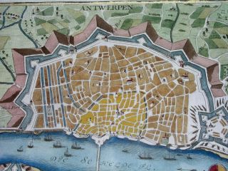
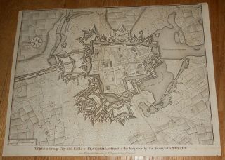
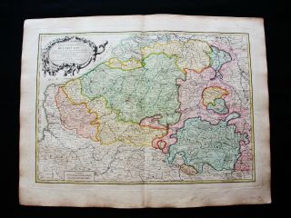
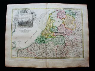
1745 RARE MAP ATH " AETH " BELGIUM BRABANT - City Plan


Item History & Price

Information:
Reference Number: Avaluer:9756Publication Year: 1745
Format: Atlas MapCartographer/Publisher: Basire / Tyndal
Type: Political MapPrinting Technique: Copper Plate
Year: 1745Original/Reproduction: Antique Original
City: ATHTopic: Maps
Date Range: 1700-1799Subgenre: Western Europe
Country/Region: Belgium
Original Description:
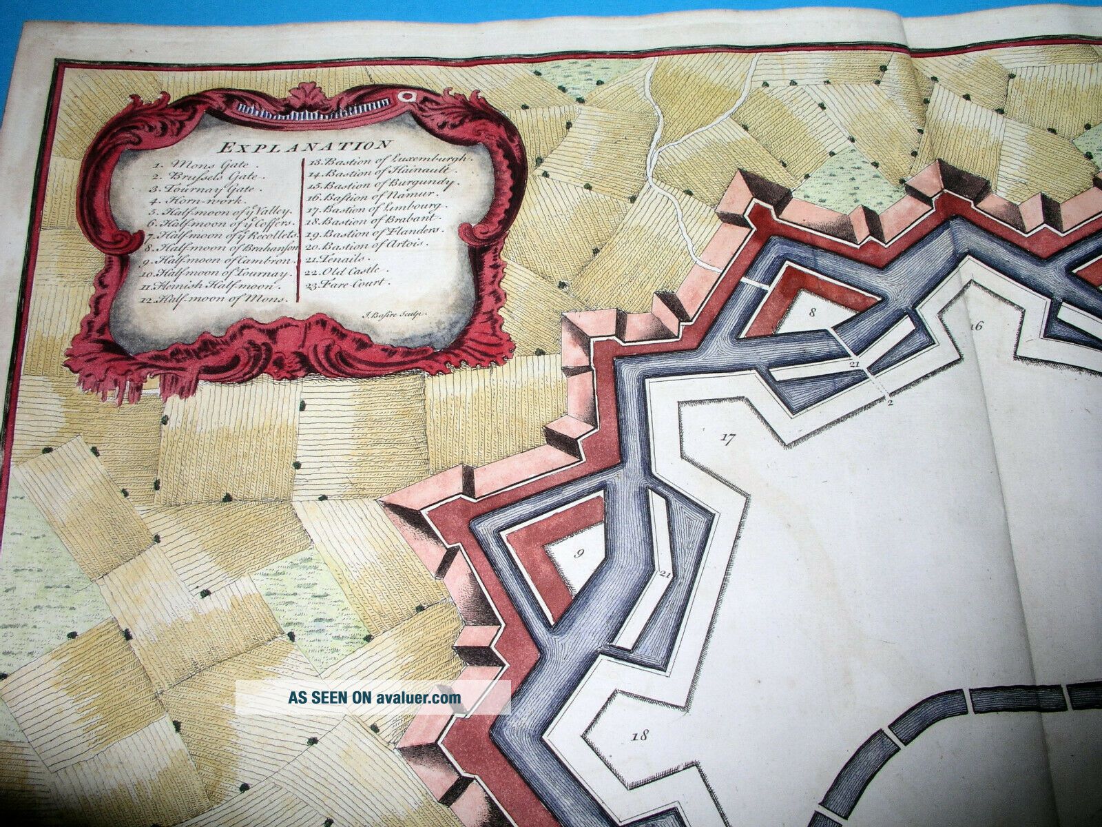
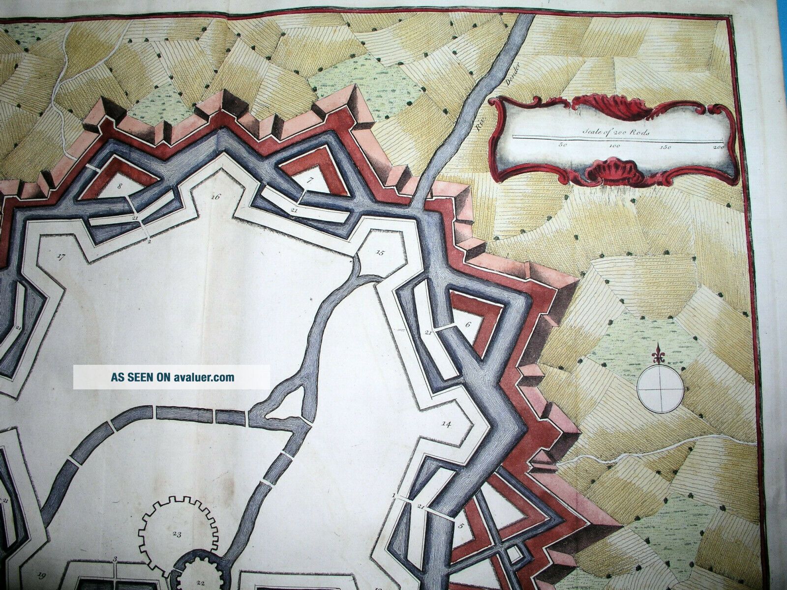
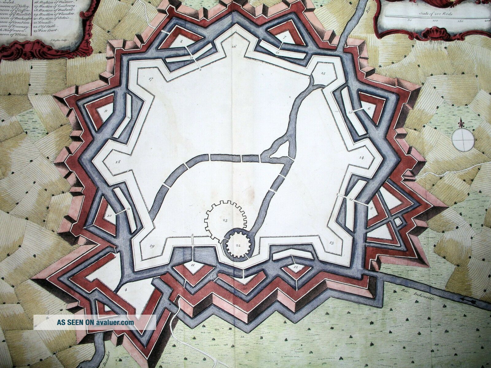
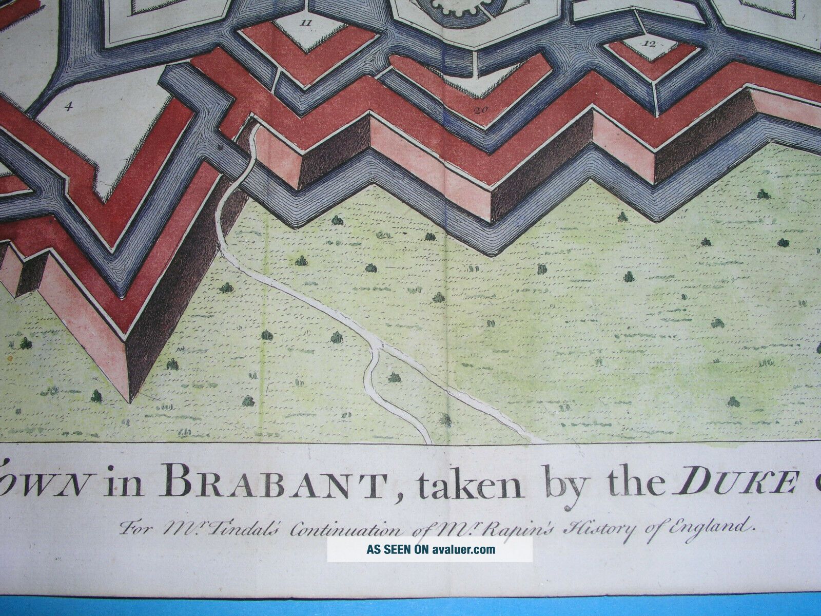
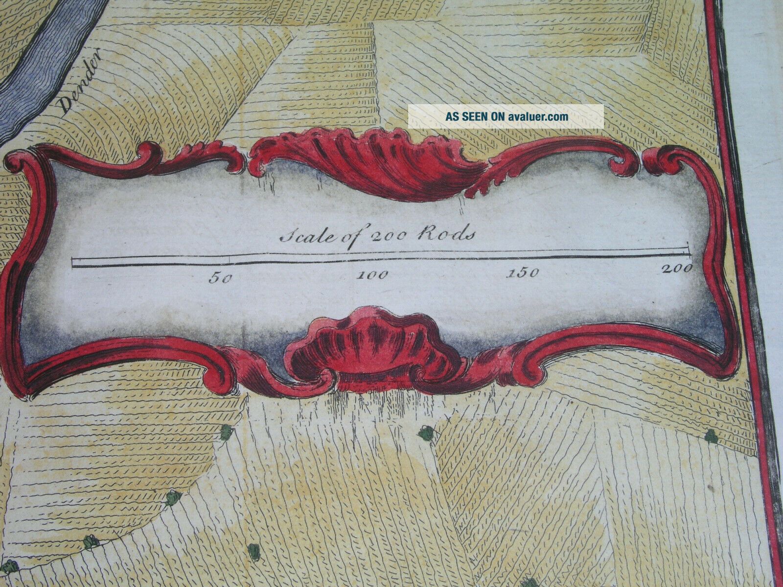
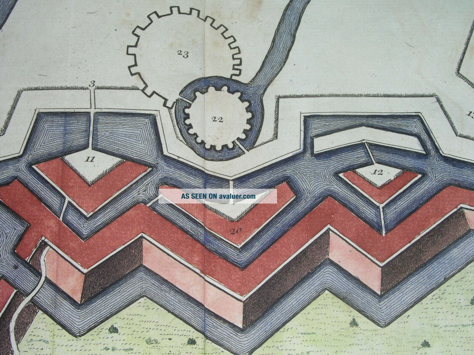
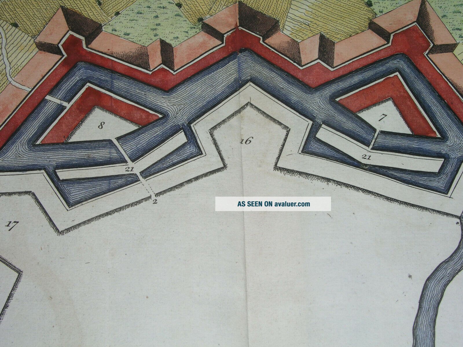
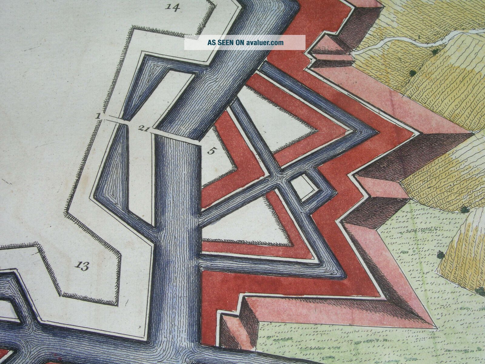
THIS ISAN ORIGINAL MAP, NOT A RECENT COPY OR REPRODUCTION.Originof the map: "Mr Tyndal's Continuation of Mr Rapin's History' [of England]; engr. by Isaac Basire, London (England); HAND COLOUREDDate ofissue: 1742Size: Thesheet measures 19" x 16" (50 x 40 cm). S/H: The map will be shippedby Priority International Air Mail. The shipping charge is 12.00 USD (withthe tracking number), or 10.50 USD (withoutthe tracking number). If you wish to save 1.50 USD on the tracking number, please let ...me know before you sendthe payment, then wait for my invoice. Attention!There is no additional shipping charge for multiple purchases!


    Similar items


  • 1725 Rare Map Anvers Antwerp Belgium Flanders Bodenehr City Plan

    1725 Rare Map Anvers Antwerp Belgium Flanders Bodenehr City Plan

  • 1745 Antique Map Of Ypres Belgium West Flanders City Plan Fortifications

    1745 Antique Map Of Ypres Belgium West Flanders City Plan Fortifications

  • 1778 Zannoni - Rare Map: Netherlands,  Holland,  Belgium,  Rotterdam,  Amsterdam.

    1778 Zannoni - Rare Map: Netherlands, Holland, Belgium, Rotterdam, Amsterdam.

  • 1778 Zannoni - Rare Map: Netherlands,  Holland,  Belgium,  Luxembourg,  Amsterdam.

    1778 Zannoni - Rare Map: Netherlands, Holland, Belgium, Luxembourg, Amsterdam.

  • Wwii Us Silk 1943 Escape Evasion C/d Map Eto - France,  Belgium,  Holland,  Etc - Rare

    Wwii Us Silk 1943 Escape Evasion C/d Map Eto - France, Belgium, Holland, Etc - Rare

  • 1778 Zannoni - Rare Map: Germany (1° Sheet),  North Europe,  Netherlands,  Belgium

    1778 Zannoni - Rare Map: Germany (1° Sheet), North Europe, Netherlands, Belgium

  • 1789 Bonne - Rare Map Of Holland,  Netherlands,  Belgium,  Luxembourg,  Belgique.

    1789 Bonne - Rare Map Of Holland, Netherlands, Belgium, Luxembourg, Belgique.

  • 1789 Bonne - Rare Map Of France,  Flanders,  Picardy,  Champagne,  Belgium,  Belgique

    1789 Bonne - Rare Map Of France, Flanders, Picardy, Champagne, Belgium, Belgique


    • You might also like


    • Hungary & Romania 1579 (1584) Ortelius Unusual Antique Copper Engraved Map

      Hungary & Romania 1579 (1584) Ortelius Unusual Antique Copper Engraved Map

    • Brussels Bruxelles Belfium 1777 De Ferraris & Dupuis Large Antique Map Sheet Xxi

      Brussels Bruxelles Belfium 1777 De Ferraris & Dupuis Large Antique Map Sheet Xxi

    • 1616 Atlas Map Of Iceland.

      1616 Atlas Map Of Iceland.

    • Kazan Russia 1767 Le Clerc/lespinasse Antique Copper Engraved City View

      Kazan Russia 1767 Le Clerc/lespinasse Antique Copper Engraved City View

    • 1899 Stanford,  Folding Map Of Norwich,  Norfolk,  Arthur Collins,  Jarrold & Sons,

      1899 Stanford, Folding Map Of Norwich, Norfolk, Arthur Collins, Jarrold & Sons,

    • 1948 Vintage Linen Colour Map Geological Survey Ten Mile Of Great Britain

      1948 Vintage Linen Colour Map Geological Survey Ten Mile Of Great Britain

    • 1944 Map Flying Bombs Sussex Ww2 Newspaper Military Kent Courier German V1 V2

      1944 Map Flying Bombs Sussex Ww2 Newspaper Military Kent Courier German V1 V2

    • Dated 1638 Vellum Map Of Icklesham Sussex Showing Land Uses Owners Etc

      Dated 1638 Vellum Map Of Icklesham Sussex Showing Land Uses Owners Etc

Avaluer          About Us          Privacy Policy          Contact Us          UP
© 2022, avaluer.net, Inc. or its affiliates