Antique Map Of Mexico, Belize, Guatemala, Honduras, And San Salvador 1858

Item History & Price
| Reference Number: Avaluer:9971 | Cartographer/Publisher: A.K. Johnston |
| Year: 1858 | Original/Reproduction: Original |
| Country/Region: Belize, Guatemala, Honduras, Mexico, El Salvador | Type: Central America Map |
NEW WORLD CARTOGRAPHIC
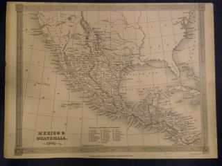
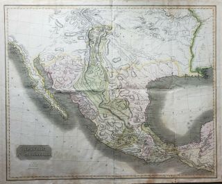
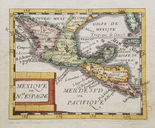
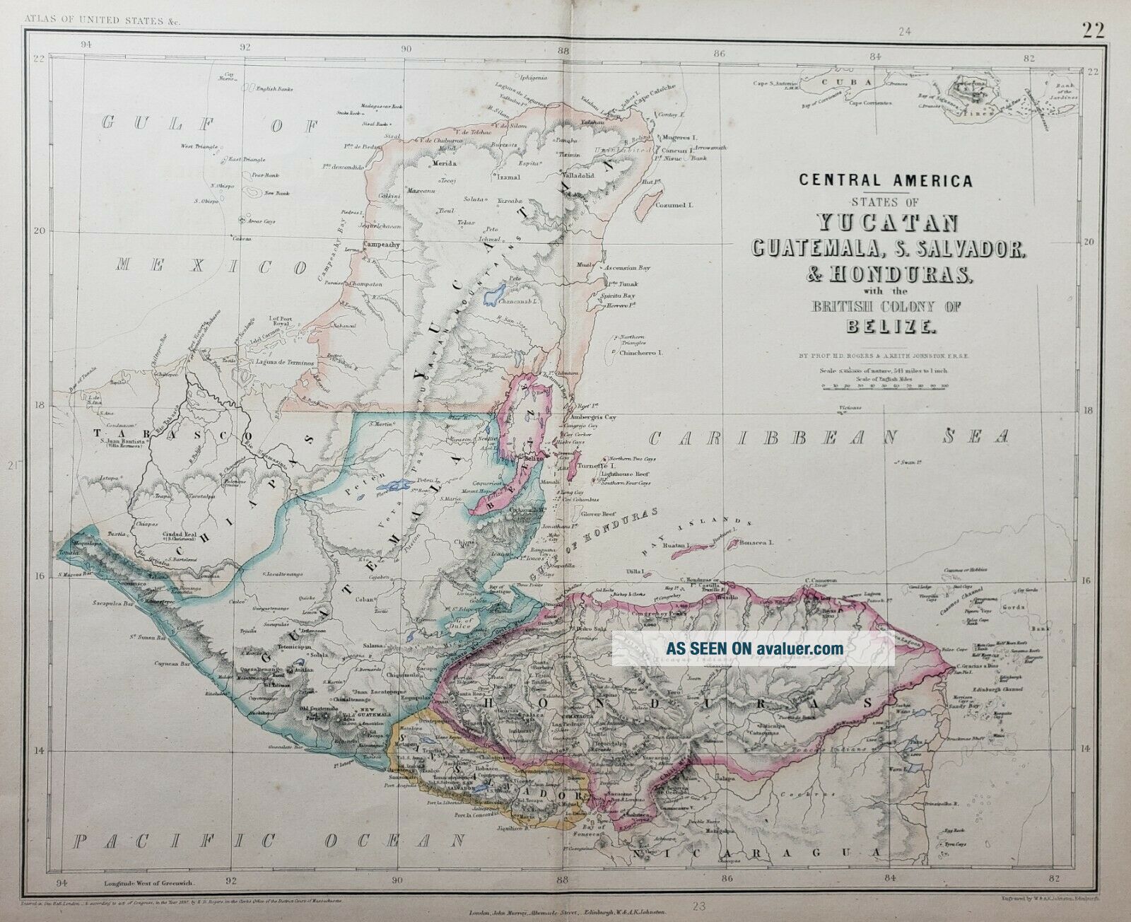
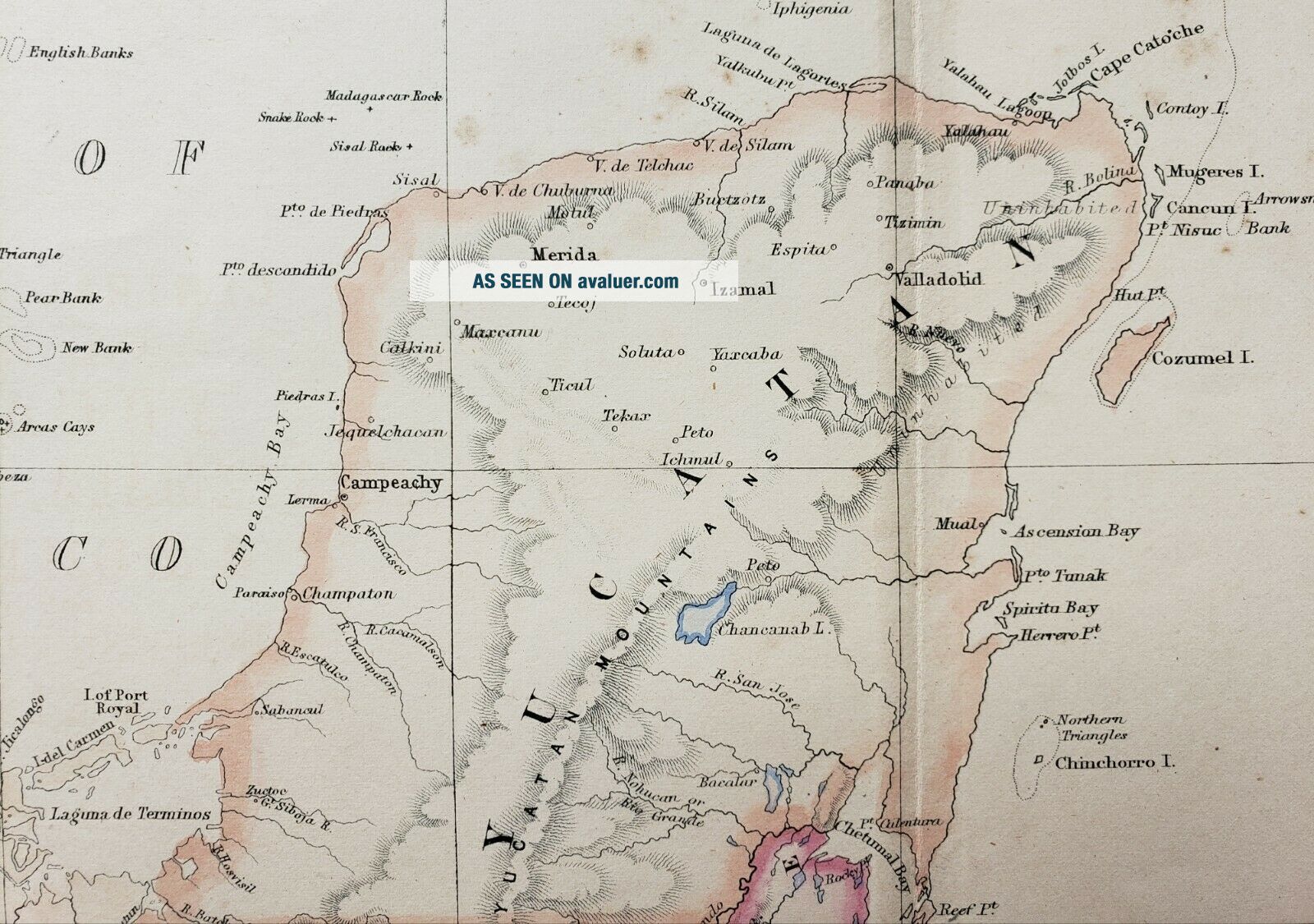
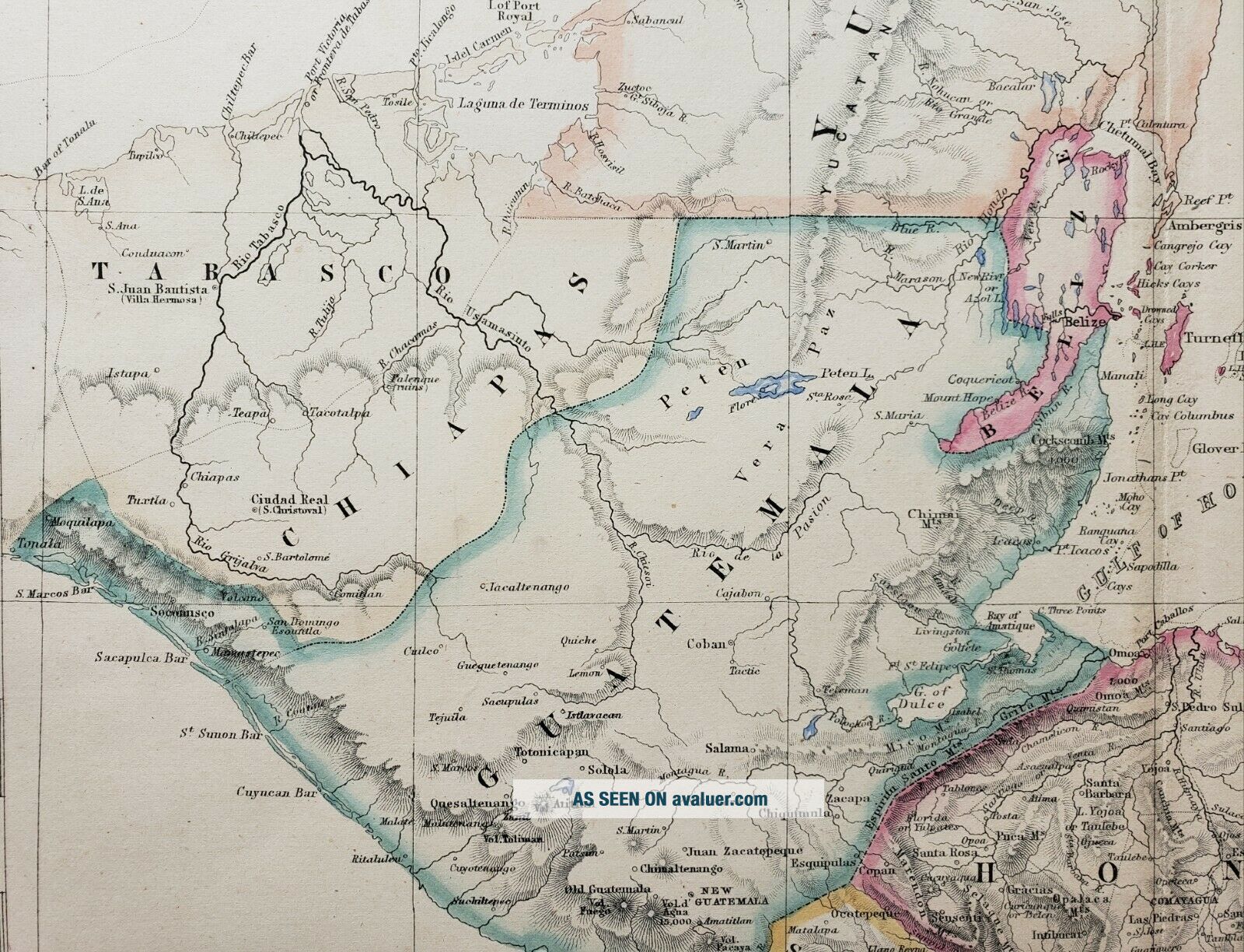
Central America - States of Yucatan, Guatemala, S. Salvador & Honduras with the British Colony of Belize.
By: Rogers & A. Keith Johnston
Date: 1857 (Published) Edinburgh
Dimensions: 13 x 16 inches
This unique map of the northern portion of Central America presents the areas topography and geo-political makeup with the utmost accuracy of the mid 19th century. As noted in the title, Belize is a British Colony and has yet to realiz...e its present shape. El Salvador is noted as San Salvador and the boundaries of Guatemala have yet to be refined. Numerous small islands and reef are noted within the Caribbean.
Condition: This map is in A condition, with small tears at the lower corner margins that do not come near the image. Original lithograph color.