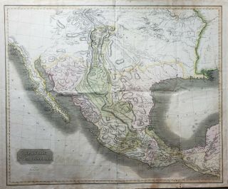
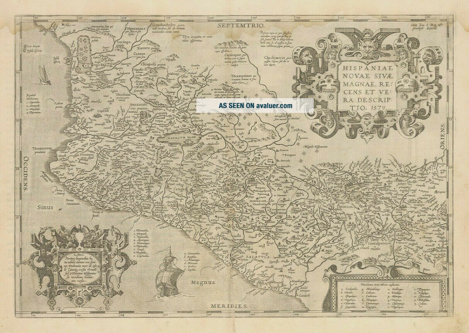
Antique Map Of Mexico By Abraham Ortelius, 1579


Item History & Price

Information:
Reference Number: Avaluer:10019Cartographer/Publisher: Abraham Ortelius
Type: Mexico MapPrinting Technique: Copper Plate
Year: 1579Original/Reproduction: Original
Country/Region: Mexico
Original Description:

NEW WORLD CARTOGRAPHIC

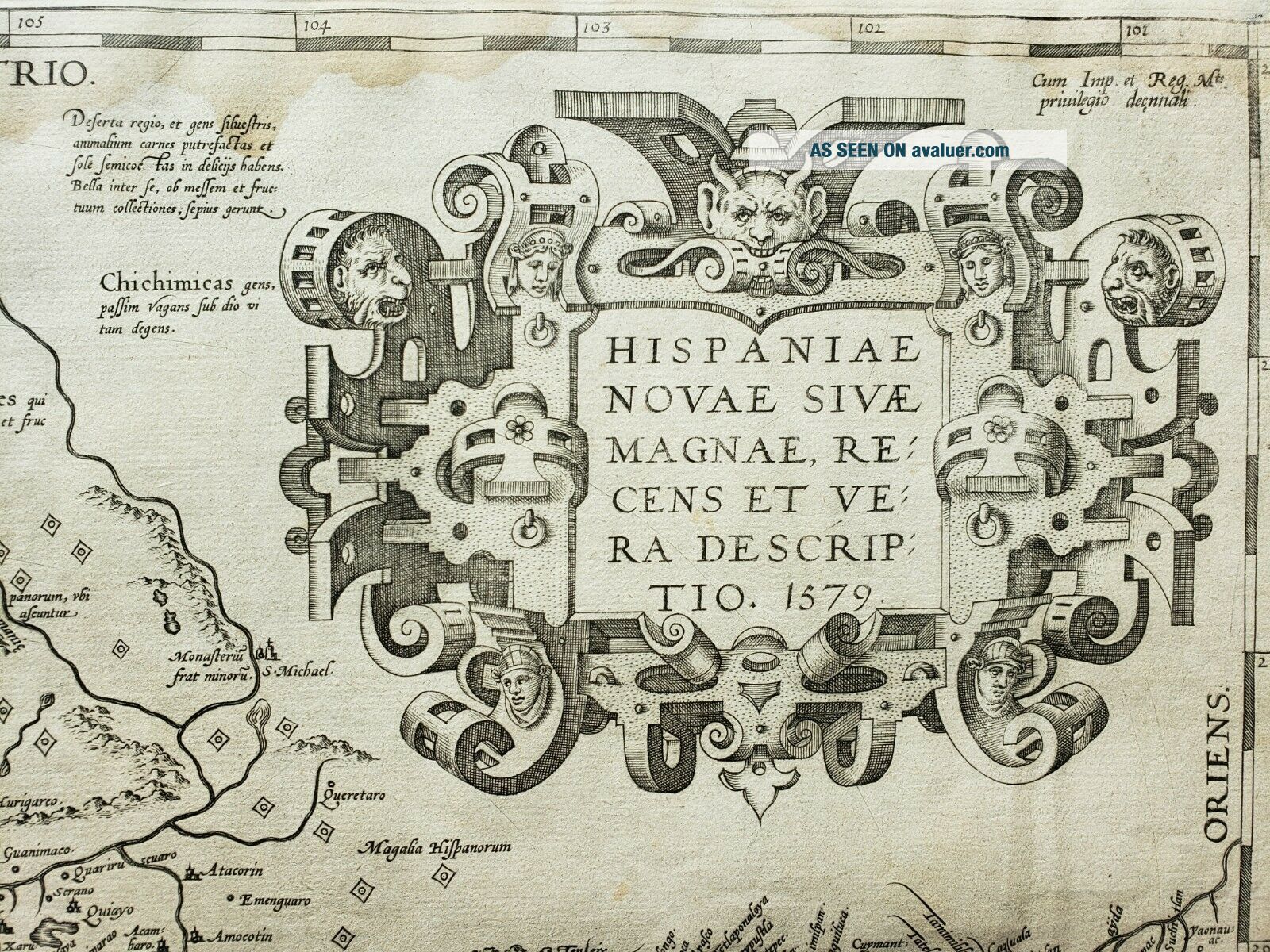
Novae Sivae Magnae, Recens et Vera Descriptio. 1579
By: Abraham Ortelius
Date: 1579 (Published) Antwerp
Dimensions: 13.5 x 19.75 inches (34.3 cm x 50.2 cm)
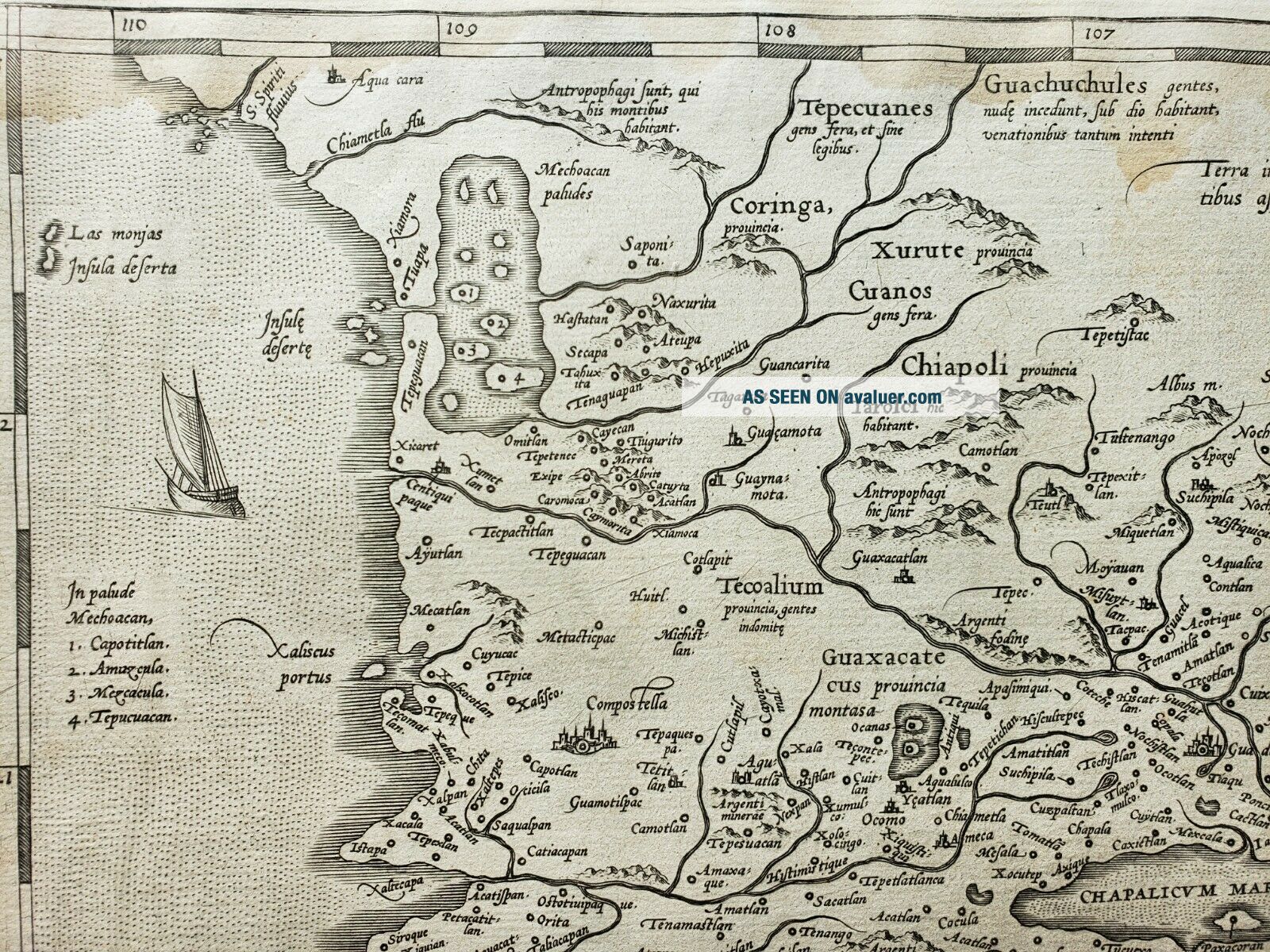
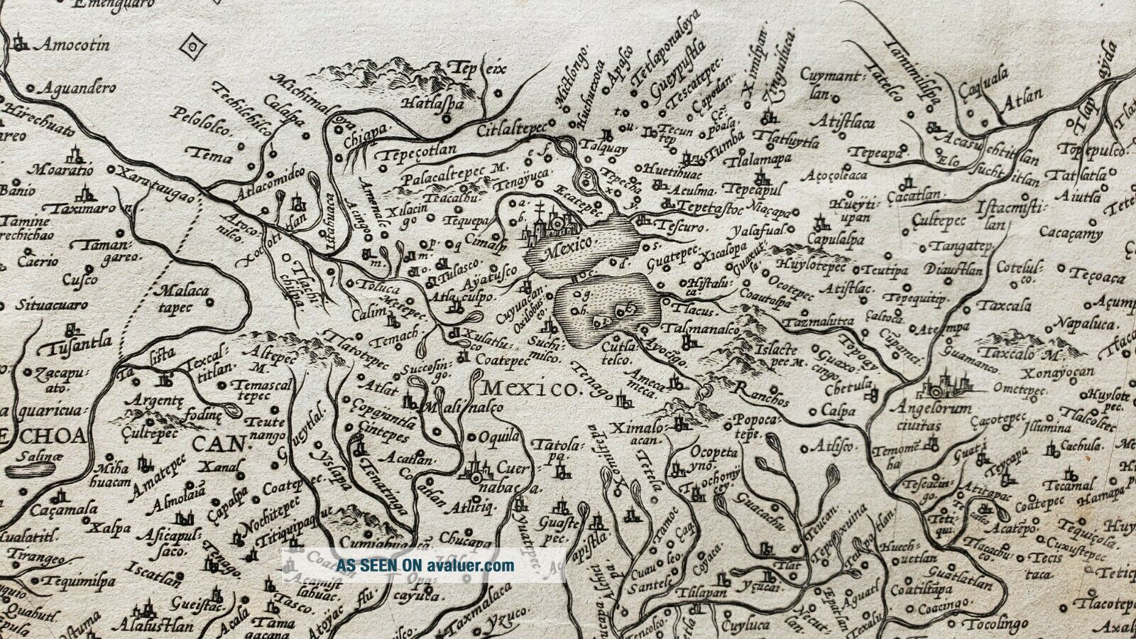
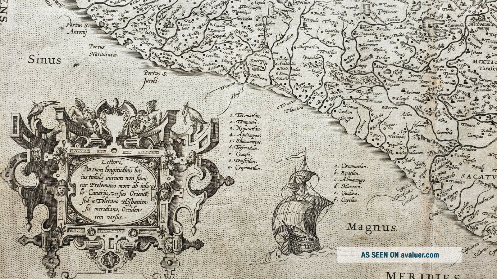
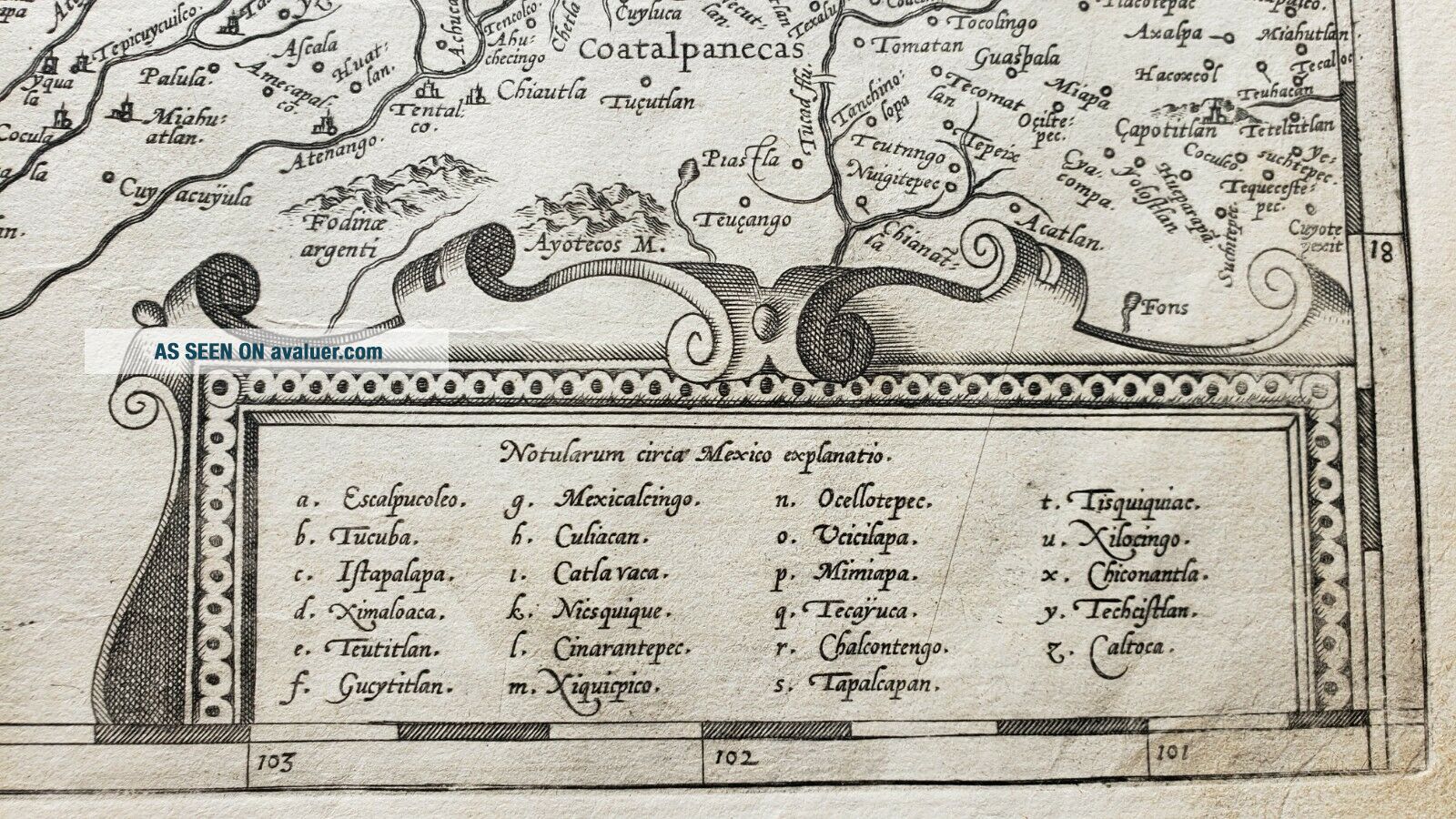
This is the first state of this important map from Ortelius’ Theatrum Orbis Terrarum. It depicts the central and western coastal regions of Mexico or New Spain, and was considered a cornerstone map and a prototype for most maps of the region in the early 17th century.
Inasmuch as Sp...anish expeditions had thoroughly explored the region, Ortelius was able with confidence to create a map which detailed the region with significant accuracy, starting from modern-day Acapulco to Mazatlan, and inland as far as Mexico City, shown situated on a large lake which has since been drained. The map is remarkable for its detail, and Ortelius names ports, cities, villages and fortified positions along with geographical features including rivers, lakes, mountains and volcanoes. The seas are fully engraved in stipple. Several gold and silver mines are located in the central region.
Embellished with three beautiful strapwork cartouches, one for the title, another in the lower left quadrant describing various points of the map in Latin, and another containing the regions of the map (each assigned a letter of the alphabet), this important map is a must-have for collectors interested in early maps of European explored/settled lands of the New World. Spanish text on the verso provides additional information regarding New Spain.
Condition: This map is a fine impression on good heavy paper in B condition with some light damp staining along the top.


    Similar items


  • Antique Map Of Mexico Or Spanish North America By Thomson,  1814

    Antique Map Of Mexico Or Spanish North America By Thomson, 1814

  • Antique Map Of Mexico,  California & Texas,  Usa,  By Rapkin & Tallis 1851

    Antique Map Of Mexico, California & Texas, Usa, By Rapkin & Tallis 1851

  • 1906 Dated Map Of Mexico By Dodd Mead & Company.  Antique

    1906 Dated Map Of Mexico By Dodd Mead & Company. Antique

  • 1882 Map Of Mexico By Blackie & Son.  Antique.

    1882 Map Of Mexico By Blackie & Son. Antique.

  • Antique Map Of Mexico And Central America From 1682 By Pierre Duval

    Antique Map Of Mexico And Central America From 1682 By Pierre Duval

  • 1900 Map Of Mexico By Carl Wolf.  Antique

    1900 Map Of Mexico By Carl Wolf. Antique

  • Hand Colored Map Of Mexico By Johnson & Ward 1863

    Hand Colored Map Of Mexico By Johnson & Ward 1863

  • Georgian Antique Map Of Devon By C Smith,  1804 With Slip Case

    Georgian Antique Map Of Devon By C Smith, 1804 With Slip Case


    • You might also like


    • 1860 Mitchell Hand Colored Map Colorado,  Nebraska & Kansas - Civil War Era

      1860 Mitchell Hand Colored Map Colorado, Nebraska & Kansas - Civil War Era

    • 18th Century French Map Of North America

      18th Century French Map Of North America

    • Las Vegas Nevada Vintage 1967 Us Geological Survey Quadrangle Map 4 Panels

      Las Vegas Nevada Vintage 1967 Us Geological Survey Quadrangle Map 4 Panels

    • Rare Antique 1845 Maps United States Exploring Expedition Book Antartica Hawaii

      Rare Antique 1845 Maps United States Exploring Expedition Book Antartica Hawaii

    • Vintage 1926 Map Hollywood From The Best Surveys Of The Time

      Vintage 1926 Map Hollywood From The Best Surveys Of The Time

    • American Continent (western Hemisphere) 1747 Bowen Antique Copper Engraved Map

      American Continent (western Hemisphere) 1747 Bowen Antique Copper Engraved Map

    • Gulf Coast Florida Texas United States 1705 De Fer Unusual Antique Engraved Map

      Gulf Coast Florida Texas United States 1705 De Fer Unusual Antique Engraved Map

    • California As Island United States 1700 De Fer Unusual First Edition Antique Map

      California As Island United States 1700 De Fer Unusual First Edition Antique Map

Avaluer          About Us          Privacy Policy          Contact Us          UP
© 2022, avaluer.net, Inc. or its affiliates