LONDON, 1883 - ISLINGTON, HACKNEY, STEPNEY, BOW, Antique Map / Plan, Bacon.


Item History & Price

Information:
Reference Number: Avaluer:10038Antique/ Modern: Antique
Format: Street AtlasCounty: London
Type: City MapCartographer/Publisher: BACON
Year: 1883Printing Technique: Lithography
City: LondonOriginal/Reproduction: Antique Original
Date Range: 1800-1899Map Type: City
Original Description:


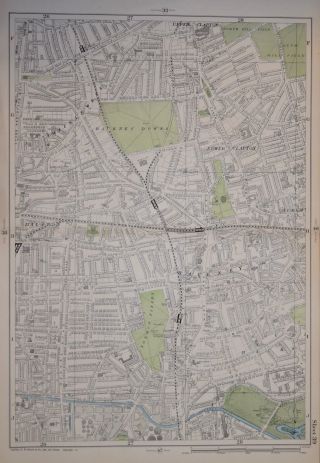
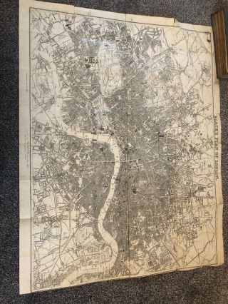
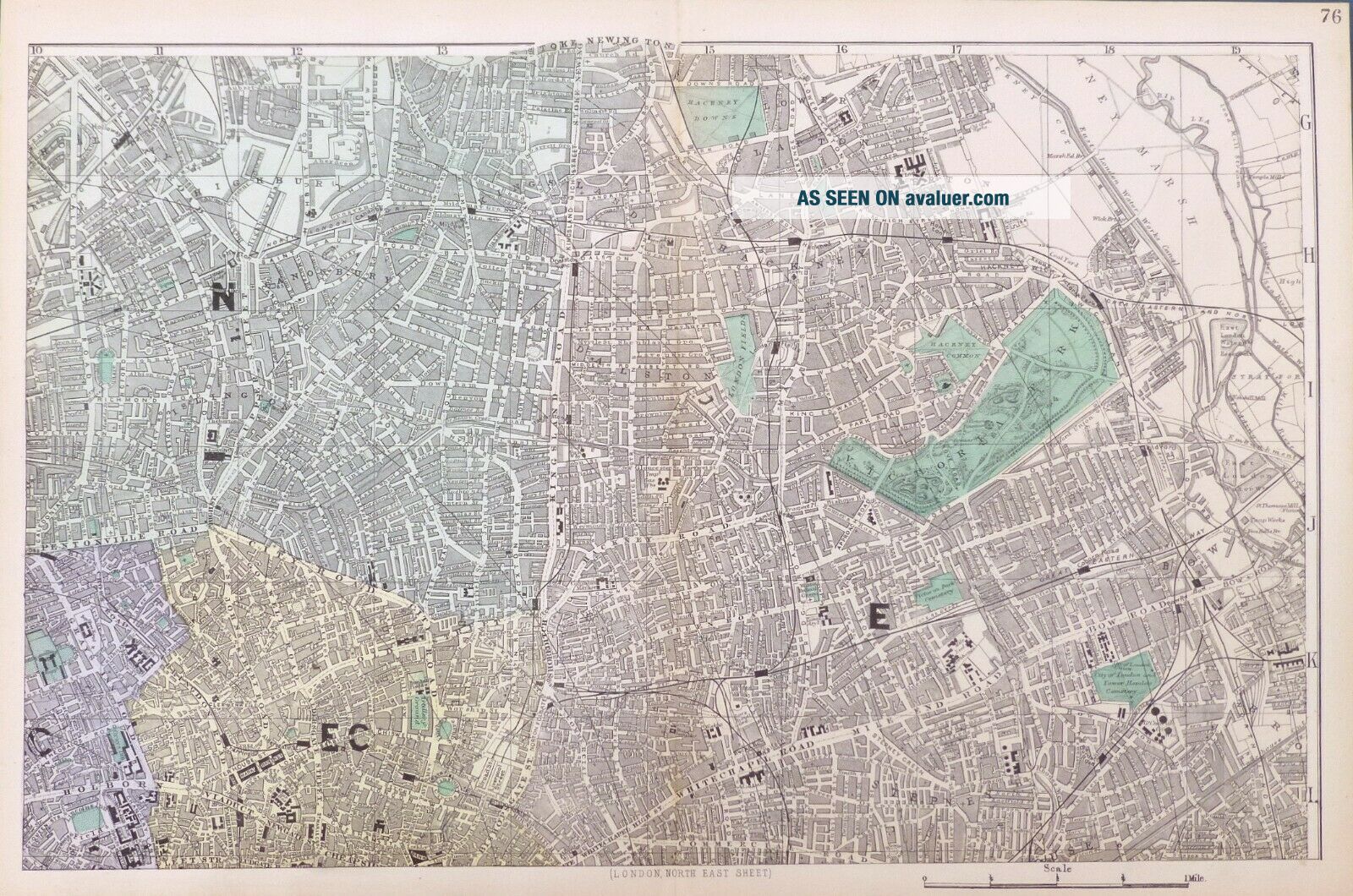
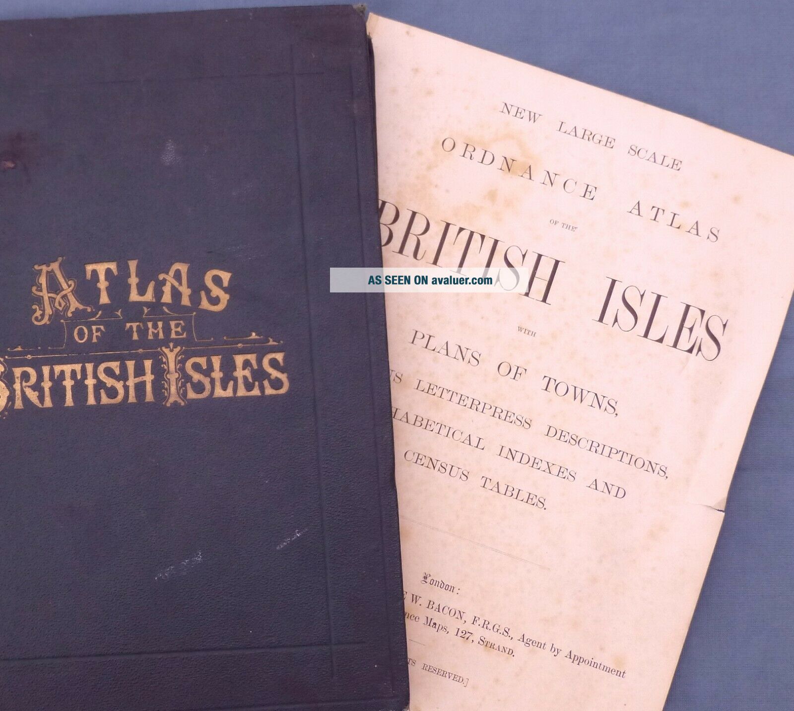
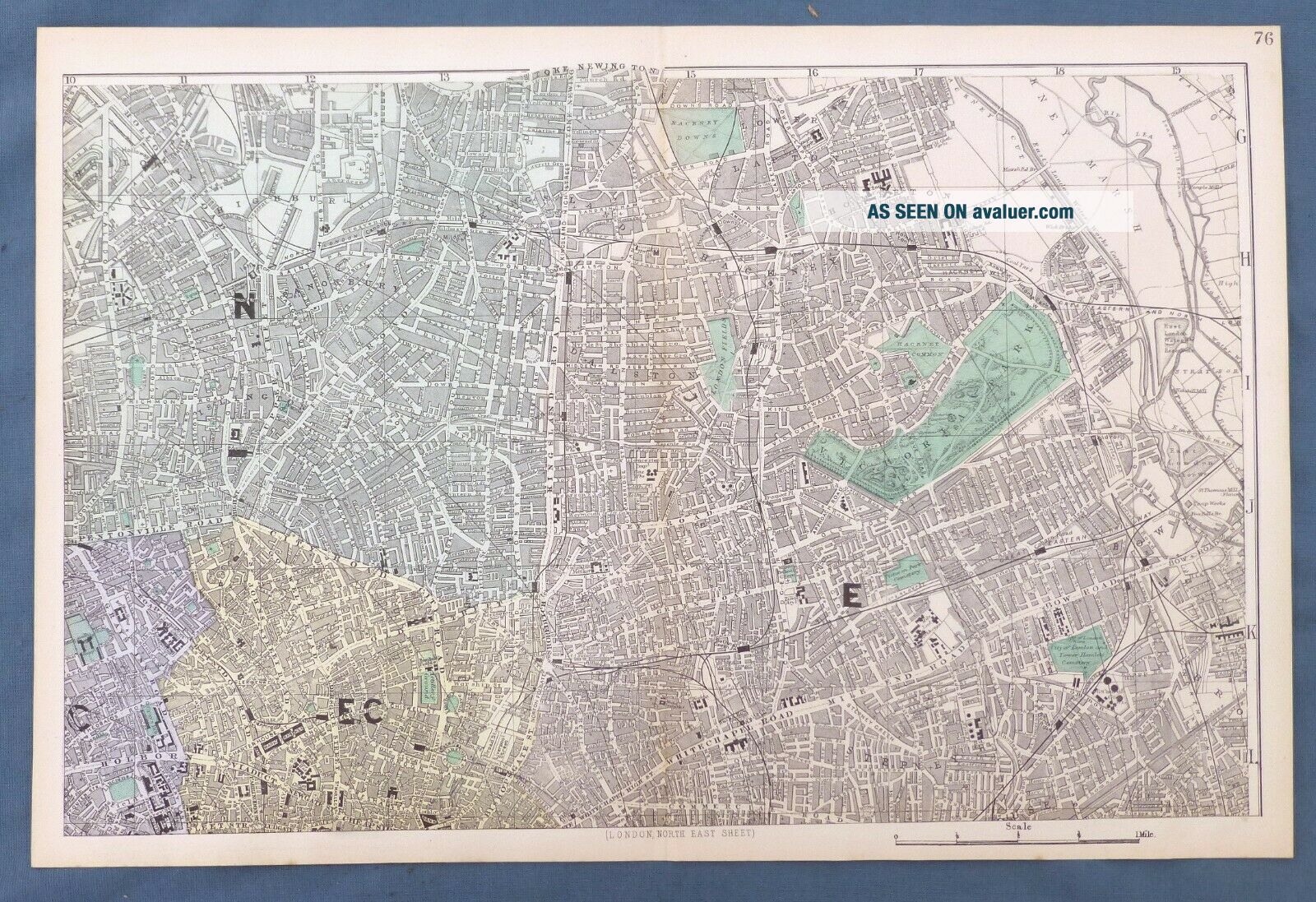
Original 19th Century  Map / Street Plan of LONDON - ISLINGTON, HIGHGATE, HACKNEY, BETHNAL GREEN , STEPNEY, BOW & THE CITY - sourced from the New Large Scale Atlas of The British Isles, published by G.W. Bacon, London.     
PRINTED IN :               1883.

SCALE :              4 Inch to Mile.
SIZE :  Folio : approx ...54 x 34 cm, (21" x 13"),    IMAGE SIZE:   Approx 50 x 30 cm, (20" x 12")

NOTES ON CONDITION:  A large Original Map in Very Good condition,  suitable for framing.Sheet map with centre fold, normal guide remains to verso else clear. Minor aging /marking consistent with light usage only. 

PACKAGING  AND SHIPMENT:  -  The map is placed in a clear polypropylene protective sleeve, and shipped in an extra strong postal tube.

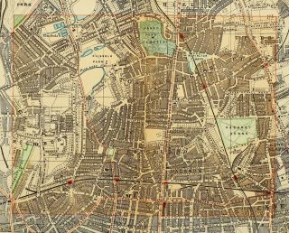
DECLARATION of AUTHENTICITY -  We guarantee the map to be an authentic historic map, published at the date stated above. We do not sell reproductions. We include a photograph of the Atlas the map has been sourced from as evidence of its provenance.
A Certificate of Authenticity accompanies the map.    

Important  Notes :-
 - the listing is for the map as described only ,  any photo's showing the atlas from where the map came from is for information / provenance purposes only. - any watermarking to the photographs above is not , of course, present on the actual map !-  virtually all antiquarian maps and prints are subject to some normal aging due to use and time which is not obtrusive unless otherwise stated.- most higher quality 19th C atlas's mounted maps on "guides" , traces of this will often remain to the back , with no significant detrimental effect to the map itself. 
 
 Other Information
We endeavour to ensure that the description of the Guide Book/ Map and its condition are accurate. If you are dissatisfied in the first instance please contact us with full details the issue so we can try to rectify the problem ...if this is not possible then we only ask you to pay the return postage and return within 30 days of arrival in its original state and packaging for a refund of the purchase price. (Original postage costs will only be refunded where an error has been made on our behalf ).
At End of The World Books and Maps we try to give detailed and accurate descriptions to all our guide-book auctions. All photographs and descriptions are specific to the item for sale. We do not use library shots. Our assessments of the condition are made in relation to the industry wide standards. We tell it like it is ...it is in no-ones interest to have a customer dissatisfied with their purchase.

      
Track Page Views With
Auctiva's FREE Counter


    Similar items


  • London - London Fields And Hackney Downs By G.  Bacon.  9 " Scale.  1902

    London - London Fields And Hackney Downs By G. Bacon. 9 " Scale. 1902

  • A Victorian Novelty Silver Drinking Horns William Leuchars,  London 1883

    A Victorian Novelty Silver Drinking Horns William Leuchars, London 1883

  • 1891 Victorian Map Street Plan London Stoke Newington Hackney Downs Dalston

    1891 Victorian Map Street Plan London Stoke Newington Hackney Downs Dalston

  • Rare Elkington Solid Silver 19th Century Victorian Tea Pot Terniers London 1883

    Rare Elkington Solid Silver 19th Century Victorian Tea Pot Terniers London 1883

  • Metropolitan London Borough Of Hackney 25mm Gilt Coat Button Pitt 1900 - 1924

    Metropolitan London Borough Of Hackney 25mm Gilt Coat Button Pitt 1900 - 1924

  • Goldsmiths Silver Salts - London 1883 - 5oz - Novelty " Bathtub Form "

    Goldsmiths Silver Salts - London 1883 - 5oz - Novelty " Bathtub Form "

  • Lovely Solid Silver Tagua Nut Pommel & Bamboo Walking Stick Cane,  London 1883

    Lovely Solid Silver Tagua Nut Pommel & Bamboo Walking Stick Cane, London 1883

  • Very Rare Black Plan Of London 1883

    Very Rare Black Plan Of London 1883


    • You might also like


    • Hungary & Romania 1579 (1584) Ortelius Unusual Antique Copper Engraved Map

      Hungary & Romania 1579 (1584) Ortelius Unusual Antique Copper Engraved Map

    • Brussels Bruxelles Belfium 1777 De Ferraris & Dupuis Large Antique Map Sheet Xxi

      Brussels Bruxelles Belfium 1777 De Ferraris & Dupuis Large Antique Map Sheet Xxi

    • 1616 Atlas Map Of Iceland.

      1616 Atlas Map Of Iceland.

    • Kazan Russia 1767 Le Clerc/lespinasse Antique Copper Engraved City View

      Kazan Russia 1767 Le Clerc/lespinasse Antique Copper Engraved City View

    • 1899 Stanford,  Folding Map Of Norwich,  Norfolk,  Arthur Collins,  Jarrold & Sons,

      1899 Stanford, Folding Map Of Norwich, Norfolk, Arthur Collins, Jarrold & Sons,

    • 1948 Vintage Linen Colour Map Geological Survey Ten Mile Of Great Britain

      1948 Vintage Linen Colour Map Geological Survey Ten Mile Of Great Britain

    • 1944 Map Flying Bombs Sussex Ww2 Newspaper Military Kent Courier German V1 V2

      1944 Map Flying Bombs Sussex Ww2 Newspaper Military Kent Courier German V1 V2

    • Dated 1638 Vellum Map Of Icklesham Sussex Showing Land Uses Owners Etc

      Dated 1638 Vellum Map Of Icklesham Sussex Showing Land Uses Owners Etc

Avaluer          About Us          Privacy Policy          Contact Us          UP
© 2022, avaluer.net, Inc. or its affiliates