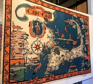
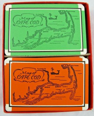
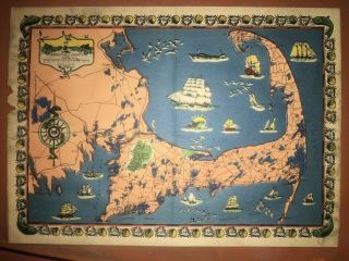
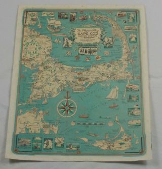
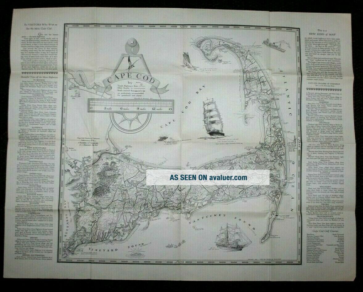
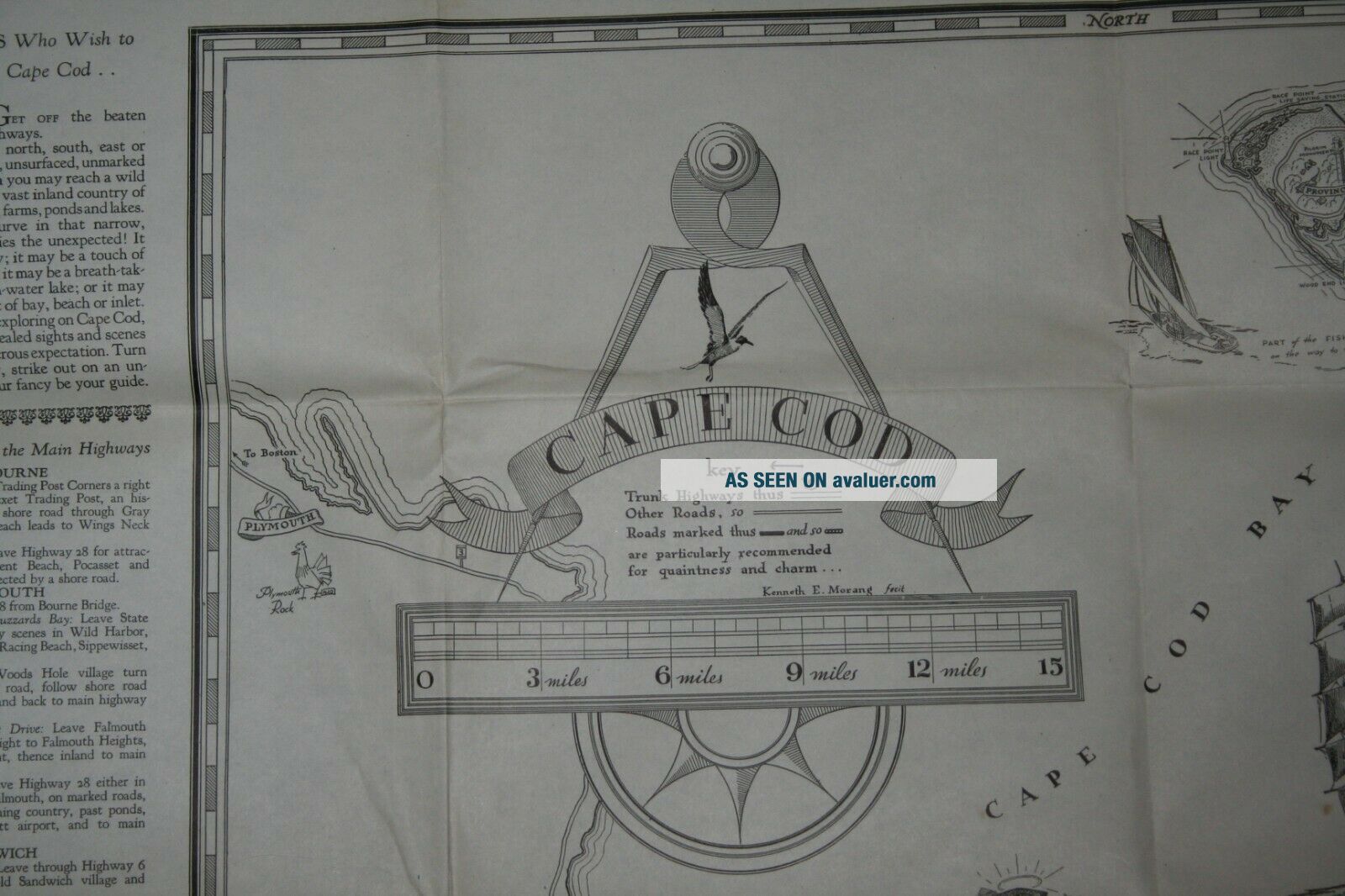
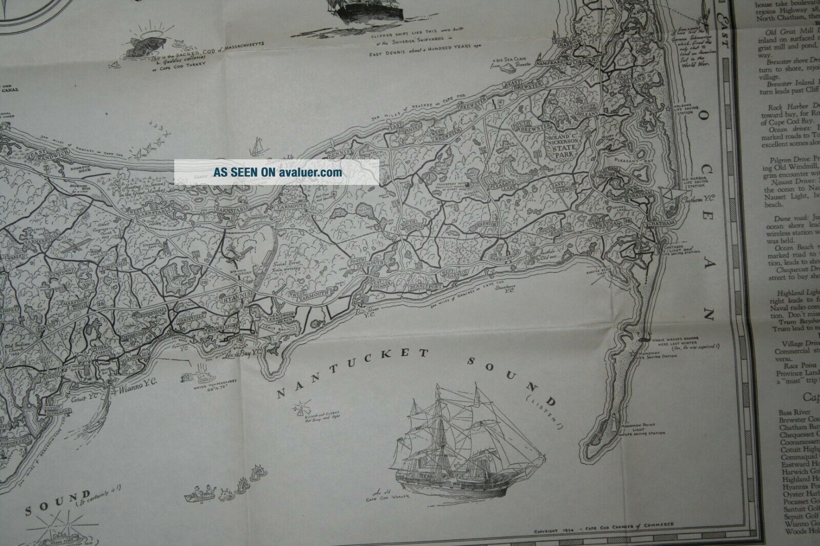
Vintage 1934 Map Of Cape Cod


Item History & Price

Information:
Reference Number: Avaluer:11152Dealer: Tryon Gold
Year: 1934Cartographer/Publisher: Cap Cod Chamber of Commerce
US State: MassachusettsOriginal/Reproduction: Reproduction
City: Cap CodFormat: Folding Map
Date Range: 1930-1939Type: City Map
Country/Region: Cap Cod
Original Description:
Vintage 1934 Map of Cape CodAll Packages are Sent Via First Class Mail with Tracking InformationCombined Shipping:Each additional item purchased ships for only $0.50. Use Add to Cart to take advantage of automatic combined shipping discounts!Satisfaction Guaranteed!


    Similar items


  • Vintage Colorful Map Of Cape Cod 25 By 36

    Vintage Colorful Map Of Cape Cod 25 By 36

  • Rare Vintage Wallet Map Of Cape Cod L.  B.  Robbin Folk Art

    Rare Vintage Wallet Map Of Cape Cod L. B. Robbin Folk Art

  • Vintage Veedol,  Flying A Road Map Of Cape Cod

    Vintage Veedol, Flying A Road Map Of Cape Cod

  • Vintage 1969 Tour Map Of Cape Cod 6 Fascinating Tours Chamber Of Commerce

    Vintage 1969 Tour Map Of Cape Cod 6 Fascinating Tours Chamber Of Commerce

  • Vintage Double Deck Playing Cards Map Of Cape Cod Massachusetts

    Vintage Double Deck Playing Cards Map Of Cape Cod Massachusetts

  • Vintage Map Of Cape Cod Circa 1930’s Printed By Town Crier Shop In Provincetown

    Vintage Map Of Cape Cod Circa 1930’s Printed By Town Crier Shop In Provincetown

  • The Golf Map Of Cape Cod - Vintage Brochure 1984 Pga

    The Golf Map Of Cape Cod - Vintage Brochure 1984 Pga

  • Vintage Atlantic Card Co.  Pilgrims Map Of Cape Cod Martha

    Vintage Atlantic Card Co. Pilgrims Map Of Cape Cod Martha ' S Vineyard & Nantucket


    • You might also like


    • 1860 Mitchell Hand Colored Map Colorado,  Nebraska & Kansas - Civil War Era

      1860 Mitchell Hand Colored Map Colorado, Nebraska & Kansas - Civil War Era

    • 18th Century French Map Of North America

      18th Century French Map Of North America

    • Las Vegas Nevada Vintage 1967 Us Geological Survey Quadrangle Map 4 Panels

      Las Vegas Nevada Vintage 1967 Us Geological Survey Quadrangle Map 4 Panels

    • Rare Antique 1845 Maps United States Exploring Expedition Book Antartica Hawaii

      Rare Antique 1845 Maps United States Exploring Expedition Book Antartica Hawaii

    • Vintage 1926 Map Hollywood From The Best Surveys Of The Time

      Vintage 1926 Map Hollywood From The Best Surveys Of The Time

    • American Continent (western Hemisphere) 1747 Bowen Antique Copper Engraved Map

      American Continent (western Hemisphere) 1747 Bowen Antique Copper Engraved Map

    • Gulf Coast Florida Texas United States 1705 De Fer Unusual Antique Engraved Map

      Gulf Coast Florida Texas United States 1705 De Fer Unusual Antique Engraved Map

    • California As Island United States 1700 De Fer Unusual First Edition Antique Map

      California As Island United States 1700 De Fer Unusual First Edition Antique Map

Avaluer          About Us          Privacy Policy          Contact Us          UP
© 2022, avaluer.net, Inc. or its affiliates