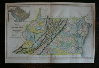
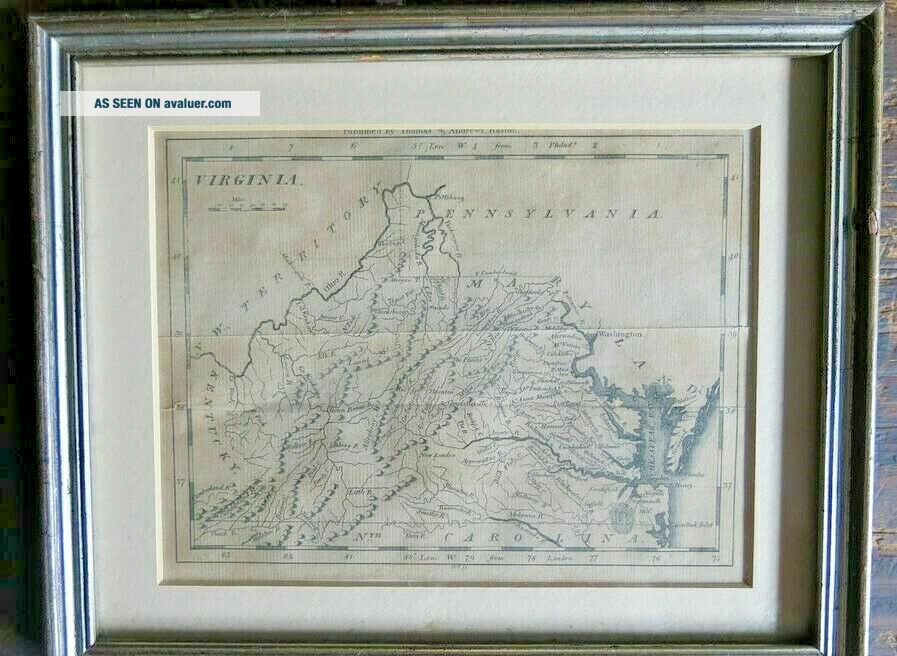
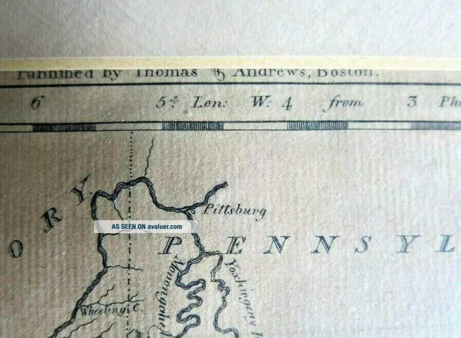
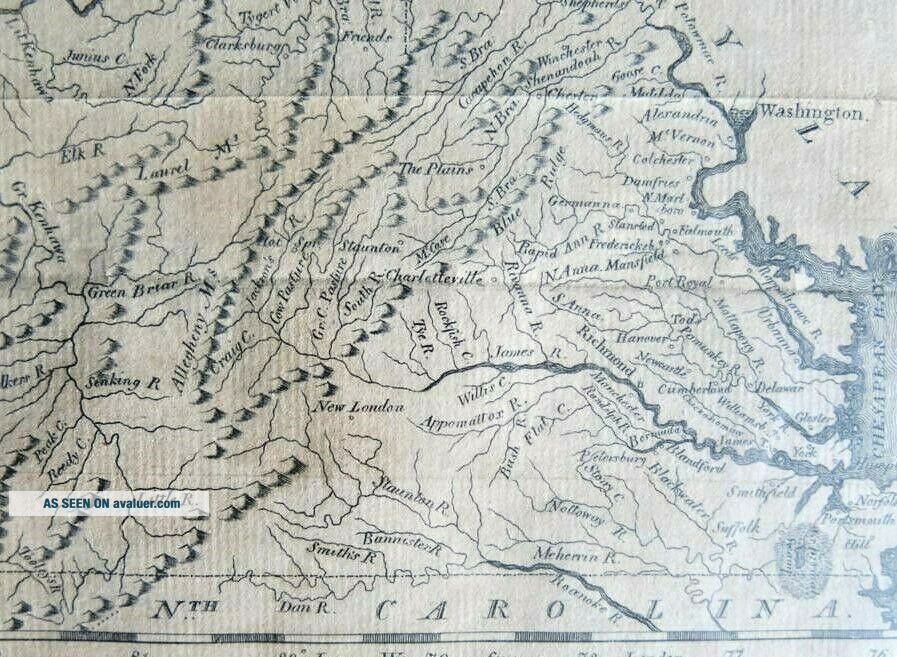
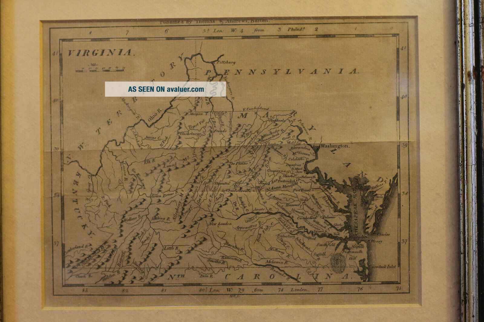
Antique Map Of Virginia, Thomas & Andrews, Boston


Item History & Price

Information:
Reference Number: Avaluer:1230725Cartographer/Publisher: Thomas & Andrews
Date Range: 1800-1899US State: Virginia
Country/Region: United States of America
Original Description:
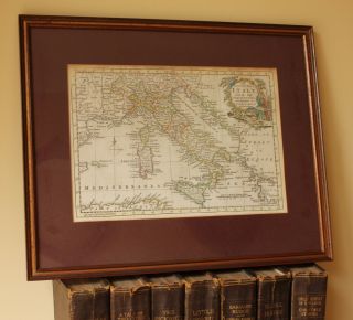
Antique Map of Virginia
Period: Circa 1800
Publication: Thomas & Andrews, Boston
Color: Black & WhiteSize:8 x 6 inches (image)
11 x 9 inches  (frame)

This map is framed under glass, as pictured, and not inspected out of the frame.  As with all my items, satisfaction is fully guaranteed.
Thanks for looking!
Dave C.


    Similar items


  • Antique Map Of Italy.  Thomas Bowen Middleton

    Antique Map Of Italy. Thomas Bowen Middleton ' S C1778. Sardinia. Sicily. Rome.

  • 1770 Antique Map Of Wiltshire - Thomas Kitchin - Hand Coloured & Framed

    1770 Antique Map Of Wiltshire - Thomas Kitchin - Hand Coloured & Framed

  • Antique Map Of Somersetshire Thomas Bowen C 1790

    Antique Map Of Somersetshire Thomas Bowen C 1790

  • Antique Map Of Staffordshire Thomas Moule 1836 - 48 Hand Coloured England

    Antique Map Of Staffordshire Thomas Moule 1836 - 48 Hand Coloured England

  • Antique Map Of Derbyshire Thomas Moule.  1836 - 48.  Barclay

    Antique Map Of Derbyshire Thomas Moule. 1836 - 48. Barclay ' S

  • Antique Map Of Dorsetshire Thomas Moule I Dower C1850.  Old Dorset Shaftesbury.

    Antique Map Of Dorsetshire Thomas Moule I Dower C1850. Old Dorset Shaftesbury.

  • Antique Map Of Virginia And Maryland Hand Coloured Published By J Hinton 1832

    Antique Map Of Virginia And Maryland Hand Coloured Published By J Hinton 1832

  • Antique Map Of Monmouthshire: Thomas Kitchin 1763; Hand Colouring.

    Antique Map Of Monmouthshire: Thomas Kitchin 1763; Hand Colouring.


    • You might also like


    • 1860 Mitchell Hand Colored Map Colorado,  Nebraska & Kansas - Civil War Era

      1860 Mitchell Hand Colored Map Colorado, Nebraska & Kansas - Civil War Era

    • 18th Century French Map Of North America

      18th Century French Map Of North America

    • Las Vegas Nevada Vintage 1967 Us Geological Survey Quadrangle Map 4 Panels

      Las Vegas Nevada Vintage 1967 Us Geological Survey Quadrangle Map 4 Panels

    • Rare Antique 1845 Maps United States Exploring Expedition Book Antartica Hawaii

      Rare Antique 1845 Maps United States Exploring Expedition Book Antartica Hawaii

    • Vintage 1926 Map Hollywood From The Best Surveys Of The Time

      Vintage 1926 Map Hollywood From The Best Surveys Of The Time

    • American Continent (western Hemisphere) 1747 Bowen Antique Copper Engraved Map

      American Continent (western Hemisphere) 1747 Bowen Antique Copper Engraved Map

    • Gulf Coast Florida Texas United States 1705 De Fer Unusual Antique Engraved Map

      Gulf Coast Florida Texas United States 1705 De Fer Unusual Antique Engraved Map

    • California As Island United States 1700 De Fer Unusual First Edition Antique Map

      California As Island United States 1700 De Fer Unusual First Edition Antique Map

Avaluer          About Us          Privacy Policy          Contact Us          UP
© 2022, avaluer.net, Inc. or its affiliates