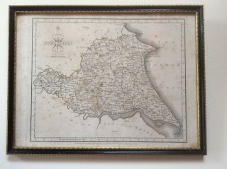
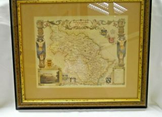
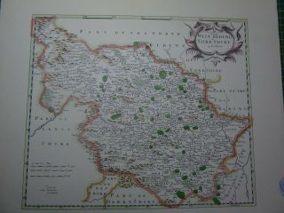
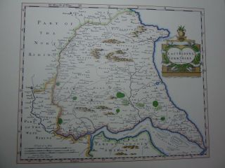
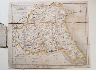
County Map Of Yorkshire North Riding 1787 Engraved By John Carey Framed


Item History & Price

Information:
Reference Number: Avaluer:1234221Year: 1787
Type: County MapCounty: Yorkshire
Original/Reproduction: Antique OriginalCartographer/Publisher: John Cary
Date Range: 1700-1799Era: 1700s
Country/Region: England, Yorkshire
Original Description:

Original County Map of Yorkshire North Riding 1787 Engraved by John Carey FramedIn good condition but with some foxing to the map and the underside of the glass. It measures approximately 33cm wide by 25cm high.   I am aprivate seller who is having a massive clear out.Allgoods are well packaged in recycled materials where possible.I only charge the approx postagecost based on the postage calculator.I am sorry but unless the item islisted as pick up only I c...an’t offer collection in person and everything isposted.Please complete payment within 48hours of the auction ending.My account is automatically set up to openunpaid item cases after 5 days.If youbuy multiple items I will dispatch them together once you have finishedshopping and requested a multiple postage cost. Thankyou for looking. 


    Similar items


  • County Map Of Yorkshire East Riding 1787 Engraved By John Cary Framed

    County Map Of Yorkshire East Riding 1787 Engraved By John Cary Framed

  • Kelly

    Kelly ' S Map Of Yorkshire North Riding 1901 Drawn, Engraved By Kelly ' S Directories

  • Decorative Print County Map Of Yorkshire West Riding,  Thomas Moule 1830 Harewood

    Decorative Print County Map Of Yorkshire West Riding, Thomas Moule 1830 Harewood

  • Framed Vintage Old County Map Of Yorkshire West Riding Print

    Framed Vintage Old County Map Of Yorkshire West Riding Print

  • Old Coloured Antique County Map Of The West Riding Of Yorkshire By Robert Morden

    Old Coloured Antique County Map Of The West Riding Of Yorkshire By Robert Morden

  • Old Coloured Antique County Map Of The East Riding Of Yorkshire By Robert Morden

    Old Coloured Antique County Map Of The East Riding Of Yorkshire By Robert Morden

  • 1842 Map Of Yorkshire East Riding Walker

    1842 Map Of Yorkshire East Riding Walker

  • Bacon

    Bacon ' S County Map Of Yorkshire


    • You might also like


    • Hungary & Romania 1579 (1584) Ortelius Unusual Antique Copper Engraved Map

      Hungary & Romania 1579 (1584) Ortelius Unusual Antique Copper Engraved Map

    • Brussels Bruxelles Belfium 1777 De Ferraris & Dupuis Large Antique Map Sheet Xxi

      Brussels Bruxelles Belfium 1777 De Ferraris & Dupuis Large Antique Map Sheet Xxi

    • 1616 Atlas Map Of Iceland.

      1616 Atlas Map Of Iceland.

    • Kazan Russia 1767 Le Clerc/lespinasse Antique Copper Engraved City View

      Kazan Russia 1767 Le Clerc/lespinasse Antique Copper Engraved City View

    • 1899 Stanford,  Folding Map Of Norwich,  Norfolk,  Arthur Collins,  Jarrold & Sons,

      1899 Stanford, Folding Map Of Norwich, Norfolk, Arthur Collins, Jarrold & Sons,

    • 1948 Vintage Linen Colour Map Geological Survey Ten Mile Of Great Britain

      1948 Vintage Linen Colour Map Geological Survey Ten Mile Of Great Britain

    • 1944 Map Flying Bombs Sussex Ww2 Newspaper Military Kent Courier German V1 V2

      1944 Map Flying Bombs Sussex Ww2 Newspaper Military Kent Courier German V1 V2

    • Dated 1638 Vellum Map Of Icklesham Sussex Showing Land Uses Owners Etc

      Dated 1638 Vellum Map Of Icklesham Sussex Showing Land Uses Owners Etc

Avaluer          About Us          Privacy Policy          Contact Us          UP
© 2022, avaluer.net, Inc. or its affiliates