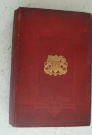
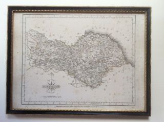
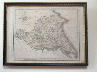
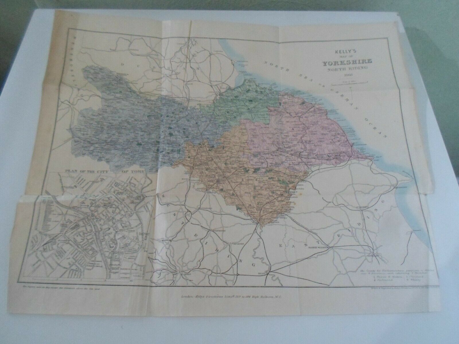
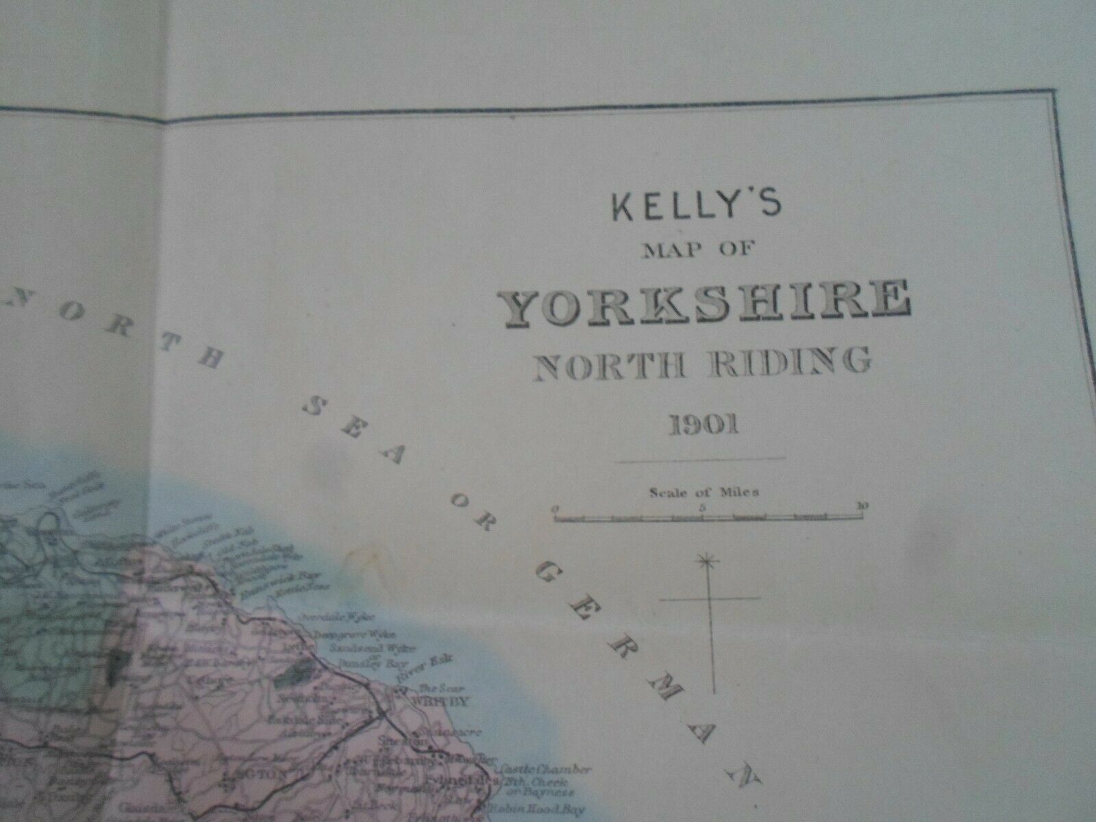
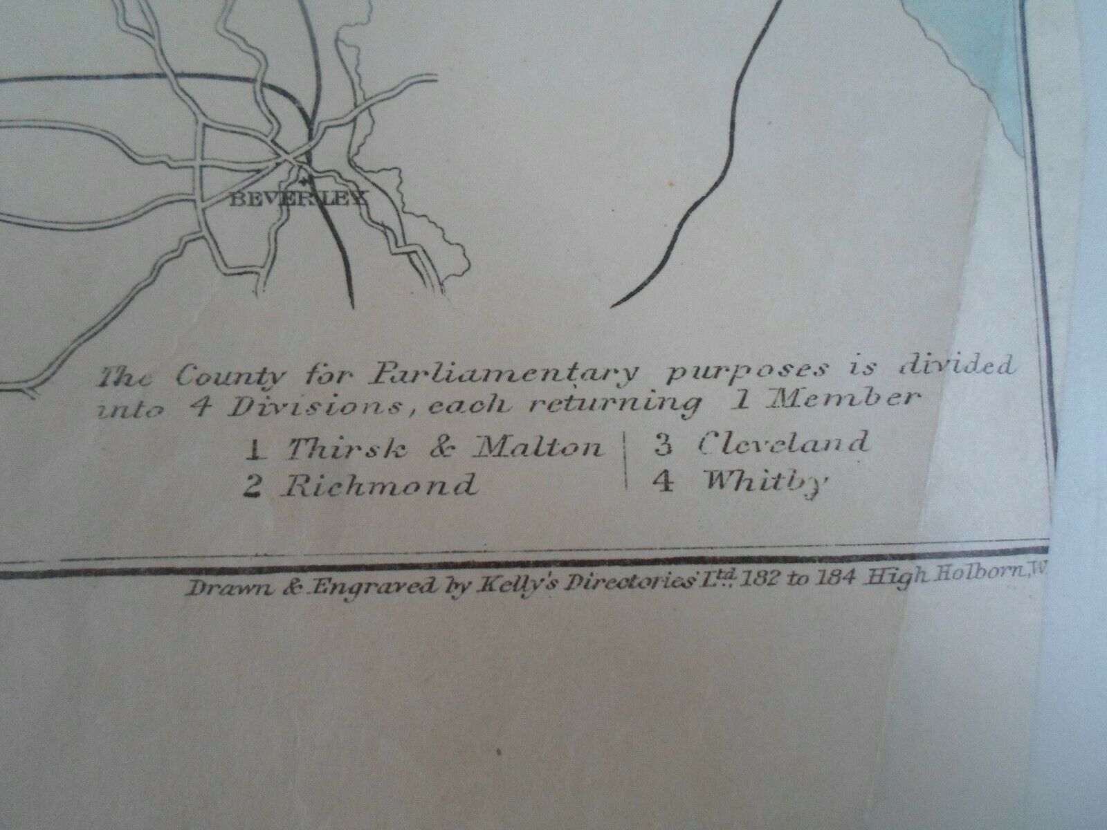
Kelly ' S Map Of Yorkshire North Riding 1901 Drawn, Engraved By Kelly ' S Directories


Item History & Price

Information:
Reference Number: Avaluer:20355569County: Yorkshire
Year: 1901
Original Description:
This Auction is for
A Single Sheet Map
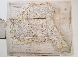
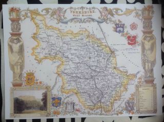
KELLY'S MAP OF YORKSHIRE, NORTH RIDING1901
Drawn and engraved by Kelly's Directories
Used condition, with some wear to the edges and creased in the folds. Slight damage to the edges of the sheet Measures approx: 17.25" x 14".  Has been folded and will be folded for transit
Please check out my other listings for a huge selection of eclectic and other vintage items.Many suitable for shop display / stage and TV Prop etc.I also hav...e a huge stock waiting to be listed so please feel free to message me via ebay if you have any queries.


    Similar items


  • Vintage Book 1889 Kelly’s Directory Of Yorkshire North And East Riding York Hull

    Vintage Book 1889 Kelly’s Directory Of Yorkshire North And East Riding York Hull

  • County Map Of Yorkshire North Riding 1787 Engraved By John Carey Framed

    County Map Of Yorkshire North Riding 1787 Engraved By John Carey Framed

  • County Map Of Yorkshire East Riding 1787 Engraved By John Cary Framed

    County Map Of Yorkshire East Riding 1787 Engraved By John Cary Framed

  • Antique 1905 Kelly

    Antique 1905 Kelly ' S Map Of London For The Post Office Directory, Linen Backed

  • Vintage O/s Map Of The North York Moors

    Vintage O/s Map Of The North York Moors

  • Kelly

    Kelly ' S Directories Of Yorkshire Kellys History & Genealogy Pdf Ebooks On Disc

  • 1842 Map Of Yorkshire East Riding Walker

    1842 Map Of Yorkshire East Riding Walker

  • Decorative Print County Map Of Yorkshire West Riding,  Thomas Moule 1830 Harewood

    Decorative Print County Map Of Yorkshire West Riding, Thomas Moule 1830 Harewood


    • You might also like


    • Hungary & Romania 1579 (1584) Ortelius Unusual Antique Copper Engraved Map

      Hungary & Romania 1579 (1584) Ortelius Unusual Antique Copper Engraved Map

    • Brussels Bruxelles Belfium 1777 De Ferraris & Dupuis Large Antique Map Sheet Xxi

      Brussels Bruxelles Belfium 1777 De Ferraris & Dupuis Large Antique Map Sheet Xxi

    • 1616 Atlas Map Of Iceland.

      1616 Atlas Map Of Iceland.

    • Kazan Russia 1767 Le Clerc/lespinasse Antique Copper Engraved City View

      Kazan Russia 1767 Le Clerc/lespinasse Antique Copper Engraved City View

    • 1899 Stanford,  Folding Map Of Norwich,  Norfolk,  Arthur Collins,  Jarrold & Sons,

      1899 Stanford, Folding Map Of Norwich, Norfolk, Arthur Collins, Jarrold & Sons,

    • 1948 Vintage Linen Colour Map Geological Survey Ten Mile Of Great Britain

      1948 Vintage Linen Colour Map Geological Survey Ten Mile Of Great Britain

    • 1944 Map Flying Bombs Sussex Ww2 Newspaper Military Kent Courier German V1 V2

      1944 Map Flying Bombs Sussex Ww2 Newspaper Military Kent Courier German V1 V2

    • Dated 1638 Vellum Map Of Icklesham Sussex Showing Land Uses Owners Etc

      Dated 1638 Vellum Map Of Icklesham Sussex Showing Land Uses Owners Etc

Avaluer          About Us          Privacy Policy          Contact Us          UP
© 2022, avaluer.net, Inc. or its affiliates