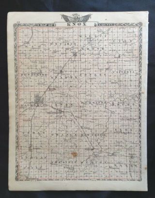
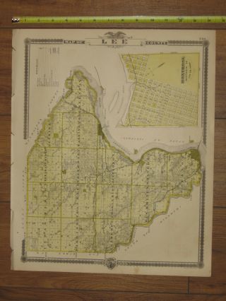
1870 Vintage Atlas Knox County IL Map Lynn Township


Item History & Price

Information:
Reference Number: Avaluer:1235173US State: Illinois
Year: 1870Format: Atlas
Publication Year: 1870Topic: Atlases
Original Description:
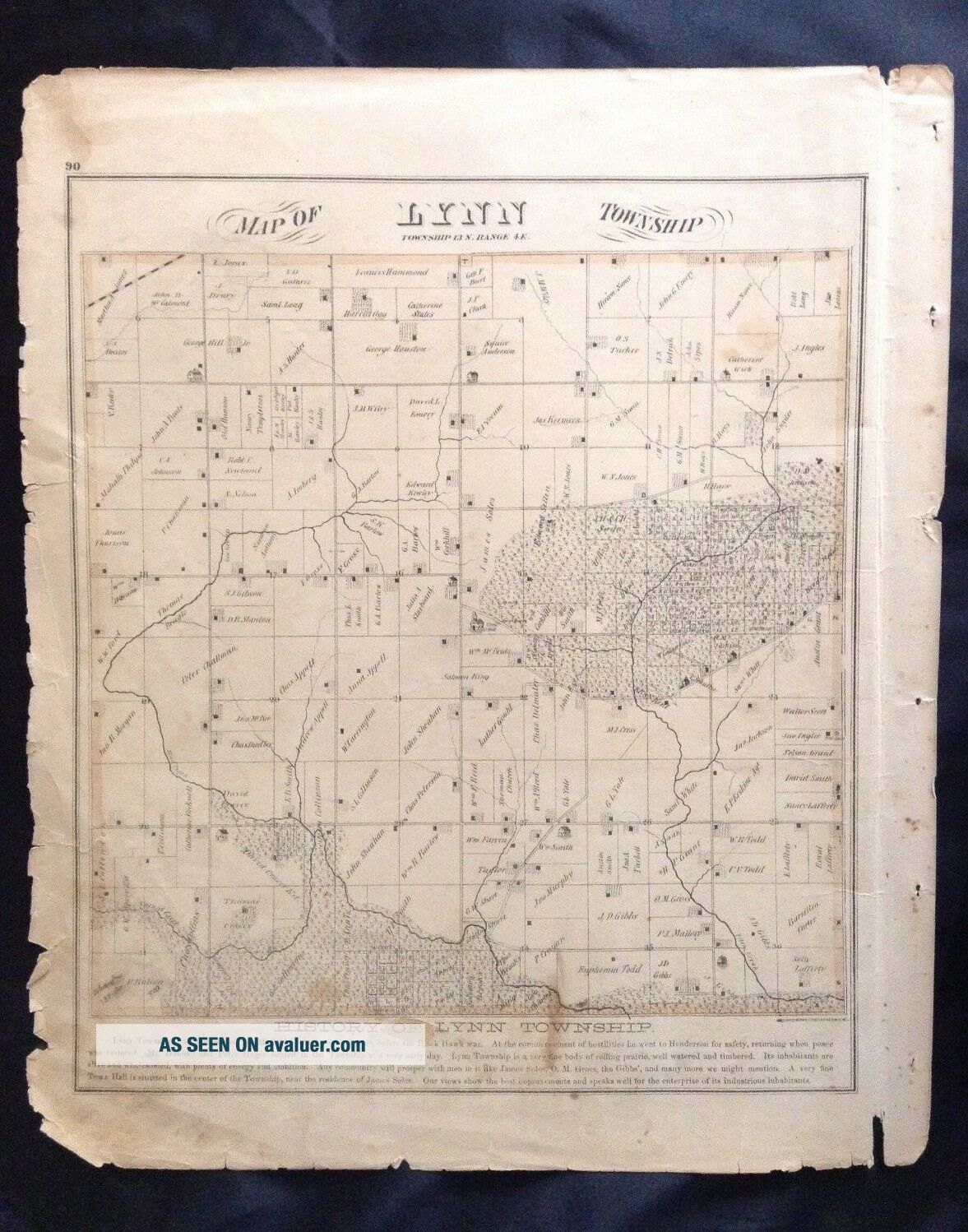
 Offered here is a vintage 1870 Knox County Illinois Atlas page....This is a single page...page 90 featuring a map of Lynn Township in Knox County...Size of the original single page measures approximately 15" x 18"...Page will be sleeved in plastic, and shipped next day after payment...in a mailing tube to protect from bending...Multiple purchases will result in combined shipping charges.  Shipping charges in this listing are US destination only; for shipping outsid...e the US, please contact me.   Feel free to post questions.                                                     Check out my other items!.            And if you like this item, check out the vintage items in my other sister ebay accounts "bunhutch" and "planestrainsautomobilesships."                                                   


    Similar items


  • 1876 Vintage Illinois Atlas Knox County Map Knoxville Galesburg Maquon Oneida

    1876 Vintage Illinois Atlas Knox County Map Knoxville Galesburg Maquon Oneida

  • 1894 - 1895 Antique Map,  Stuart

    1894 - 1895 Antique Map, Stuart ' S Maine Atlas, Rockland, Knox County

  • Vintage 1978 Riverside County California Maps,  Street Atlas Thomas Bros

    Vintage 1978 Riverside County California Maps, Street Atlas Thomas Bros

  • Antique 1870 Henderson Township Knox County Illinois Handcolored Map Nr

    Antique 1870 Henderson Township Knox County Illinois Handcolored Map Nr

  • 1902 - 03 Antique Map,  Stuart

    1902 - 03 Antique Map, Stuart ' S Maine Atlas, Rockland, Knox County

  • Vintage 1949 Howard County Maryland Map - Topography & Election Districts

    Vintage 1949 Howard County Maryland Map - Topography & Election Districts

  • Vintage Antique Knox County Ohio 1853 Jacquard Coverlet Named

    Vintage Antique Knox County Ohio 1853 Jacquard Coverlet Named

  • 1875 Atlas - Lee County,  Iowa Map - Keokuk Fort Madison Montrose Antique

    1875 Atlas - Lee County, Iowa Map - Keokuk Fort Madison Montrose Antique


    • You might also like


    • 1860 Mitchell Hand Colored Map Colorado,  Nebraska & Kansas - Civil War Era

      1860 Mitchell Hand Colored Map Colorado, Nebraska & Kansas - Civil War Era

    • 18th Century French Map Of North America

      18th Century French Map Of North America

    • Las Vegas Nevada Vintage 1967 Us Geological Survey Quadrangle Map 4 Panels

      Las Vegas Nevada Vintage 1967 Us Geological Survey Quadrangle Map 4 Panels

    • Rare Antique 1845 Maps United States Exploring Expedition Book Antartica Hawaii

      Rare Antique 1845 Maps United States Exploring Expedition Book Antartica Hawaii

    • Vintage 1926 Map Hollywood From The Best Surveys Of The Time

      Vintage 1926 Map Hollywood From The Best Surveys Of The Time

    • American Continent (western Hemisphere) 1747 Bowen Antique Copper Engraved Map

      American Continent (western Hemisphere) 1747 Bowen Antique Copper Engraved Map

    • Gulf Coast Florida Texas United States 1705 De Fer Unusual Antique Engraved Map

      Gulf Coast Florida Texas United States 1705 De Fer Unusual Antique Engraved Map

    • California As Island United States 1700 De Fer Unusual First Edition Antique Map

      California As Island United States 1700 De Fer Unusual First Edition Antique Map

Avaluer          About Us          Privacy Policy          Contact Us          UP
© 2022, avaluer.net, Inc. or its affiliates