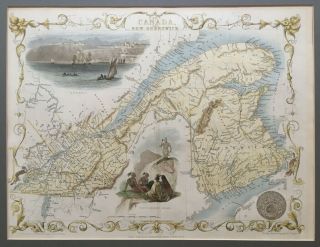
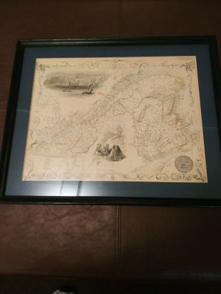
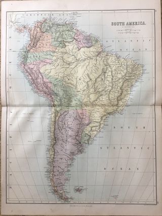
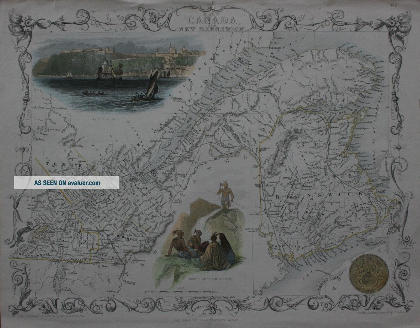
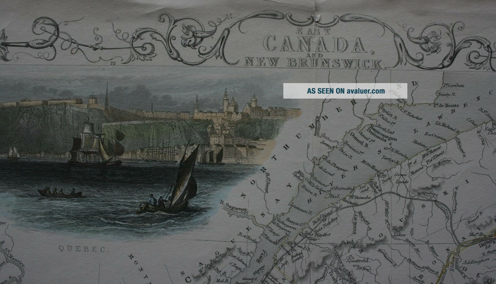
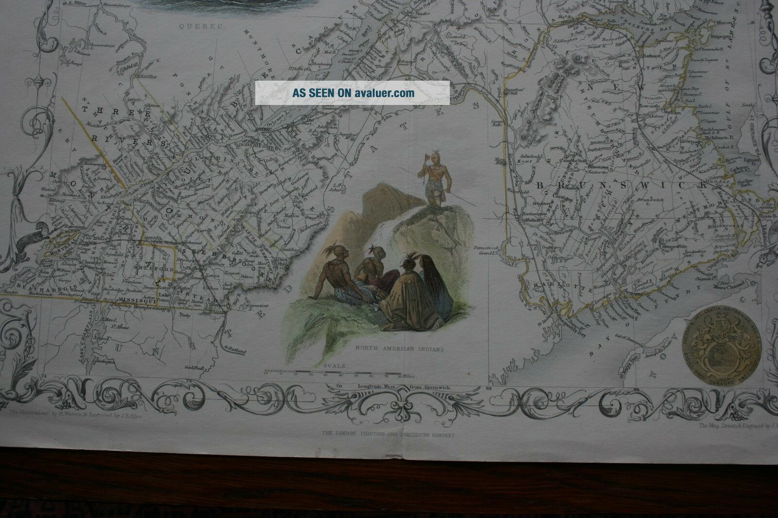
East Canada And Brunswick Antique Map By John Tallis 1851


Item History & Price

Information:
Reference Number: Avaluer:1238232Cartographer/Publisher: John Tallis
Type: World AtlasPrinting Technique: steel engraving
Year: 1851Original/Reproduction: Antique Original
Date Range: 1800-1899Canadian Province: New Brunswick, Quebec
Country/Region: CanadaFormat: Atlas Map
Era: 1800s
Original Description:
JohnTallis is considered to be one of the most renowned cartographers andpublisher of the C19th .Hismaps are considered to be the last of the lavishly decorated andornamental maps, works of art as much of geography. He was born in Stourbridge in Worcestershire in about 1818 and it is possible he stayed working in the Midlands working as a publisher in Birmingham, until he moved to London in the early 1840’s. John then set up the first of his publishing businesses, in Crippl...egate, with Frederick Tallis, who was quite possibly his brother. This business lasted from 1842 to 1849 when it was dissolved. By 1846 the business had moved to Smithfield. From 1851 – 54, John set up another business, operating as John Tallis and Company and it was during this period that he produced the Illustrated World Atlas, produced for the 1851 Great Exhibition.
Theintriguing thing is, that at some point, John Tallis made theacquaintance of an engraver called John Rapkin who was an inspirationto Tallis. His stunning illustrations enabled the maps they producedto be beautiful illumanitive works of art.JohnRapkin’s work inspired John Tallis and they used traveloguesextensively to guide John  Rapkin as he produced vignettes andornamental engravings to embelish the Tallis maps.Themaps were surprisingly uncoloured, although when sold colourists werefrequently employed to add tints to themEngraving measures approx 25 cm x 32 cmReady for Framing


    Similar items


  • 1851 Antique Map; East Canada And Brunswick,  Canada - John Tallis / Rapkin

    1851 Antique Map; East Canada And Brunswick, Canada - John Tallis / Rapkin

  • Antique Map Of East Canada And Brunswick (framed) 16 3/4 Wide × 13 3/4 " High

    Antique Map Of East Canada And Brunswick (framed) 16 3/4 Wide × 13 3/4 " High

  • Durham (county) 1787: Antique Map By John Cary - Copper Engraving And Hand Colour -

    Durham (county) 1787: Antique Map By John Cary - Copper Engraving And Hand Colour -

  • Guernsey And Alderney: Two Antique Maps By John Cary,  1789

    Guernsey And Alderney: Two Antique Maps By John Cary, 1789

  • 1826 Turkey In Asia Persia Middle East Hand Coloured Antique Map By John Cary

    1826 Turkey In Asia Persia Middle East Hand Coloured Antique Map By John Cary

  • Cambridgeshire And Isle Of Ely: Antique Map By John Bill,  1626

    Cambridgeshire And Isle Of Ely: Antique Map By John Bill, 1626

  • 1800 Malta Valletta City Plan Antique Map By John Stockdale 219 Years Old

    1800 Malta Valletta City Plan Antique Map By John Stockdale 219 Years Old

  • 1888 South America Large Antique Map By John Bartholomew & A & C Black

    1888 South America Large Antique Map By John Bartholomew & A & C Black


    • You might also like


    • 1860 Mitchell Hand Colored Map Colorado,  Nebraska & Kansas - Civil War Era

      1860 Mitchell Hand Colored Map Colorado, Nebraska & Kansas - Civil War Era

    • 18th Century French Map Of North America

      18th Century French Map Of North America

    • Las Vegas Nevada Vintage 1967 Us Geological Survey Quadrangle Map 4 Panels

      Las Vegas Nevada Vintage 1967 Us Geological Survey Quadrangle Map 4 Panels

    • Rare Antique 1845 Maps United States Exploring Expedition Book Antartica Hawaii

      Rare Antique 1845 Maps United States Exploring Expedition Book Antartica Hawaii

    • Vintage 1926 Map Hollywood From The Best Surveys Of The Time

      Vintage 1926 Map Hollywood From The Best Surveys Of The Time

    • American Continent (western Hemisphere) 1747 Bowen Antique Copper Engraved Map

      American Continent (western Hemisphere) 1747 Bowen Antique Copper Engraved Map

    • Gulf Coast Florida Texas United States 1705 De Fer Unusual Antique Engraved Map

      Gulf Coast Florida Texas United States 1705 De Fer Unusual Antique Engraved Map

    • California As Island United States 1700 De Fer Unusual First Edition Antique Map

      California As Island United States 1700 De Fer Unusual First Edition Antique Map

Avaluer          About Us          Privacy Policy          Contact Us          UP
© 2022, avaluer.net, Inc. or its affiliates