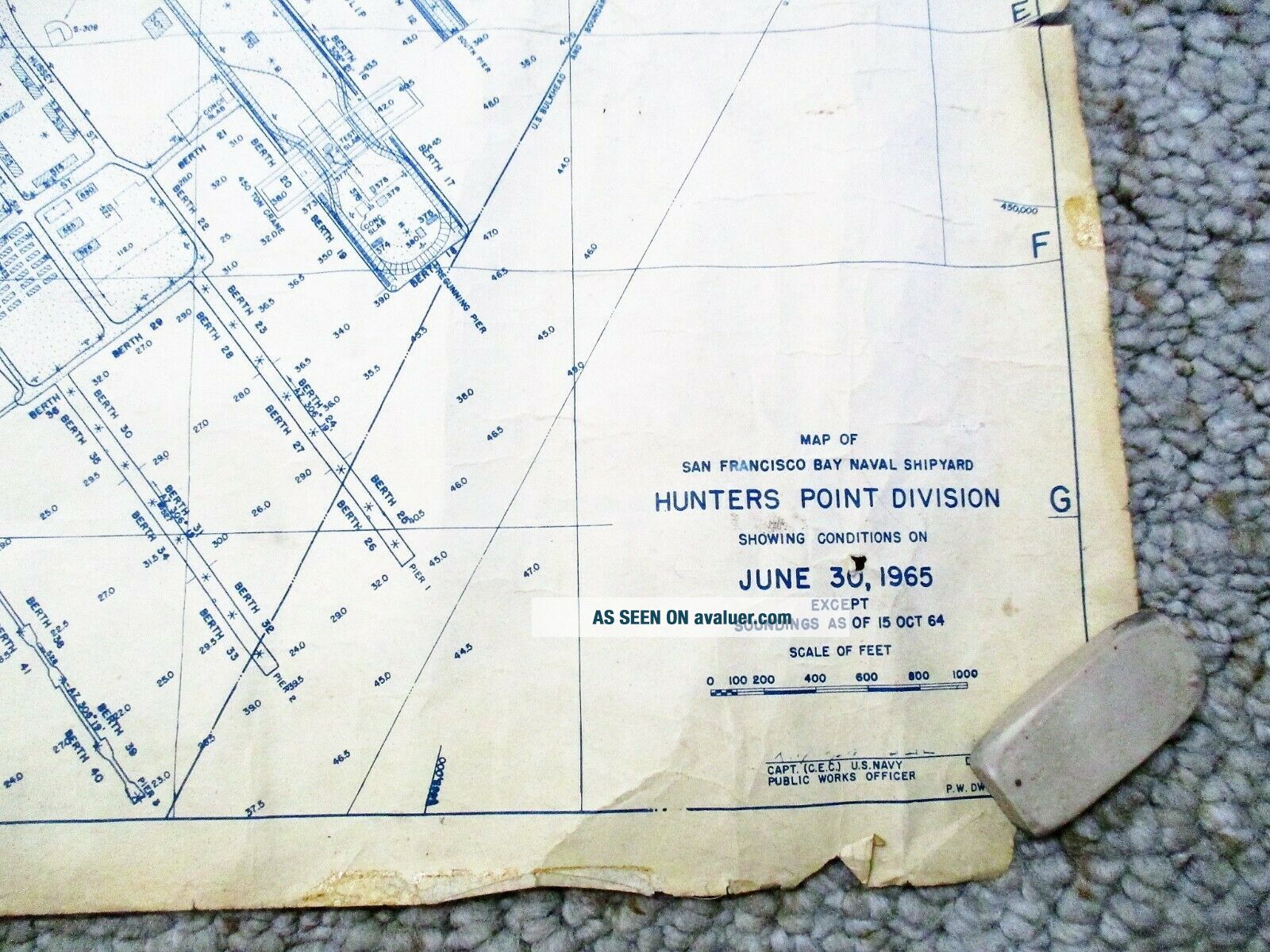
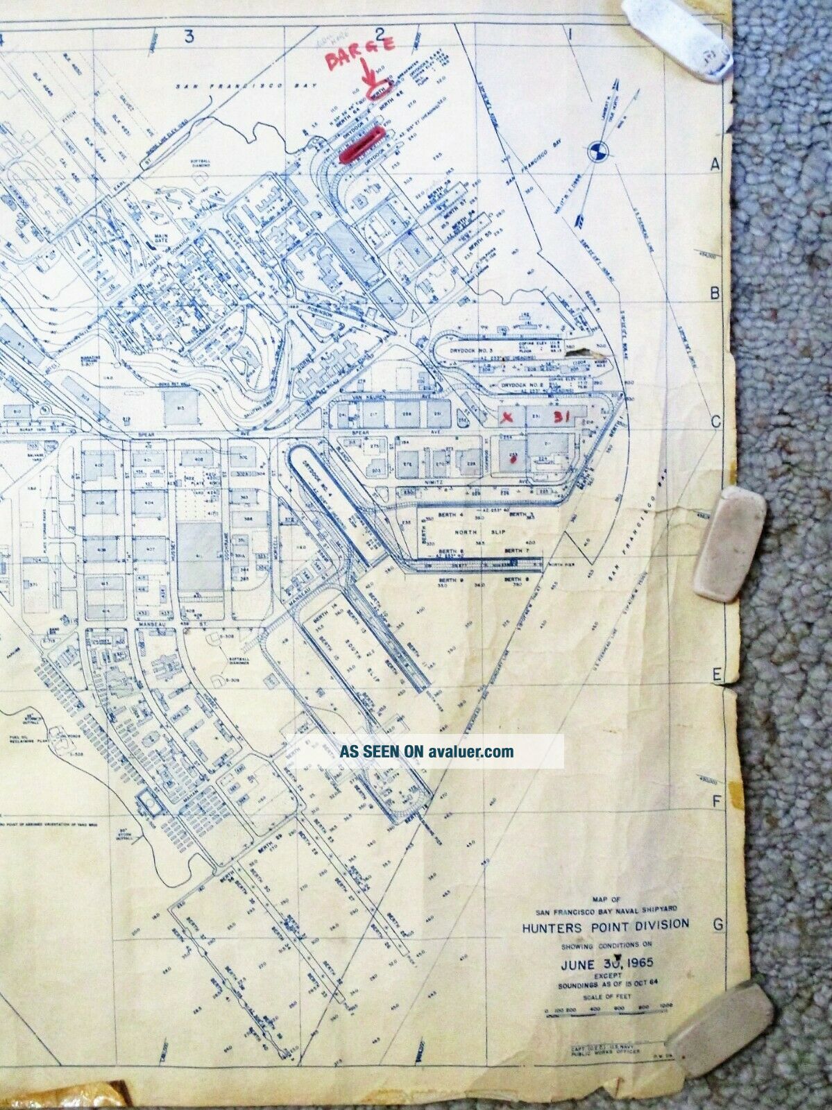
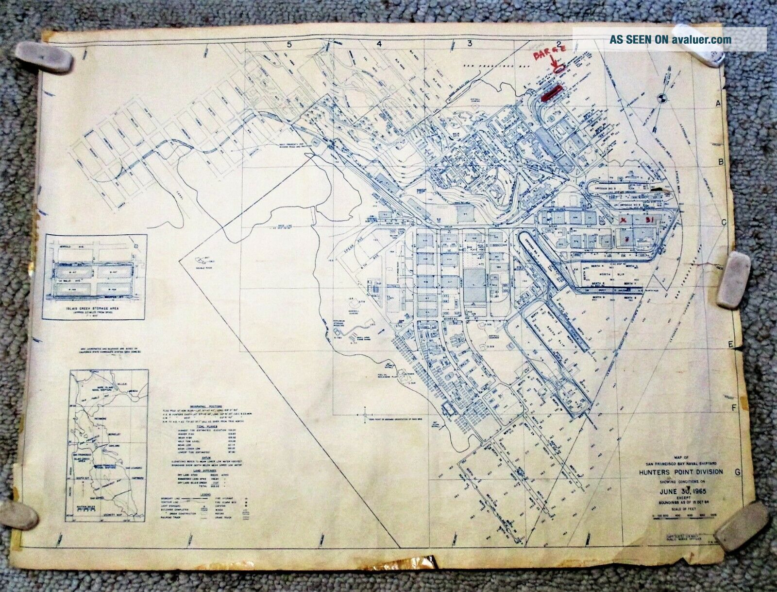
1965 DETAILED MAP Of SAN FRANCISCO HUNTERS POINT NAVAL SHIPYARD


Item History & Price

Information:
Reference Number: Avaluer:1245996Original/Reproduction: Original
US State: CaliforniaFormat: Rolled Map
Date Range: 1960-1969Type: Map
City: San FranciscoYear: 1965
Country/Region: United States
Original Description:

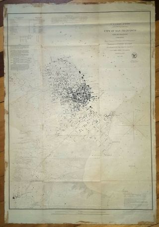
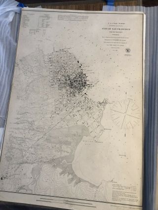
MAP of SAN FRANCISCO BAY NAVAL SHIPYARD / HUNTERS POINT DIVISION Showing Conditions on JUNE 30, 1965. ROLL OPEN MAP. Printed with blue ink. 22 x 29 inches. Only FAIR condition, edge wear, closed tears including a 3 inch closed tear starting at the right edge, a couple small holes, creases from handling, a few relevant red marks and notes e.g. “BARGE”; nonetheless a complete and SCARCE MAP of HUNTERS POINT NAVAL SHIPYARD in 1965. Please see the provided photos for a cl...earer picture of condition. Would look great if carefully mounted and framed.
You think Hunters Point has changed? I don't know. Maybe ask Twitter, Square, Salesforce, Google... Rolled is the map's natural state. It will be shipped rolled in a mailing tube.


    Similar items


  • Vintage Lovely Cartoon Map Of San Francisco Ca Very Detailed Bechtel Itel 1978

    Vintage Lovely Cartoon Map Of San Francisco Ca Very Detailed Bechtel Itel 1978

  • 1853 Map Of San Francisco Gold Rush Era Ad Bache 19 X 27

    1853 Map Of San Francisco Gold Rush Era Ad Bache 19 X 27

  • 3 Vintage 1974 Mark Hopkins Hotel Issue Pictorial Maps Of San Francisco

    3 Vintage 1974 Mark Hopkins Hotel Issue Pictorial Maps Of San Francisco

  • 1853 Map Of San Francisco Gold Rush Era; Antique And Printing.

    1853 Map Of San Francisco Gold Rush Era; Antique And Printing.

  • 1888 Antique Map Of San Francisco Ca Vintage Atlas Page

    1888 Antique Map Of San Francisco Ca Vintage Atlas Page

  • 1887 Street & Railroad Map Of San Francisco By Hunt & Eaton

    1887 Street & Railroad Map Of San Francisco By Hunt & Eaton

  • 1942 Antique San Francisco Map Vintage Map Of San Francisco California 6936

    1942 Antique San Francisco Map Vintage Map Of San Francisco California 6936

  • 1937 Antique San Francisco Map Vintage Map Of San Francisco California 6459

    1937 Antique San Francisco Map Vintage Map Of San Francisco California 6459


    • You might also like


    • 1860 Mitchell Hand Colored Map Colorado,  Nebraska & Kansas - Civil War Era

      1860 Mitchell Hand Colored Map Colorado, Nebraska & Kansas - Civil War Era

    • 18th Century French Map Of North America

      18th Century French Map Of North America

    • Las Vegas Nevada Vintage 1967 Us Geological Survey Quadrangle Map 4 Panels

      Las Vegas Nevada Vintage 1967 Us Geological Survey Quadrangle Map 4 Panels

    • Rare Antique 1845 Maps United States Exploring Expedition Book Antartica Hawaii

      Rare Antique 1845 Maps United States Exploring Expedition Book Antartica Hawaii

    • Vintage 1926 Map Hollywood From The Best Surveys Of The Time

      Vintage 1926 Map Hollywood From The Best Surveys Of The Time

    • American Continent (western Hemisphere) 1747 Bowen Antique Copper Engraved Map

      American Continent (western Hemisphere) 1747 Bowen Antique Copper Engraved Map

    • Gulf Coast Florida Texas United States 1705 De Fer Unusual Antique Engraved Map

      Gulf Coast Florida Texas United States 1705 De Fer Unusual Antique Engraved Map

    • California As Island United States 1700 De Fer Unusual First Edition Antique Map

      California As Island United States 1700 De Fer Unusual First Edition Antique Map

Avaluer          About Us          Privacy Policy          Contact Us          UP
© 2022, avaluer.net, Inc. or its affiliates