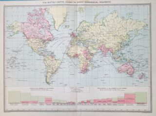
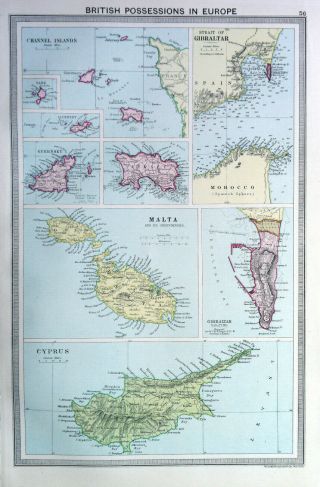
Map Of British Possessions 1905. Cyprus. Malta. Gibraltar. Channel Islands

Item History & Price
HyperionAntiques , Maps, Curios, Tools & Vintage
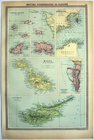
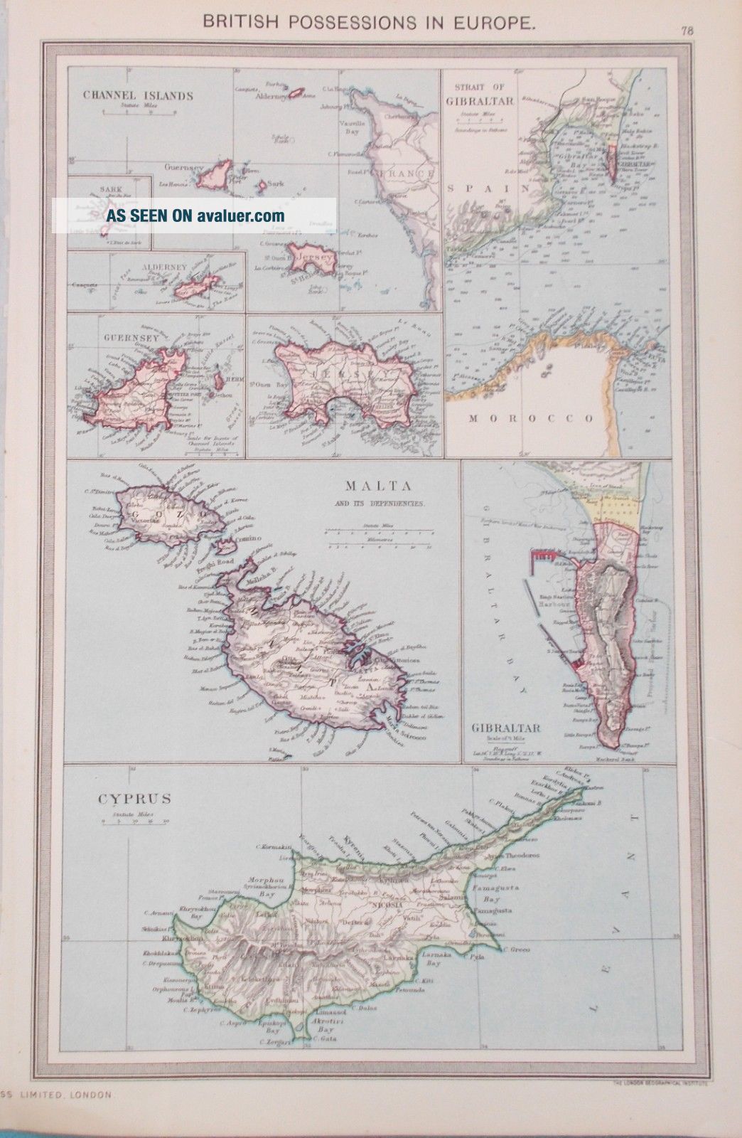
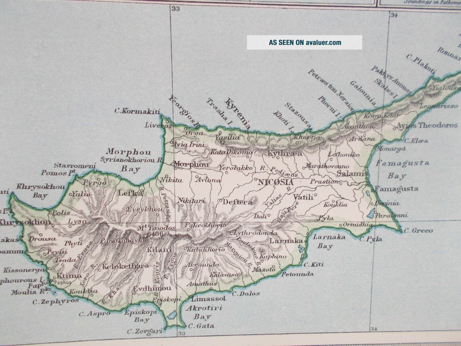
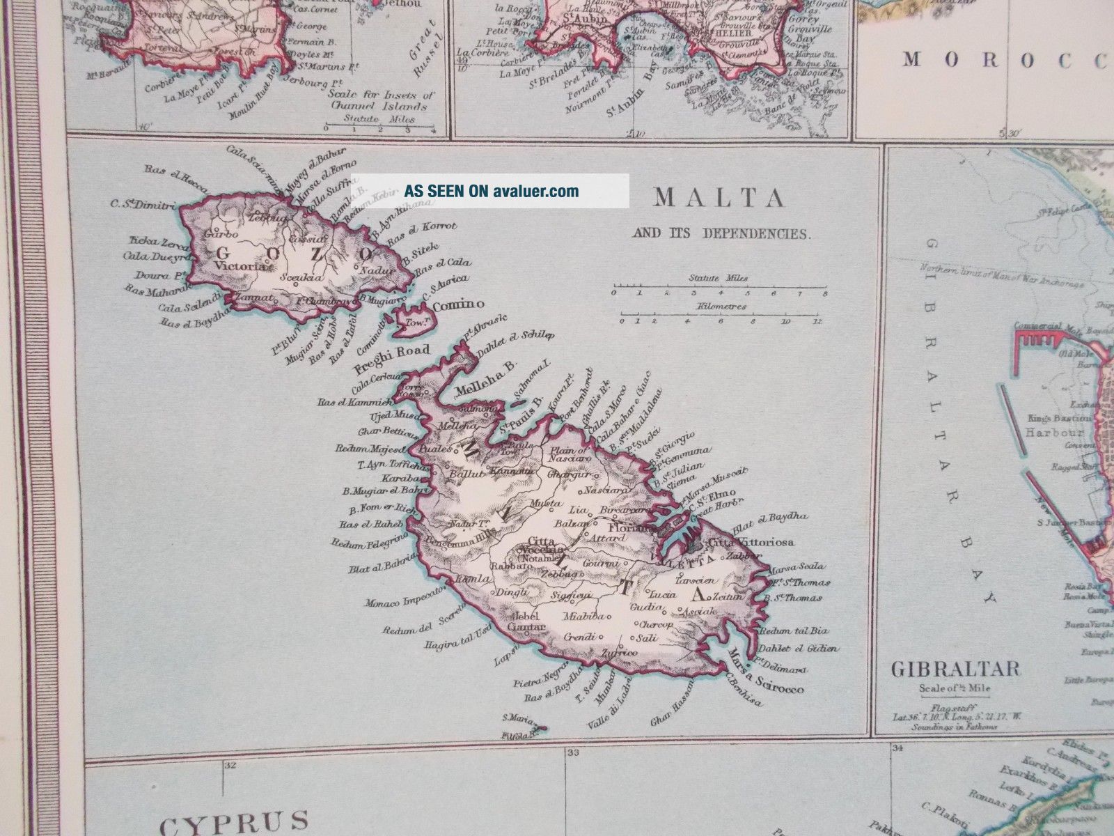
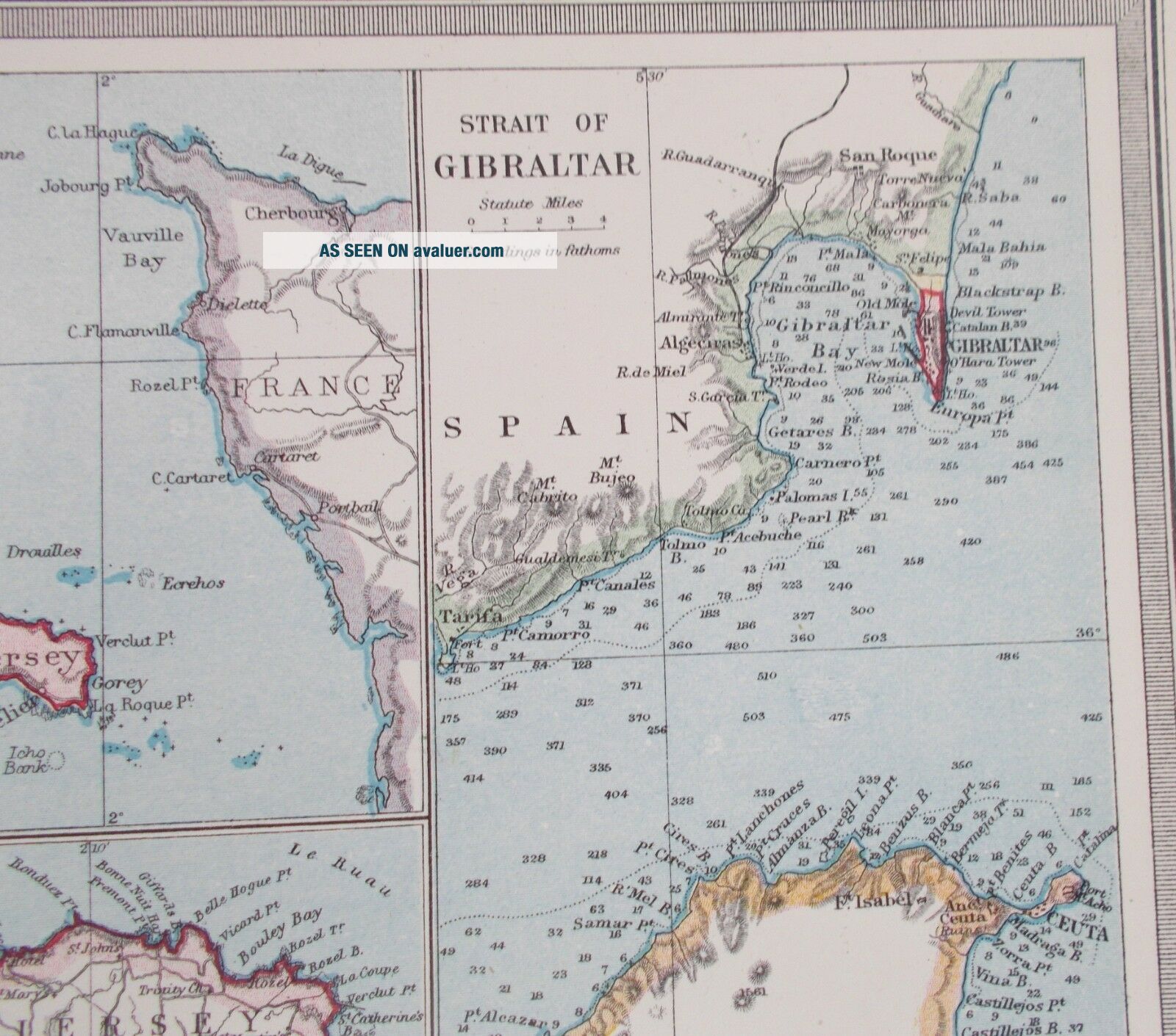
BRITISH POSSESSIONS. CYPRUS, MALTA, GIBRALTAR & CHANNEL ISLANDS1905. HARMSWORTH ATLAS
Amap of British possessions in Europe. Cyprus, Channel islands, Malta & Gibraltar. Map is well detailed, showing each country and larger towns. Is in very good condition with very slight ageing on edge of margins. Measures 10" x 15.5".
ShippingWithinthe Uk2ndClass Free1stClass: £0.50NextDay before 1pm: £7.50...International:EUROPE £8.70/REST OF THE WORLD £10.00Theitem will be posted in a sturdy cardboard packaging, we don't chargefor packaging. Shipping - We can combine up to 5 maps/prints inone shipping charge. We ship by Royal Mail 2ndClass signed for delivery within the UK and Airmail overseas. Insureddelivery covers any loss or damage in transit and buyer will becompletely refunded if item is not received or once item is returnedafter damage which occurred in transit and was not described inlisting.Wehappily accept PaypalPaymentsare by Paypal, cheque, bankers draft or postal order. However makingpayments by Paypal ensures faster shipping times and easiertransactions. We only accept cheques and money orders in sterling &accept credit cards via Paypal. Pleasemake initial contact after purchasing within 2 days and paymentwithin 7 days.Goodswill not dispatched until cheque/bankers draft have cleared. Allgoods dispatched within 2 working days of cleared payment.ReturnsIfyou receive an item which you feel was not accurately described or isnot in the condition stated then you have 30 days to return it with afull purchase refund (less postage) providing the item is received inthe same condition as it was sent. Please contact us before returningor leaving feedback. We will move heaven & earth to rectify yourproblem to your satisfaction.
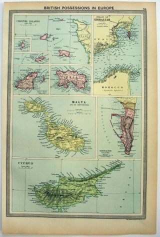
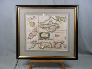