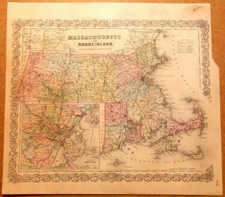
MA RI 1910 MASSACHUSETTS, RHODE ISLAND Electric INTERURBAN, STEAM RAILROAD Map


Item History & Price

Information:
Reference Number: Avaluer:1250462Topic: Maps
Type: Railroad MapPublication Year: 1910
Year: 1910Cartographer/Publisher: George Cram
US State: Massachusetts, Rhode IslandOriginal/Reproduction: Antique Original
Date Range: 1910-1919Format: Atlas Map
Country/Region: United States of America
Original Description:
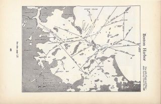
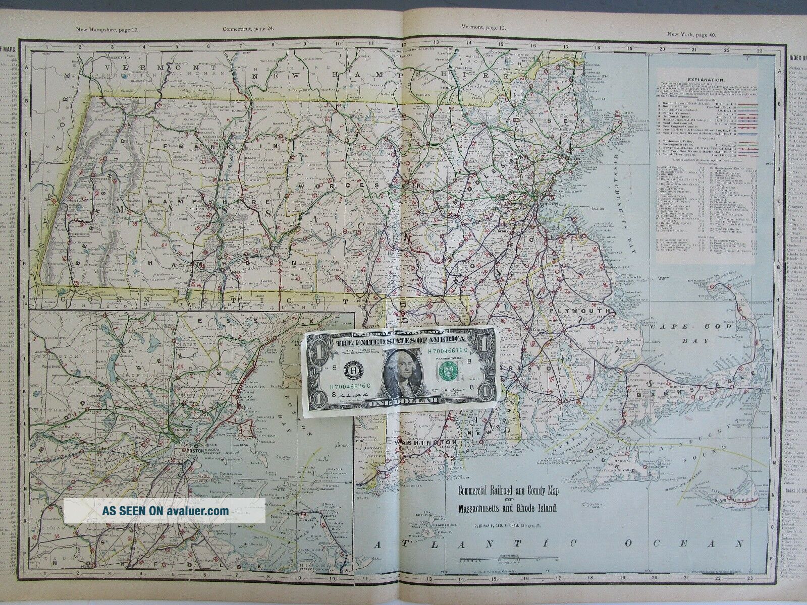
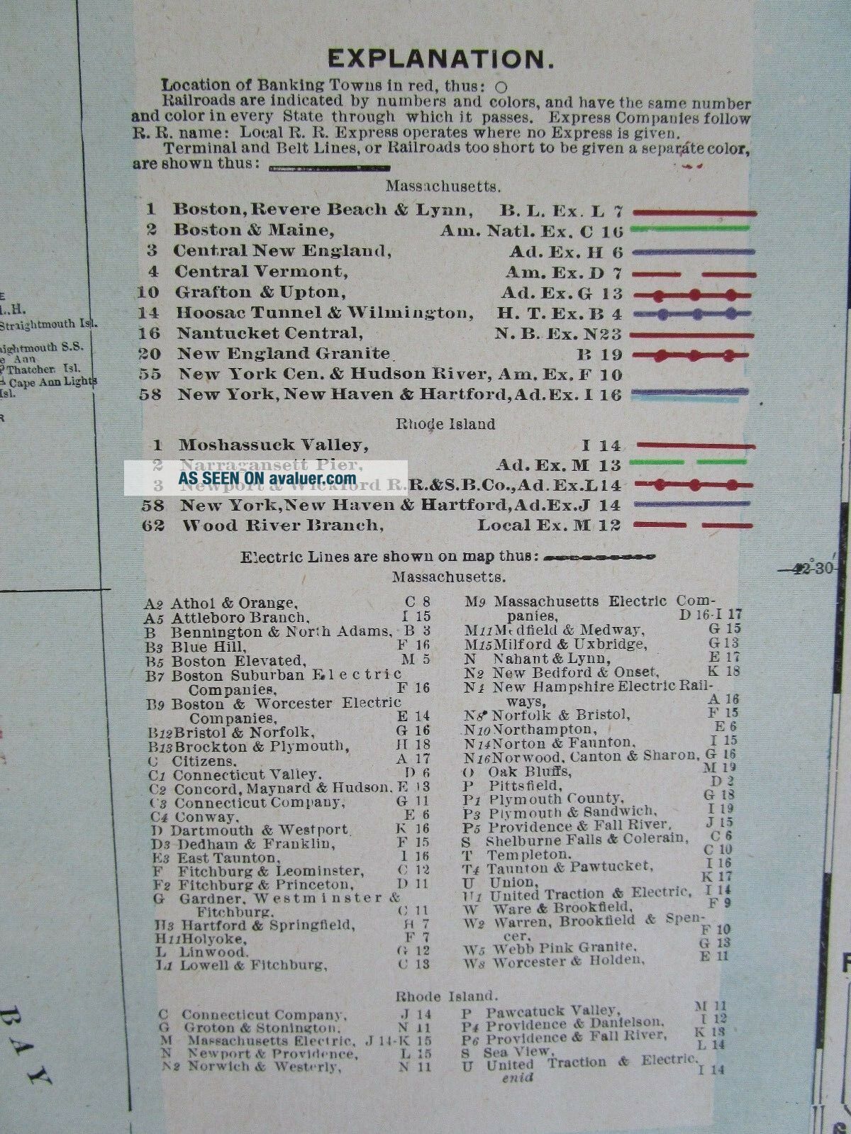
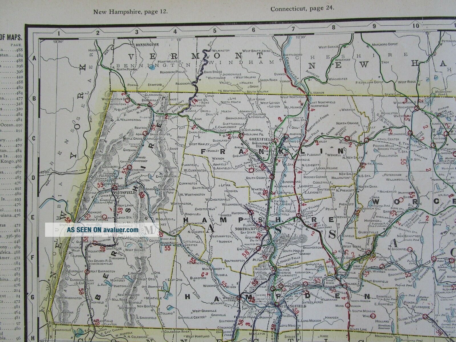
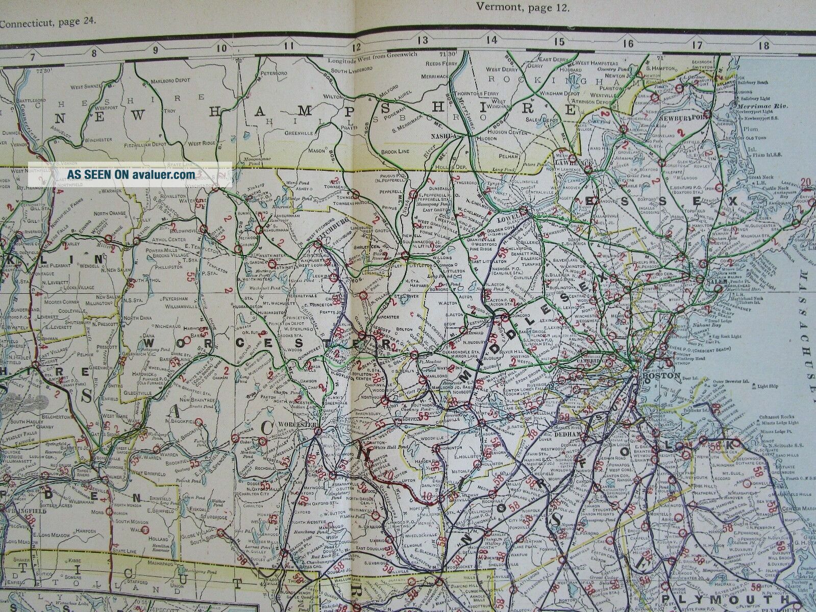
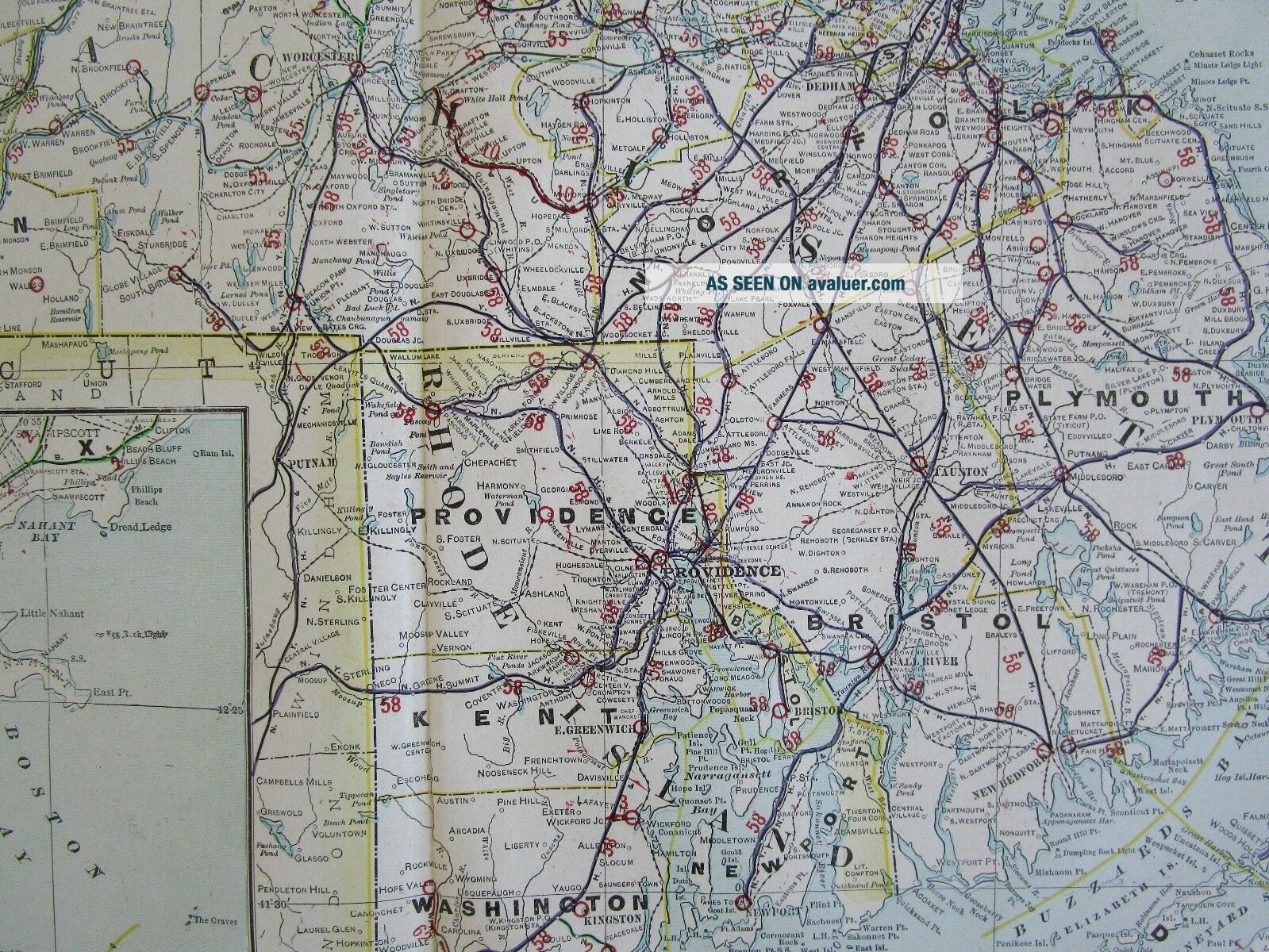
Combined shipping is offered in the shopping cart.Scarce George Cram Railroad large early 20th century double page continuous seam "tipped-in" map of Massachusetts and Rhode Island with Boston harbor inset map LL.  Large sheet 27" x 18 1/4" with a map inside the border of 21 7/8" x 16". Early railroad lines are marked in color with the operators to correspond with the list (railroad freight companies are noted next to name). Electric Railroads (interurbans) are uncommonly lis...ted on a separate list. The other sides are text.  This is an ORIGINAL atlas map. Sourced from the 1910 George Cram Standard American Railway System Atlas large format.
Overall fine. Colors are still vibrant. Impressive for 100+ years old. Zoom to inspect. 
Shipped fast in a tube due to size.
Indiana residents add 7% sales tax. More Massachusetts maps here:http://www.ebay.com/sch/m.html?_odkw=&_sop=1&_ssn=stereoview&_armrs=1&_osacat=0&_ipg=200&_from=R40&_trksid=p2046732.m570.l1313.TR12.TRC2.A0.H0.XMA.TRS0&_nkw=MA&_sacat=0Search my listings for your state: http://www.ebay.com/sch/m.html?_odkw=railroad+map&_ssn=stereoview&_from=R40&_osacat=0&_from=R40&_trksid=p2046732.m570.l1313.TR0.TRC0.H0.X.TRS0&_nkw=&_sacat=0Returns only if item is not as described. The photos are part of the description.
INV: 1910-1.XL.CRAM. MMFIT.16.17


    Similar items


  • 1910 Bristol,  Rhode Island Postcard: Benjamin Church Old Age/aged Men Home - Ri

    1910 Bristol, Rhode Island Postcard: Benjamin Church Old Age/aged Men Home - Ri

  • 1770 Bonne - Orig.  Map: North America,  United States,  Massachusetts,  Rhode Island

    1770 Bonne - Orig. Map: North America, United States, Massachusetts, Rhode Island

  • 1856 Map Massachusetts & Rhode Island Colton

    1856 Map Massachusetts & Rhode Island Colton ' S Atlas

  • 1938 Mcnally Map Massachusetts & Rhode Island Boston Providence Salem Cape Cod

    1938 Mcnally Map Massachusetts & Rhode Island Boston Providence Salem Cape Cod

  • 1930

    1930 ' S Nautical Charts Boston Massachusetts Rhode Island Maine Nantucket Block

  • 1910s Providence Rhode Island Postcard Narragansett Hotel Street View

    1910s Providence Rhode Island Postcard Narragansett Hotel Street View

  • Ri Little Compton Rhode Island Police Patch

    Ri Little Compton Rhode Island Police Patch

  • 1908 Bristol Rhode Island Pc Postcard Ri Soldiers Home Rhode Island News

    1908 Bristol Rhode Island Pc Postcard Ri Soldiers Home Rhode Island News


    • You might also like


    • 1860 Mitchell Hand Colored Map Colorado,  Nebraska & Kansas - Civil War Era

      1860 Mitchell Hand Colored Map Colorado, Nebraska & Kansas - Civil War Era

    • 18th Century French Map Of North America

      18th Century French Map Of North America

    • Las Vegas Nevada Vintage 1967 Us Geological Survey Quadrangle Map 4 Panels

      Las Vegas Nevada Vintage 1967 Us Geological Survey Quadrangle Map 4 Panels

    • Rare Antique 1845 Maps United States Exploring Expedition Book Antartica Hawaii

      Rare Antique 1845 Maps United States Exploring Expedition Book Antartica Hawaii

    • Vintage 1926 Map Hollywood From The Best Surveys Of The Time

      Vintage 1926 Map Hollywood From The Best Surveys Of The Time

    • American Continent (western Hemisphere) 1747 Bowen Antique Copper Engraved Map

      American Continent (western Hemisphere) 1747 Bowen Antique Copper Engraved Map

    • Gulf Coast Florida Texas United States 1705 De Fer Unusual Antique Engraved Map

      Gulf Coast Florida Texas United States 1705 De Fer Unusual Antique Engraved Map

    • California As Island United States 1700 De Fer Unusual First Edition Antique Map

      California As Island United States 1700 De Fer Unusual First Edition Antique Map

Avaluer          About Us          Privacy Policy          Contact Us          UP
© 2022, avaluer.net, Inc. or its affiliates