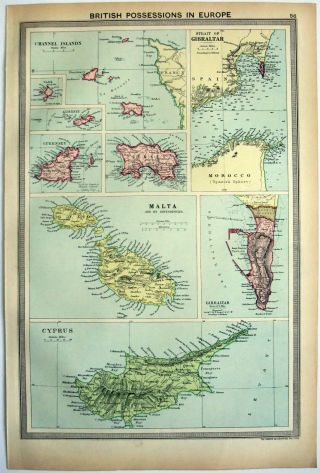
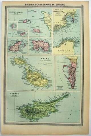
1903 British Possessions In Europe Antique Map Malta Cyprus Gibraltar


Item History & Price

Information:
Reference Number: Avaluer:1250638Cartographer/Publisher: Bartholomew
Year: 1903Printing Technique: Lithography
Date Range: 1900-1909Original/Reproduction: Antique Original
Country/Region: Malta, Jersey, Guernsey, Cyprus, GibraltarFormat: Atlas Map
Era: 1900sType: Political Map
Original Description:
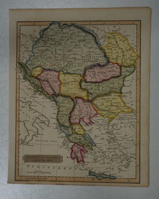
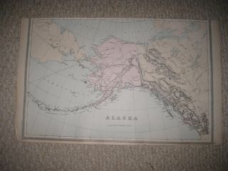
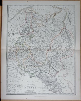
This is an original antique map taken from The Harmsworth Atlas and Gazetteer published in 1903
Condition: Very good, please see listing photos for details of any markings or foxing. 
Measurements including white borders are 10 x 15 inches including surrounding white border. 
UK Orders will be sent by 2nd Class and International Orders will be sent by Standard international mail (not tracked). 
 This map will be sent in a protective plastic sleeve and ca...rdboard mailing tube. 
See our other listings for many more antique maps, prints and photos


    Similar items


  • 1926 Map Of British Possessions In Europe By George Philip.  Vintage

    1926 Map Of British Possessions In Europe By George Philip. Vintage

  • 1926 Map Of British Possessions In Europe By George Philip.  Vintage

    1926 Map Of British Possessions In Europe By George Philip. Vintage

  • Russia In Europe Antique Map C.  1851,  Tallis And Co.

    Russia In Europe Antique Map C. 1851, Tallis And Co.

  • 1766 Brion De La Tour Atlas Map Russia - Russie Europeenne - Russia In Europe

    1766 Brion De La Tour Atlas Map Russia - Russie Europeenne - Russia In Europe

  • 1823 J Russell Map Of Turkey In Europe

    1823 J Russell Map Of Turkey In Europe

  • 1945 Kaliher And White Set Of Pictorial Wwii Route Maps Of 79th Inf.  In Europe

    1945 Kaliher And White Set Of Pictorial Wwii Route Maps Of 79th Inf. In Europe

  • Large Gorgeous Antique 1894 Alaska Handcolored Map British Possessions Canada Nr

    Large Gorgeous Antique 1894 Alaska Handcolored Map British Possessions Canada Nr

  • 1874 Large Antique Map - Johnston - Russia In Europe

    1874 Large Antique Map - Johnston - Russia In Europe


    • You might also like


    • Hungary & Romania 1579 (1584) Ortelius Unusual Antique Copper Engraved Map

      Hungary & Romania 1579 (1584) Ortelius Unusual Antique Copper Engraved Map

    • Brussels Bruxelles Belfium 1777 De Ferraris & Dupuis Large Antique Map Sheet Xxi

      Brussels Bruxelles Belfium 1777 De Ferraris & Dupuis Large Antique Map Sheet Xxi

    • 1616 Atlas Map Of Iceland.

      1616 Atlas Map Of Iceland.

    • Kazan Russia 1767 Le Clerc/lespinasse Antique Copper Engraved City View

      Kazan Russia 1767 Le Clerc/lespinasse Antique Copper Engraved City View

    • 1899 Stanford,  Folding Map Of Norwich,  Norfolk,  Arthur Collins,  Jarrold & Sons,

      1899 Stanford, Folding Map Of Norwich, Norfolk, Arthur Collins, Jarrold & Sons,

    • 1948 Vintage Linen Colour Map Geological Survey Ten Mile Of Great Britain

      1948 Vintage Linen Colour Map Geological Survey Ten Mile Of Great Britain

    • 1944 Map Flying Bombs Sussex Ww2 Newspaper Military Kent Courier German V1 V2

      1944 Map Flying Bombs Sussex Ww2 Newspaper Military Kent Courier German V1 V2

    • Dated 1638 Vellum Map Of Icklesham Sussex Showing Land Uses Owners Etc

      Dated 1638 Vellum Map Of Icklesham Sussex Showing Land Uses Owners Etc

Avaluer          About Us          Privacy Policy          Contact Us          UP
© 2022, avaluer.net, Inc. or its affiliates