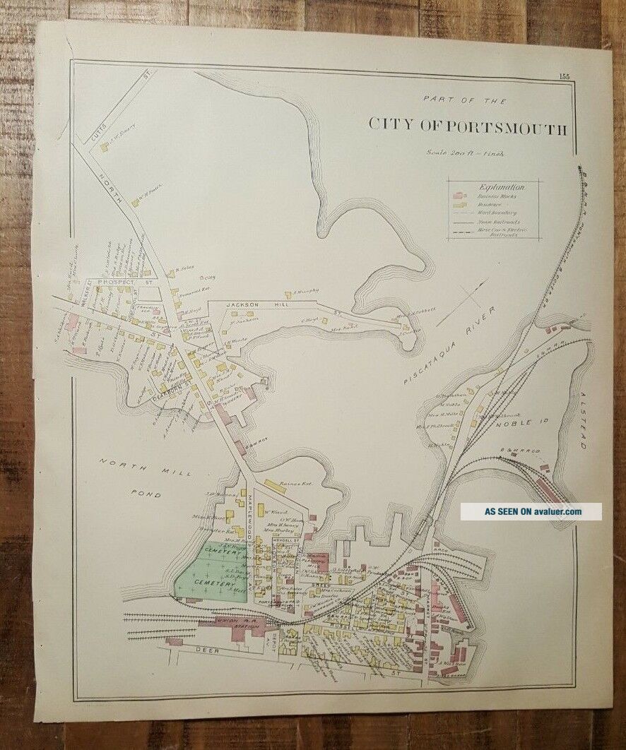
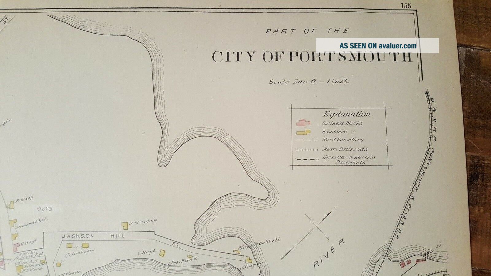
Antique MAP - PART 1 OF THE CITY OF PORTSMOUTH - N. HAMPSHIRE - 1892 ATLAS
Item History & Price
| Reference Number: Avaluer:13520 | US State: New Hampshire |
| Original/Reproduction: Antique Original |
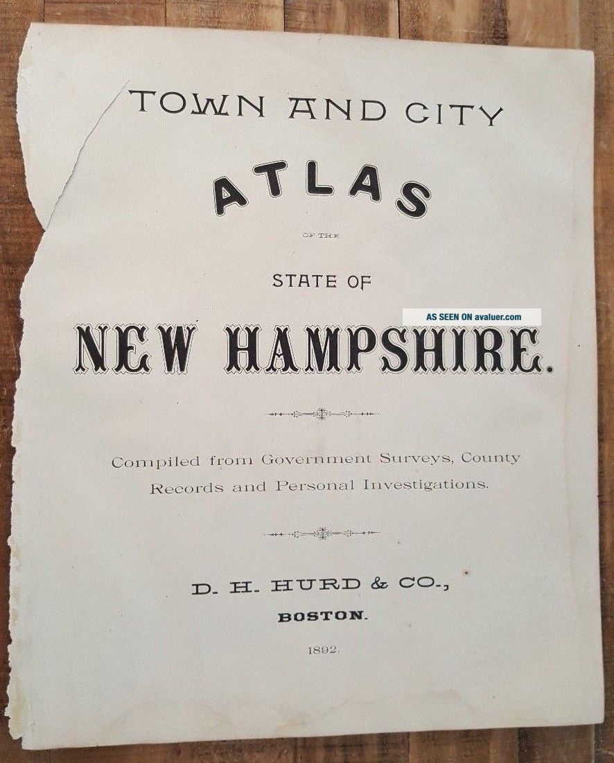
Up for sale is a great, original, ANTIQUE MAP from the TOWN AND CITY ATLAS OF THE STATE OF NEW HAMPSHIRE. 1892
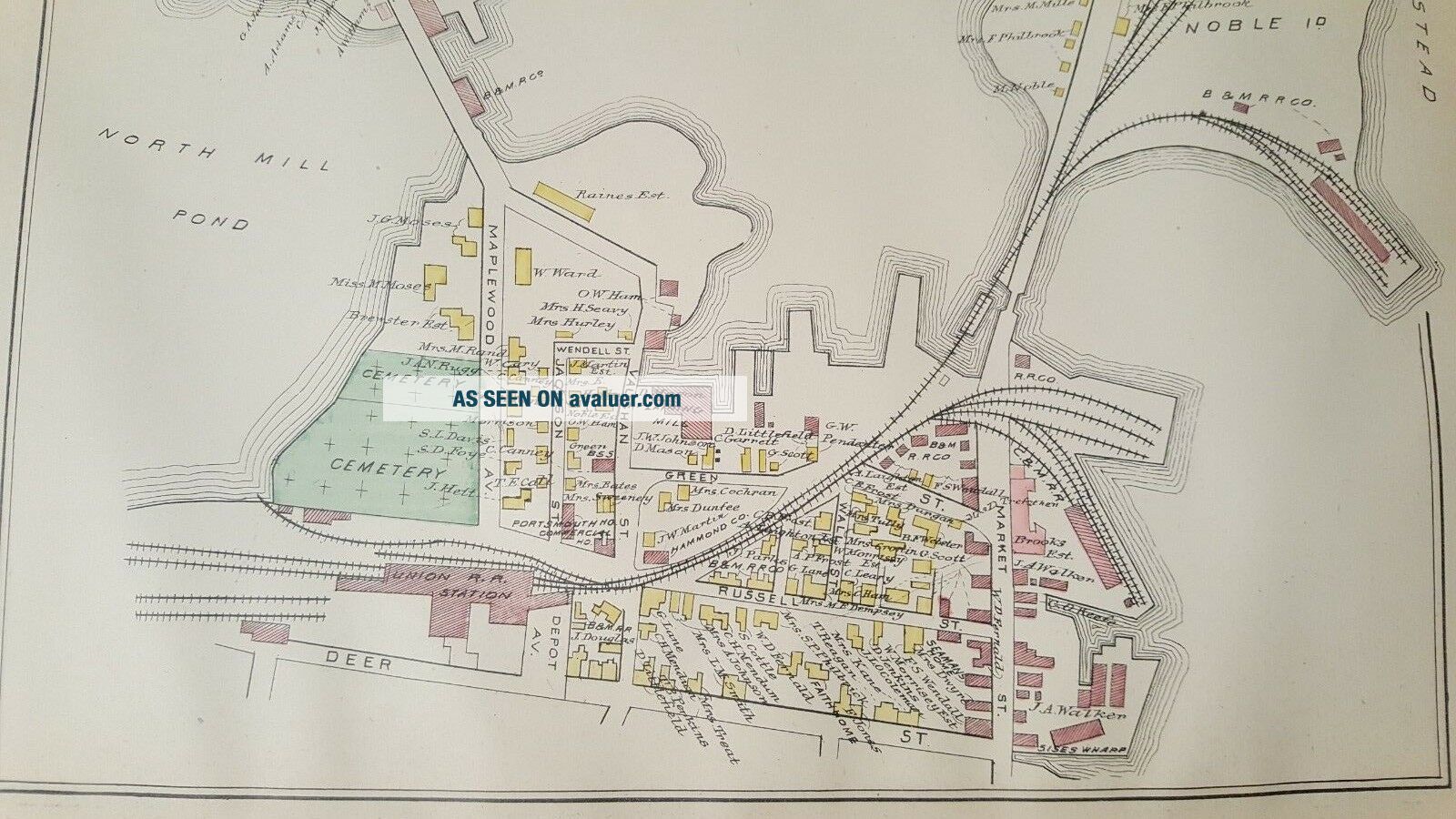
It features a colored MAP OF PART OF THE CITY OF PORTSMOUTH - NEW HAMPSHIRE.
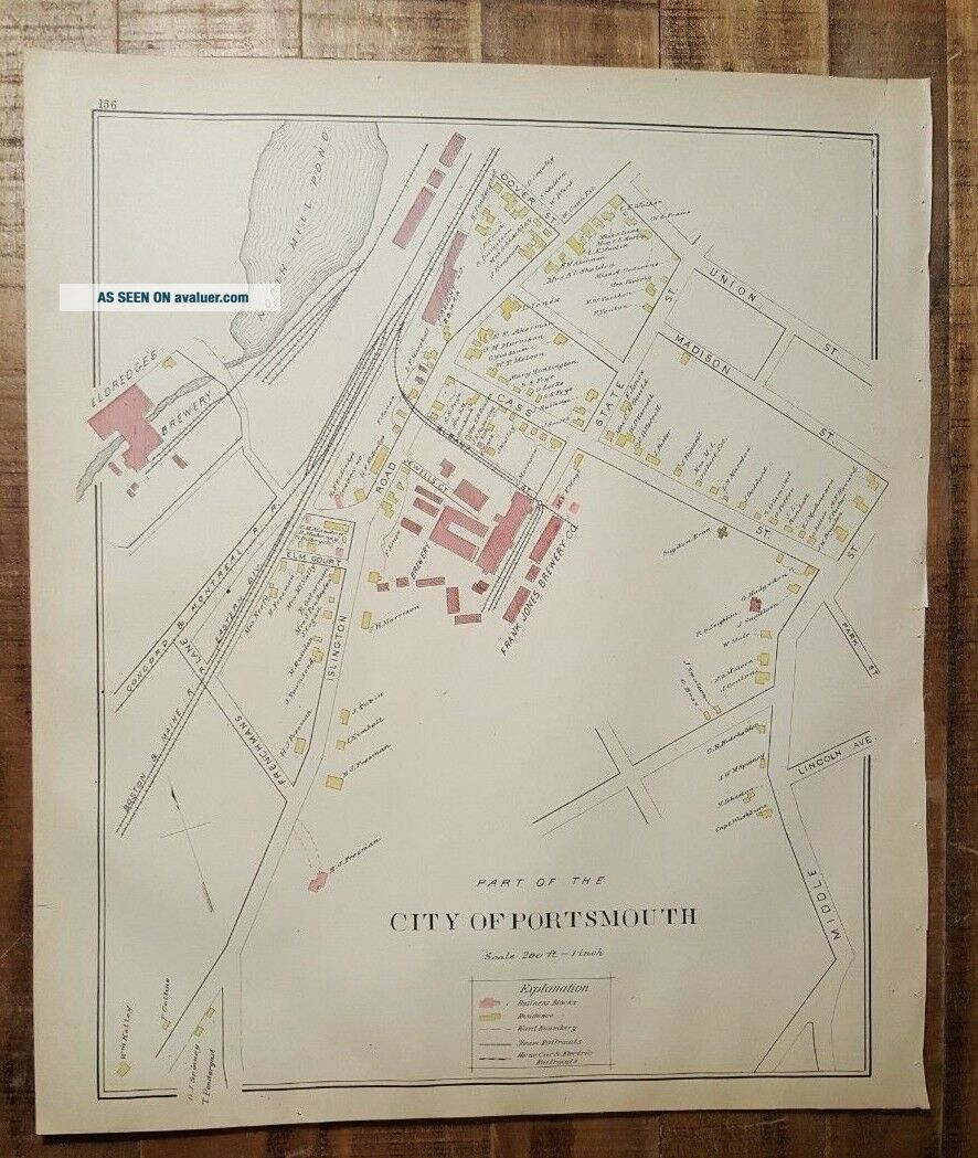
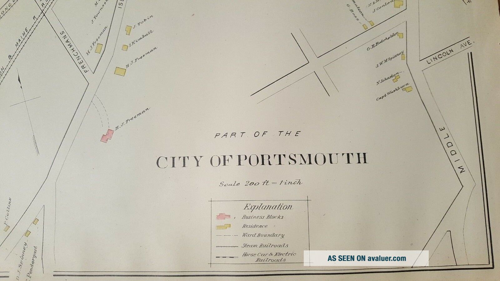
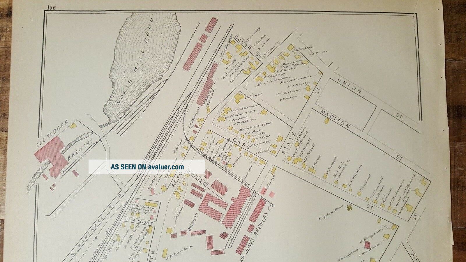
On the reverse side is a colored MAP OF PART OF THE CITY OF PORTSMOUTH - NEW HAMPSHIRE.
It is a very detailed map measuring approximately 14 1/2 x 17 1/2 inches, including the border area.
This map is from the "TOWN AND CITY ATLAS OF THE STATE OF NEW HAMPSHIRE - Comp...iled from Government Surveys, County Records and Personal Investigations. Published by D. H. Hurd & Co., Boston, Massachusetts - 1892".
There are tears down one side from where it was originally bound. It is generally in Very Good Condition. Some age related browning and toning and some spotting and stains. It has some small tears and chips around the edges, but they do not affect the map, as well as some other stains here and there. Some other dings here and there, as well. There are damp stains along the borders.
This map would be a great addition to any collection and will look very nice when framed!
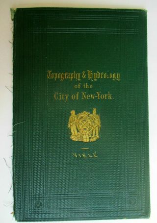
Please note that while I have included a picture of the Title Page of the Atlas that this map was taken from, it is NOT included in the sale, as it is a reference piece to determine authenticity for other maps/engravings. I would be happy to include a copy if requested.
Please see my store for other great items.
00217
It features a colored MAP OF PART OF THE CITY OF PORTSMOUTH - NEW HAMPSHIRE.
On the reverse side is a colored MAP OF PART OF THE CITY OF PORTSMOUTH - NEW HAMPSHIRE.
It is a very detailed map measuring approximately 14 1/2 x 17 1/2 inches, including the border area.
This map is from the "TOWN AND CITY ATLAS OF THE STATE OF NEW HAMPSHIRE - Comp...iled from Government Surveys, County Records and Personal Investigations. Published by D. H. Hurd & Co., Boston, Massachusetts - 1892".
There are tears down one side from where it was originally bound. It is generally in Very Good Condition. Some age related browning and toning and some spotting and stains. It has some small tears and chips around the edges, but they do not affect the map, as well as some other stains here and there. Some other dings here and there, as well. There are damp stains along the borders.
This map would be a great addition to any collection and will look very nice when framed!
Please note that while I have included a picture of the Title Page of the Atlas that this map was taken from, it is NOT included in the sale, as it is a reference piece to determine authenticity for other maps/engravings. I would be happy to include a copy if requested.
Please see my store for other great items.
00217