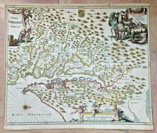
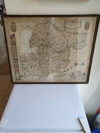
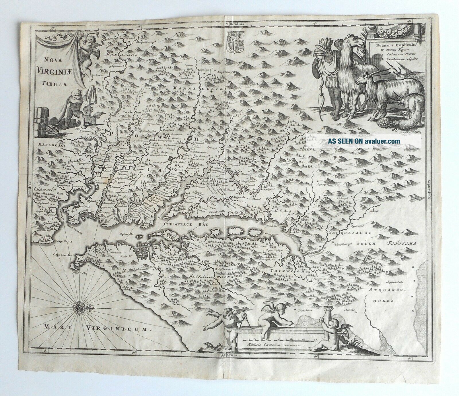
Rare 17th Century Virginia Map Nova Virginiae Tabula London 1671 John Ogilby


Item History & Price

Information:
Reference Number: Avaluer:14272Cartographer/Publisher: Talis
Type: Thematic MapOriginal/Reproduction: Antique Original
Date Range: 1600-1699
Original Description:
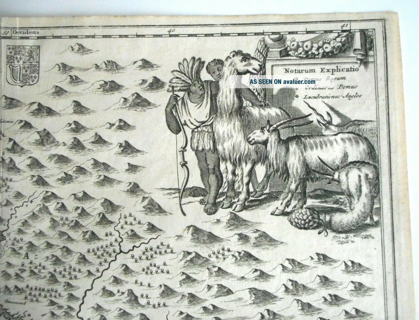
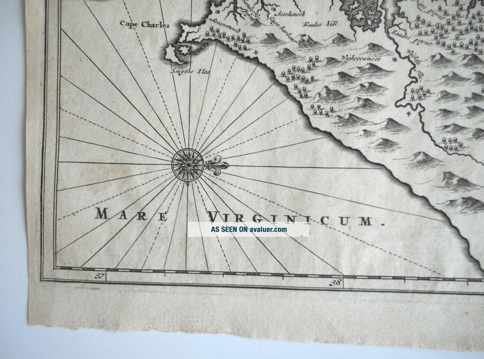
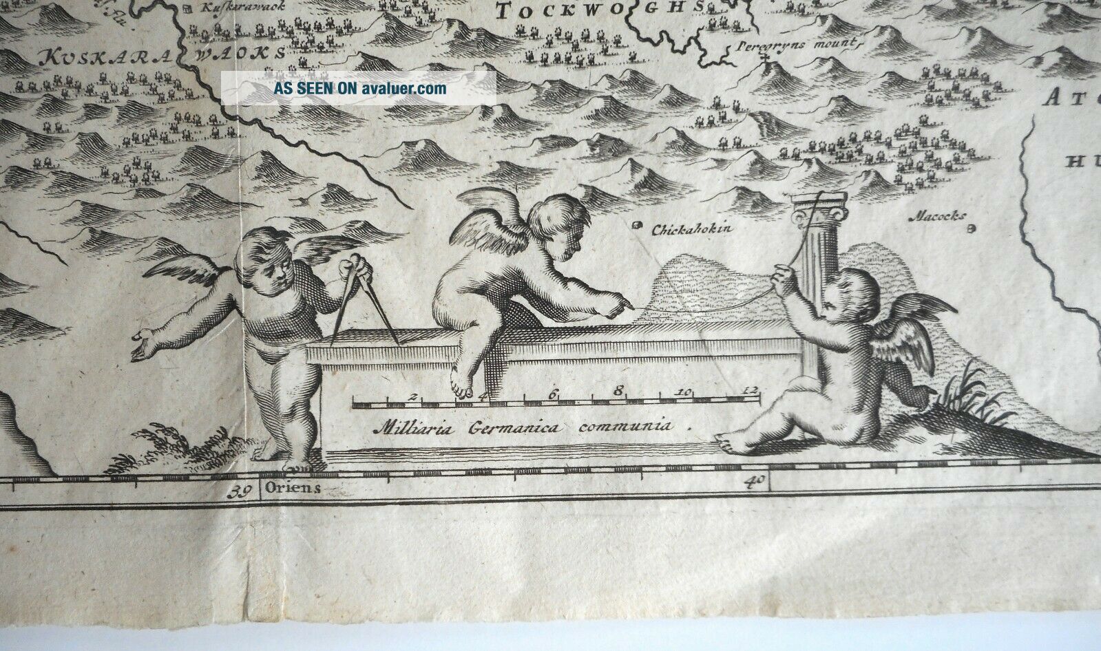
Steve Szentesi | Fine Art                  Canadian buyers: Please wait until you are invoiced before paying! We are required to charge HST or GST on all orders mailed to Canadian destinations. The invoice we send to Canadian buyers will include the appropriate tax.Title: Nova Virginiae Tabula.Date: 1671.Period: 17th century.Cartographer: John Ogilby.Condition: Very good condition o...verall; see detailed photos.Comments: Based upon earlier maps b Hondius and Blaeu, derived from Capt John Smith map 1612.  Shows Chesapeake Bay area.  Note the cartouche of the Brazilian Indian with a llama, goat and unicorn!Note: This is an authentic and original antique map and not a copy or re-strike.  From a Canadian estate collection.Dimensions: 14 1/4" x 12".TERMSOF SALESHIPPING & PICKUPShipping quoted in ourlistings is for regular Canada Post small parcel service.  Foroverseas shipping (i.e. outside Canada or United States) pleaseinquire about rates.  Overseas shipments can take 1-3 weeks (thoughcan arrive sooner), depending on Canada Post, foreign postal servicesand customs.  We have no control over the speed of postal services butare happy to ship by courier if requested for an additional fee and to answerany shipping questions.We do not normally allowpickup because we are not a retail store and do not keep retailhours.  For very inexpensive, large or fragile items we are happy todiscuss pickup.  If in doubt, please ask us and we would be happy todiscuss shipping and pickup arrangements.RETURNSWe make every effort todescribe all of our items in detail and try to find and sell high quality andunusual pieces.  However, any item may be returned within two weeks ofreceipt if the item does not match our description.  Buyers mustpay all postage.  Items must be received by us in the same conditionas originally shipped before a refund will be made.PAYMENTPayment must be receivedwithin five days of the item closing or we retain the right to relistor resell the item without any prior notice to the buyer.LOST ITEMSIf items have not arrivedwithin one month, our policy is to file a lost item claim with Canada Post, claim the applicable insurance and refund the buyer's purchaseprice.  Lost item claims will not be filed before one month from the endof the listing as Canada Post has specific timelines for filing claims.

00055


    Similar items


  • Virginia America 1683 Alain Manesson Mallet Antique Map In Colors 17th Century

    Virginia America 1683 Alain Manesson Mallet Antique Map In Colors 17th Century

  • Virginia Maryland 1673 Montanus Arnoldus Unusual Antique Map 17th Century

    Virginia Maryland 1673 Montanus Arnoldus Unusual Antique Map 17th Century

  • Rare 19th Century Virginia Shenandoah Valley Redware Folk Pottery Wall Sconce

    Rare 19th Century Virginia Shenandoah Valley Redware Folk Pottery Wall Sconce

  • 17th Century Virginia Medicine Gift Quality Scarce American Medical History

    17th Century Virginia Medicine Gift Quality Scarce American Medical History

  • Rare 17th Century Map Of Europe By Jodoco Hondio

    Rare 17th Century Map Of Europe By Jodoco Hondio

  • Rare Important 17th Century French Map Of America On Chinese Export Painted Fan

    Rare Important 17th Century French Map Of America On Chinese Export Painted Fan

  • Rare 17th Century Map Of Essex By Joan Blaeu Dutch Cartographer Circa 1648

    Rare 17th Century Map Of Essex By Joan Blaeu Dutch Cartographer Circa 1648

  • La Geographie Ancienne 1689 Geography 17th Century Colored Maps Audiffret Rare

    La Geographie Ancienne 1689 Geography 17th Century Colored Maps Audiffret Rare


    • You might also like


    • 1860 Mitchell Hand Colored Map Colorado,  Nebraska & Kansas - Civil War Era

      1860 Mitchell Hand Colored Map Colorado, Nebraska & Kansas - Civil War Era

    • 18th Century French Map Of North America

      18th Century French Map Of North America

    • Las Vegas Nevada Vintage 1967 Us Geological Survey Quadrangle Map 4 Panels

      Las Vegas Nevada Vintage 1967 Us Geological Survey Quadrangle Map 4 Panels

    • Rare Antique 1845 Maps United States Exploring Expedition Book Antartica Hawaii

      Rare Antique 1845 Maps United States Exploring Expedition Book Antartica Hawaii

    • Vintage 1926 Map Hollywood From The Best Surveys Of The Time

      Vintage 1926 Map Hollywood From The Best Surveys Of The Time

    • American Continent (western Hemisphere) 1747 Bowen Antique Copper Engraved Map

      American Continent (western Hemisphere) 1747 Bowen Antique Copper Engraved Map

    • Gulf Coast Florida Texas United States 1705 De Fer Unusual Antique Engraved Map

      Gulf Coast Florida Texas United States 1705 De Fer Unusual Antique Engraved Map

    • California As Island United States 1700 De Fer Unusual First Edition Antique Map

      California As Island United States 1700 De Fer Unusual First Edition Antique Map

Avaluer          About Us          Privacy Policy          Contact Us          UP
© 2022, avaluer.net, Inc. or its affiliates