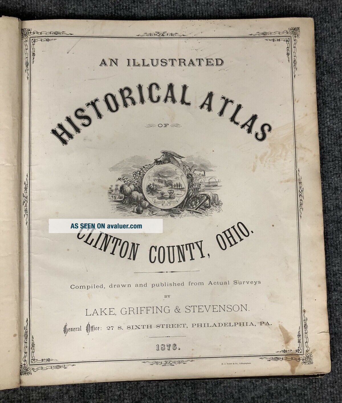
Antique 1876 Atlas Of Clinton County Ohio Lake Griffing & Stevenson


Item History & Price

Information:
Reference Number: Avaluer:14727Cartographer/Publisher: Lake Griffing & Stevenson
US State: OhioOriginal/Reproduction: Antique Original
City: ClintonFormat: Atlas
Country/Region: United States of AmericaYear: 1876
Topic: Atlases
Original Description:
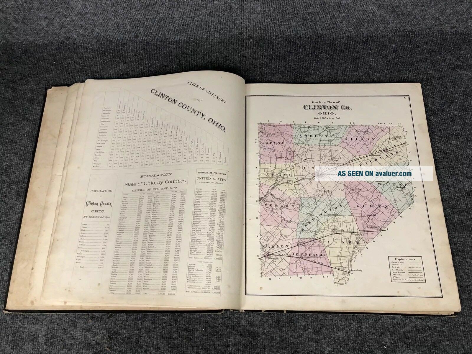
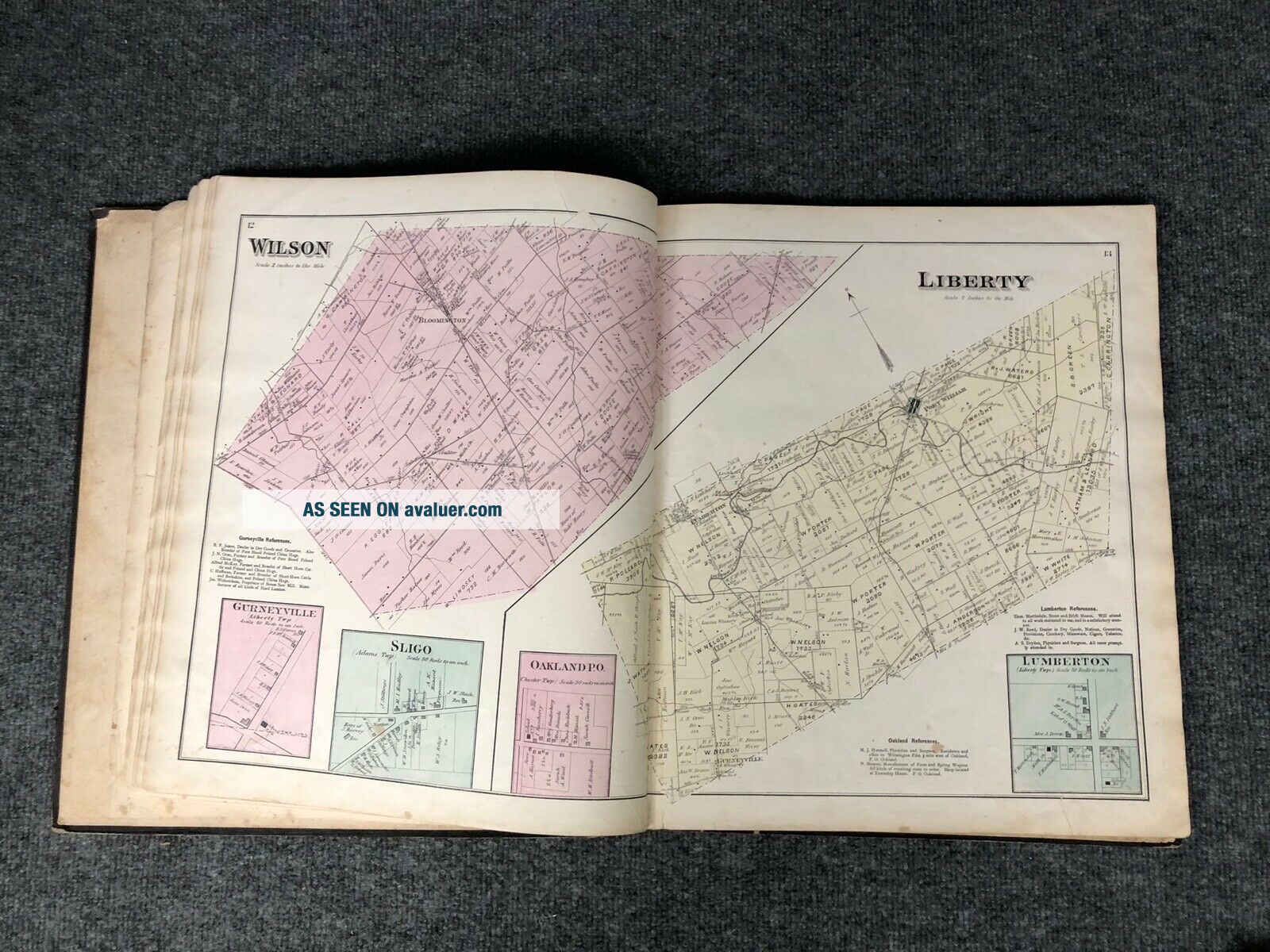
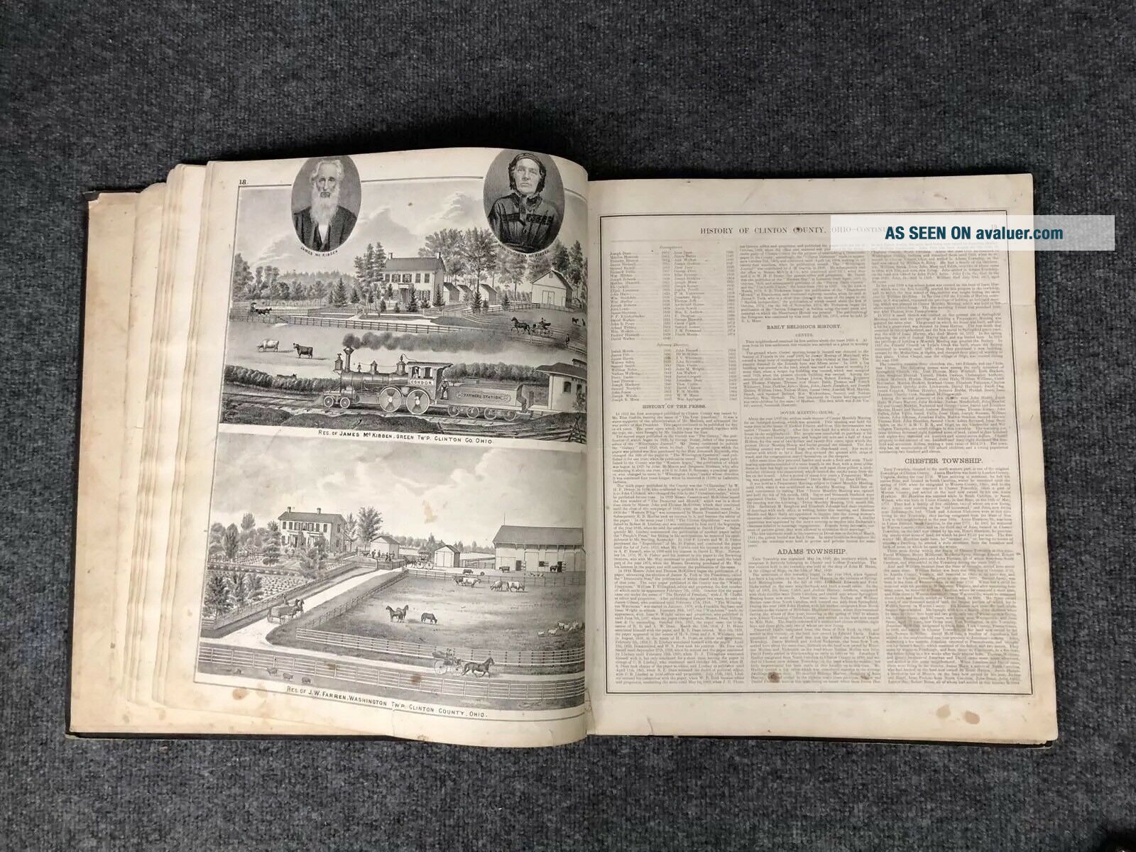
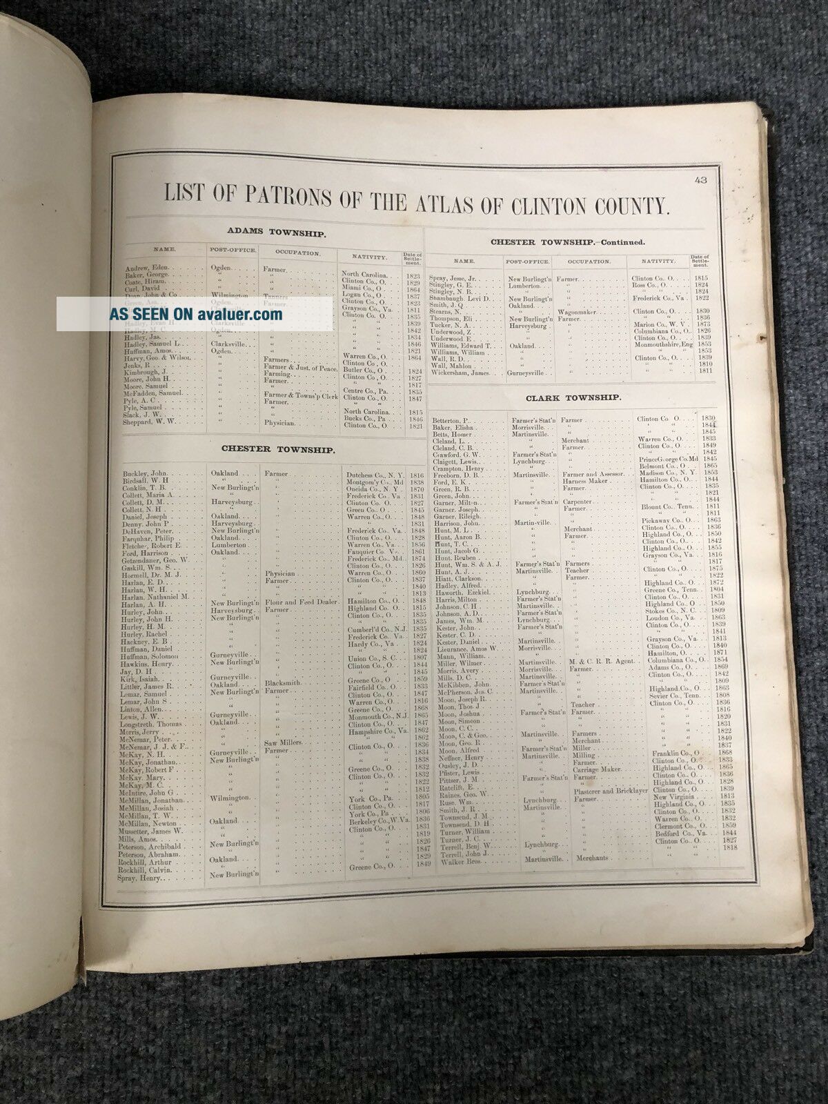
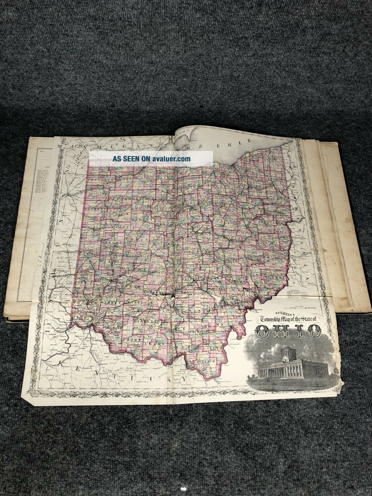
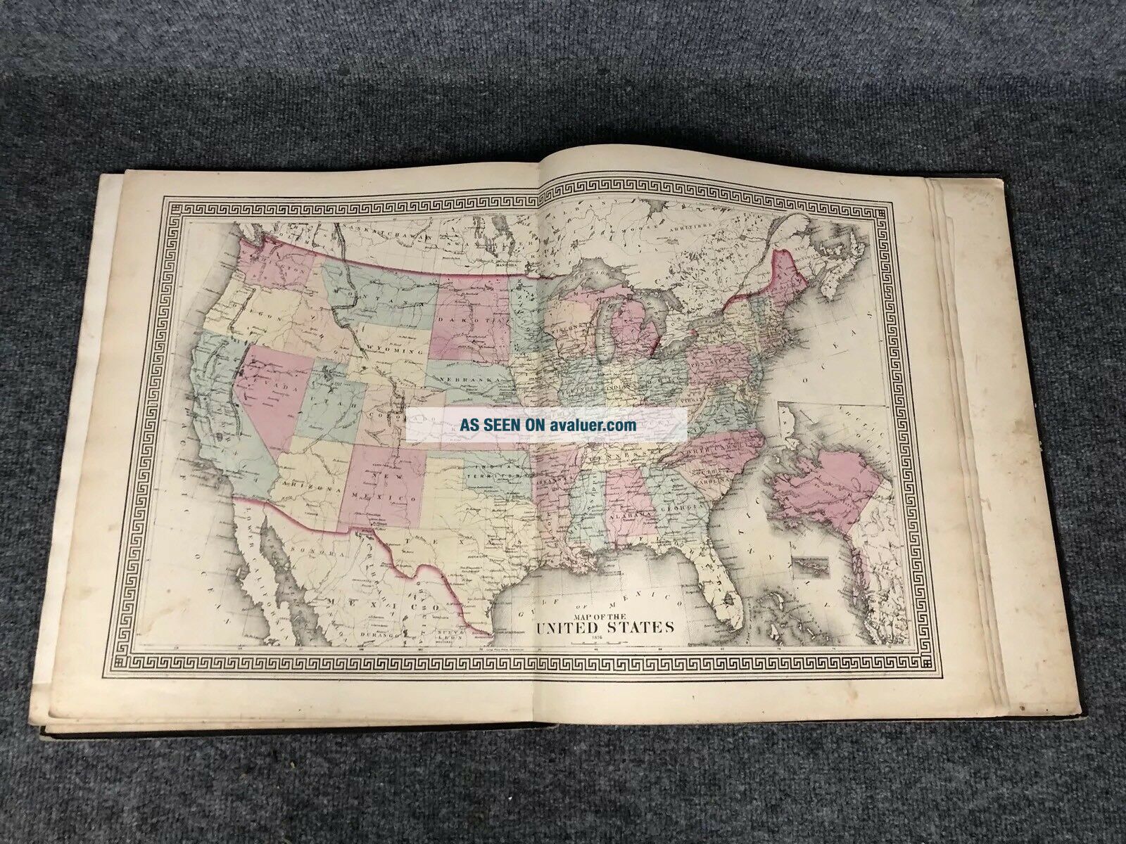
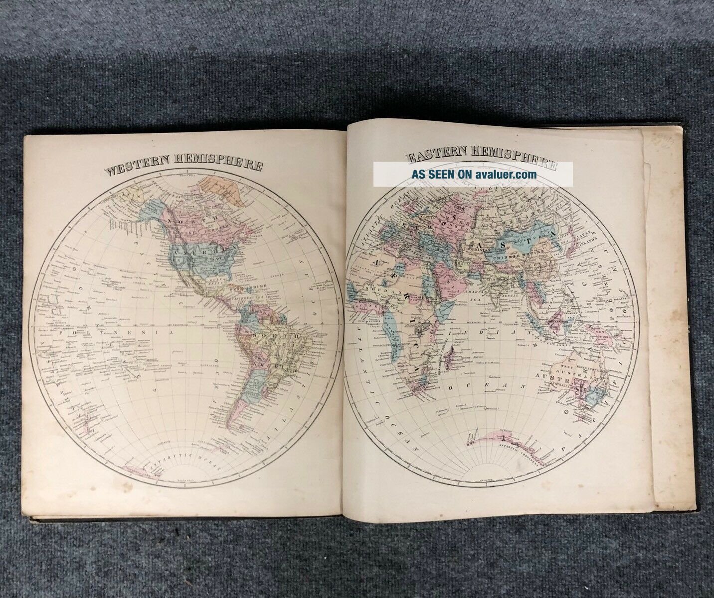
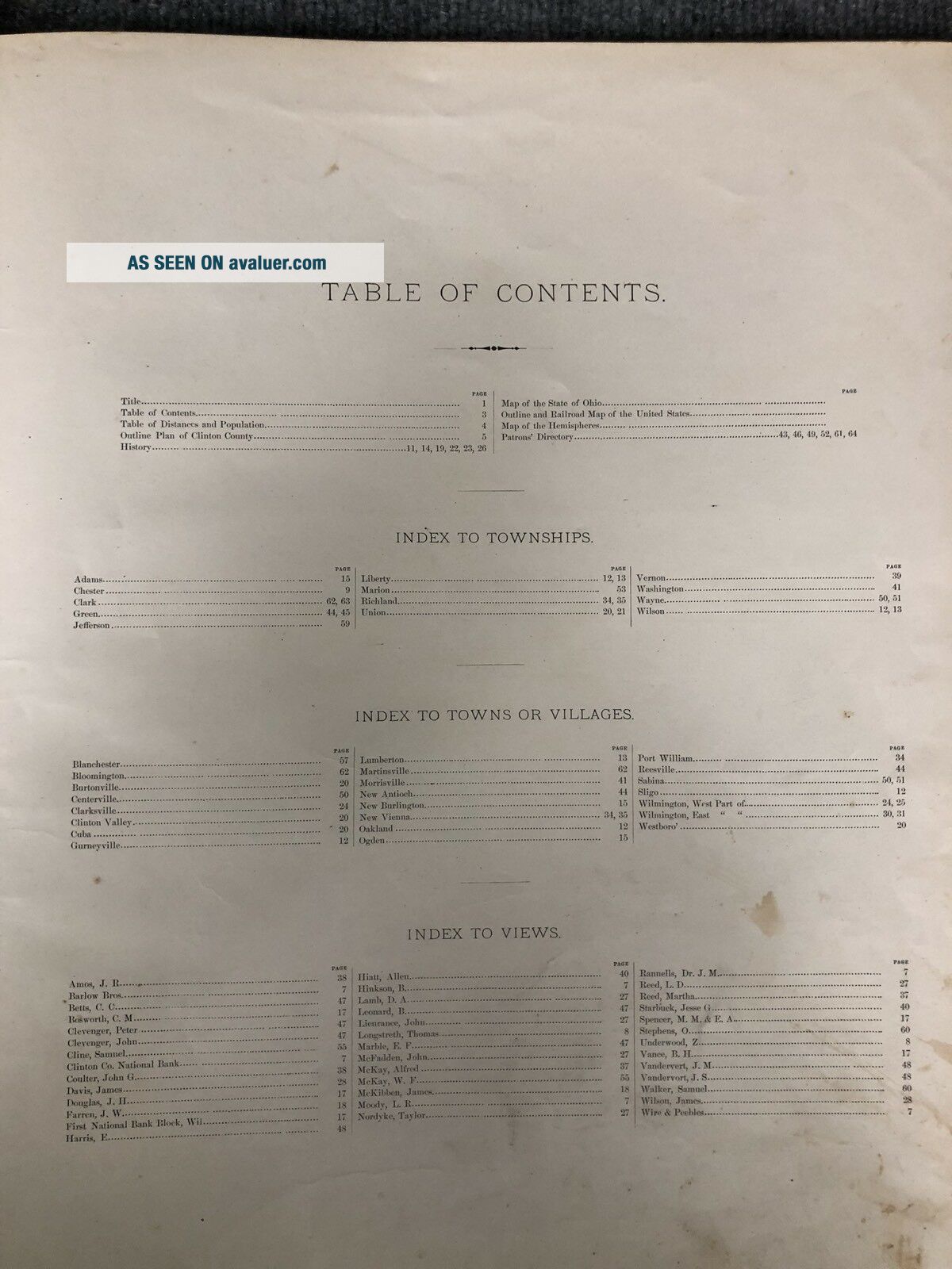
Original 1876 atlas of Clinton county in Ohio. Has a history of the area. Maps of the state, towns, townships and villages. Also has an outline and railroad map of the United States and maps of the hemispheres. There are illustrations of many homes and businesses of the time. It even has a list of patrons of the atlas. In good condition considering it is 142 years old. The binding for the cover is weak. Pages have some age spots and minor tears. Fold out map of the state was printed on... a lighter paper and has a tear where it folds in the middle. Overall the book shows it’s age but is in good condition. Paper is holding up well and it can be easily looked through. Measures 16 1/2” x 14 1/2” See photos for best description.


    Similar items


  • G.  M.  Hopkins 1876 Atlas Of Allegheny County Pa –

    G. M. Hopkins 1876 Atlas Of Allegheny County Pa –

  • Beautifully Detailed 1876 Atlas Of York County Pa - Pomeroy,  Whitman & Co.

    Beautifully Detailed 1876 Atlas Of York County Pa - Pomeroy, Whitman & Co.

  • 1878 Atlas Of Marion County.  Ohio With Township & City Maps,  History Prints

    1878 Atlas Of Marion County. Ohio With Township & City Maps, History Prints

  • Historical Atlas Of Greene County,  Ohio,  Illustrated,  L H Everts,  1874

    Historical Atlas Of Greene County, Ohio, Illustrated, L H Everts, 1874

  • Atlas Of Ashtabula County Ohio 1874 - D.  J.  Lake,  C.  E.  - Titus,  Simmons,  & Titus

    Atlas Of Ashtabula County Ohio 1874 - D. J. Lake, C. E. - Titus, Simmons, & Titus

  • 1897 Atlas Of Wayne County Ohio Caldwells Maps History Antique

    1897 Atlas Of Wayne County Ohio Caldwells Maps History Antique

  • Orig 1876 Atlas Of Berkshire County Ma 116 Pages F.  W.  Beers R.  T.  White & Co Ny

    Orig 1876 Atlas Of Berkshire County Ma 116 Pages F. W. Beers R. T. White & Co Ny

  • 1875 Caldwell

    1875 Caldwell ' S Atlas Of Madison County Ohio With Engravings


    • You might also like


    • 1860 Mitchell Hand Colored Map Colorado,  Nebraska & Kansas - Civil War Era

      1860 Mitchell Hand Colored Map Colorado, Nebraska & Kansas - Civil War Era

    • 18th Century French Map Of North America

      18th Century French Map Of North America

    • Las Vegas Nevada Vintage 1967 Us Geological Survey Quadrangle Map 4 Panels

      Las Vegas Nevada Vintage 1967 Us Geological Survey Quadrangle Map 4 Panels

    • Rare Antique 1845 Maps United States Exploring Expedition Book Antartica Hawaii

      Rare Antique 1845 Maps United States Exploring Expedition Book Antartica Hawaii

    • Vintage 1926 Map Hollywood From The Best Surveys Of The Time

      Vintage 1926 Map Hollywood From The Best Surveys Of The Time

    • American Continent (western Hemisphere) 1747 Bowen Antique Copper Engraved Map

      American Continent (western Hemisphere) 1747 Bowen Antique Copper Engraved Map

    • Gulf Coast Florida Texas United States 1705 De Fer Unusual Antique Engraved Map

      Gulf Coast Florida Texas United States 1705 De Fer Unusual Antique Engraved Map

    • California As Island United States 1700 De Fer Unusual First Edition Antique Map

      California As Island United States 1700 De Fer Unusual First Edition Antique Map

Avaluer          About Us          Privacy Policy          Contact Us          UP
© 2022, avaluer.net, Inc. or its affiliates