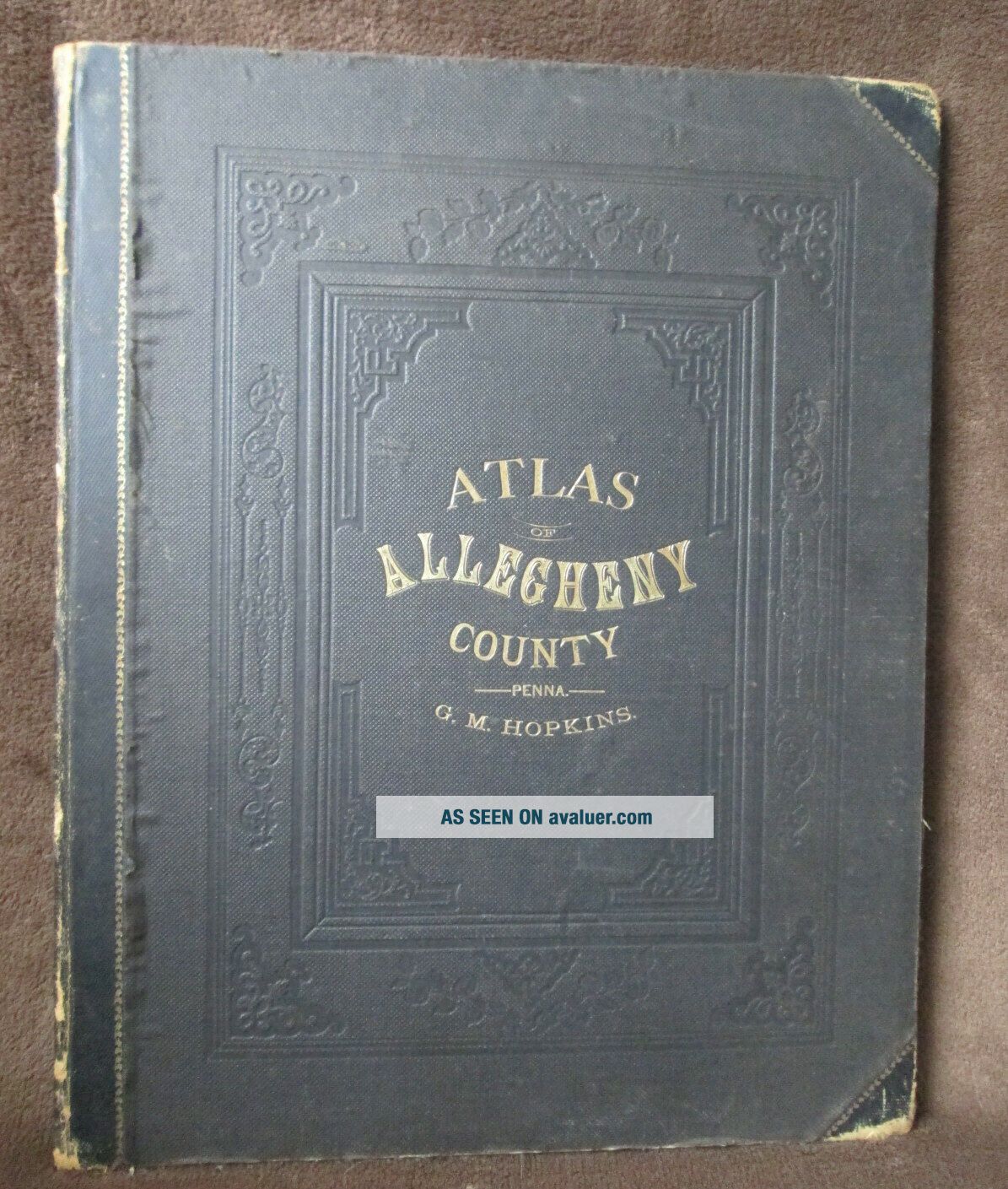
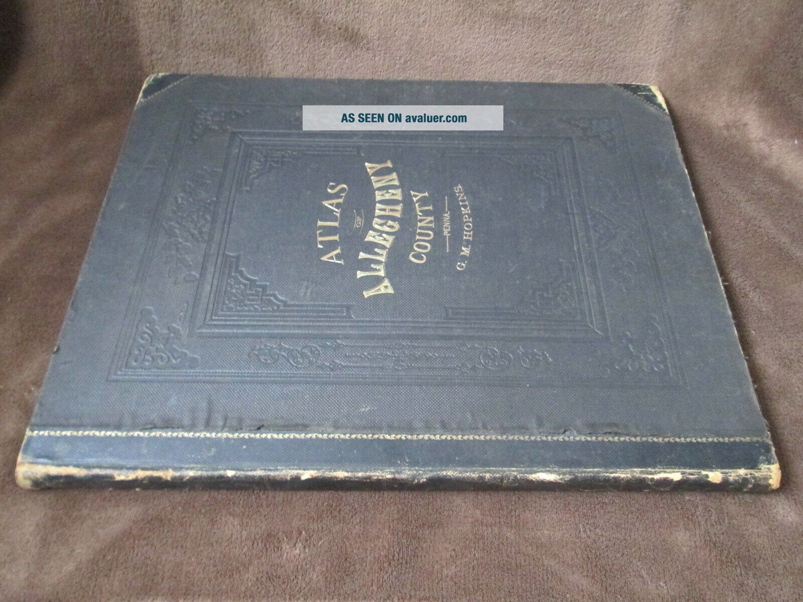
G. M. Hopkins 1876 Atlas Of Allegheny County PA –


Item History & Price

Information:
Reference Number: Avaluer:8419Original/Reproduction: Antique Original
Year: 1876Format: Atlas
US State: Pennsylvania
Original Description:
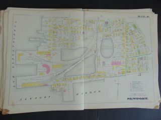
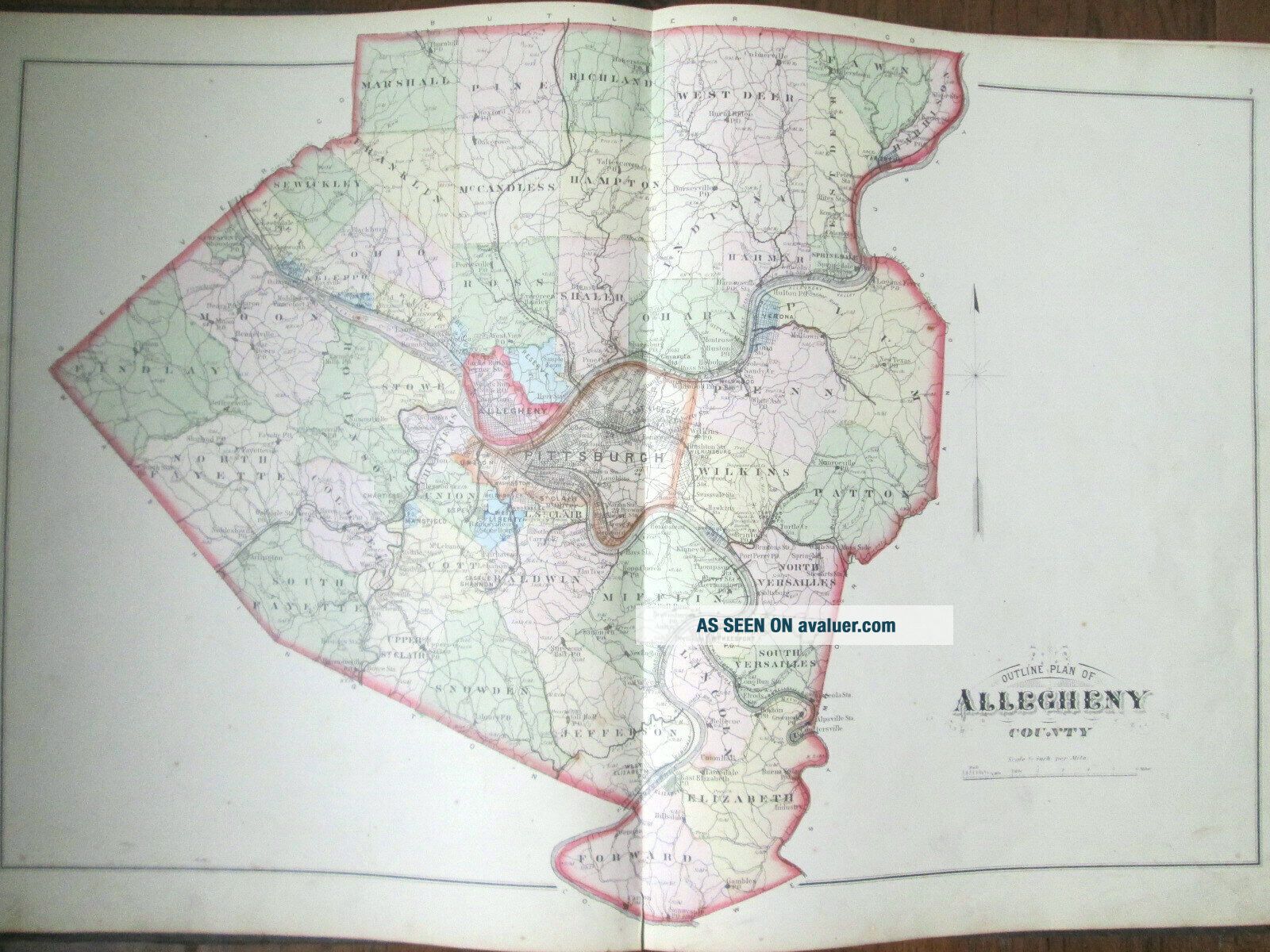
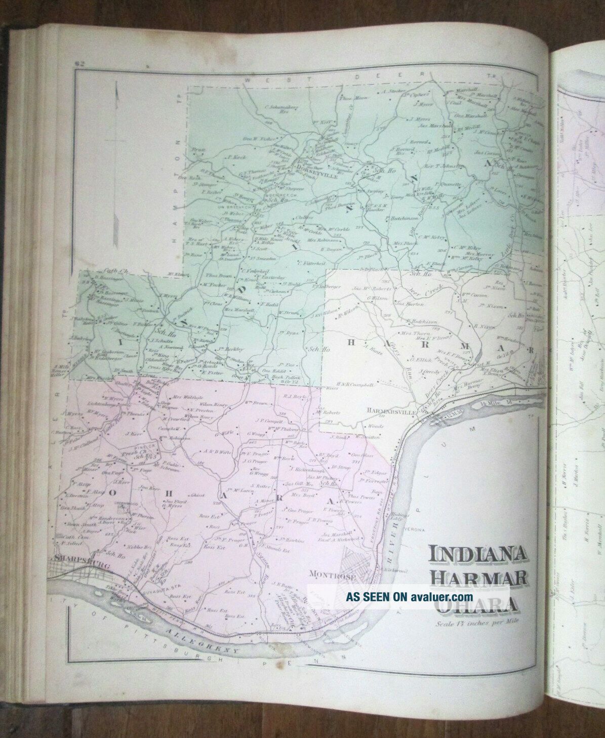
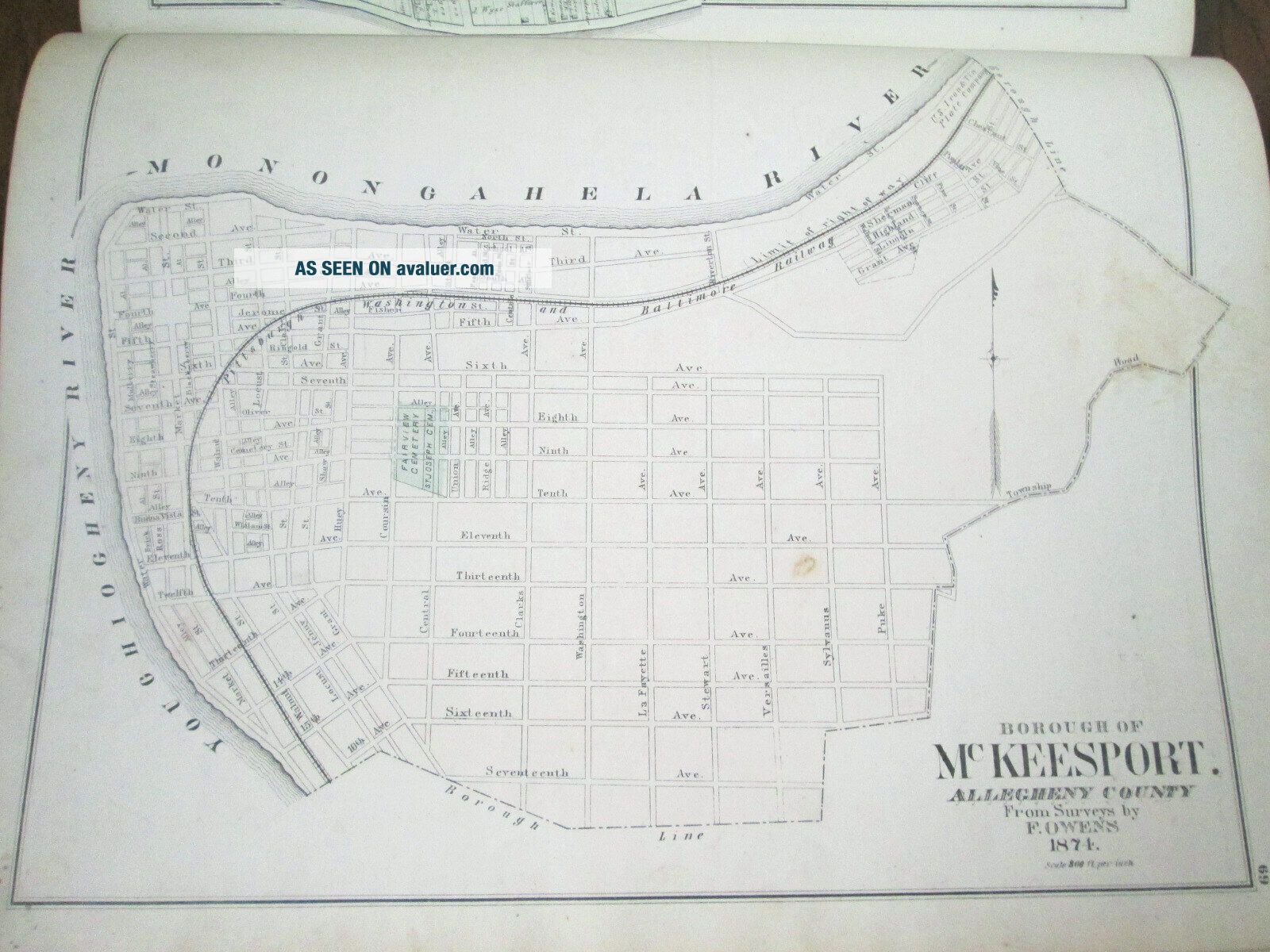
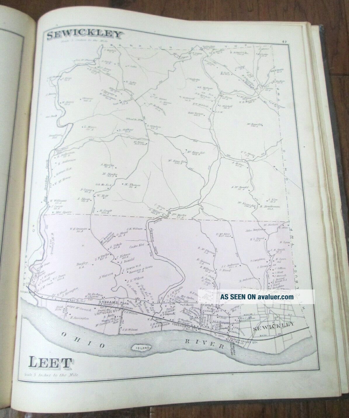
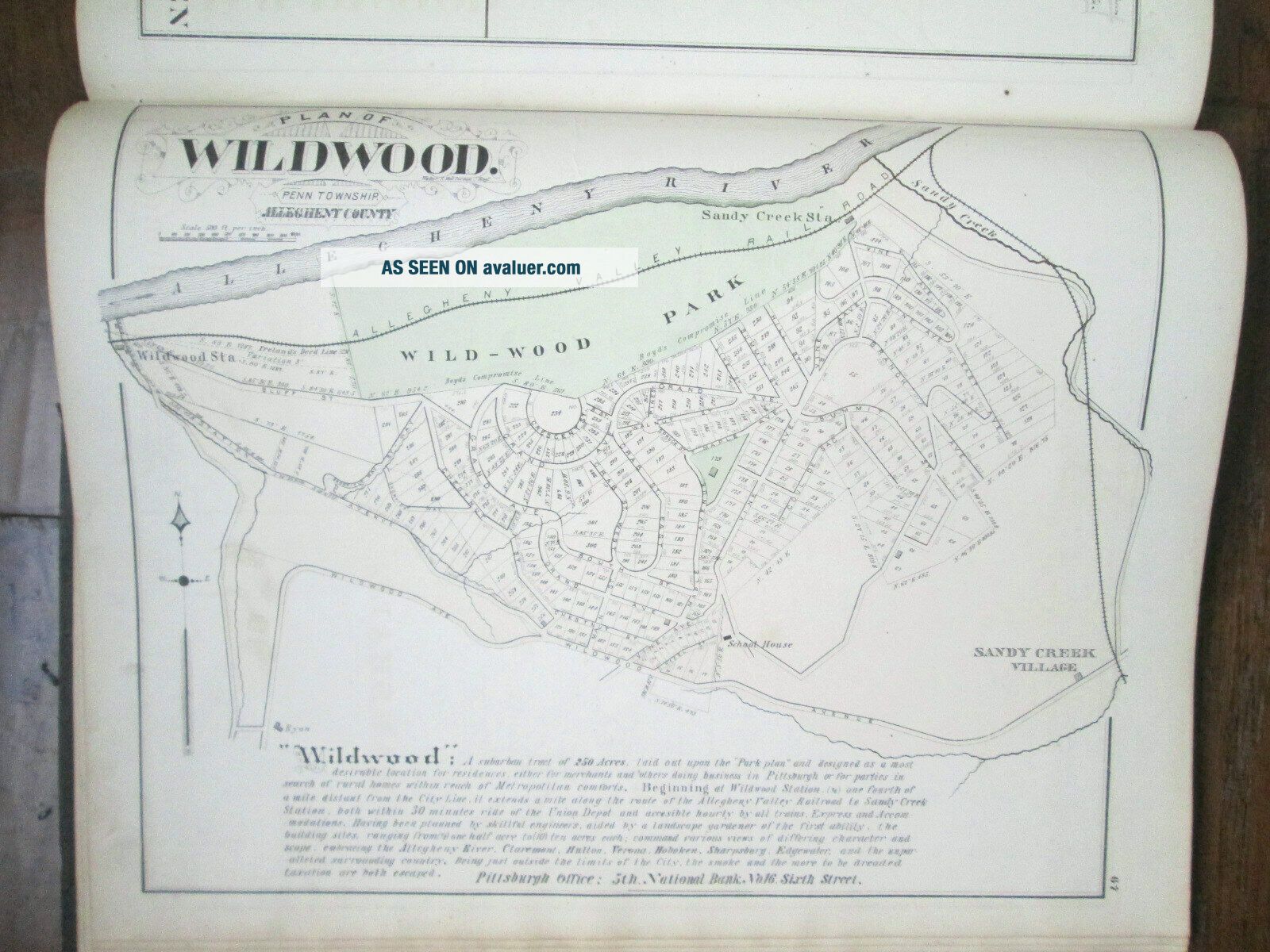
Offeredhere is a G.M. Hopkins 1876 atlas of Allegheny County Pennsylvania including Pittsburgh, Allegheny City, and the surrounding boroughs, townships, villages andtowns.  This is one of the nicestexamples of this atlas that I have come across in my 25+ years of buying, sellingand collecting.  The book is square, tight and solid.  There are no torn, loose, or missing pages, writing or offensive odors.  There is age-appropriate wear on the spineand cover boards, fra...yed and rounded corners, and some foxing and smudges onthe interior pages.    Page 12 is not in the book but it is notreferenced in the table of contents so perhaps there were some problems withthe pagination when the book was produced. The atlas includes the following:PennsylvaniaState Map, United States Map, Geological Map of the County, Allegheny CountyMap, Pittsburgh, Allegheny & Adjoining Boroughs, Description and HistoricalSketch of the County Allegheny County and its Formation, Table of Distances, Tableof Contents, Warrant Plans Townships:Aleppo, Baldwin, Crescent, Chartiers, Collier, Elizabeth, East Deer, Fawn, Findlay, Forward, Hampton, Harmar, Harrison, Jefferson, Kilbuck, Leet, Lincoln, Lower StClair, McCandless, Marshall, Mifflin, Moon, Neville, South Fayette, NorthVersailles, Ohio, O’Hara, Patton, Penn, Pine, Plum, Richland, Robinson, Reserve,   Ross, Scott, Sewickley, Shaler, Snowden, South Fayette,   South Versailles, Springdale, Stowe, Union, Upper St. Clair, West Deer, Wilkins BoroughMaps:Braddock, Bellevue, Glenfield, Chartiers, Elizabeth, Mansfield, McKeesport, Sewickley, Tarentum, Verona, West Bellevue, West Elizabeth, West Liberty Villageand Town Plans:Amity, Bakerstown, Banksville, Boston, Brinton’s Station, Bridgeville, Buena Vista, Clinton, Dravosburg, Edgewood, Elizabeth, Emsworth, Green Oak, Harmersville, Hitesville, Hoboken, Homestead, Jefferson, Lovedale, Middletown, Montrose, Noblestown, Oakdale, Petersburg, Port Perry, Sandy Creek, Shousetown, Springdale, Swissvale, Turtle Creek, Walls Station, Walker’s Mills, Wilkinsburg, Wildwood, William Dunn’s Plan Thereare four pages of business notices after the map section that list localDoctors, Lawyers, Banks, and Merchants etc.


    Similar items


  • Complete G.  M.  Hopkins 1888 Atlas Of The City And Town Of Bridgeport P.  T.  Barnum

    Complete G. M. Hopkins 1888 Atlas Of The City And Town Of Bridgeport P. T. Barnum

  • Antique 1876 City Atlas Of Philadelphia,  23rd Ward,  G.  M.  Hopkins Colored Maps

    Antique 1876 City Atlas Of Philadelphia, 23rd Ward, G. M. Hopkins Colored Maps

  • Atlas Of The Town Of Brookline Massachusetts - 1874 - G.  M.  Hopkins - Color Plates - 2

    Atlas Of The Town Of Brookline Massachusetts - 1874 - G. M. Hopkins - Color Plates - 2

  • 1877 Atlas Of Baltimore County Maryland 1968 Reprint G.  M.  Hopkins Map Scarce

    1877 Atlas Of Baltimore County Maryland 1968 Reprint G. M. Hopkins Map Scarce

  • Atlas Map Of Butler County Pa 1874 G.  M.  Hopkins Pennsylvania History

    Atlas Map Of Butler County Pa 1874 G. M. Hopkins Pennsylvania History

  • C.  1883 Atlas Of The City Of Newport Rhode Island By G.  M.  Hopkins Phila.  1883

    C. 1883 Atlas Of The City Of Newport Rhode Island By G. M. Hopkins Phila. 1883

  • 1883 Title Page City Of Newport Rhode Island G.  M.  Hopkins Atlas Map

    1883 Title Page City Of Newport Rhode Island G. M. Hopkins Atlas Map

  • Atlas Of The Town Of Brookline Massachusetts - 1874 - G.  M.  Hopkins - Color Plates

    Atlas Of The Town Of Brookline Massachusetts - 1874 - G. M. Hopkins - Color Plates


    • You might also like


    • 1860 Mitchell Hand Colored Map Colorado,  Nebraska & Kansas - Civil War Era

      1860 Mitchell Hand Colored Map Colorado, Nebraska & Kansas - Civil War Era

    • 18th Century French Map Of North America

      18th Century French Map Of North America

    • Las Vegas Nevada Vintage 1967 Us Geological Survey Quadrangle Map 4 Panels

      Las Vegas Nevada Vintage 1967 Us Geological Survey Quadrangle Map 4 Panels

    • Rare Antique 1845 Maps United States Exploring Expedition Book Antartica Hawaii

      Rare Antique 1845 Maps United States Exploring Expedition Book Antartica Hawaii

    • Vintage 1926 Map Hollywood From The Best Surveys Of The Time

      Vintage 1926 Map Hollywood From The Best Surveys Of The Time

    • American Continent (western Hemisphere) 1747 Bowen Antique Copper Engraved Map

      American Continent (western Hemisphere) 1747 Bowen Antique Copper Engraved Map

    • Gulf Coast Florida Texas United States 1705 De Fer Unusual Antique Engraved Map

      Gulf Coast Florida Texas United States 1705 De Fer Unusual Antique Engraved Map

    • California As Island United States 1700 De Fer Unusual First Edition Antique Map

      California As Island United States 1700 De Fer Unusual First Edition Antique Map

Avaluer          About Us          Privacy Policy          Contact Us          UP
© 2022, avaluer.net, Inc. or its affiliates