C1689 Antique Map - MAP OF ENGLAND ROADS John Ogilby Ireland (LM6)
Item History & Price
| Reference Number: Avaluer:15367 |
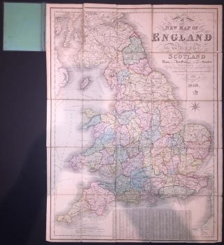
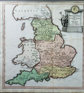
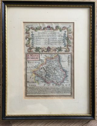
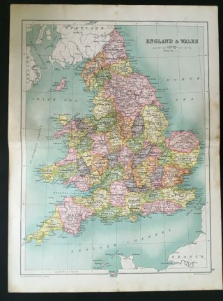
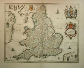
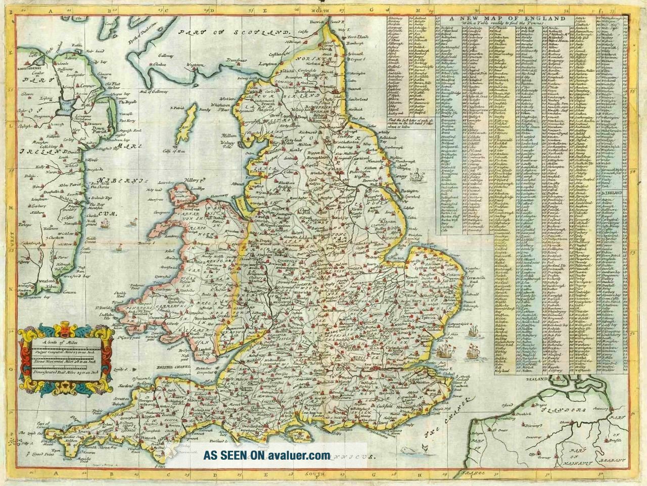
c1689 Original Antique Map - NEW MAP OF ENGLAND ROADS John Ogilby Ireland (LM6) c1689 Original Antique Map - NEW MAP OF ENGLAND ROADS John Ogilby Ireland (LM6) c1689 Original Antique Map - NEW MAP OF ENGLAND ROADS John Ogilby Ireland (LM6) Click images to enlarge Description c1689 " A NEW MAP OF ENGLAND with a table readily to find the Townes " A fine early copper plate engraved map by John Ogilby with early outline hand colouring. Here, the roads of England and Wales are clearly delin...eated and the major towns are depicted pictorially with spires and towers. Where the early issues of the map had a decorative title cartouche on the left side, this example has a newly engraved, extensive, alphabetical table of the towns, including a number in Ireland. Measures 480 x 360mm John Ogilby (also Ogelby, Oglivie; November 1600 – 4 September 1676) was a Scottish translator, impresario and cartographer. Best known for publishing the first British road atlas, he was also a successful translator, noted for publishing his work in handsome illustrated editions. CONDITION: Original antique Map is in good condition with central fold, as issued. Good to large margins, perfect for mounting and framing. ALL OF OUR MAPS & PRINTS ARE GUARANTEED ORIGINAL ANTIQUES. We do not sell reproductions. Payment We prefer payment via PAYPAL. In some circumstances, we are able to accept a Cheque from UK Buyers, drawn on a UK Bank. Buyers will need to wait for 7 working days for the cheque to clear before any items are sent out. We can also accept Cash Payment in UK Pounds Stirling, Euros or US Dollars, but payment by cash methods are sent at the risk of the buyer. If you want to pay in any way apart from PAYPAL, please contact us PRIOR to making any bid or outright purchase. Shipping We always try to ship items within 3 working days of any order. We are very happy to combine many items for a single postal charge. All our items are sent in either Board Backed envelopes or Art Tubes and are in the case of sending to tropical areas of the world, additionally provded with sealed plastic envelopes. We ship to almost anywhere in the world but there are just a few territories we are unable to ship to. About Us Antique Paper Company are established dealers in Antique Maps, Prints, Stamps, Postal History, Antiquarian Books and in fact all forms of Antique Paper also including Post Cards, Old Posters, Archives, Manuscripts, Ephemera etc. We are keen buyers and are prepared to travel throughout the UK, Europe and most of the world in search of opportunites to buy. Cash funds of up to £250, 000 are available immediately for the right opportunities. We work closely with Libraries & Solicitors/probate situations where they are looking for disposal options and seek better single items to large quantities and also Specialised Collections of almost any genre. Please do not hesitate to contact us with details of any items you might have for sale. Contact Us Pictures sell!Auctiva offers Free Image Hosting and Editing.250+ Listing Templates!Auctiva gets you noticed!The complete eBay Selling Solution. c1689 Original Antique Map - NEW MAP OF ENGLAND ROADS John Ogilby Ireland (LM6) c1689 Original Antique Map - NEW MAP OF ENGLAND ROADS John Ogilby Ireland (LM6)
c1689 Original Antique Map - NEW MAP OF ENGLAND ROADS John Ogilby Ireland (LM6) Click images to enlarge Description c1689" A NEW MAP OF ENGLAND with a table readily to find the Townes "A fine early copper plate engraved map by John Ogilby with early outline hand colouring. Here, the roads of England and Wales are clearly delineated and the major towns are depicted pictorially with spires and towers. Where the early issues of the map had a decorative title cartouche on the left side, this example has a newly engraved, extensive, alphabetical table of the towns, including a number in Ireland.
Measures 480 x 360mmJohn Ogilby (also Ogelby, Oglivie; November 1600 – 4 September 1676) was a Scottish translator, impresario and cartographer. Best known for publishing the first British road atlas, he was also a successful translator, noted for publishing his work in handsome illustrated editions.CONDITION:Original antique Map is in good condition with central fold, as issued. Good to large margins, perfect for mounting and framing. ALL OF OUR MAPS & PRINTS ARE GUARANTEED ORIGINAL ANTIQUES. We do not sell reproductions. Payment We prefer payment via PAYPAL. In some circumstances, we are able to accept a Cheque from UK Buyers, drawn on a UK Bank. Buyers will need to wait for 7 working days for the cheque to clear before any items are sent out. We can also accept Cash Payment in UK Pounds Stirling, Euros or US Dollars, but payment by cash methods are sent at the risk of the buyer. If you want to pay in any way apart from PAYPAL, please contact us PRIOR to making any bid or outright purchase. Shipping We always try to ship items within 3 working days of any order. We are very happy to combine many items for a single postal charge. All our items are sent in either Board Backed envelopes or Art Tubes and are in the case of sending to tropical areas of the world, additionally provded with sealed plastic envelopes.
We ship to almost anywhere in the world but there are just a few territories we are unable to ship to.
About Us Antique Paper Company are established dealers in Antique Maps, Prints, Stamps, Postal History, Antiquarian Books and in fact all forms of Antique Paper also including Post Cards, Old Posters, Archives, Manuscripts, Ephemera etc.
We are keen buyers and are prepared to travel throughout the UK, Europe and most of the world in search of opportunites to buy. Cash funds of up to £250, 000 are available immediately for the right opportunities. We work closely with Libraries & Solicitors/probate situations where they are looking for disposal options and seek better single items to large quantities and also Specialised Collections of almost any genre.
Please do not hesitate to contact us with details of any items you might have for sale. Contact Us
Pictures sell!
Auctiva offers Free Image Hosting and Editing.250+ Listing Templates!
Auctiva gets you noticed!
The complete eBay Selling Solution.
Track Page Views With
Auctiva's FREE Counter ×
Buy now and save! Tell a friend Visit store Watch now Postage info Click the Postage tab above the listing description for more info FREE Postage See more... Royal Mail 1st Class Signed For - £0.00 Royal Mail Special Delivery (TM) 1:00 pm - £8.00 Royal Mail International Tracked - £12.00 Click the Postage tab above the listing description for more info! Additional delivery notes PICK UP OPTION Sorry, our items are NOT available for pick-up. PAYING VIA PAYPAL
We accept PayPal on our all our items so you can shop with confidence. Simple choose the PayPal option when proceeding through the checkout. Additional Information No additional information at this time Ask seller a question You might also like 1855 Antique Print - RUSSIA Crimea Sebastopol Trenches Crowe Soldiers (322) 1855 Antique Print LONDON Westminster Royal Commissioners Patriotic Fund (120) 1855 FINE ART Antique Print - Runaway Knock George Cruikshank British Dogs (92) 1855 Antique Print - FRANCE Paris New Years Gifts Family Table Bonnet Chair(244) Contact To contact our Customer Service Team, simply click the button here and our Customer Service team will be happy to assist. Ask seller a question © antiquepapercompany Postage Shipping is FREE for this item Payment Accepted Payment Methods PayPal Returns Returns are accepted Items must be returned within 30 days of the auction ending Seller will pay for return shipping. eBay integration by