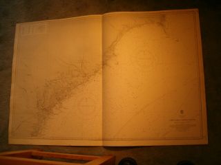
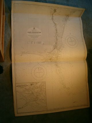
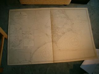
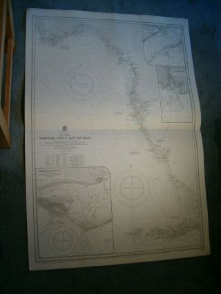
Vintage Admiralty Chart 260 USA - CAPE FEAR To SAPELO SOUND 1912 Edn


Item History & Price

Information:
Reference Number: Avaluer:15711203Original/Reproduction: Vintage Original
Year: 1912Format: Sheet Map
Date Range: 1910-1919Type: Nautical Map
Country/Region: United States of America
Original Description:
MARINE  CHART  SERVICESThe Worlds largest supplier of quality used genuine Admiralty charts Combined postage discounts - pay the full price & we will refund the overspendVisit our eBay shopfor over 800 originalVintage Admiralty & OTHER Charts VINTAGE  BRITISH  ADMIRALTYCHART NO. 268 NORTH AMERICA - EAST COASTCAPE FEAR to SAPELO SOUND Scale 1:NOT GIVEN 1912 editionwith printed corrections to 1928UNUSED  Size 3...8 x 25 inchesGENUINE 91 YEAR OLD CHARTNICE CHART  Will be posted in a tube  PLEASE NOTE - We require payment within 2 days of 'buy-it-now'If you are unable to pay within these times, you MUST LET US KNOW otherwise we may take action against against you. We aim to dispatch most items within 2 working days of your payment (or final payment) clearing. We will offer a reduced carriage charge for multiple items sent in one parcelbut only where you wait for us to send a combined-item invoice(This includes items from Ebay and from our own website, sent in one consignment)POSTAGE for multiple purchases :-100% carriage charge on first item, or on heaviest itemthen 25% of carriage charges for each extra itemFurther reductions for 11 items or more in some casesIf you opt to pay the 'transit insurance' and this item becomes lost in the postal system, we will either refund or replace it if the original is not found. If you prefer not to pay this insurance, then the item is sent at your risk
Seller is not responsible for transit time or transit delays. Once item has been posted we have no control over it 
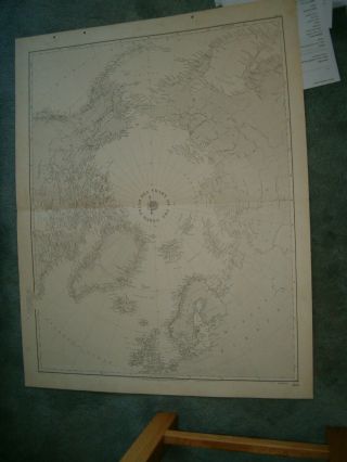
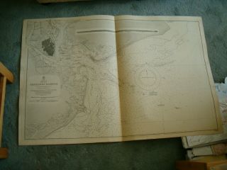
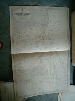
Photo is of actual chart you are buying Please check back regularly for other marine items for sale 


    Similar items


  • Vintage Admiralty Chart 268 Usa - Cape Fear To Sapelo Sound 1912 Edn

    Vintage Admiralty Chart 268 Usa - Cape Fear To Sapelo Sound 1912 Edn

  • Vintage Admiralty Chart 2863 Usa - Cape Fear River 1876 Edn

    Vintage Admiralty Chart 2863 Usa - Cape Fear River 1876 Edn

  • Vintage Admiralty Chart 3096 Usa - Cape Cod Bay 1913 Edn

    Vintage Admiralty Chart 3096 Usa - Cape Cod Bay 1913 Edn

  • Vintage Admiralty Chart 267 Usa - Albermarle Sound To Cape Fear 1914 Edn

    Vintage Admiralty Chart 267 Usa - Albermarle Sound To Cape Fear 1914 Edn

  • Vintage Admiralty Chart 1274 Usa - Florida - Tortugas Cays To Cape S Bl 1915 Edn

    Vintage Admiralty Chart 1274 Usa - Florida - Tortugas Cays To Cape S Bl 1915 Edn

  • Vintage Admiralty Chart 260 North Polar Sea 1931 Edn

    Vintage Admiralty Chart 260 North Polar Sea 1931 Edn

  • Vintage Admiralty Chart 2806 Usa - Charleston Harbour 1914 Edn

    Vintage Admiralty Chart 2806 Usa - Charleston Harbour 1914 Edn

  • Vintage Admiralty Chart 2489 Usa - Nantucket Sound & Eastern Approaches 1915 Edn

    Vintage Admiralty Chart 2489 Usa - Nantucket Sound & Eastern Approaches 1915 Edn


    • You might also like


    • 1860 Mitchell Hand Colored Map Colorado,  Nebraska & Kansas - Civil War Era

      1860 Mitchell Hand Colored Map Colorado, Nebraska & Kansas - Civil War Era

    • 18th Century French Map Of North America

      18th Century French Map Of North America

    • Las Vegas Nevada Vintage 1967 Us Geological Survey Quadrangle Map 4 Panels

      Las Vegas Nevada Vintage 1967 Us Geological Survey Quadrangle Map 4 Panels

    • Rare Antique 1845 Maps United States Exploring Expedition Book Antartica Hawaii

      Rare Antique 1845 Maps United States Exploring Expedition Book Antartica Hawaii

    • Vintage 1926 Map Hollywood From The Best Surveys Of The Time

      Vintage 1926 Map Hollywood From The Best Surveys Of The Time

    • American Continent (western Hemisphere) 1747 Bowen Antique Copper Engraved Map

      American Continent (western Hemisphere) 1747 Bowen Antique Copper Engraved Map

    • Gulf Coast Florida Texas United States 1705 De Fer Unusual Antique Engraved Map

      Gulf Coast Florida Texas United States 1705 De Fer Unusual Antique Engraved Map

    • California As Island United States 1700 De Fer Unusual First Edition Antique Map

      California As Island United States 1700 De Fer Unusual First Edition Antique Map

Avaluer          About Us          Privacy Policy          Contact Us          UP
© 2022, avaluer.net, Inc. or its affiliates