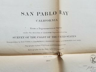
1863 US Coast Survey Chesapeake Bay, Delaware Bay And The Delmarva Peninsula


Item History & Price

Information:
Reference Number: Avaluer:15787Year: 1863
US State: Delaware
Original Description:
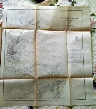
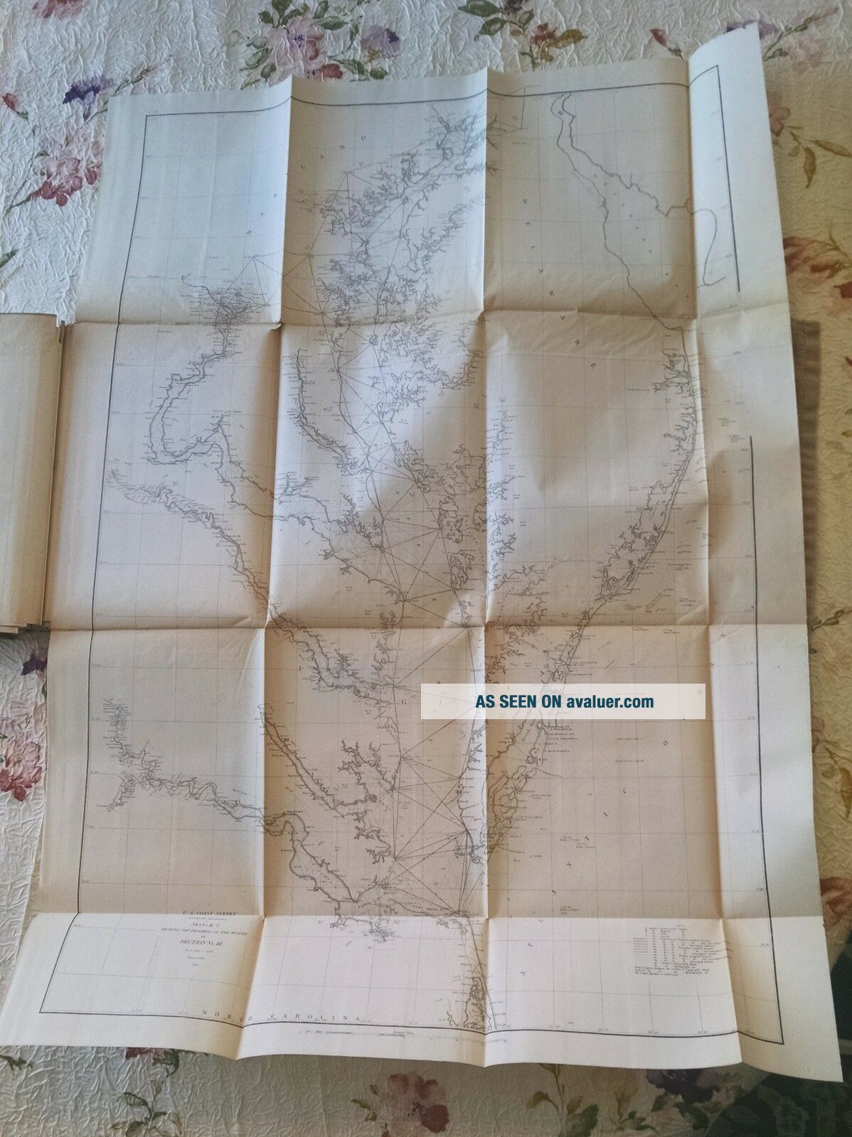
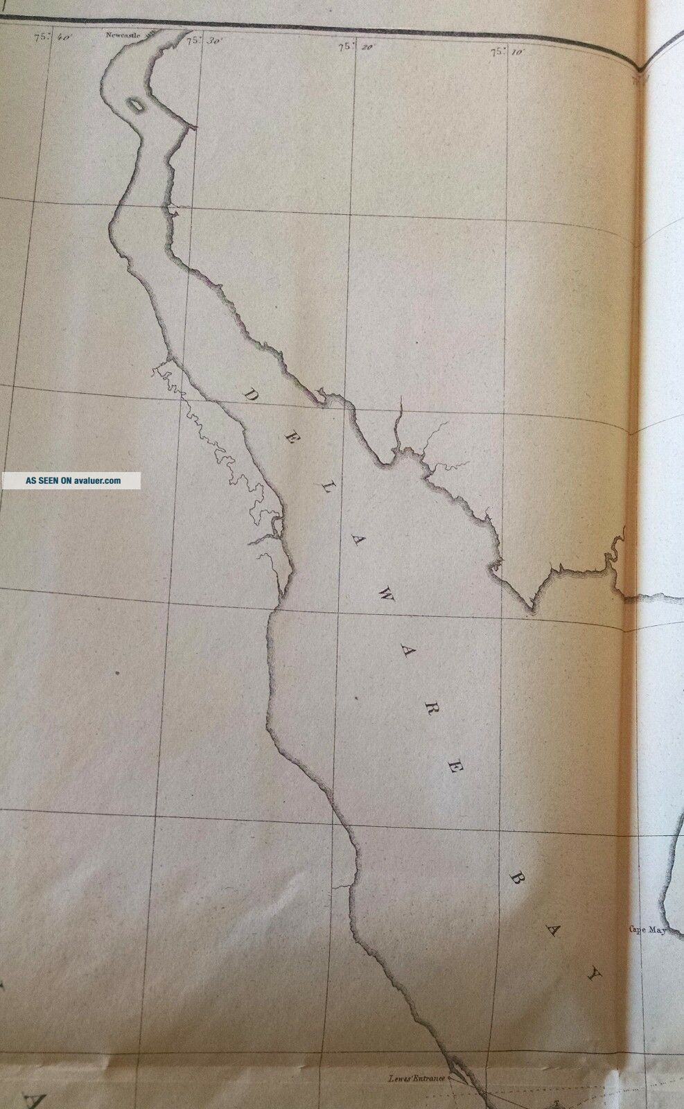
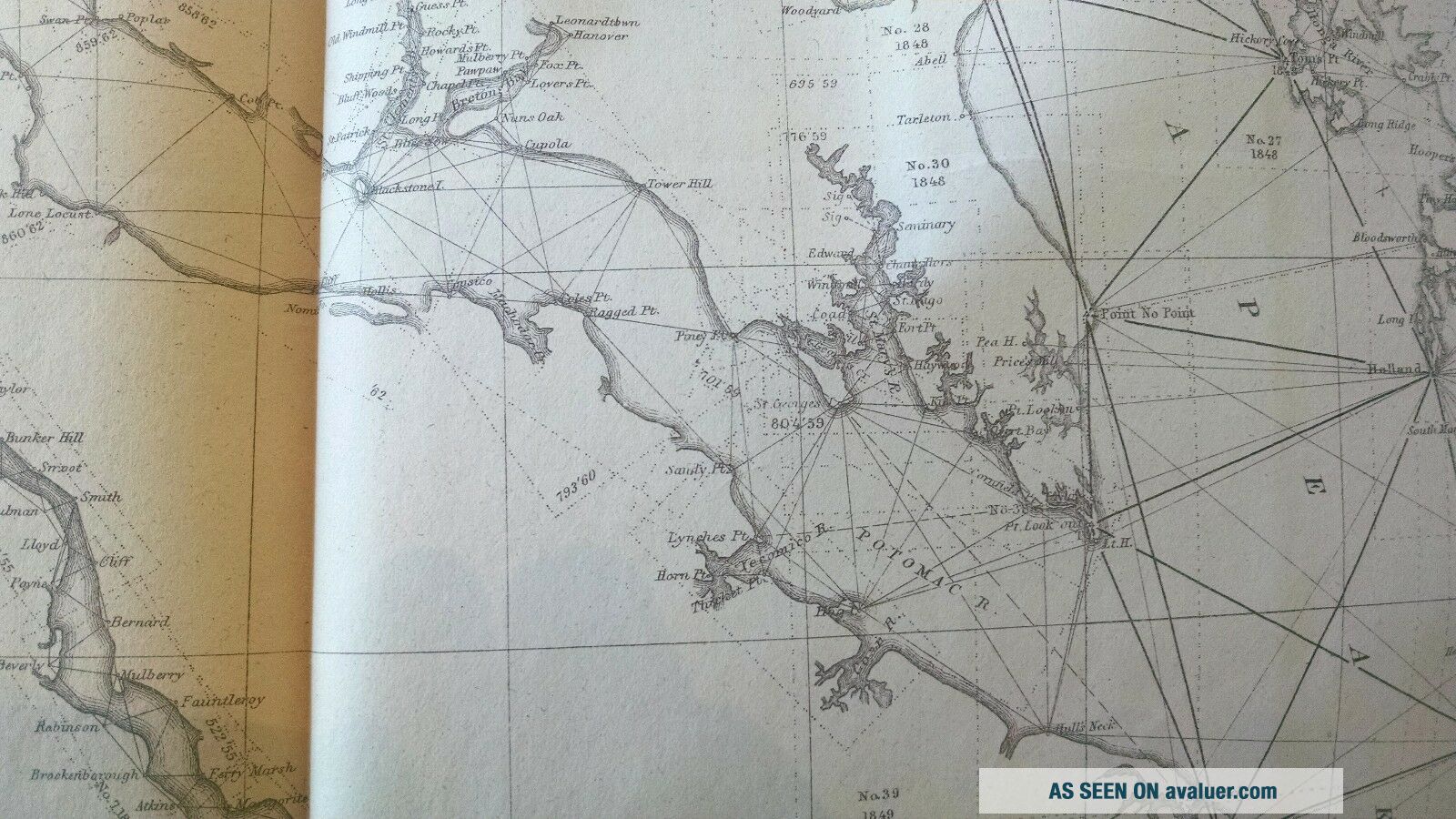
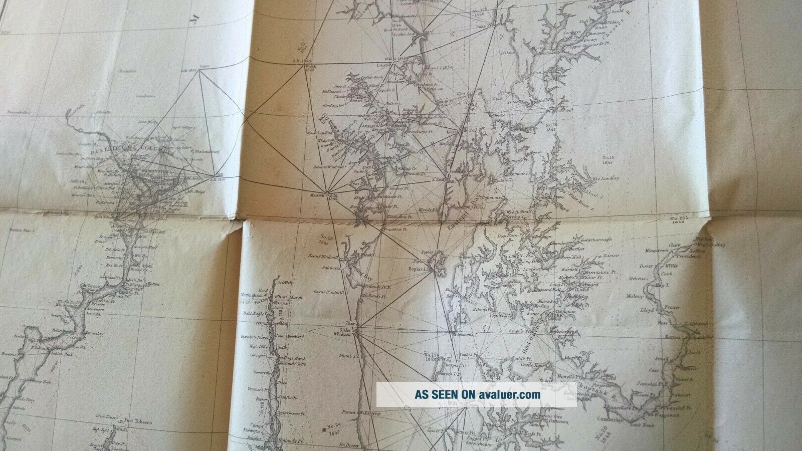
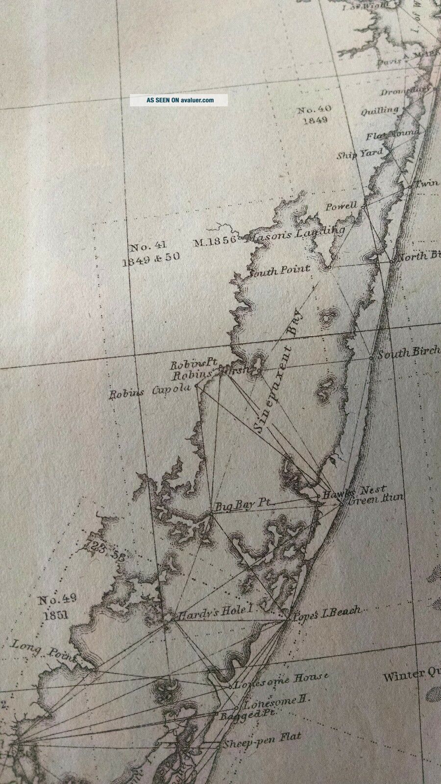
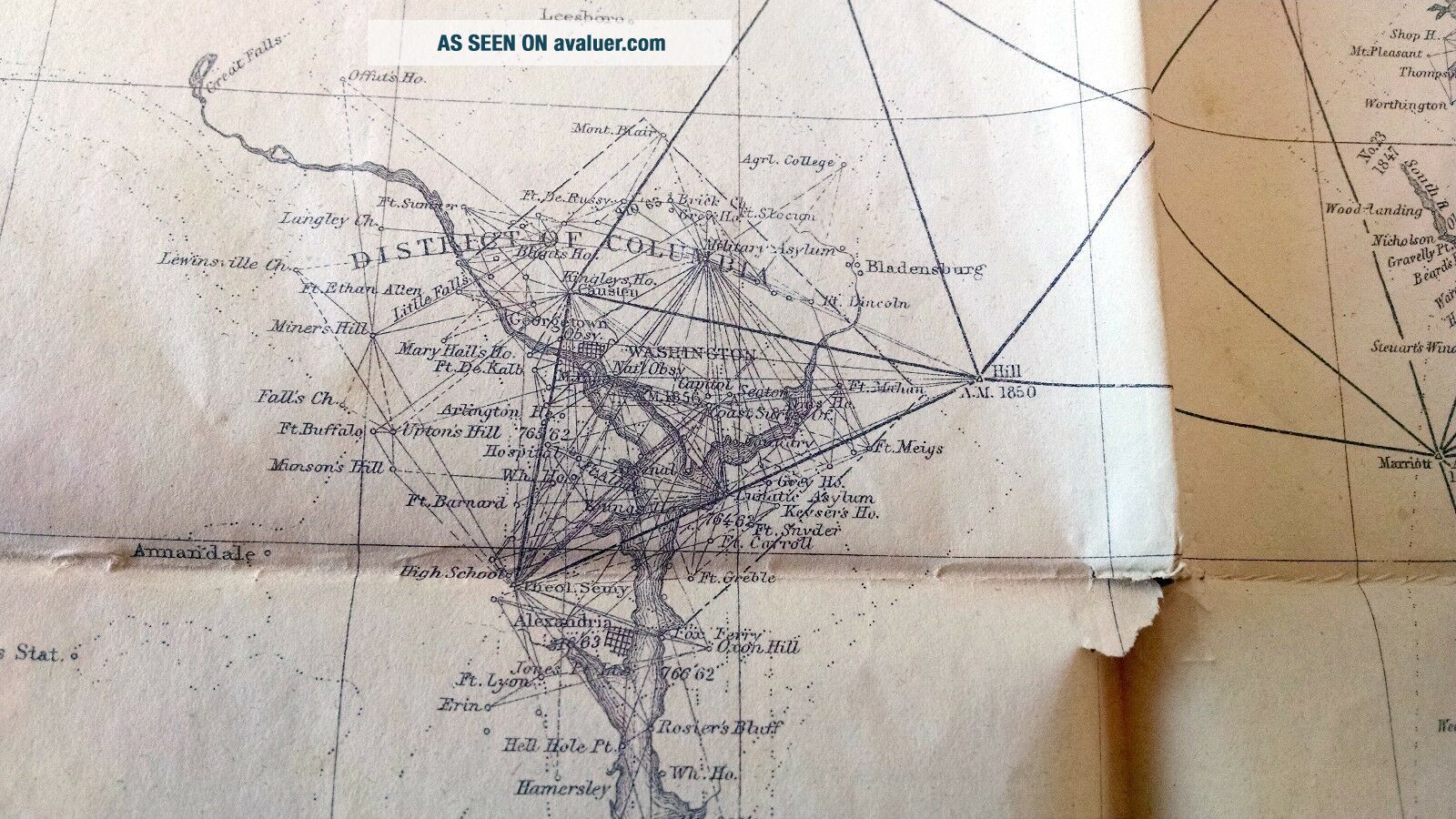
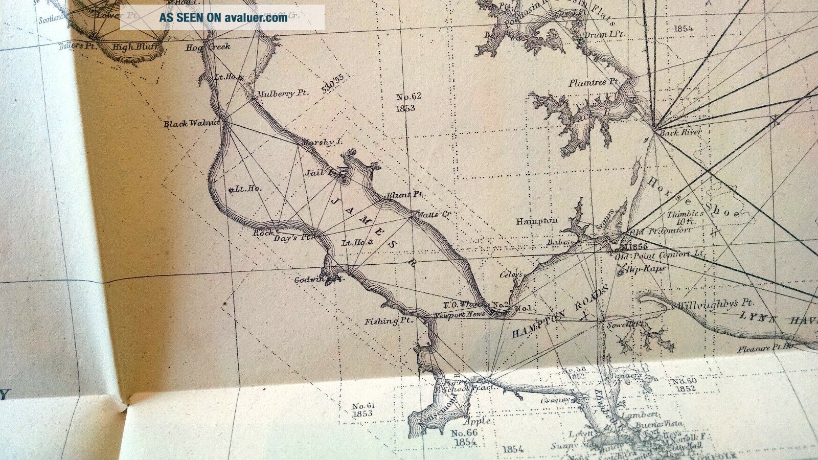
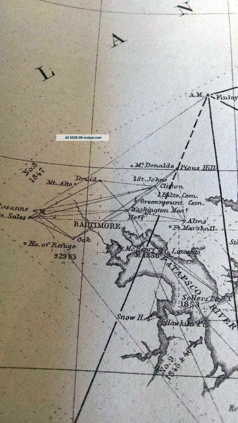
The chart covers the work done from 1843 to1863 on the survey of Chesapeake Bay, Delaware Bay and the Delmarva Peninsula.This 1862 chart was included in the 1863 Annual Report prepared under thedirection of A.D. Bache, Superintendent. This chart covers the areasurrounding Delaware Bay, the Delmarva Peninsula along with Chesapeake Bay andIts tributaries. The cities of Baltimore, MD; Washington, D.C.; Annapolis, MD;Richmond, VA and Norfolk, VA.are shown along with many others. Rivers inc...lude, Patapsco River, the Potomac River, the Rappahannock River,   the York River the James River and others.This is an original black and white 33.50 H x22.80 W Inches produced by the U. S. Coast Survey. Scale 1/400, 000Condition: The chart has been protected inthe 1863 US Coast Survey book for the past ~150 years.  Condition is good as noted in the photographsand the grading scheme noted below. Minimal toning along the fold lines. Smallseparations at the corners of the left most fold line. Map will beshipped as folded, insured, and well protected.A Note on the Grading of Maps (usingconvention outlined in Rosenthal's Antique Map Price Record & Handbook):•               Fine:Clean and bright, with crisp engraved lines. On sound paper with wide margins.Fine quality coloring.•               VeryGood: Clean and bright, with crisp engraved lines. On sound paper with noimperfections in the image. Small tears or minor discoloration in the marginsonly. Very good quality coloring.•               Good:No significant imperfections. Minor spotting, foxing, short separations oncenterfold with no image loss, or overall age toning may be present. May havenarrow margins but paper is still sound. Good coloring.•               Fair:Noticeable imperfections. Scattered foxing or spotting. Long separations oncenterfold or tears entering image which can be easily repaired. Color may beslightly faded.•               Poor:Needs significant repair and cleaning. Paper may be highly acid and brittle.Color may be faded.


    Similar items


  • Preliminary Chart Of Half Moon Bay California 1863 Us Coast Survey Map Chart

    Preliminary Chart Of Half Moon Bay California 1863 Us Coast Survey Map Chart

  • San Pablo Bay California 1863 Us Coast Survey Map Chart

    San Pablo Bay California 1863 Us Coast Survey Map Chart

  • Atlantic Gulf Of Mexico And Pacific Coasts 1863 Us Coast Survey Map Chart

    Atlantic Gulf Of Mexico And Pacific Coasts 1863 Us Coast Survey Map Chart

  • Washington Sound And Approaches Washington Territory 1863 Us Coast Survey Map

    Washington Sound And Approaches Washington Territory 1863 Us Coast Survey Map

  • Rockland Harbor And Vicinity Maine Map 1863 Us Coast Survey Annual Report Map

    Rockland Harbor And Vicinity Maine Map 1863 Us Coast Survey Annual Report Map

  • 1863 Us Coast Survey Florida Reef - Elbow To Lower Matecumbe Key Map Chart

    1863 Us Coast Survey Florida Reef - Elbow To Lower Matecumbe Key Map Chart

  • Us Gulf Coast - Key West To The Rio Grande Western Part 1863 Us Coast Survey Map

    Us Gulf Coast - Key West To The Rio Grande Western Part 1863 Us Coast Survey Map

  • Us Gulf Coast - Key West To The Rio Grande Eastern Part 1863 Us Coast Survey Map

    Us Gulf Coast - Key West To The Rio Grande Eastern Part 1863 Us Coast Survey Map


    • You might also like


    • 1860 Mitchell Hand Colored Map Colorado,  Nebraska & Kansas - Civil War Era

      1860 Mitchell Hand Colored Map Colorado, Nebraska & Kansas - Civil War Era

    • 18th Century French Map Of North America

      18th Century French Map Of North America

    • Las Vegas Nevada Vintage 1967 Us Geological Survey Quadrangle Map 4 Panels

      Las Vegas Nevada Vintage 1967 Us Geological Survey Quadrangle Map 4 Panels

    • Rare Antique 1845 Maps United States Exploring Expedition Book Antartica Hawaii

      Rare Antique 1845 Maps United States Exploring Expedition Book Antartica Hawaii

    • Vintage 1926 Map Hollywood From The Best Surveys Of The Time

      Vintage 1926 Map Hollywood From The Best Surveys Of The Time

    • American Continent (western Hemisphere) 1747 Bowen Antique Copper Engraved Map

      American Continent (western Hemisphere) 1747 Bowen Antique Copper Engraved Map

    • Gulf Coast Florida Texas United States 1705 De Fer Unusual Antique Engraved Map

      Gulf Coast Florida Texas United States 1705 De Fer Unusual Antique Engraved Map

    • California As Island United States 1700 De Fer Unusual First Edition Antique Map

      California As Island United States 1700 De Fer Unusual First Edition Antique Map

Avaluer          About Us          Privacy Policy          Contact Us          UP
© 2022, avaluer.net, Inc. or its affiliates