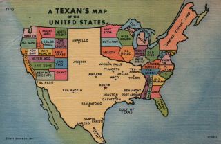
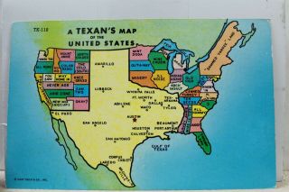
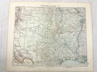
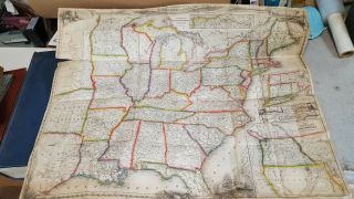
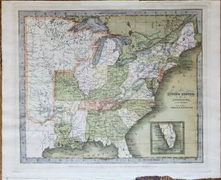
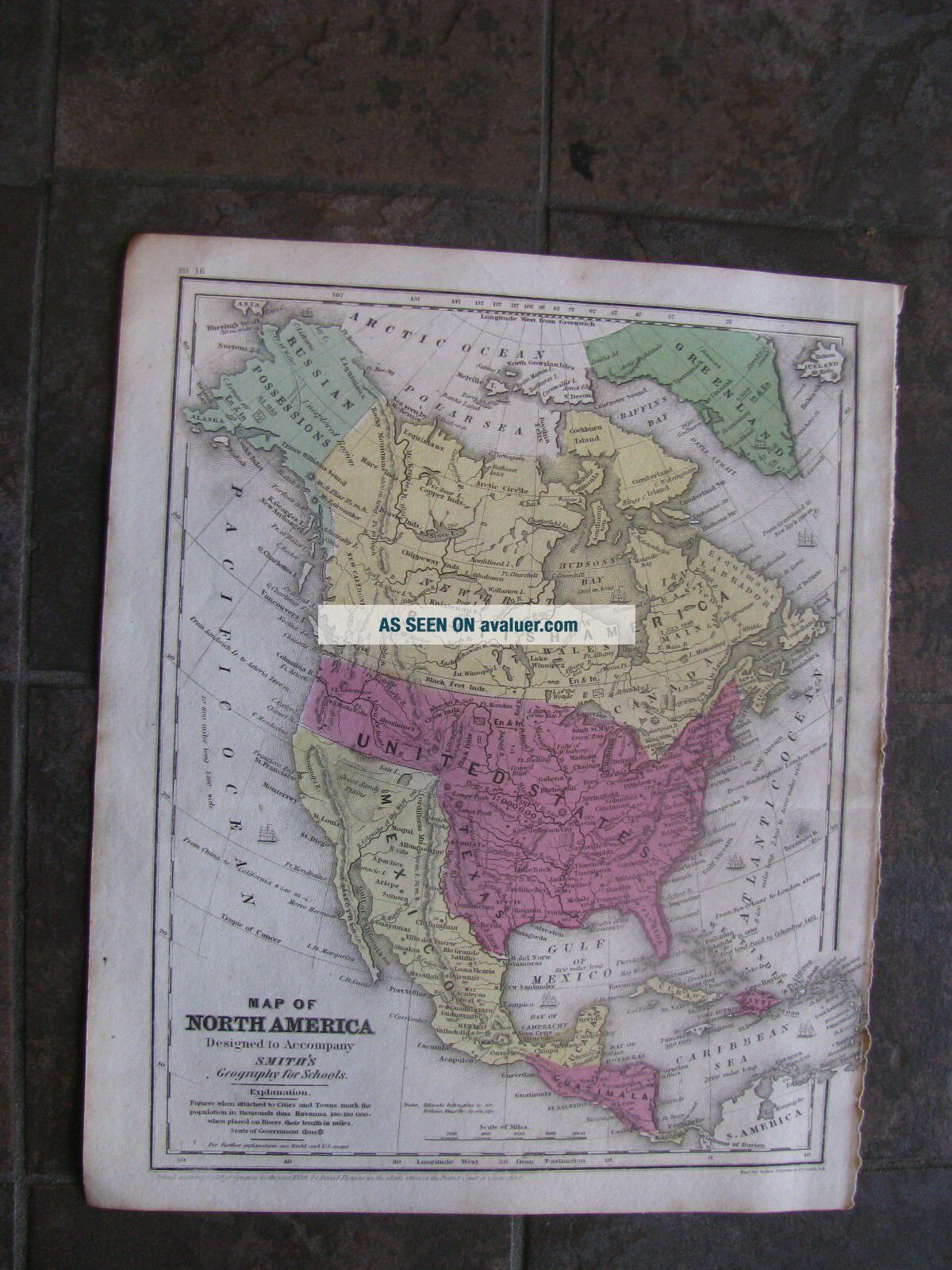
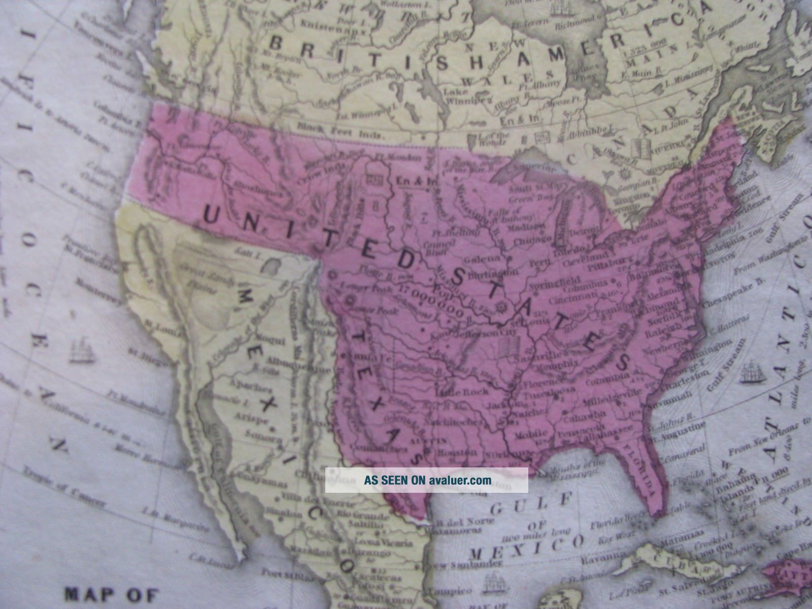
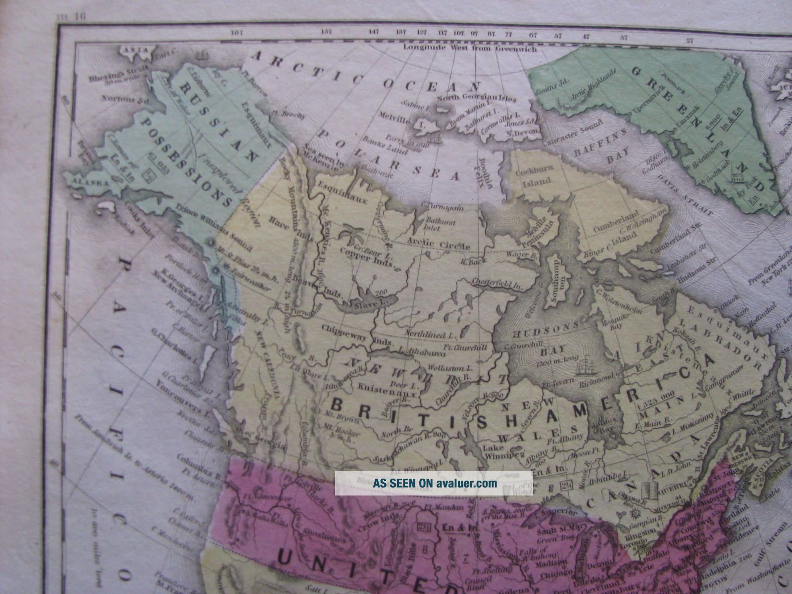
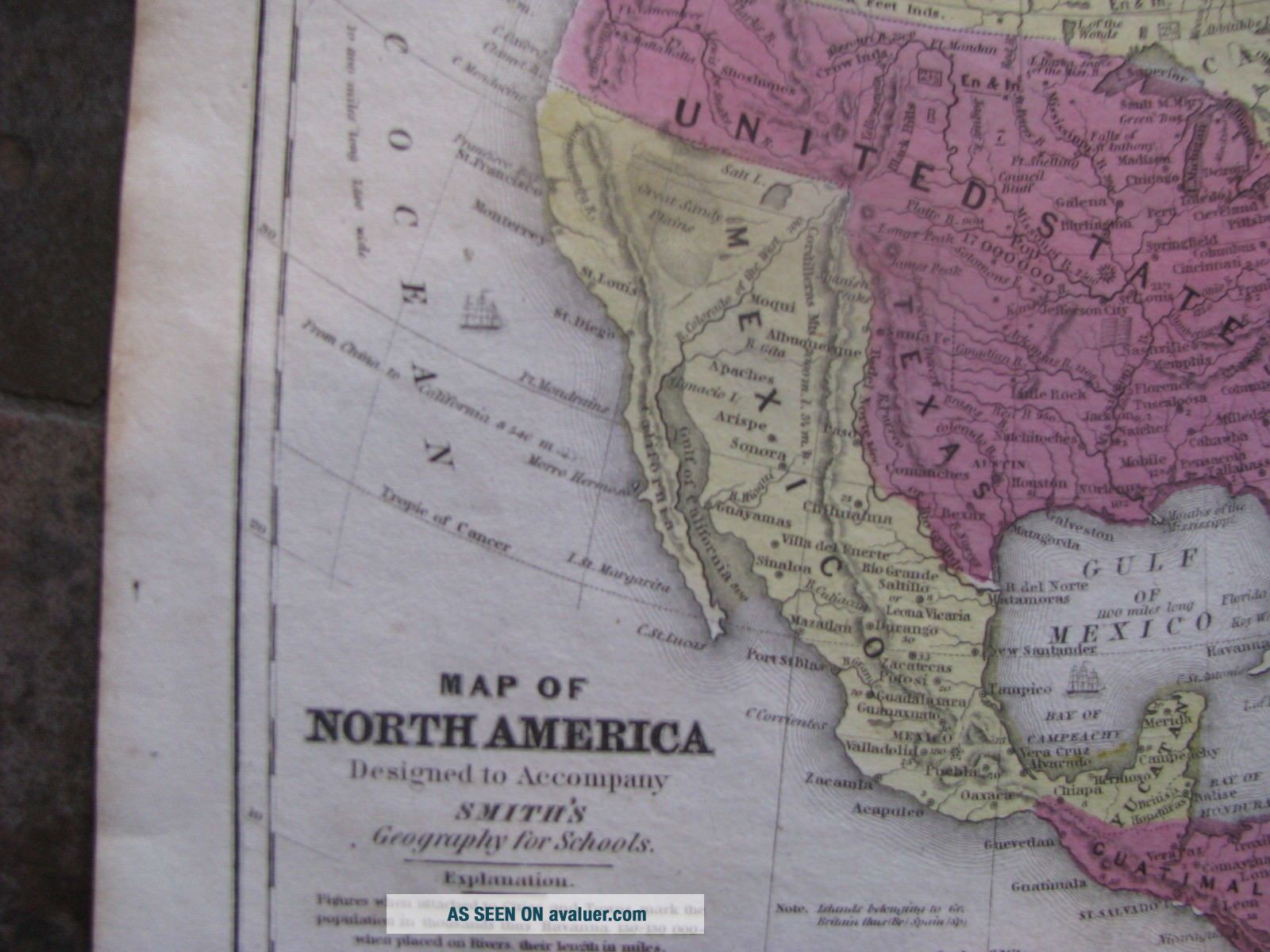
1839 Map Of The United States, Texas Republic, Canada, Mexico


Item History & Price

Information:
Reference Number: Avaluer:16113Country/Region: Canada
Year: 1839US State: Texas
Topic: United StatesRegion: Mexico
Publication Year: 1839
Original Description:
Original hand colored engraving as issued.Blank on verso, dated in the plate. Engraved by Stiles, Sherman & Smith.Entered into US Congress by David Burgess.Image area is 8.25" wide x 10.5" high.Interesting and detailed map of North America showing "Stovepipe Texas" as a republic.Alaska is "Russian America." A large area is listed as "Unexplored Region."Present day California, Arizona, New Mexico and the southwest are part of Mexico.Beautifully executed, great color will frame nicel...y.Overall good condition with mild ageing.A wonderful piece of American historyLow starting bid with no reserve.Postage charge is for domestic insured priority mail.


    Similar items


  • A Texan

    A Texan ' S Map Of The United States Vintage Linen Postcard

  • Texas Tx Texan

    Texas Tx Texan ' S Map Of The United States Postcard Old Vintage Card View Post Pc

  • 1907 Antique Map Of The United States Of America Texas Oklahoma Kansas Missouri

    1907 Antique Map Of The United States Of America Texas Oklahoma Kansas Missouri

  • 1848 Map Of The United States Including A Piece Of Texas & Also California & Or.

    1848 Map Of The United States Including A Piece Of Texas & Also California & Or.

  • Map A Pictorial Map Of The United States Elmer Jacobs

    Map A Pictorial Map Of The United States Elmer Jacobs

  • Antique Map Of The United States By: David Burr,  1835

    Antique Map Of The United States By: David Burr, 1835

  • Old School Map Of The United States And Possessions

    Old School Map Of The United States And Possessions

  • A Geological Map Of The United States_1832_john Howard Hinton_history_americana

    A Geological Map Of The United States_1832_john Howard Hinton_history_americana


    • You might also like


    • 1860 Mitchell Hand Colored Map Colorado,  Nebraska & Kansas - Civil War Era

      1860 Mitchell Hand Colored Map Colorado, Nebraska & Kansas - Civil War Era

    • 18th Century French Map Of North America

      18th Century French Map Of North America

    • Las Vegas Nevada Vintage 1967 Us Geological Survey Quadrangle Map 4 Panels

      Las Vegas Nevada Vintage 1967 Us Geological Survey Quadrangle Map 4 Panels

    • Rare Antique 1845 Maps United States Exploring Expedition Book Antartica Hawaii

      Rare Antique 1845 Maps United States Exploring Expedition Book Antartica Hawaii

    • Vintage 1926 Map Hollywood From The Best Surveys Of The Time

      Vintage 1926 Map Hollywood From The Best Surveys Of The Time

    • American Continent (western Hemisphere) 1747 Bowen Antique Copper Engraved Map

      American Continent (western Hemisphere) 1747 Bowen Antique Copper Engraved Map

    • Gulf Coast Florida Texas United States 1705 De Fer Unusual Antique Engraved Map

      Gulf Coast Florida Texas United States 1705 De Fer Unusual Antique Engraved Map

    • California As Island United States 1700 De Fer Unusual First Edition Antique Map

      California As Island United States 1700 De Fer Unusual First Edition Antique Map

Avaluer          About Us          Privacy Policy          Contact Us          UP
© 2022, avaluer.net, Inc. or its affiliates