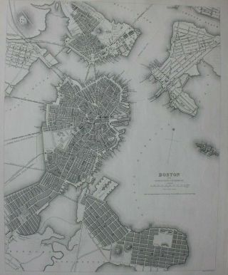
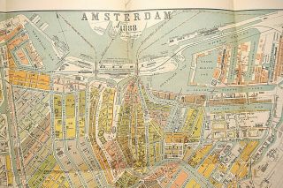
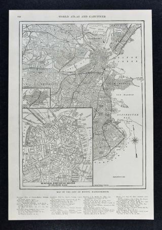
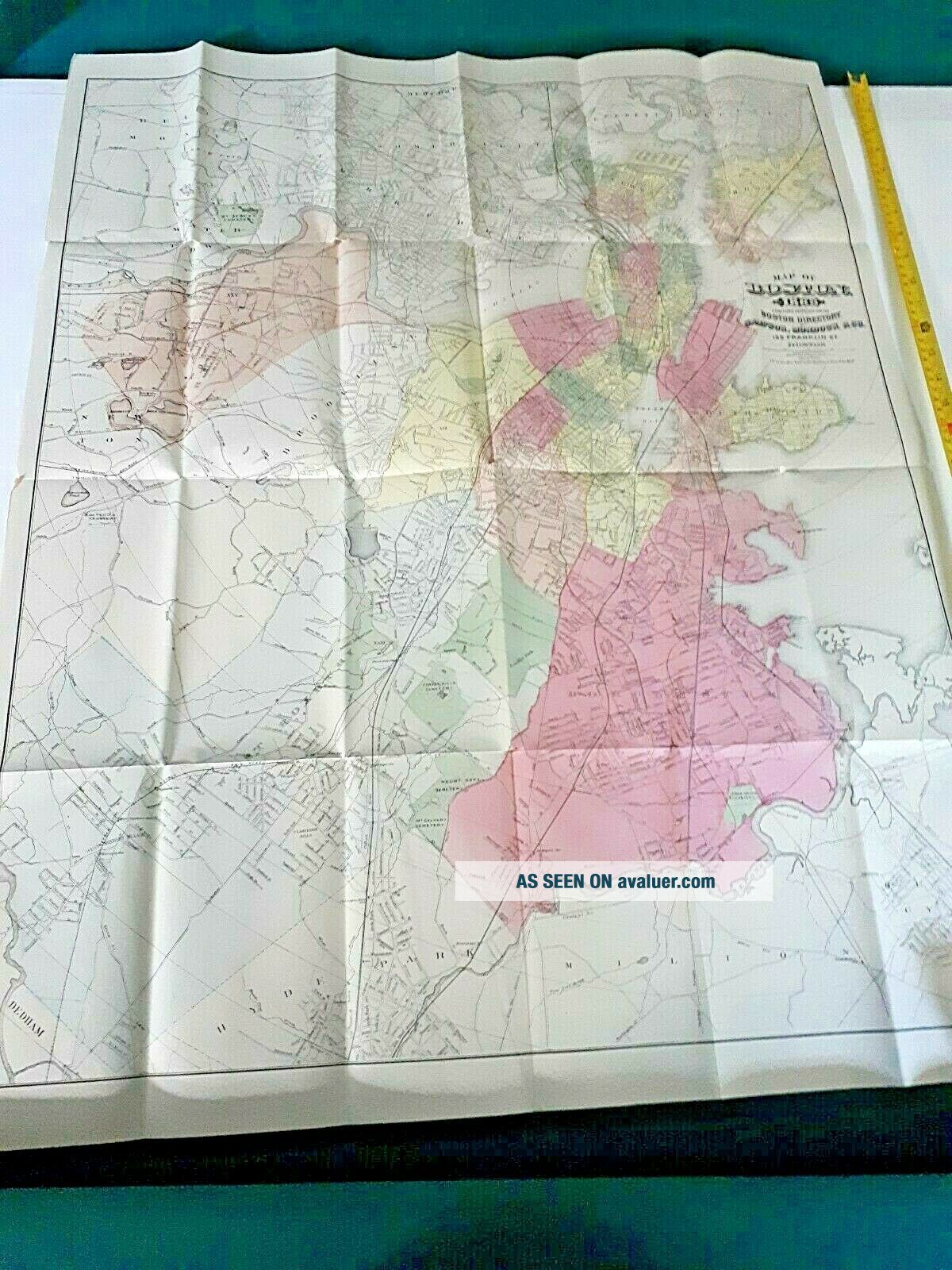
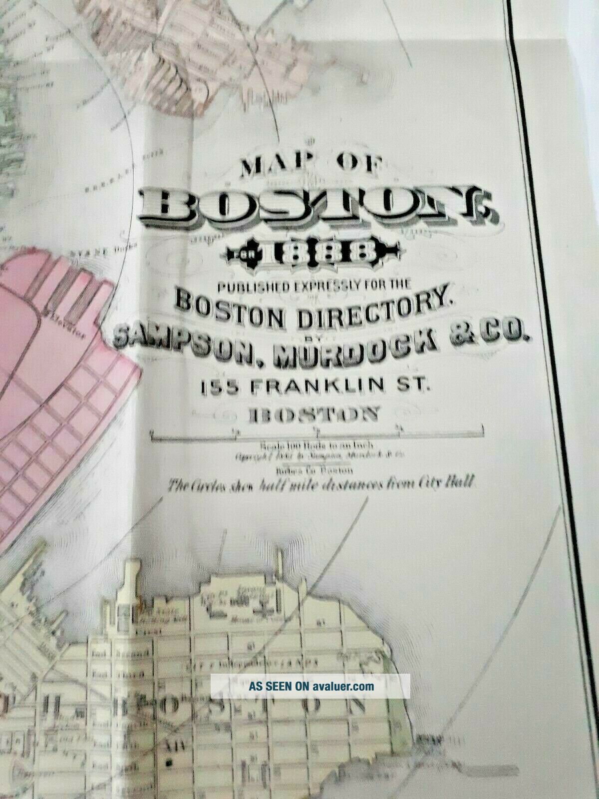
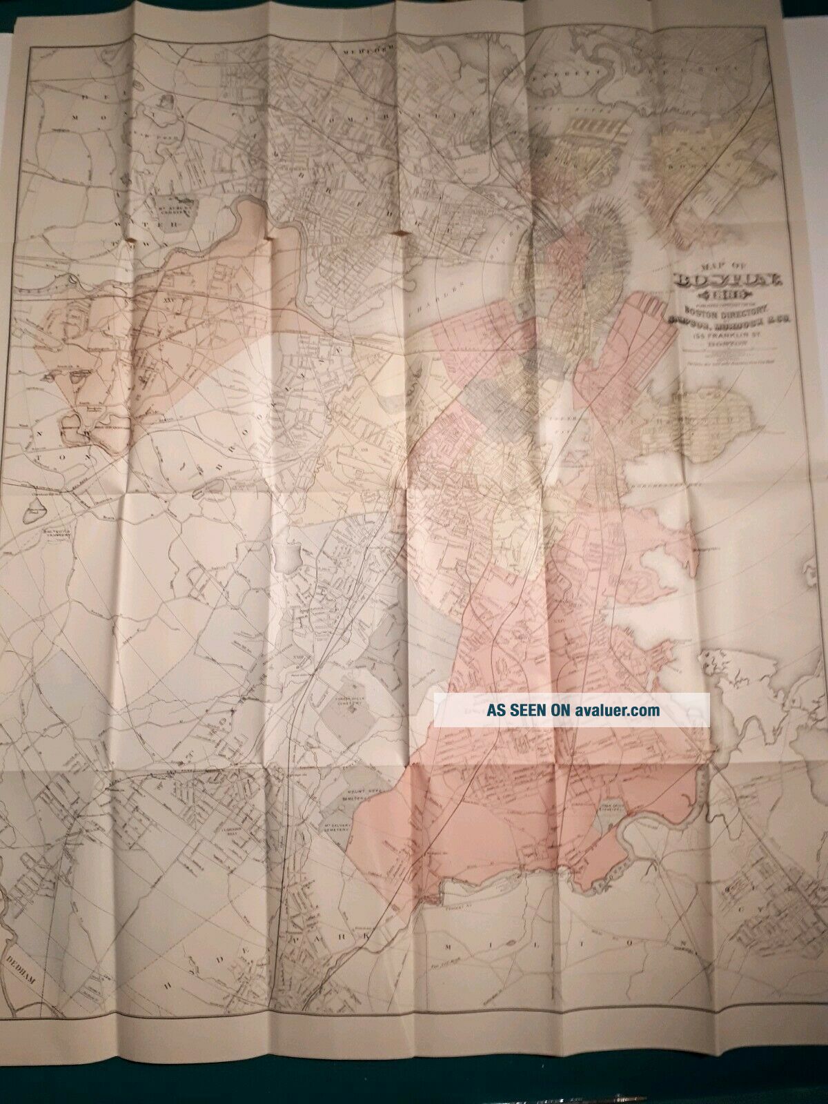
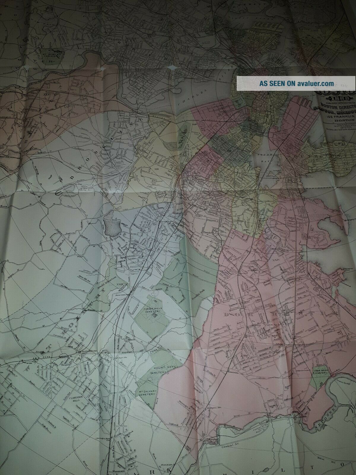
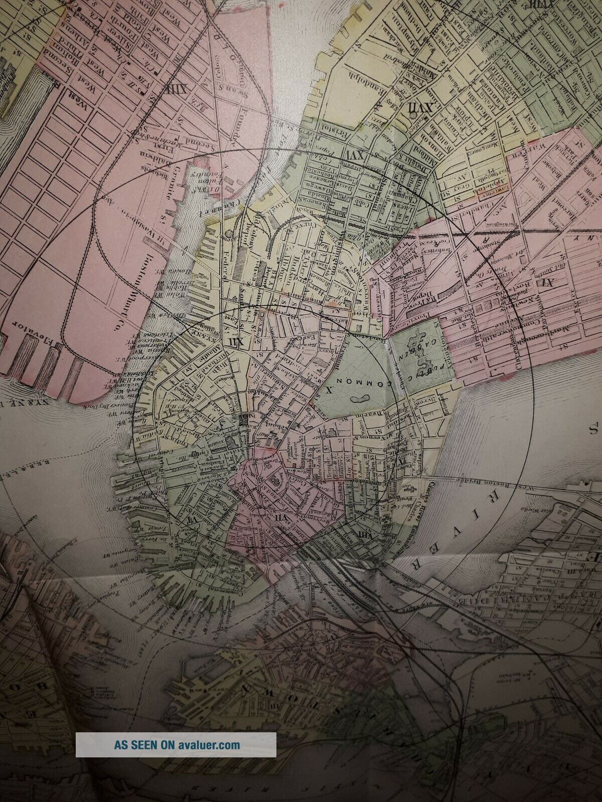
Large 1888 Boston City Plan Map Railways Colored Trains Railroads


Item History & Price

Information:
Reference Number: Avaluer:16423Type: City Map
Date Range: 1800-1899Year: 1888
City: BostonUS State: Massachusetts
Original Description:
Large 1888 Boston City Plan Map Railways Colored.approx 90 x 50 cm 


    Similar items


  • Leeds - Large Antique City Plan / Map - Bacon,  1897.

    Leeds - Large Antique City Plan / Map - Bacon, 1897.

  • 1926 Map Detroit City Plan Michigan Railway Street Plan

    1926 Map Detroit City Plan Michigan Railway Street Plan

  • Boston City Plan,  Usa,  Antique Map,  Sduk,  1844

    Boston City Plan, Usa, Antique Map, Sduk, 1844

  • 1926 Map Toronto Ontario City Plan Canada Railways Harbour

    1926 Map Toronto Ontario City Plan Canada Railways Harbour

  • Antique Rare 1888 Amsterdam City Plan Folding Map Van Der Stok,  Van Holkema

    Antique Rare 1888 Amsterdam City Plan Folding Map Van Der Stok, Van Holkema

  • Dublin - Large Antique City Plan / Map - Bacon,  1897.

    Dublin - Large Antique City Plan / Map - Bacon, 1897.

  • 1952 Large - Scale Colour City Plan Montevideo Map 74 X 109.  5cm Street Index Vg

    1952 Large - Scale Colour City Plan Montevideo Map 74 X 109. 5cm Street Index Vg

  • 1917 Map - Boston City Plan - Commons Harvard Downtown Business Massachusetts Ma

    1917 Map - Boston City Plan - Commons Harvard Downtown Business Massachusetts Ma


    • You might also like


    • 1860 Mitchell Hand Colored Map Colorado,  Nebraska & Kansas - Civil War Era

      1860 Mitchell Hand Colored Map Colorado, Nebraska & Kansas - Civil War Era

    • 18th Century French Map Of North America

      18th Century French Map Of North America

    • Las Vegas Nevada Vintage 1967 Us Geological Survey Quadrangle Map 4 Panels

      Las Vegas Nevada Vintage 1967 Us Geological Survey Quadrangle Map 4 Panels

    • Rare Antique 1845 Maps United States Exploring Expedition Book Antartica Hawaii

      Rare Antique 1845 Maps United States Exploring Expedition Book Antartica Hawaii

    • Vintage 1926 Map Hollywood From The Best Surveys Of The Time

      Vintage 1926 Map Hollywood From The Best Surveys Of The Time

    • American Continent (western Hemisphere) 1747 Bowen Antique Copper Engraved Map

      American Continent (western Hemisphere) 1747 Bowen Antique Copper Engraved Map

    • Gulf Coast Florida Texas United States 1705 De Fer Unusual Antique Engraved Map

      Gulf Coast Florida Texas United States 1705 De Fer Unusual Antique Engraved Map

    • California As Island United States 1700 De Fer Unusual First Edition Antique Map

      California As Island United States 1700 De Fer Unusual First Edition Antique Map

Avaluer          About Us          Privacy Policy          Contact Us          UP
© 2022, avaluer.net, Inc. or its affiliates