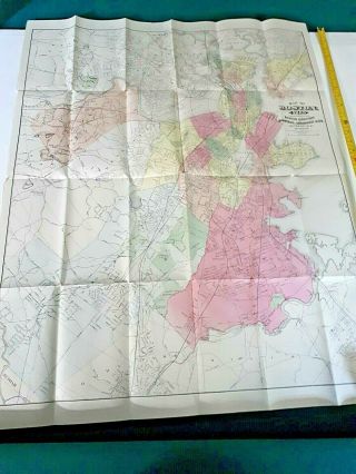
1917 Map - Boston City Plan - Commons Harvard Downtown Business Massachusetts MA

Item History & Price
| Reference Number: Avaluer:48261170 | Year: 1917 |
| Publication Year: 1917 |
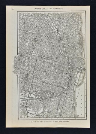
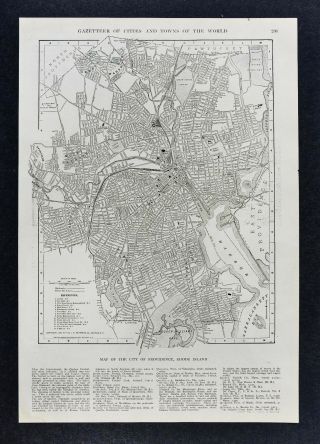
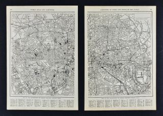
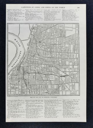
Lake Erie Maps & Prints Ebay Store!An Original Antique Map: Not a Reproduction! Free US Shipping on Purchases of 5 or More Maps and PrintsDescription: It is an authentic antique map approximately 100 years old, circa 1917 from Collier's World Atlas and Gazetteer. There is a copyright of 1905 by the G.T. Rowland in small print on the map. There is text on the reverse. A very nicely preserved map that would frame up well.
Size: The m...ap image area between the neat lines measuring approximately 9 by 12 inches on a page measuring 10 1/2 by 15"
Condition: The map is in Very Good condition with slight tonal ageing and slight darkening around the edges as typical of an antique map. Overall, it is very clean, see the pics for more on condition. The pics are of the actual map.Save on Shipping: We only charge one shipping fee based on the largest map or print with multiple items shipped along with it for no extra costs. Purchase 5 or more maps or prints and receive Free First Class shipping in USA.International Customs and VAT Fees: It is the responsibility of the buyer to pay all Customs Taxes, VAT or other fees that may be due upon arrival. These fees vary greatly from country to country and ebay policy is that the buyer is responsible for their country's taxes and fees. Please consult your country's Customs Regulations for more details on your country, printed matter is duty free in many countries. We declare the full purchase value as required by law. Delays by Customs: Although most items arrive at their destination very quickly, we have no control over how long it takes an item to move through Customs, which can be held for up to six weeks in rare cases.Satisfaction Guaranteed: We stand fully behind our products and offer a full refund minus shipping with no questions asked.Check out my other items! Be sure to add me to your favorites list!
00034