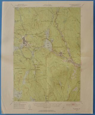
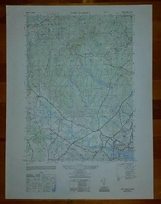
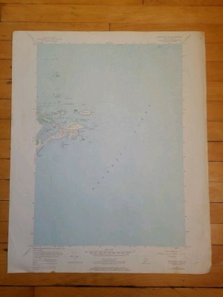
USGS Topographic Map MILLINOCKET Maine USA - 19XX - 250K - 1° X 2° - Flat -
Item History & Price
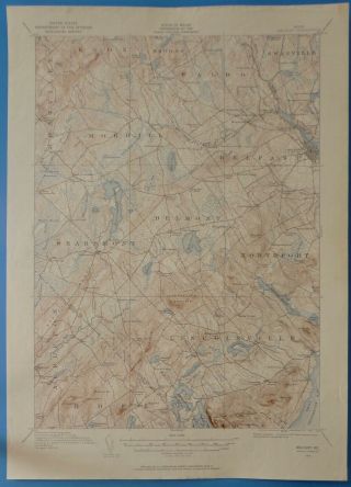
USGS Topographic Map MILLINOCKET Maine USA - 19XX - 250K - 1° X 2° - flat -
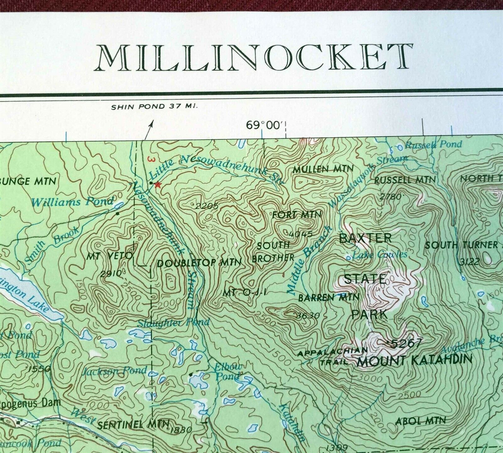
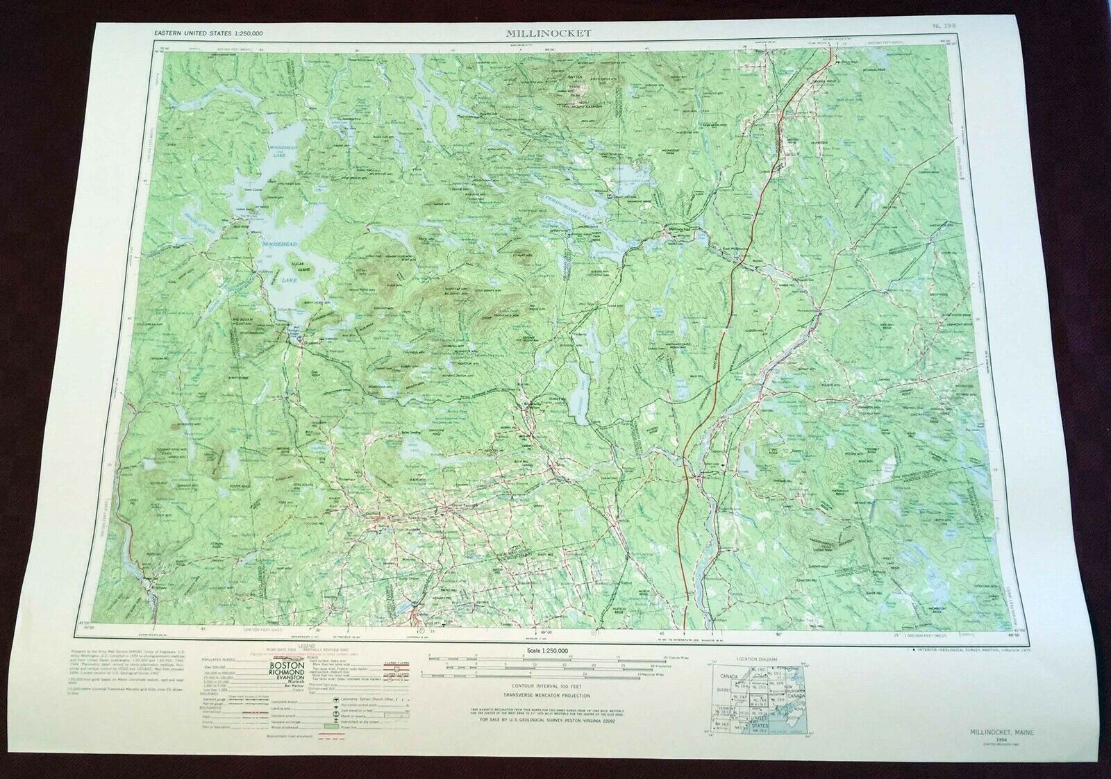
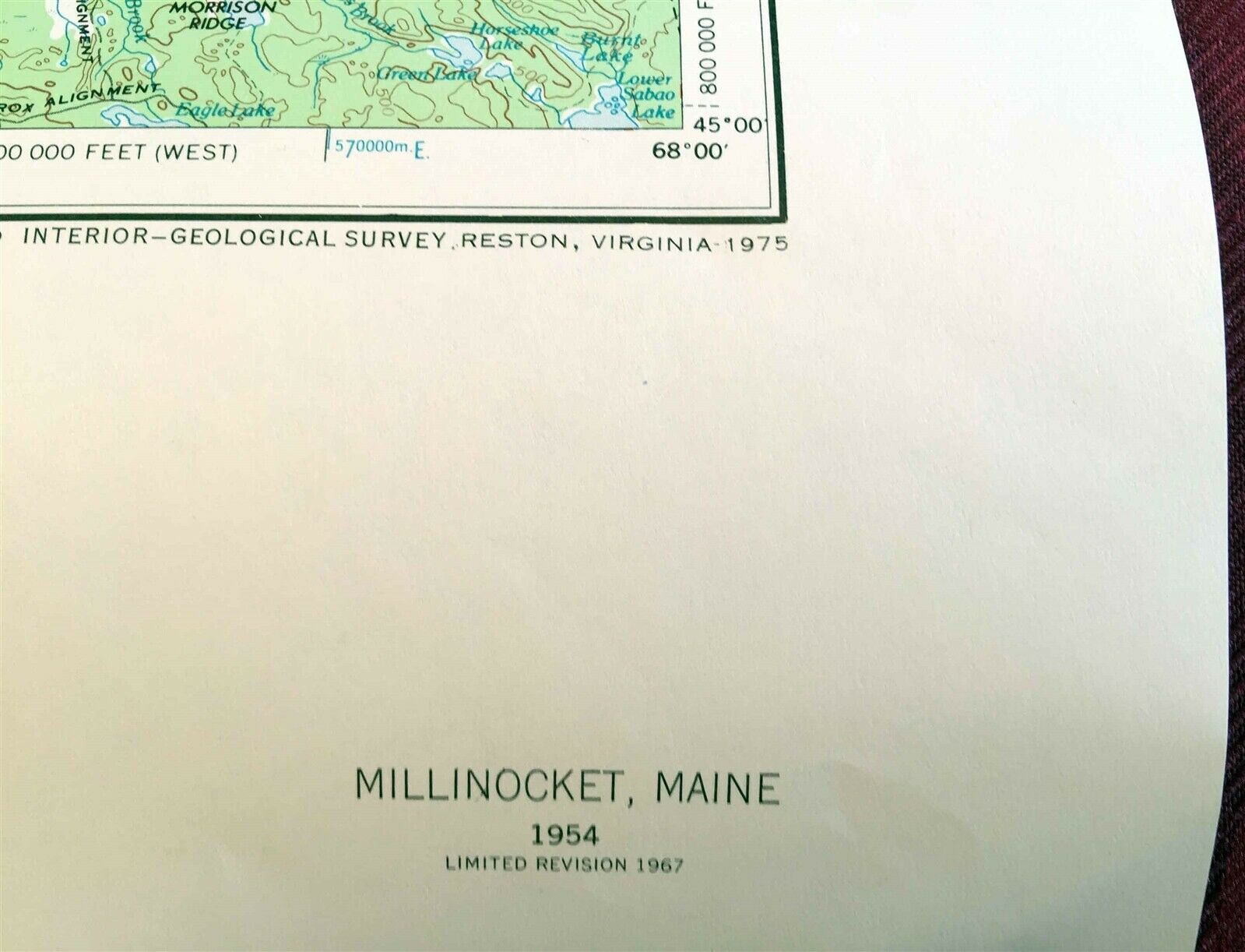
One Printed Map Sheet Map Data: 1954, Limited Revised 1967, Printing 1975 Originally prepared by the US Army Map Service (AMGN) Paper Single-Sided Has instructions chart on how to interpret the GRID ZONE DESIGNATION reference. Scale 1:250, 000 (250K) 1° x 2° DEGREE QUADRANGLE Map Publisher: United States of America Department of Interior, US Geological Survey (USGS) CONDITION: Unsold & Unused Old Map S...tore Stock: Bio-predation & Oxidation. Map will be rolled for shipping. The map sheet measures approximately 29 inches wide by 22 inches tall. STOCK Pictures are of one of the items in the original quantity stack. All the same issue or version. Please note that the map name does not represent the political boundaries of that name. 60' Arc Minutes equals 1° Degree In general, the USGS 1:250K Series serves as base maps for aeronautical charts and geologic maps, for geographic reference, and in planning regional land use, transportation, and utility systems. For the large Conterminous United States. Quadrangles are 1 degree of latitude by 2 degrees of longitude. Along the coasts dimensions are modified to fit some maps. The series consists of 489 sheets. Ground area shown varies with latitude, from 8, 218 square miles at 30 degrees north to 6, 222 square miles
All of my maps are vintage. Maps are intended for historical & collection use, not for navigation.
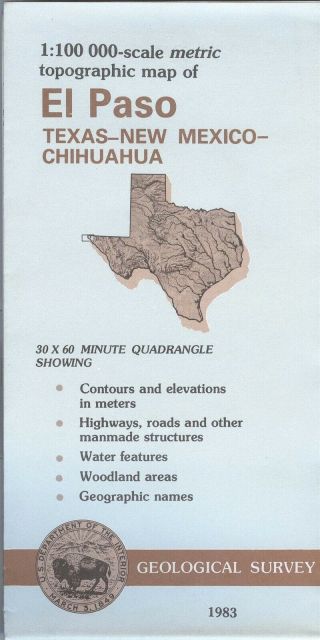
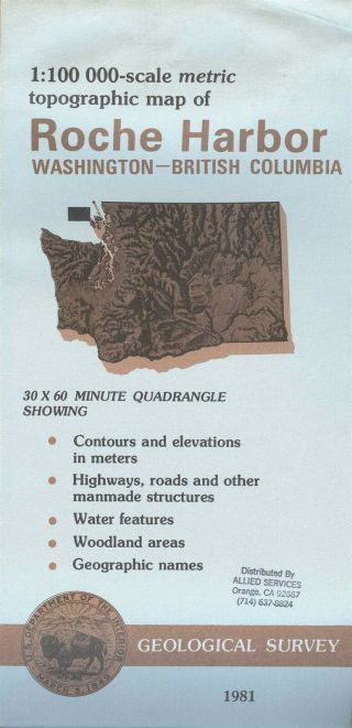
About USGS maps, a generalization and not precision: The world, Earth as we know it, is not flat & not two-dimensional. It is sort of a sphere; round & three-dimensional. Printed Topographic Maps convert this sphere & curvature to a flat, 2D piece of paper as a rectangular quadrangle. The United States Geological Survey (USGS) is a bureau of the U. S. Department of the Interior (DOI) of the United States of America federal government. On the front title panel there is a picture of the state. Usually there is a rectangle on that map that shows the area covered by the map. USGS topographic map usually is named for the most prominent feature within the bounds of the map, which frequently is a community, town, or city. The name given a map can be based on that or a big mountain or big creek or something else that is in the area covered by the map. Map names are not political boundaries or a geographical area name, in other words in may not cover the entire community, city, town or whatever it's named after. The map covers a specific amount of area. Map names usually don't change, but community or features names change constantly. A communities area may also change boundaries as well but the map name may not change. When a map covers multiple states a map's primary state is the state that contains the name feature, which is not always the same as the state that has most of the map area. One may need several maps to cover the desired area like a city or hiking trail. On the back of USGS maps their is usually a box that shows the map names of the adjoining maps. Typically that map at hand, the one being looked at, is in the center box. Vintage USGS maps: These are general-use maps at medium scales that present elevation (contour lines), hydrography, geographic place names, and a variety of cultural features. Historic maps were originally published as paper documents in the period 1884-2006/2009. All of my USGS maps are original prints from the US Government. The USGS stopped traditional methods of surveying and updating topographic maps based on aerial photography and field checks in 2008. Scales range from topographic quadrangle maps with scales between 1:10, 000 and 1:250, 000 as the most commonly used. They also make special maps that may be compiled of previous maps. There also may be a sponsoring or co-ordinating entity. LIke another federal government organization, a county, military, and so on. Usually they will provide the name of the other organization. Latitude and Longitude along with Seconds, Minutes, and Degrees are physical measurements. Inches, feet, miles, centimeters, . kilometers, et cetera are flat measurements. USGS maps help to co-ordinate between the two. Topographic maps have contour lines which give the elevation of the land.Common Scales Series in general:Scales are not the size of the piece of paper or plastic that a map is printed on. 1:24, 000 is a ratio and 1/24, 000 is a fraction. They typically are the same. 1:24, 000 & 1:25, 000 - typically 7.5 minute that is about 49 to 70 square miles. On 1:24, 000 one inch on a ruler is 2000 feet very roughly under one half mile (½) in the real world. On 1:25, 000 1 centimeter is 0.25 kilometer (¼) and 1 inch is 2083 feet. 1:31, 680 - typically 7.5 minute by 7.5 minute. One inch on a ruler is one half mile (½) in the real world. 1:50, 000 - 1 inch is about 0.8 mile. 1 cm is 500 meters or ½ kilometer. 1:62, 500 - 15 minute (four 7.5 maps would cover the same land area on the map.) One inch on a ruler is one mile on the ground. The printed 15 minute map sheet is usually smaller than a 7.5 printed map sheet. Covers 197 to 282 square miles depending upon latitude & longitude location. 1:100, 000 metric - 30 minutes by 60 minutes. One centimeter on the map represents one kilometer of distance on the ground. One inch is about 1.6 miles. Covers about 1, 568 to 2, 240 square miles depending up the longitude & latitude location. There are about 500 different maps in this series to cover the contiguous conterminous USA. 1:250, 000 - usually 1 degree by 2 degrees (1°x 2°) but can be 1°x 3° . Covers an area ranging from 8, 218 square miles at 30° north to 6, 222 square miles at 49° north There are other scales that are smaller, like 1:2, 000, 000 and a big sheet of paper. They have produced many different scales based on special projects or needs. The larger the second number the more area covered. As a fraction the 1/24, 000 is bigger piece of pie than a 1/250, 000 piece of pie. In math 1/24, 000 equals 0.00004167 and 1/250, 000 equals 0.000004. It takes more paper to cover 1 square mile at 1/24, 000 than at 1/250, 000.OC Map Store International Buyers & Shipping to non-USA addresses Please Note: Customs / Import duties, taxes, and charges are not included in the item price or shipping charges. These charges are the buyer’s responsibility. Please check with your country's customs office to determine what these additional costs will be prior to bidding/buying. In some situations some items are not allowed to be sent to your country because of the buyers import laws, buyers please check that an item is allowed to be sent to your country. These charges are normally collected by the shipping delivering freight company or when you pick the item up. Do not confuse them for additional shipping charges from me. The amount reported to Customs for merchandise value is the amount of the items plus the amount of shipping We do not mark merchandise values below value or mark items as "gift" - US and International government regulations prohibit such behavior. ID: map1303m
Powered by SixBit's eCommerce Solution
00072
One Printed Map Sheet Map Data: 1954, Limited Revised 1967, Printing 1975 Originally prepared by the US Army Map Service (AMGN) Paper Single-Sided Has instructions chart on how to interpret the GRID ZONE DESIGNATION reference. Scale 1:250, 000 (250K) 1° x 2° DEGREE QUADRANGLE Map Publisher: United States of America Department of Interior, US Geological Survey (USGS) CONDITION: Unsold & Unused Old Map S...tore Stock: Bio-predation & Oxidation. Map will be rolled for shipping. The map sheet measures approximately 29 inches wide by 22 inches tall. STOCK Pictures are of one of the items in the original quantity stack. All the same issue or version. Please note that the map name does not represent the political boundaries of that name. 60' Arc Minutes equals 1° Degree In general, the USGS 1:250K Series serves as base maps for aeronautical charts and geologic maps, for geographic reference, and in planning regional land use, transportation, and utility systems. For the large Conterminous United States. Quadrangles are 1 degree of latitude by 2 degrees of longitude. Along the coasts dimensions are modified to fit some maps. The series consists of 489 sheets. Ground area shown varies with latitude, from 8, 218 square miles at 30 degrees north to 6, 222 square miles
All of my maps are vintage. Maps are intended for historical & collection use, not for navigation.
About USGS maps, a generalization and not precision: The world, Earth as we know it, is not flat & not two-dimensional. It is sort of a sphere; round & three-dimensional. Printed Topographic Maps convert this sphere & curvature to a flat, 2D piece of paper as a rectangular quadrangle. The United States Geological Survey (USGS) is a bureau of the U. S. Department of the Interior (DOI) of the United States of America federal government. On the front title panel there is a picture of the state. Usually there is a rectangle on that map that shows the area covered by the map. USGS topographic map usually is named for the most prominent feature within the bounds of the map, which frequently is a community, town, or city. The name given a map can be based on that or a big mountain or big creek or something else that is in the area covered by the map. Map names are not political boundaries or a geographical area name, in other words in may not cover the entire community, city, town or whatever it's named after. The map covers a specific amount of area. Map names usually don't change, but community or features names change constantly. A communities area may also change boundaries as well but the map name may not change. When a map covers multiple states a map's primary state is the state that contains the name feature, which is not always the same as the state that has most of the map area. One may need several maps to cover the desired area like a city or hiking trail. On the back of USGS maps their is usually a box that shows the map names of the adjoining maps. Typically that map at hand, the one being looked at, is in the center box. Vintage USGS maps: These are general-use maps at medium scales that present elevation (contour lines), hydrography, geographic place names, and a variety of cultural features. Historic maps were originally published as paper documents in the period 1884-2006/2009. All of my USGS maps are original prints from the US Government. The USGS stopped traditional methods of surveying and updating topographic maps based on aerial photography and field checks in 2008. Scales range from topographic quadrangle maps with scales between 1:10, 000 and 1:250, 000 as the most commonly used. They also make special maps that may be compiled of previous maps. There also may be a sponsoring or co-ordinating entity. LIke another federal government organization, a county, military, and so on. Usually they will provide the name of the other organization. Latitude and Longitude along with Seconds, Minutes, and Degrees are physical measurements. Inches, feet, miles, centimeters, . kilometers, et cetera are flat measurements. USGS maps help to co-ordinate between the two. Topographic maps have contour lines which give the elevation of the land.Common Scales Series in general:Scales are not the size of the piece of paper or plastic that a map is printed on. 1:24, 000 is a ratio and 1/24, 000 is a fraction. They typically are the same. 1:24, 000 & 1:25, 000 - typically 7.5 minute that is about 49 to 70 square miles. On 1:24, 000 one inch on a ruler is 2000 feet very roughly under one half mile (½) in the real world. On 1:25, 000 1 centimeter is 0.25 kilometer (¼) and 1 inch is 2083 feet. 1:31, 680 - typically 7.5 minute by 7.5 minute. One inch on a ruler is one half mile (½) in the real world. 1:50, 000 - 1 inch is about 0.8 mile. 1 cm is 500 meters or ½ kilometer. 1:62, 500 - 15 minute (four 7.5 maps would cover the same land area on the map.) One inch on a ruler is one mile on the ground. The printed 15 minute map sheet is usually smaller than a 7.5 printed map sheet. Covers 197 to 282 square miles depending upon latitude & longitude location. 1:100, 000 metric - 30 minutes by 60 minutes. One centimeter on the map represents one kilometer of distance on the ground. One inch is about 1.6 miles. Covers about 1, 568 to 2, 240 square miles depending up the longitude & latitude location. There are about 500 different maps in this series to cover the contiguous conterminous USA. 1:250, 000 - usually 1 degree by 2 degrees (1°x 2°) but can be 1°x 3° . Covers an area ranging from 8, 218 square miles at 30° north to 6, 222 square miles at 49° north There are other scales that are smaller, like 1:2, 000, 000 and a big sheet of paper. They have produced many different scales based on special projects or needs. The larger the second number the more area covered. As a fraction the 1/24, 000 is bigger piece of pie than a 1/250, 000 piece of pie. In math 1/24, 000 equals 0.00004167 and 1/250, 000 equals 0.000004. It takes more paper to cover 1 square mile at 1/24, 000 than at 1/250, 000.OC Map Store International Buyers & Shipping to non-USA addresses Please Note: Customs / Import duties, taxes, and charges are not included in the item price or shipping charges. These charges are the buyer’s responsibility. Please check with your country's customs office to determine what these additional costs will be prior to bidding/buying. In some situations some items are not allowed to be sent to your country because of the buyers import laws, buyers please check that an item is allowed to be sent to your country. These charges are normally collected by the shipping delivering freight company or when you pick the item up. Do not confuse them for additional shipping charges from me. The amount reported to Customs for merchandise value is the amount of the items plus the amount of shipping We do not mark merchandise values below value or mark items as "gift" - US and International government regulations prohibit such behavior. ID: map1303m
Powered by SixBit's eCommerce Solution
00072