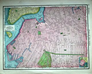
1911 Brooklyn, NY Antique, Atlas Map S. York City Back. 108 Years - Old


Item History & Price
1911 Brooklyn, NY Antique, Used Atlas map* S. New York City back ..108 years-old

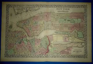
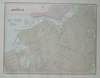
Vintage Circa 1874 York City - Brooklyn Old Antique Atlas Map
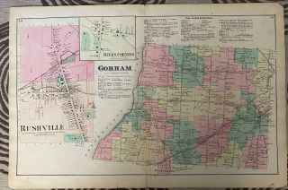
1874 Gorham, Rushville, Reeds Corners York Ny Antique Atlas Map - 23 X 15. 5”
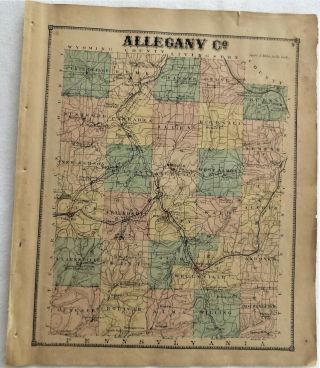
1869 Allegany County Ny Antique Atlas Map
1874 Sodus Point Alton Wayne County Ny Antique Atlas Map

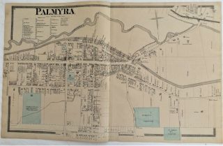
1874 Village Of Palmyra Wayne County Ny Antique Atlas Map
1901 Brooklyn, Ny Antique Dated Atlas Map S. York City Back. 118 Years - Old
1891 Brooklyn, Ny Antique Color Atlas Map 128 Years - Old
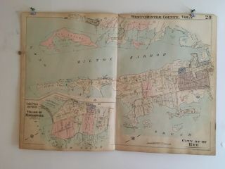
City Of Rye, Village Of Mamaroneck, Westchester County, Ny 1929 Atlas Map

1860 Mitchell Hand Colored Map Colorado, Nebraska & Kansas - Civil War Era

18th Century French Map Of North America

Las Vegas Nevada Vintage 1967 Us Geological Survey Quadrangle Map 4 Panels

Rare Antique 1845 Maps United States Exploring Expedition Book Antartica Hawaii

Vintage 1926 Map Hollywood From The Best Surveys Of The Time

American Continent (western Hemisphere) 1747 Bowen Antique Copper Engraved Map

Gulf Coast Florida Texas United States 1705 De Fer Unusual Antique Engraved Map

California As Island United States 1700 De Fer Unusual First Edition Antique Map