1650 RADZIWILL ANTIQUE MAP LITHUANIA, LIETUVA, POLAND, BELARUS, VILNIUS, WILNA, MINSK


Item History & Price

Information:
Reference Number: Avaluer:23764640Year: 1650
Country/Region: Belarus, Poland
Original Description:
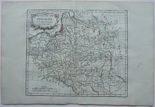
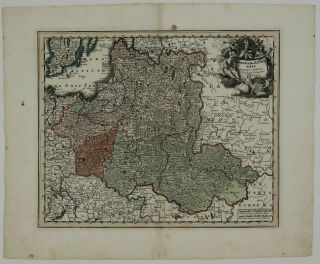
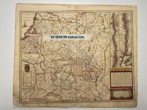
Title : Magni Ducatus Lithuaniae Caetrarumq Regionum illi Adiacentium exacta decrip. . ..
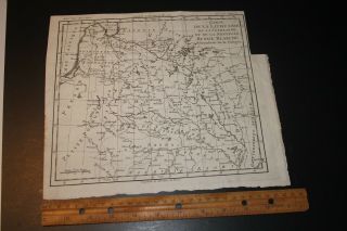
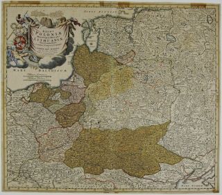
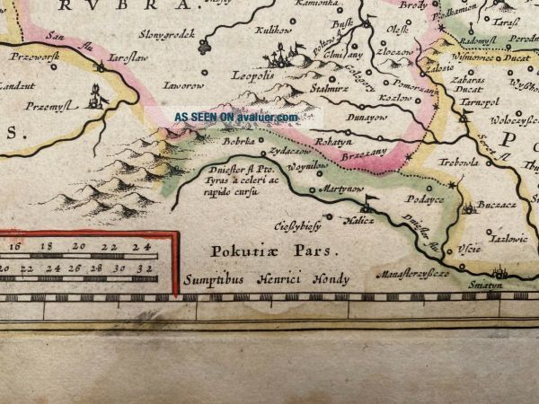
Detailed map of Lithuania, Poland and part of Russia up to the River Dnepr, based upon Blaeu's four sheet map.
Highly detailed, extending from Cracow to the Baltic in the west and Kiev and Smolenzlo in the east. From Riga to Smolensk in the north, and from Cracow to Kiev in the south. The map provides a great amount of information and includes several historical notations and two vignettes i...llustrating important battles in the vicinity of Braclaw (Bratslav), and near Smolensk.A scare and highly sought after map.
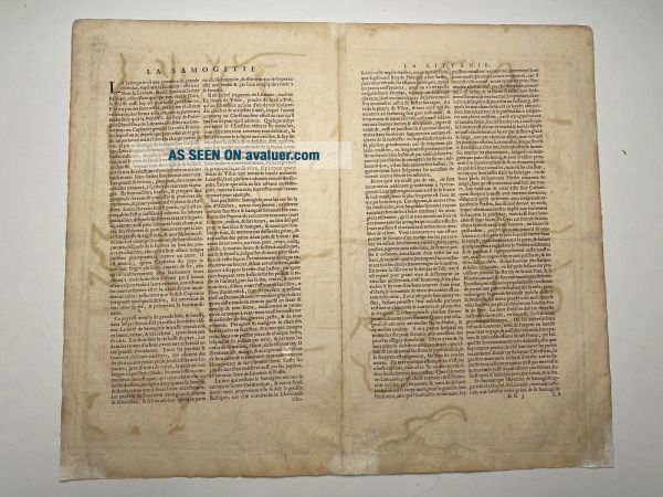
Condition : A good impression. Paper slightly browned and age-toned as usual. Repair of split lower part center fold. Into engraved area. French text on verso.
 Size 44.1 x 54.7 cm.


    Similar items


  • Antique Map Lithuania Poland 1790 Russia Baltic

    Antique Map Lithuania Poland 1790 Russia Baltic

  • Poland 1739 Antique Map Lithuania Latvia Russia Belarus Baltics Homann

    Poland 1739 Antique Map Lithuania Latvia Russia Belarus Baltics Homann

  • Blaeu 1650 Atlas Antique Map Nottinghamshire Coats Of Arms

    Blaeu 1650 Atlas Antique Map Nottinghamshire Coats Of Arms

  • Poland Ca.  1550 Antique Map Lithuania Russia Belarus Ukraine Munster

    Poland Ca. 1550 Antique Map Lithuania Russia Belarus Ukraine Munster

  • Poland 1786 Antique Map Lithuania Russia Belarus Latvia Vaugondy

    Poland 1786 Antique Map Lithuania Russia Belarus Latvia Vaugondy

  • C.  1695 Robert Morden,  (1650 - 1703) Antique Map Of " Herefordshire " Hand Coloured

    C. 1695 Robert Morden, (1650 - 1703) Antique Map Of " Herefordshire " Hand Coloured

  • Poland 1718 Antique Map Lithuania Latvia Russia Belarus Baltics Weigel

    Poland 1718 Antique Map Lithuania Latvia Russia Belarus Baltics Weigel

  • Poland 1756 Antique Map Lithuania Latvia Russia Belarus Le Rouge

    Poland 1756 Antique Map Lithuania Latvia Russia Belarus Le Rouge


    • You might also like


    • Hungary & Romania 1579 (1584) Ortelius Unusual Antique Copper Engraved Map

      Hungary & Romania 1579 (1584) Ortelius Unusual Antique Copper Engraved Map

    • Brussels Bruxelles Belfium 1777 De Ferraris & Dupuis Large Antique Map Sheet Xxi

      Brussels Bruxelles Belfium 1777 De Ferraris & Dupuis Large Antique Map Sheet Xxi

    • 1616 Atlas Map Of Iceland.

      1616 Atlas Map Of Iceland.

    • Kazan Russia 1767 Le Clerc/lespinasse Antique Copper Engraved City View

      Kazan Russia 1767 Le Clerc/lespinasse Antique Copper Engraved City View

    • 1899 Stanford,  Folding Map Of Norwich,  Norfolk,  Arthur Collins,  Jarrold & Sons,

      1899 Stanford, Folding Map Of Norwich, Norfolk, Arthur Collins, Jarrold & Sons,

    • 1948 Vintage Linen Colour Map Geological Survey Ten Mile Of Great Britain

      1948 Vintage Linen Colour Map Geological Survey Ten Mile Of Great Britain

    • 1944 Map Flying Bombs Sussex Ww2 Newspaper Military Kent Courier German V1 V2

      1944 Map Flying Bombs Sussex Ww2 Newspaper Military Kent Courier German V1 V2

    • Dated 1638 Vellum Map Of Icklesham Sussex Showing Land Uses Owners Etc

      Dated 1638 Vellum Map Of Icklesham Sussex Showing Land Uses Owners Etc

Avaluer          About Us          Privacy Policy          Contact Us          UP
© 2022, avaluer.net, Inc. or its affiliates