1805 Large Antique Map - CORNWALL SCILLY John Cary Hand Coloured (LM8)
Item History & Price
| Reference Number: Avaluer:28275 |
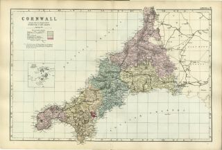
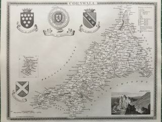
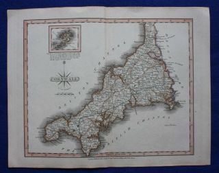
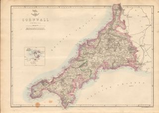
1805 Original Large Antique Map - CORNWALL SCILLY John Cary hand coloured (LM8)
1805 Original Large Antique Map - CORNWALL SCILLY John Cary hand coloured (LM8) ... Click images to enlarge Description 1805
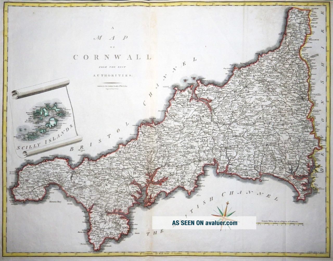
A fine original antique copperplate map titled
" A MAP OF CORNWALL from the Best Authorities "
by John Cary & published by John Stockdale, Piccadilly 1805
A fine map by John Cary of Cornwall with in vignette inset of SCILLY ISLANDS along with Compass Rose & with outline hand colouring.
Overall in excellent condition and measuring approx 55cm x 45cm with outline hand colouring and good to large margins, perfect for mounting and framing.
WE ONLY SELL ORIGINAL ANTIQUE MAPS AS DATED. WE NEVER SELL MODERN REPRODUCTIONS Payment We prefer payment via PAYPAL. In some circumstances, we are able to accept a Cheque from UK Buyers, drawn on a UK Bank. Buyers will need to wait for 7 working days for the cheque to clear before any items are sent out. We can also accept Cash Payment in UK Pounds Stirling, Euros or US Dollars, but payment by cash methods are sent at the risk of the buyer. If you want to pay in any way apart from PAYPAL, please contact us PRIOR to making any bid or outright purchase. Shipping We always try to ship items within 3 working days of any order. We are very happy to combine many items for a single postal charge. All our items are sent in either Board Backed envelopes or Art Tubes and are in the case of sending to tropical areas of the world, additionally provded with sealed plastic envelopes.
We ship to almost anywhere in the world but there are just a few territories we are unable to ship to.
About Us Antique Paper Company are established dealers in Antique Maps, Prints, Stamps, Postal History, Antiquarian Books and in fact all forms of Antique Paper also including Post Cards, Old Posters, Archives, Manuscripts, Ephemera etc.
We are keen buyers and are prepared to travel throughout the UK, Europe and most of the world in search of opportunites to buy. Cash funds of up to £250, 000 are available immediately for the right opportunities. We work closely with Libraries & Solicitors/probate situations where they are looking for disposal options and seek better single items to large quantities and also Specialised Collections of almost any genre.
Please do not hesitate to contact us with details of any items you might have for sale. Contact Us Tel: (+44) (0)1233 720703
Email: [email protected]
Get images that
make Supersized seem small.Tailor your auctions with Auctiva's
Listing Templates!
The complete eBay Selling Solution.
Track Page Views With
Auctiva's FREE Counter
1805 Original Large Antique Map - CORNWALL SCILLY John Cary hand coloured (LM8) ... Click images to enlarge Description 1805
A fine original antique copperplate map titled
" A MAP OF CORNWALL from the Best Authorities "
by John Cary & published by John Stockdale, Piccadilly 1805
A fine map by John Cary of Cornwall with in vignette inset of SCILLY ISLANDS along with Compass Rose & with outline hand colouring.
Overall in excellent condition and measuring approx 55cm x 45cm with outline hand colouring and good to large margins, perfect for mounting and framing.
WE ONLY SELL ORIGINAL ANTIQUE MAPS AS DATED. WE NEVER SELL MODERN REPRODUCTIONS Payment We prefer payment via PAYPAL. In some circumstances, we are able to accept a Cheque from UK Buyers, drawn on a UK Bank. Buyers will need to wait for 7 working days for the cheque to clear before any items are sent out. We can also accept Cash Payment in UK Pounds Stirling, Euros or US Dollars, but payment by cash methods are sent at the risk of the buyer. If you want to pay in any way apart from PAYPAL, please contact us PRIOR to making any bid or outright purchase. Shipping We always try to ship items within 3 working days of any order. We are very happy to combine many items for a single postal charge. All our items are sent in either Board Backed envelopes or Art Tubes and are in the case of sending to tropical areas of the world, additionally provded with sealed plastic envelopes.
We ship to almost anywhere in the world but there are just a few territories we are unable to ship to.
About Us Antique Paper Company are established dealers in Antique Maps, Prints, Stamps, Postal History, Antiquarian Books and in fact all forms of Antique Paper also including Post Cards, Old Posters, Archives, Manuscripts, Ephemera etc.
We are keen buyers and are prepared to travel throughout the UK, Europe and most of the world in search of opportunites to buy. Cash funds of up to £250, 000 are available immediately for the right opportunities. We work closely with Libraries & Solicitors/probate situations where they are looking for disposal options and seek better single items to large quantities and also Specialised Collections of almost any genre.
Please do not hesitate to contact us with details of any items you might have for sale. Contact Us Tel: (+44) (0)1233 720703
Email: [email protected]
Get images that
make Supersized seem small.Tailor your auctions with Auctiva's
Listing Templates!
The complete eBay Selling Solution.
Track Page Views With
Auctiva's FREE Counter