Antique Maps, A Mapp Of St Andrews Holborn Parish As Well Within The Liberty

Item History & Price
| Reference Number: Avaluer:29785 | Map Type: Sea Chart |
| Original/Repro: Original | Format: Sheet Map |
| Age: Pre-1800 | Colouring: Black & White |
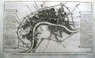
Title: A mapp of St Andrews Holborn Parish as well within the Liberty as without taken from the last survey, with corrections and enlargements Description: This engraving shows a detailed plan of the parish of St. Andrew's, Holborn, stretching from Boswell and Procter streets in the west to the River Fleet (The Towne ditch!) in the east and Great Ormond St. in the north to Lincoln's Inns Field in the south. John Stow's "Survey" appeared first in 1598 and remained the major reference so...urce on the city's history for decades. However, it was not until around 1700 that steps were taken to produce an up-dated edition with maps illustrating the areas described. Richard Blome (1641-1705) was charged with preparing a series of ward plans, copied from the detail of the recently published large-scale map of London by John Ogilby and William Morgan, frequently at a larger scale, thus with more clarity, and with major buildings shown pictorially in profile as "uprights". The plans were finally published in John Strype's "Survey Of The Cities Of London And Westminster ... ", being the first ward maps to be published. Blank verso.Publication: A Survey of the Cities of
London and Westminster: containing the original, antiquity, increase, modern estate and government of those Cities.
Written at first in the Year MDXCVIII.
By John Stow, citizen and native of London.
Since Reprinted and Augmented by the author now lastly corrected, improved, and very much enlarged: And the survey and
history brought down from the Year 1633, (being near Fourscore Years
since it was last printed) to the present time;
By John Strype, M.A. a native also of the said City.Condition: Good. Mildly age toned. The sheet has been washed and pressed by a professional conservator. The attached photo is part of the item description, please examine carefully.Color: Uncoloured.Size (h x w): approx. 28.9 x 35.8 cm, (neat line)Technique: Copperplate Engraver: Blome. R, Date: 1720Ref:JJB2831