6 Various ORDNANCE SURVEY REPRINTS OF THE 1 " FIRST EDITION - DAVID & CHARLES


Item History & Price
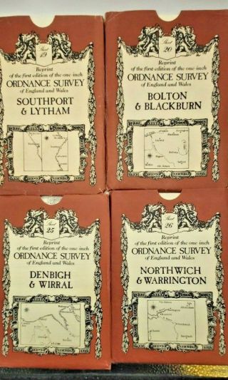
6 Ordnance Survey reprintsof the 1 inch first edition, produced by David & Charles, Newton Abbot, within paper wallets.
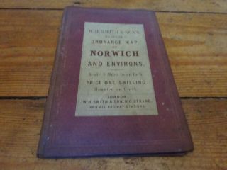
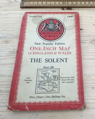
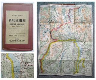
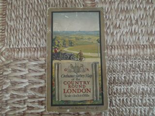
The maps are 21 – Huddersfield & Manchester, 34 – Stafford, 35 – Nottingham, 42 – Lichfield & Birmingham, 46 – Norwich & 57 –Carmarthen.
The maps are in good condition and the wallets have a little marking& creasing. 500 Purchasing Information Overseas Buyers - Please note that all pricesare in UK Pounds Sterling, unl...ess shown as converted tolocal currencyI try to accurately describe each item, and photographs/scans form partof the description. Please contact me, preferably at least 24 hours before theend of the listing if you require any further information, before purchasing.
All Items are pre-owned Originals, unless otherwise stated, and may also haveminor imperfections not mentioned, commensurate with their age/use.
Postage and packing is shown separately for the U.K., Europe &Worldwide, but if not, please contact me for an estimate of the likely cost toyour address. Inclusive Postage Offers apply within the UK only, as shown on thelisting. Postage prices shown separately also include the e bay & Paypalpostage fees. All Payments must be through Paypal (NO e Cheques, please) If buying multiple items, where a postage price appliesto your location, please use the basket system, click RequestTotal from Seller and await combined invoice, before checking out & makingpaymentAll items are normally sent assoon as possible, and within 4 working days, following receipt of clearedfunds, packed suitably to withstand the normal rigours of the postal system.Items up to 2kg are sent through the Post Office, unless otherwisestated and a Certificate of Posting is always obtained, which offerscompensation up to £20, within the U.K., in the unlikely event of an item goingastray. Insured & tracked p & p will be quoted at cost. Items, individually or together, weighing over 2kg are sent through a Courier, unlessotherwise stated, automatically tracked and insured. Please contact me first if an item is not received within the stipulatedtime, so that the matter can be addressed and taken up with the Carrier.Overseas buyers are responsible for any Customs matters and importchargesThank you for reading this