Antique County Map - Dorset / Dorseshire - Robert Morden - Framed & Glazed


Item History & Price
Antique County Map - Dorset / Dorseshire - Robert Morden - Framed & glazed
Please note that I am not a Map expert but I have listed what I believe to have discovered about this map below.
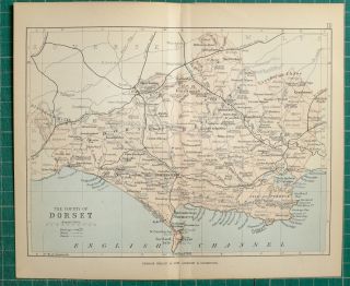
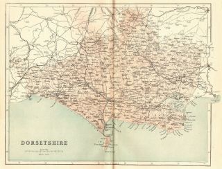
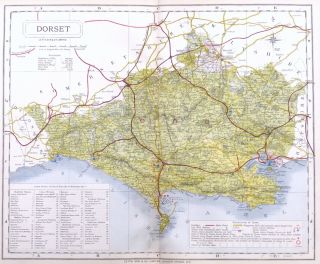
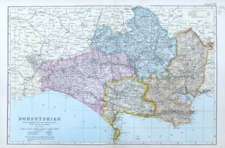
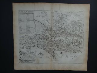
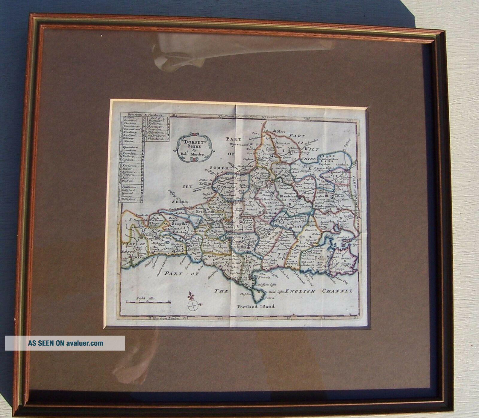
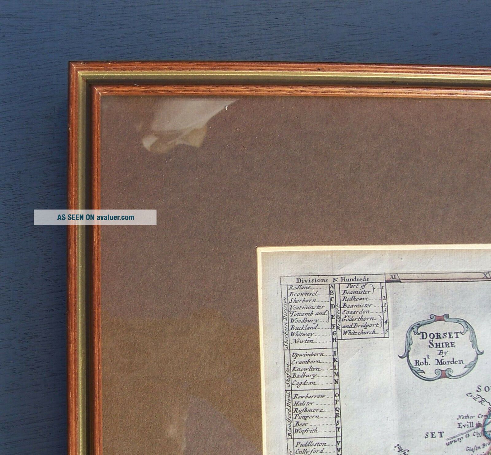
A coloured map of Dorset, from a series of maps referred to as 'miniature Mordens', first published in 1701 there were following publications withalterations being carried ...out by Herman Moll, the most significant of which was the addition of compass-indicators which this has. I believe this version of the map featured in 'Magna Britannia et Hibernia', an atlas published in monthly issues between 1720 and 1731.
Framed, glazed and mounted.
I have included a number of photos and these probably describe the item better than I can and form part of the description. Everyone has different considerations when purchasing items and if you need any further information, please feel free to contact me and I will try to help.
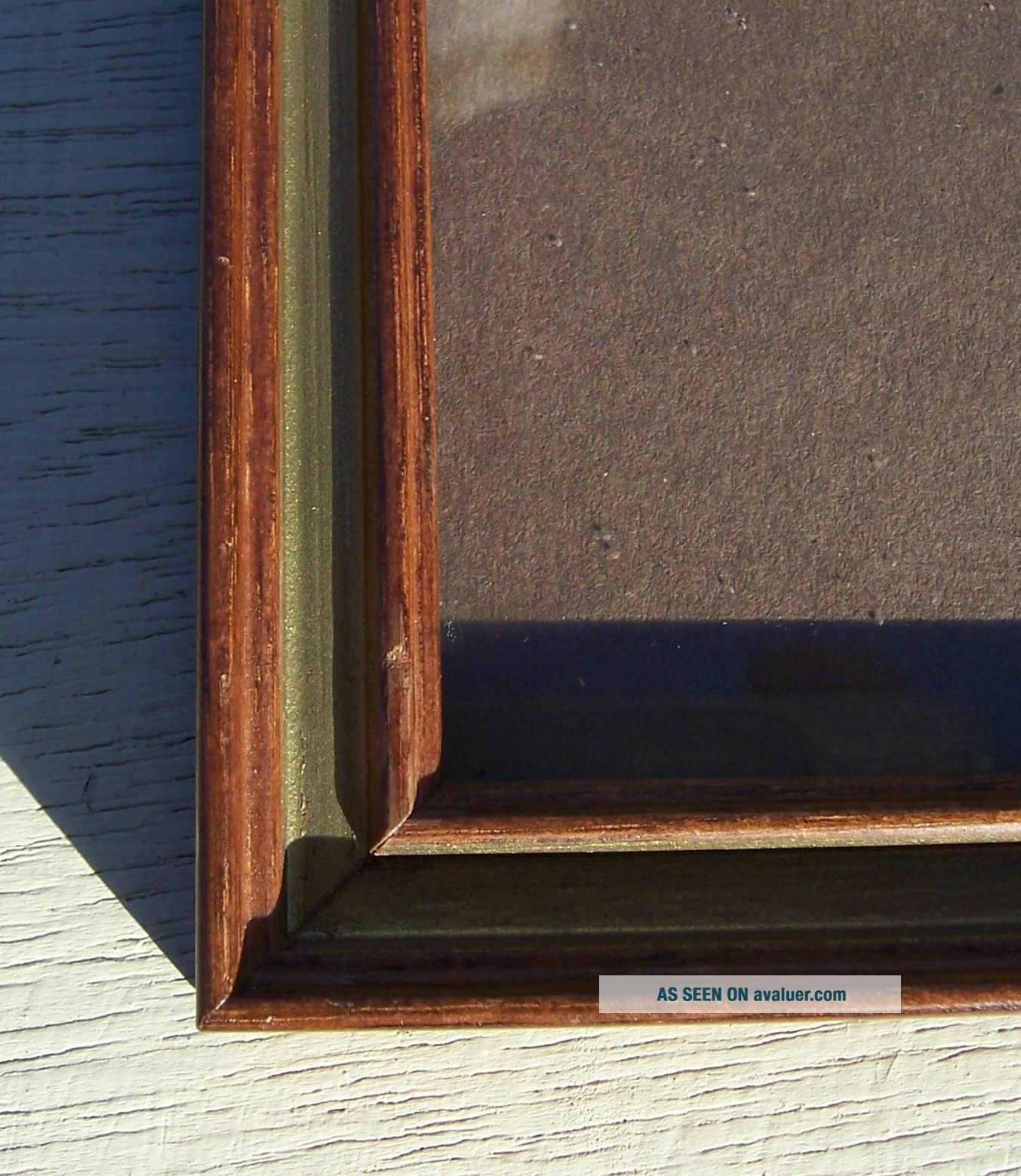
Condition: Appears to be in a good condition under glass, one heavy fold down the middle two lighter folds to each side. Frame appears to be in a good condition but please see photos.
Size: Frame 37.2 x 34cm. Viewable 22.2 by 19cm. 859grams
I am selling a number of small antique maps this week. Always happy to combine postage.
Please feel free to ask any questions but please please ask through Ebay. Unfortunately, selling on Ebay generates a lot of spam and dubious emails and I now only respond to questions placed directly through Ebay. I will try to answer questions as soon as possible, but this will normally be in the evening. There are times where I may not be able to reply within 24 hours but I will reply well before the listing ends.
Postage
I am always happy to combine postage, but please contact me before paying to arrange the most suitable method. Unless I am offering free postage, I tend to charge P&P at cost plus 15-20% to cover packaging materials & other charges ( a little more for smaller items). Items that are under 2kg and fitinto a box 45 x 35 x 16cm will be sent by Royal Mail, at a cost of £3.40. Larger or heavier items will be sent by courier. Parcels up to 2kg £4.70, up to 5kg £6.95 and up to 10kg £9 ( please note that there are some exceptions to this for large items). If the items have a value of over £25 and up to £100 an additional £2.22 may be added for insurance and signature. There may also be a surcharge for delivery to the Islands and Highlands. I will still happily send an item by any of the Royal Mail services if you prefer (Standard, Confirmed, Special Delivery), so please just let me know and I will provide a quote.If you require a tracking number for the item, please ensure that you pay for a tracked service.
I am always happy for collection in person or for a buyer to arrange their own courier which may be cheaper for the winning bidder. Hermes is preferred for UK collection as we have an exceptionally good delivery man.
International items under 2kg will still be sent via Royal Mail. I will quite happily post most itemsoverseas, but if I have not already been provided international prices, please ask me for postage costs beforebidding.
I will not post to the Middle East, South America or Africa. International items sent by courier will require a contact telephone number.
Packing -I pack to ensure the item arrives with you undamaged. If you have specific packing instructions, please contact me before paying as this may have an impact on the price, as both an increase in weight or size can increase the cost of delivery.
I do try to recycle boxes and other materials wherever possible and will sometimes use newspaper forpadding out, if it does not have any impact on the cost of postage.
Please note that I am not a Map expert but I have listed what I believe to have discovered about this map below.
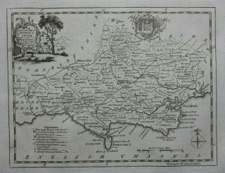
A coloured map of Dorset, from a series of maps referred to as 'miniature Mordens', first published in 1701 there were following publications withalterations being carried ...out by Herman Moll, the most significant of which was the addition of compass-indicators which this has. I believe this version of the map featured in 'Magna Britannia et Hibernia', an atlas published in monthly issues between 1720 and 1731.
Framed, glazed and mounted.
I have included a number of photos and these probably describe the item better than I can and form part of the description. Everyone has different considerations when purchasing items and if you need any further information, please feel free to contact me and I will try to help.
Condition: Appears to be in a good condition under glass, one heavy fold down the middle two lighter folds to each side. Frame appears to be in a good condition but please see photos.
Size: Frame 37.2 x 34cm. Viewable 22.2 by 19cm. 859grams
I am selling a number of small antique maps this week. Always happy to combine postage.
Please feel free to ask any questions but please please ask through Ebay. Unfortunately, selling on Ebay generates a lot of spam and dubious emails and I now only respond to questions placed directly through Ebay. I will try to answer questions as soon as possible, but this will normally be in the evening. There are times where I may not be able to reply within 24 hours but I will reply well before the listing ends.
Postage
I am always happy to combine postage, but please contact me before paying to arrange the most suitable method. Unless I am offering free postage, I tend to charge P&P at cost plus 15-20% to cover packaging materials & other charges ( a little more for smaller items). Items that are under 2kg and fitinto a box 45 x 35 x 16cm will be sent by Royal Mail, at a cost of £3.40. Larger or heavier items will be sent by courier. Parcels up to 2kg £4.70, up to 5kg £6.95 and up to 10kg £9 ( please note that there are some exceptions to this for large items). If the items have a value of over £25 and up to £100 an additional £2.22 may be added for insurance and signature. There may also be a surcharge for delivery to the Islands and Highlands. I will still happily send an item by any of the Royal Mail services if you prefer (Standard, Confirmed, Special Delivery), so please just let me know and I will provide a quote.If you require a tracking number for the item, please ensure that you pay for a tracked service.
I am always happy for collection in person or for a buyer to arrange their own courier which may be cheaper for the winning bidder. Hermes is preferred for UK collection as we have an exceptionally good delivery man.
International items under 2kg will still be sent via Royal Mail. I will quite happily post most itemsoverseas, but if I have not already been provided international prices, please ask me for postage costs beforebidding.
I will not post to the Middle East, South America or Africa. International items sent by courier will require a contact telephone number.
Packing -I pack to ensure the item arrives with you undamaged. If you have specific packing instructions, please contact me before paying as this may have an impact on the price, as both an increase in weight or size can increase the cost of delivery.
I do try to recycle boxes and other materials wherever possible and will sometimes use newspaper forpadding out, if it does not have any impact on the cost of postage.