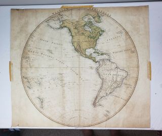
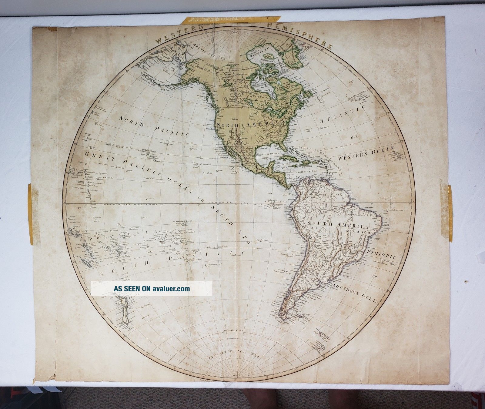
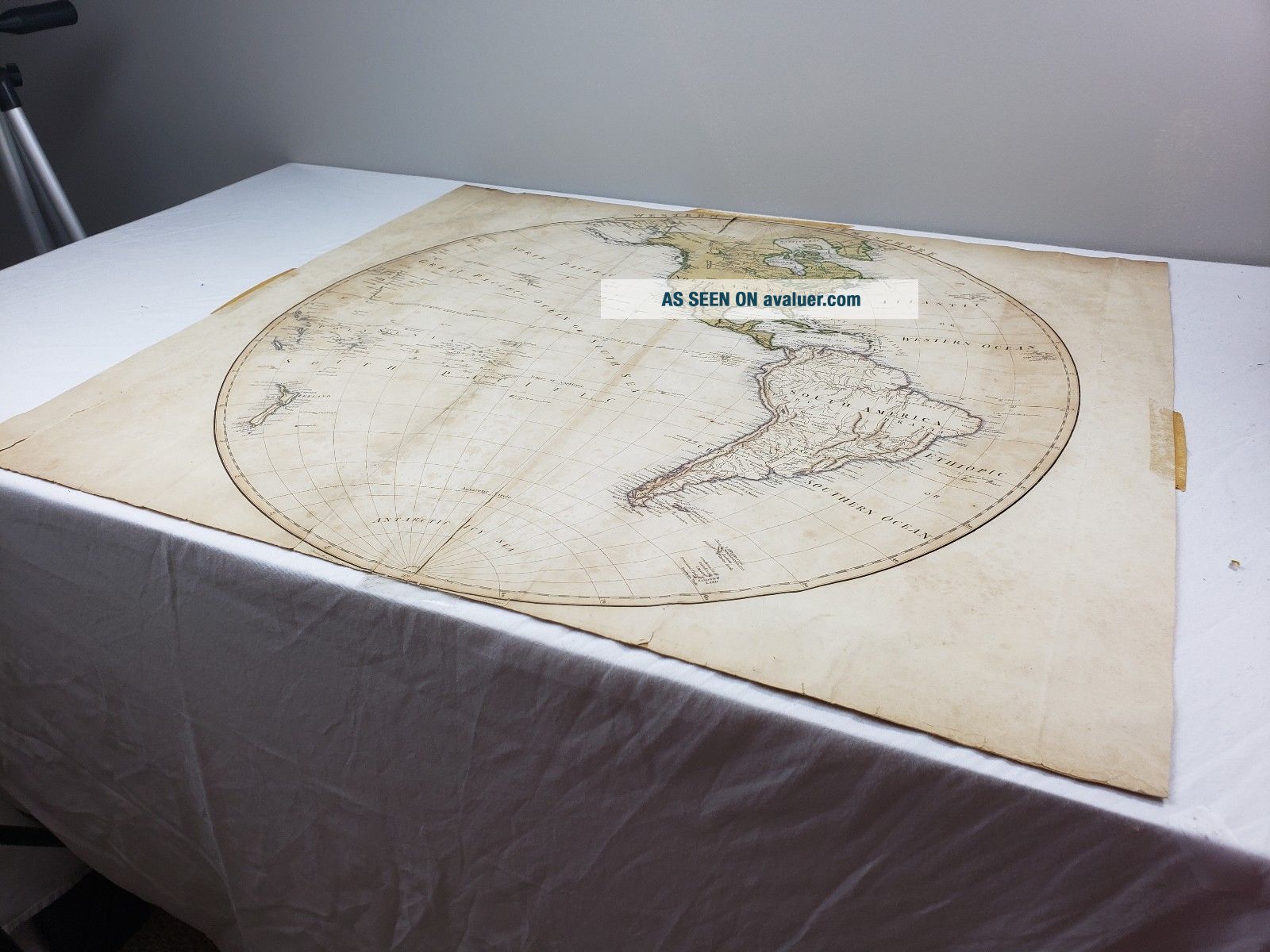
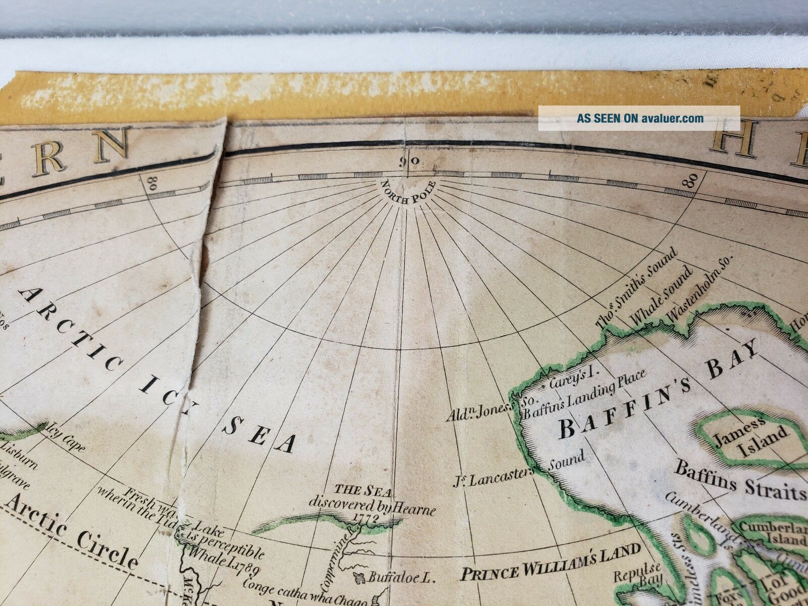
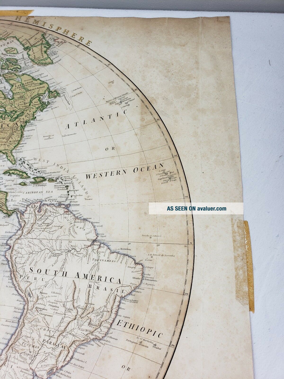
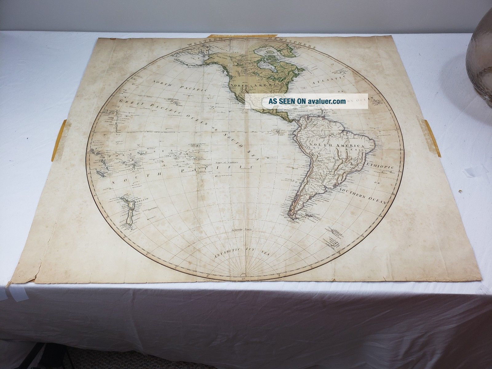
Herman Moll Map Of The Western Hemisphere Circa 1802


Item History & Price
| Reference Number: Avaluer:32140 | Year: 1802 |
| Original/Reproduction: Antique Original | Format: Atlas Map |
| Date Range: 1800-1899 | Cartographer/Publisher: Herman Moll |
| Country/Region: western hemisphere |
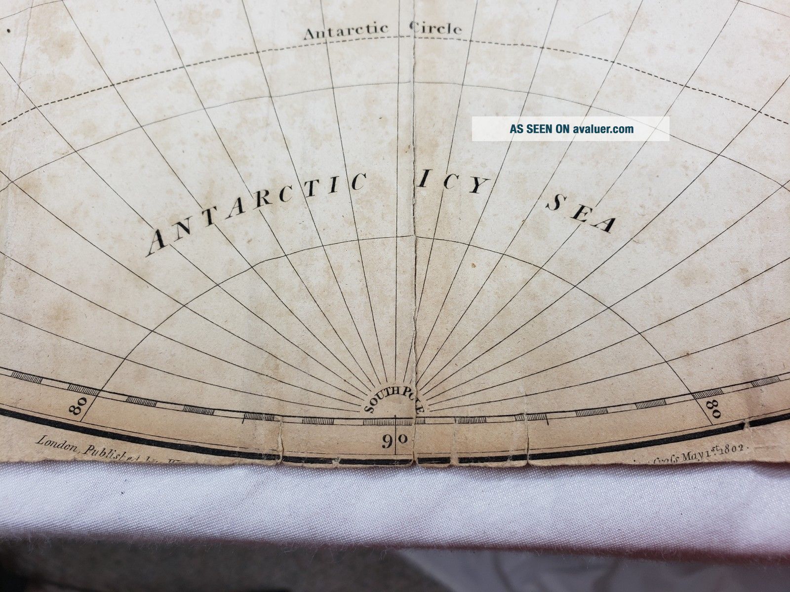
I do not have an official appraisal for this map, but I have had a few different people look at it and they all agree that it is a Herman Moll map. The date on the bottom reads 1802 which is after he died, so I imagine it was a reprint of an original mapping. The condition is great for something so old. You can see some crease lines where it was once kept in an atlas. There are some age spots on the paper, but no major defects. Along the top, the vertical fold line has worn a tear into... the map, but it is minor.
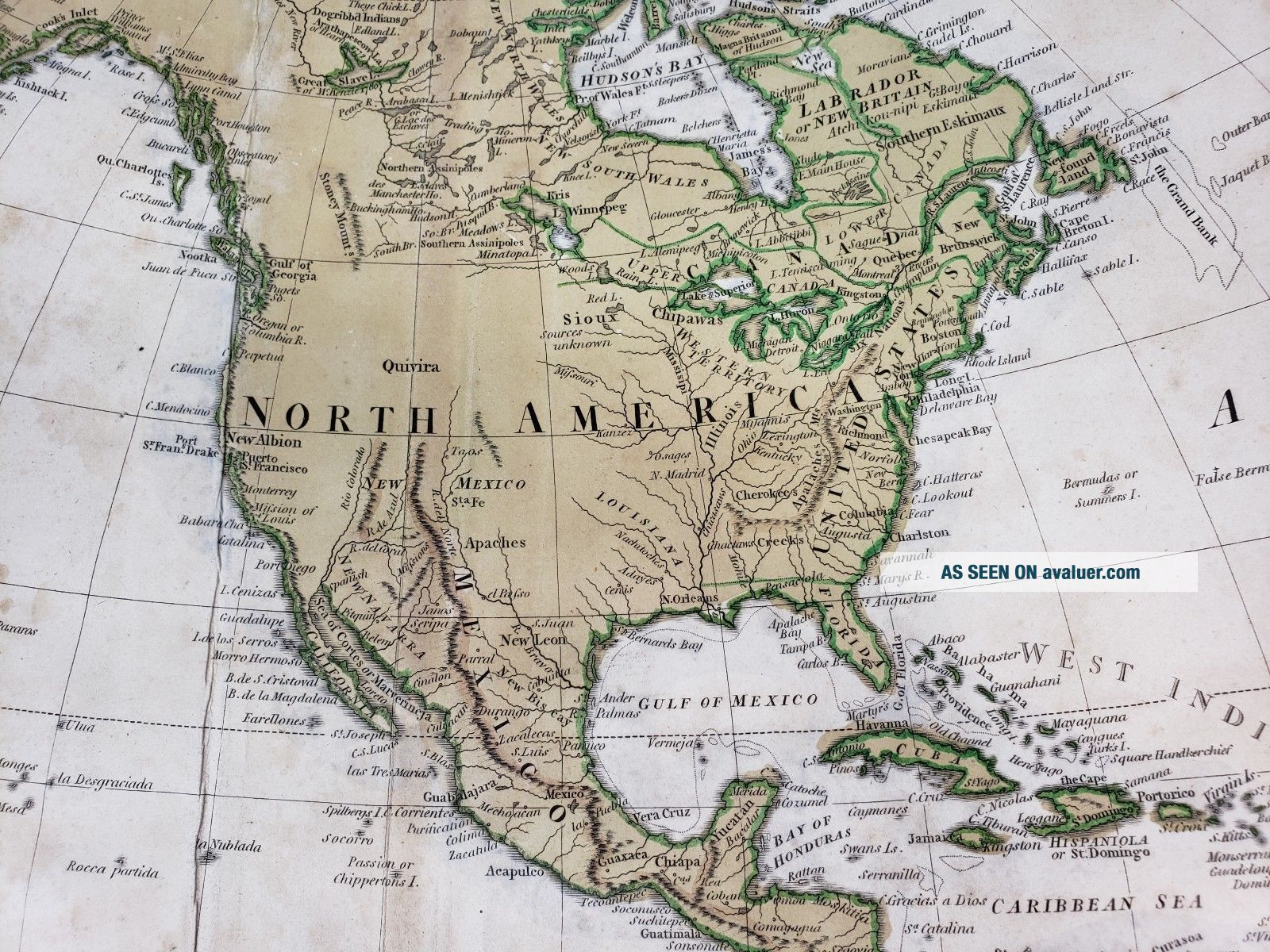
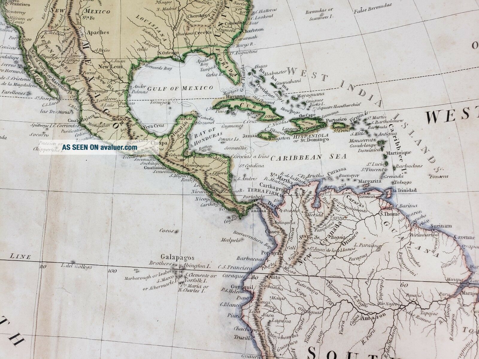
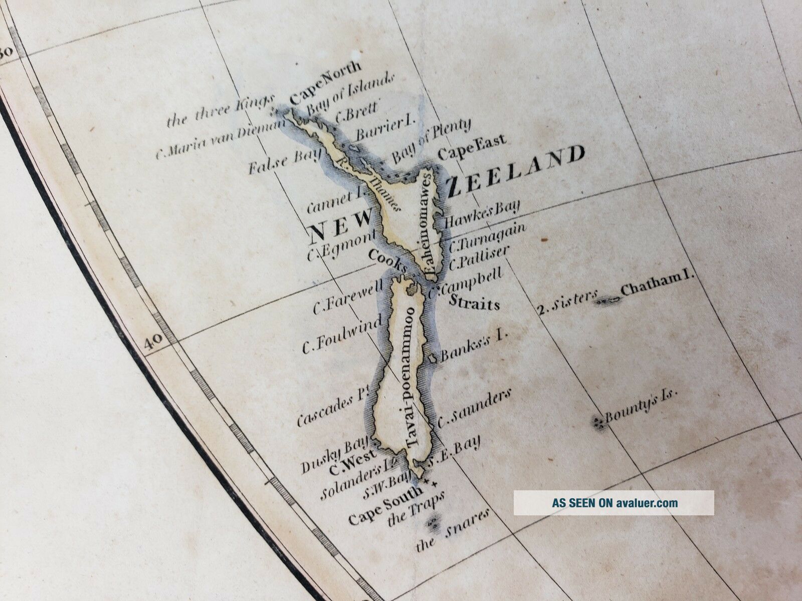
There is so much detail in this map. It's wonderful to look at and everyone that sees it, loves it. I do not have a frame for it. I have kept it in plastic. Really wonderful map filled with history.
The map is 23 inches tall and 26.5 inches wide.
There is so much detail in this map. It's wonderful to look at and everyone that sees it, loves it. I do not have a frame for it. I have kept it in plastic. Really wonderful map filled with history.
The map is 23 inches tall and 26.5 inches wide.