ORIG 1929 DELAWARE COUNTY, PA, HAVERFORD HS, MERION COUNTRY CLUB PLAT ATLAS MAP


Item History & Price
| Reference Number: Avaluer:33604 |
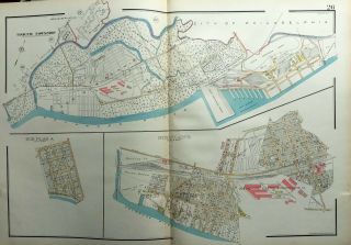
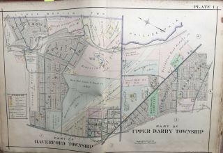
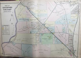
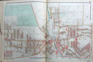
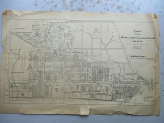
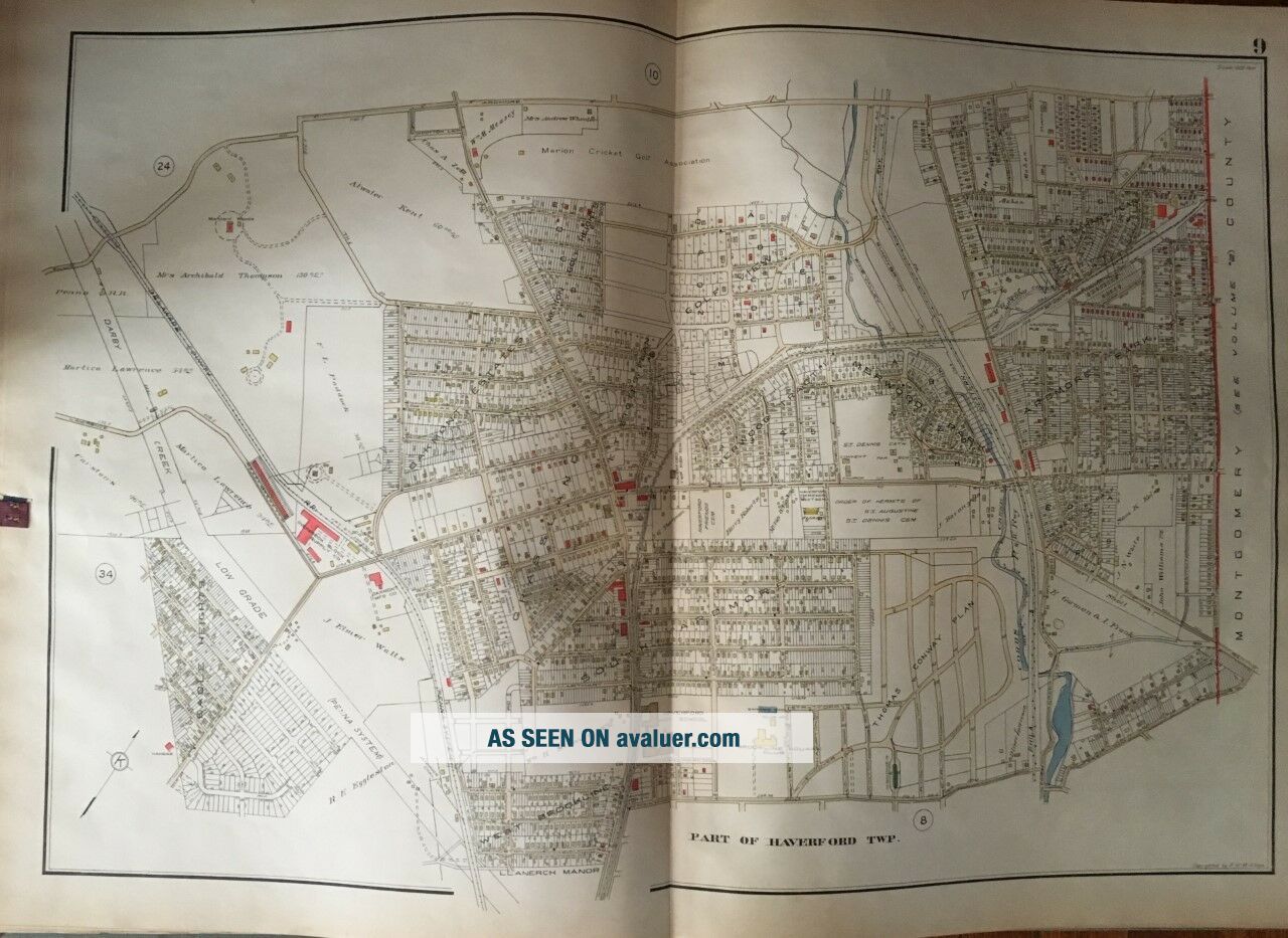
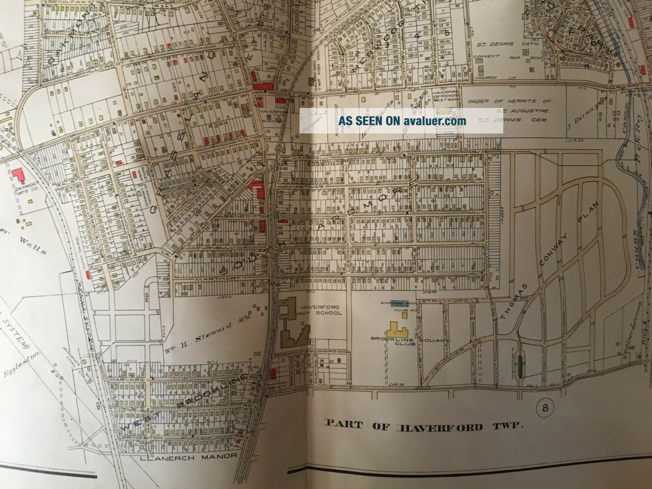
This is an original 1929 Frank H.M. Klinge plat atlas map on double weight paper of Haverford Township in Delaware County, Pennsylvania. It includes Haverford High School, Brookline Square Club, St. Dennis, School, Church, Rectory & Cemetery and the Merion Cricket and Golf Country Club. It measures 23" x 33".Plate 9: covers from Ardmore Rd. to Mill Rd. and from Darby Creek Rd. to County Line Rd.Each color represents adifferent type of building: Yellow is Wood; Pink is Br...ick; Blue is Stone and White is Asbestos. Box with black lines = Metal and Box with an X = Stable or Barn. See key for what all thesymbols indicate.I am selling my collection of rare maps. If there is an area or street address of Long Island, Brooklyn, Manhattan, Queens, Staten Island, Bronx, Elmira, Newark, Cleveland, Boston, Rochester, Philadelphia, Pittsburgh that you might be interested in, contact me . I have insurance maps from 1880 to mid-1950s. Looks great framed! Check out my other items!