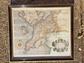
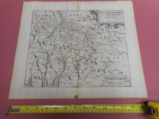
Map, Ch. Saxton & Will. Kip, Cumbria Cumberlandia, Antique, 1610 - 1637
Item History & Price
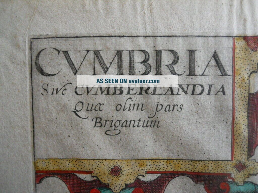
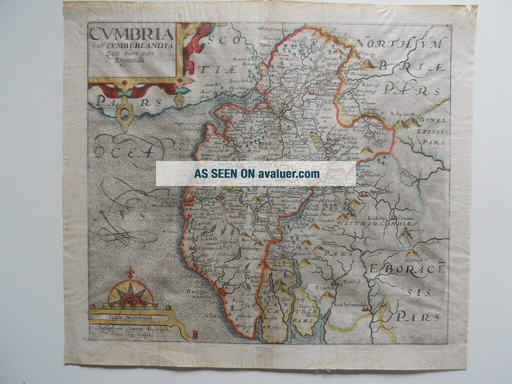
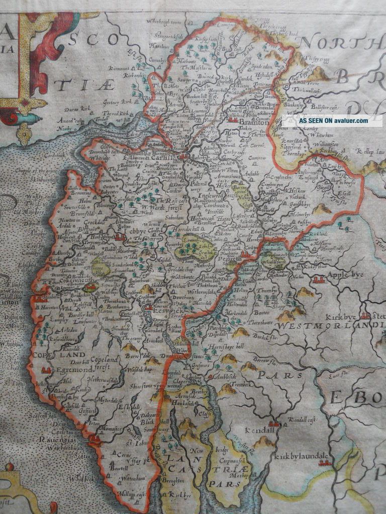
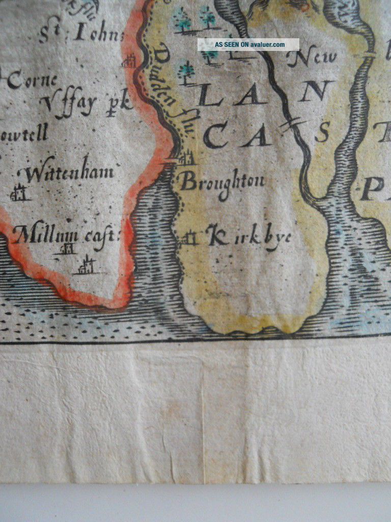
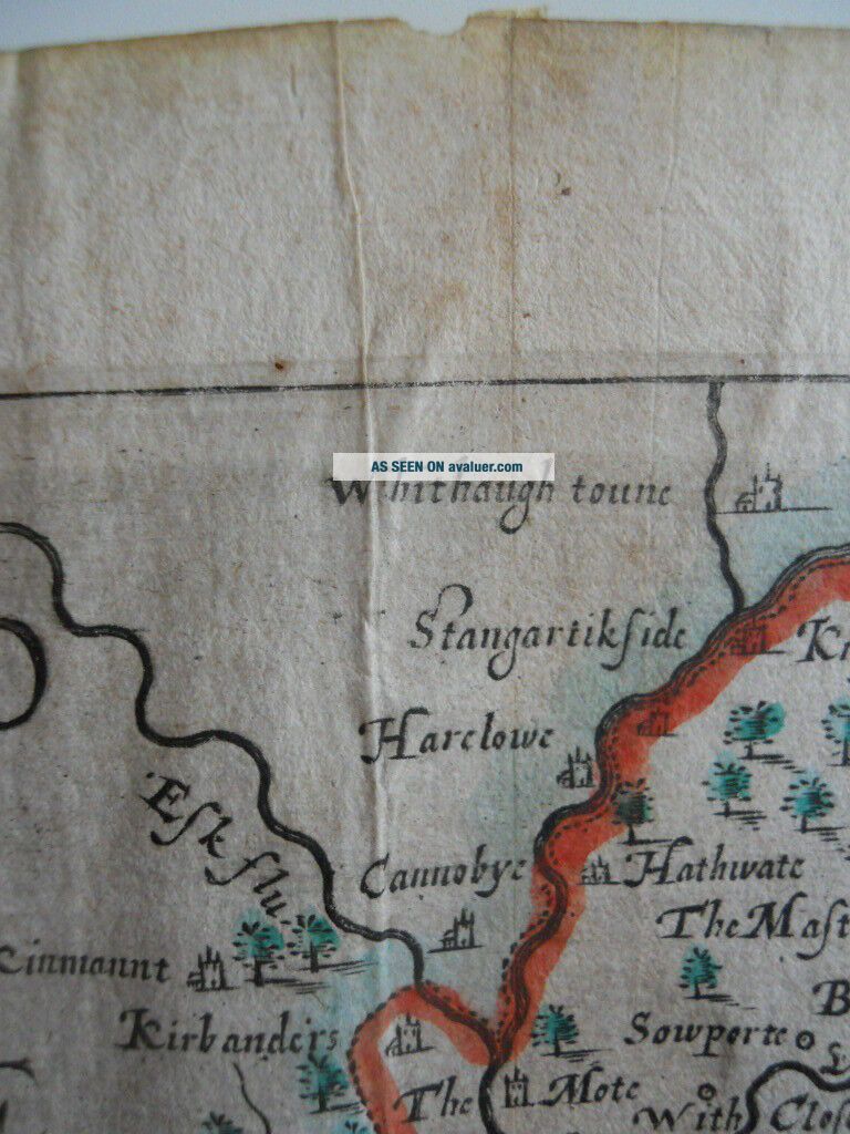
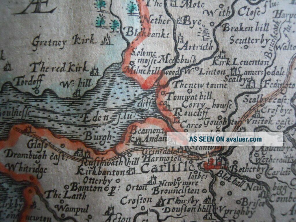
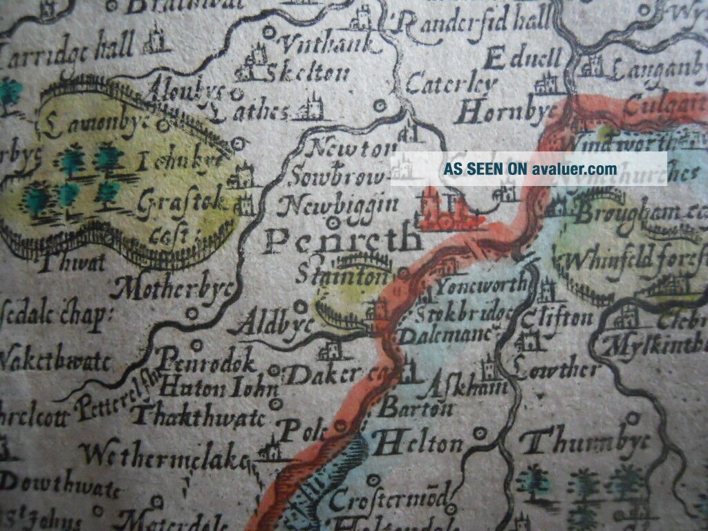
A Map by Christopher Saxton & William KipCumbria, Cumberlandia c.1610 - 1637From Camdens' Britannia
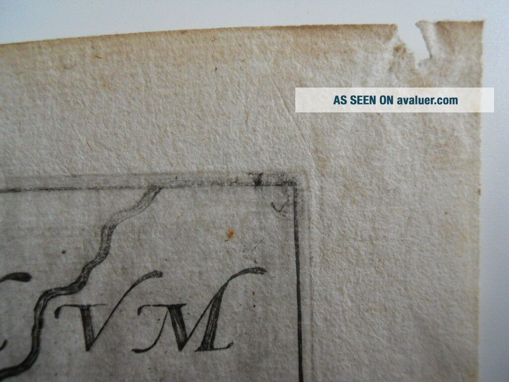
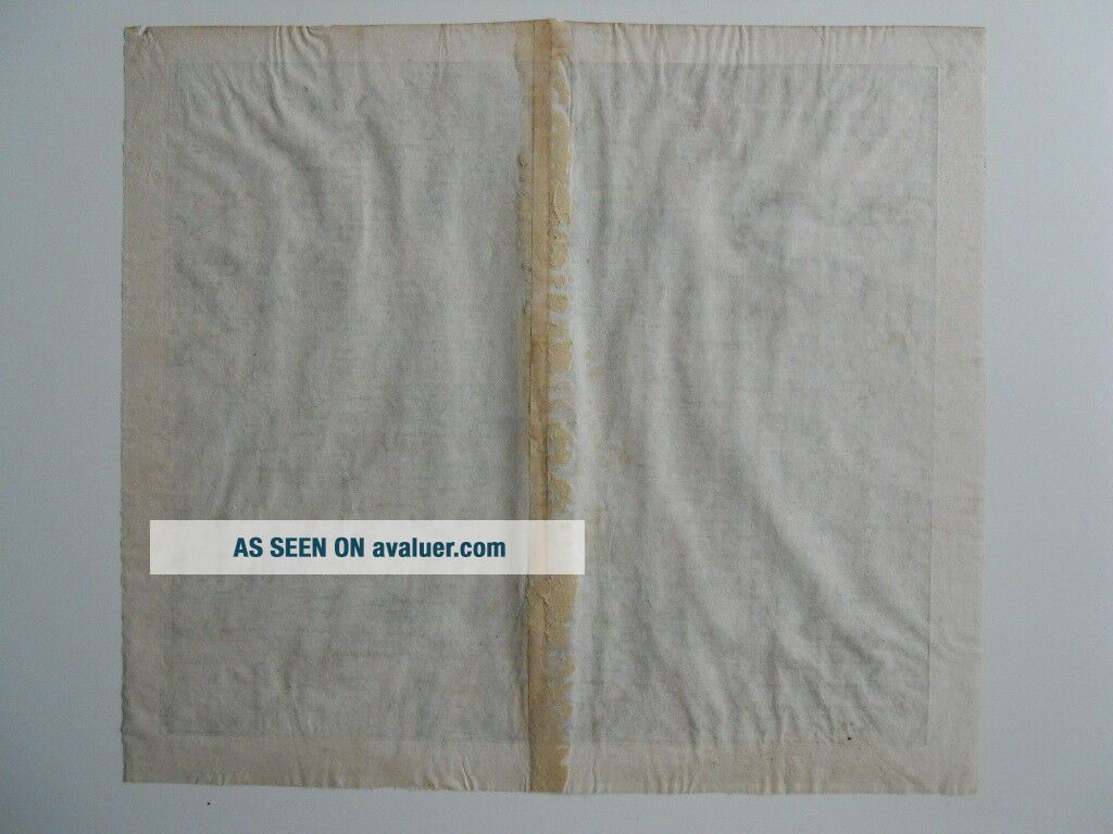
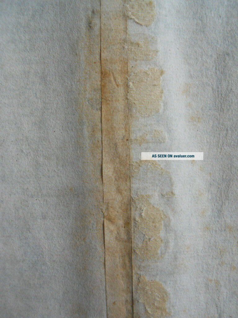
Published London, 1610 - 1637Verso:A clean, lightly-coloured map. small paper nibble top right margin, At some point the guard has been gummed to a brown paper backing. This backing has been removed, leaving traces of the brown paper attached to the map. There has been no paper loss from the map. [see photos]
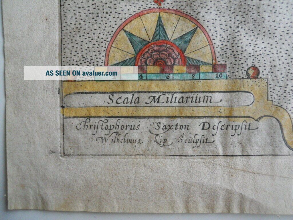
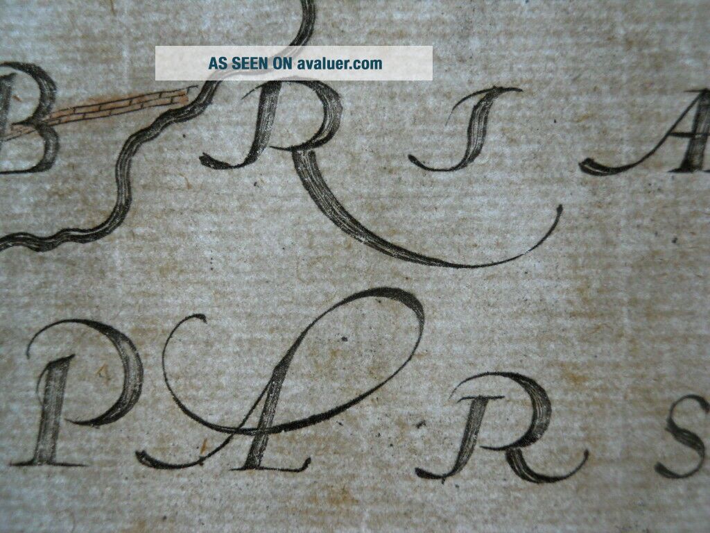
The back-lit photo shows the distinc...tive ' shadow ' around the chain [vertical] lines, found only on pre-1750 'antique laid' paper, made with a single-faced laid & chain mould.plate size 320mm wide x 290mm. sheet size 360mm wide x 325mm, **********
**********
Shipping:UKfree Europe free
World free **********
Here are some of my map sales feedbacks :-
Great item, perfect service, thanks, , rm1680(817), , Title page, Lucas J Waghenaer, J Doetecum, Spieghel der Zeevaerdt 1584 - 160? ~ (#152969315693) £1, 370-00, , Best Offer price was accepted
~~~~~~~~~~~~
Delighted with purchase, many thanks, , cassien10(163), , A Framed Map Scandia ex Ptolemy Geographiae edition by G A Magini 1596-1617(#1527151018-60) £199-00, , Best offer was accepted~~~~~~~~~~~~Fast, friendly and efficient - highly recommended, , ubique3(3925), , Map Tigris Amarah to Kumamait Iraq Mesopotamia Indian Expeditionary Force"D" 1916 (#152406467379), , £271-05~~~~~~~~~~~~
Really excellent Ebayer, , Very helpful and smooth transaction, , Owt4nowtandy(104), , Framed Map of Northumberland by Robert Morden 1722, , {#151626677284), , £95-00, , Best offer was accepted, ~~~~~~~~~~~~
Excellent service, , rwhainsworth(15), , A Framed Map of Yorkshire by Richard Blome, after John Speed c.1673, , (#151534915457), , £90-00, ~~~~~~~~~~~~Map arrived safely, Thanks for your good service, , daveb5648(742), , Map of West Riding Yorkshire Framed Christopher Saxton - William Hole 1607-1637, , (#141512413432), , £220-00, , Best Offer was accepted, ~~~~~~~~~~~~~Better than described, very happy indeed, , sack122(364), , Map John Speed North & East Ridings of Yorkshire Sudbury & Humbell 1612, , (#151251283637), , £450-00,
~~~~~~~~~~~~~
00046
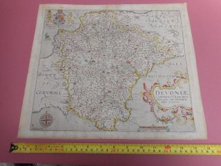
Published London, 1610 - 1637Verso:A clean, lightly-coloured map. small paper nibble top right margin, At some point the guard has been gummed to a brown paper backing. This backing has been removed, leaving traces of the brown paper attached to the map. There has been no paper loss from the map. [see photos]
The back-lit photo shows the distinc...tive ' shadow ' around the chain [vertical] lines, found only on pre-1750 'antique laid' paper, made with a single-faced laid & chain mould.plate size 320mm wide x 290mm. sheet size 360mm wide x 325mm, **********
**********
Shipping:UKfree Europe free
World free **********
Here are some of my map sales feedbacks :-
Great item, perfect service, thanks, , rm1680(817), , Title page, Lucas J Waghenaer, J Doetecum, Spieghel der Zeevaerdt 1584 - 160? ~ (#152969315693) £1, 370-00, , Best Offer price was accepted
~~~~~~~~~~~~
Delighted with purchase, many thanks, , cassien10(163), , A Framed Map Scandia ex Ptolemy Geographiae edition by G A Magini 1596-1617(#1527151018-60) £199-00, , Best offer was accepted~~~~~~~~~~~~Fast, friendly and efficient - highly recommended, , ubique3(3925), , Map Tigris Amarah to Kumamait Iraq Mesopotamia Indian Expeditionary Force"D" 1916 (#152406467379), , £271-05~~~~~~~~~~~~
Really excellent Ebayer, , Very helpful and smooth transaction, , Owt4nowtandy(104), , Framed Map of Northumberland by Robert Morden 1722, , {#151626677284), , £95-00, , Best offer was accepted, ~~~~~~~~~~~~
Excellent service, , rwhainsworth(15), , A Framed Map of Yorkshire by Richard Blome, after John Speed c.1673, , (#151534915457), , £90-00, ~~~~~~~~~~~~Map arrived safely, Thanks for your good service, , daveb5648(742), , Map of West Riding Yorkshire Framed Christopher Saxton - William Hole 1607-1637, , (#141512413432), , £220-00, , Best Offer was accepted, ~~~~~~~~~~~~~Better than described, very happy indeed, , sack122(364), , Map John Speed North & East Ridings of Yorkshire Sudbury & Humbell 1612, , (#151251283637), , £450-00,
~~~~~~~~~~~~~
00046