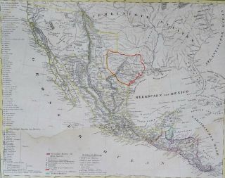
1777 Large Map Of Texas, Mexico, Spain


Item History & Price

Information:
Reference Number: Avaluer:36626US State: New Mexico, Texas
Printing Technique: Copper PlateYear: 1777
Original/Reproduction: Antique OriginalDate Range: 1700-1799
Cartographer/Publisher: thomas kitchenCountry/Region: United States of America
Original Description:
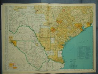
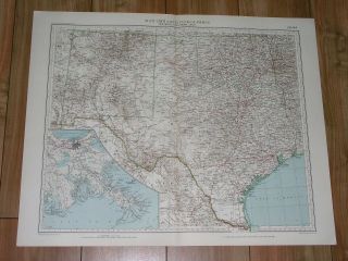
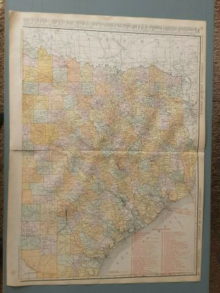
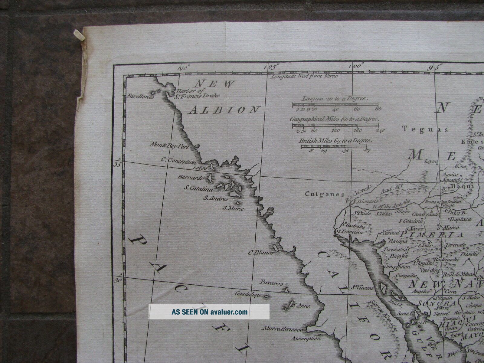
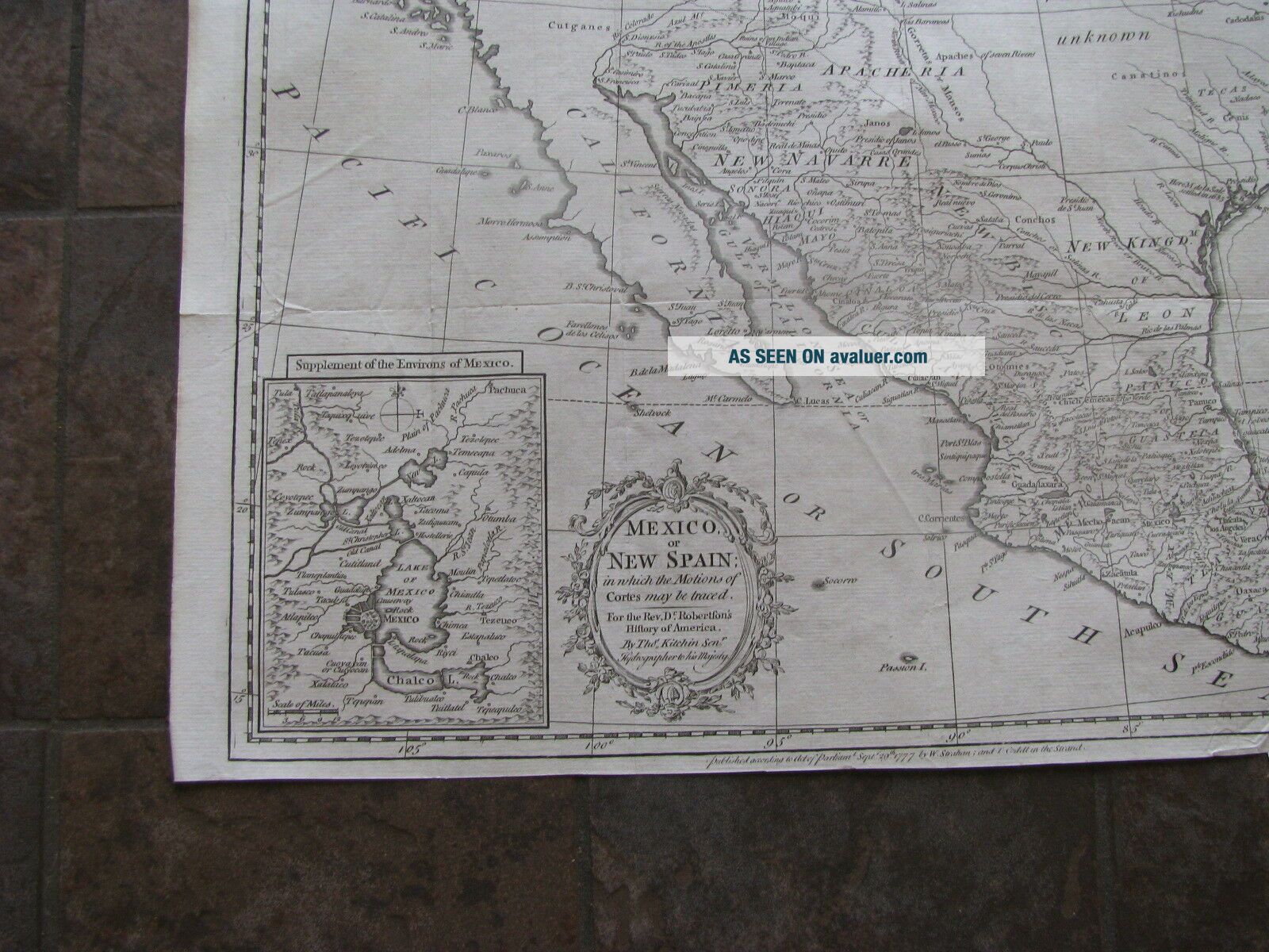
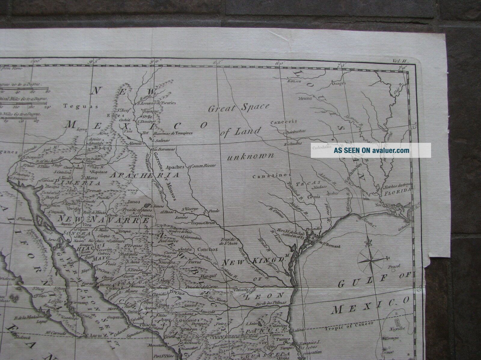
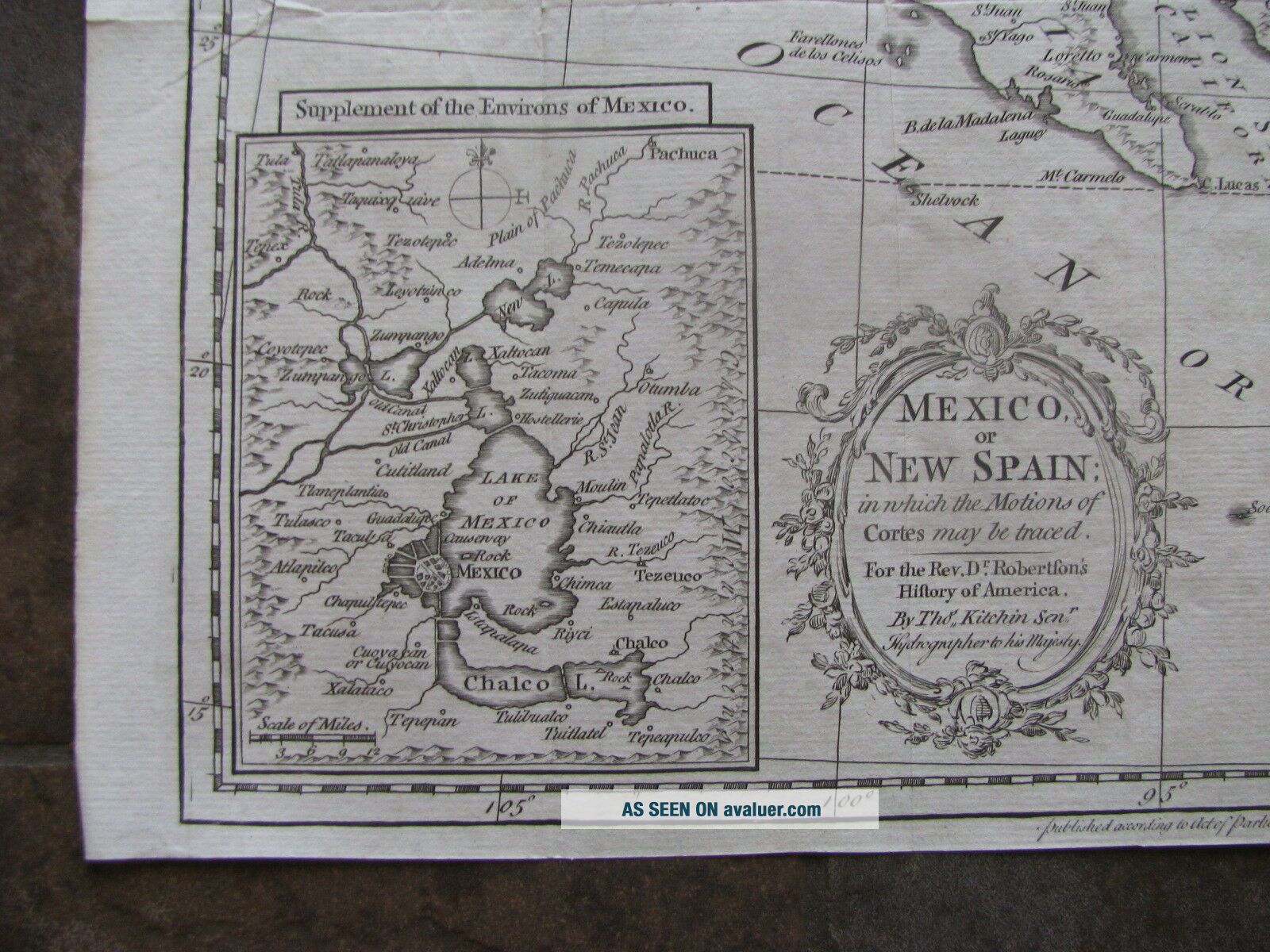
Original uncolored copper plate engraving as issued.Blank on verso. Dated in the plate.Engraved by Thomas Kitchen.Published by Strahan and Cadell.Image area is 15.0" w. X 11.0" h. Interesting and very detailed map.Texas is labeled "Great Space of Land Unknown."The 1685 settlement of De La Sale on the Texas coast is located and identified. Cenis is shown. There is an inset map of the "Environments  of Mexico City." A "charming map " with sugarloaf mountains..., cartouche and compass rose.This is a wonderful piece of American History.Beautifully executed will frame nicely.Overall good condition with moderate ageing. Some typical small tears in the margins, for an item of this age.Low starting bid with no reserve.Shipping cost is for insured domestic priority mail.                

00014


    Similar items


  • 111 Large Maps Of The Rio Grande Int

    111 Large Maps Of The Rio Grande Int ' L Boundary With Mexico Per The 1970 Treaty

  • Us,  Republic Of Texas,  Mexico Flemming,  1844,  Mexico,  Mittel America,  Texas Rare

    Us, Republic Of Texas, Mexico Flemming, 1844, Mexico, Mittel America, Texas Rare

  • Map Of Texas,  Houston,  Dallas,  El Paso,  Austin,  Gulf Of Mexico Etc Tx - Postcard

    Map Of Texas, Houston, Dallas, El Paso, Austin, Gulf Of Mexico Etc Tx - Postcard

  • Vintage Map.  Guide Of The Lower Rio Grande Valleys Of Texas & Mexico - Lithographed

    Vintage Map. Guide Of The Lower Rio Grande Valleys Of Texas & Mexico - Lithographed

  • Large 1942 Vintage Full Color Two Part Map Of Texas 27 5/8 " X 41 "

    Large 1942 Vintage Full Color Two Part Map Of Texas 27 5/8 " X 41 "

  • Large Format 1924 Map Of Texas Eastern Section Railroads Keyed In Red & Labelled

    Large Format 1924 Map Of Texas Eastern Section Railroads Keyed In Red & Labelled

  • 1929 Rare Vintage Map Of Texas Houston Dallas Oklahoma Mexico Orleans

    1929 Rare Vintage Map Of Texas Houston Dallas Oklahoma Mexico Orleans

  • 1914 Antique Map - Rare 20.  5 " X 28 " Large Map Of E.  Texas W/ Railroads

    1914 Antique Map - Rare 20. 5 " X 28 " Large Map Of E. Texas W/ Railroads


    • You might also like


    • 1860 Mitchell Hand Colored Map Colorado,  Nebraska & Kansas - Civil War Era

      1860 Mitchell Hand Colored Map Colorado, Nebraska & Kansas - Civil War Era

    • 18th Century French Map Of North America

      18th Century French Map Of North America

    • Las Vegas Nevada Vintage 1967 Us Geological Survey Quadrangle Map 4 Panels

      Las Vegas Nevada Vintage 1967 Us Geological Survey Quadrangle Map 4 Panels

    • Rare Antique 1845 Maps United States Exploring Expedition Book Antartica Hawaii

      Rare Antique 1845 Maps United States Exploring Expedition Book Antartica Hawaii

    • Vintage 1926 Map Hollywood From The Best Surveys Of The Time

      Vintage 1926 Map Hollywood From The Best Surveys Of The Time

    • American Continent (western Hemisphere) 1747 Bowen Antique Copper Engraved Map

      American Continent (western Hemisphere) 1747 Bowen Antique Copper Engraved Map

    • Gulf Coast Florida Texas United States 1705 De Fer Unusual Antique Engraved Map

      Gulf Coast Florida Texas United States 1705 De Fer Unusual Antique Engraved Map

    • California As Island United States 1700 De Fer Unusual First Edition Antique Map

      California As Island United States 1700 De Fer Unusual First Edition Antique Map

Avaluer          About Us          Privacy Policy          Contact Us          UP
© 2022, avaluer.net, Inc. or its affiliates