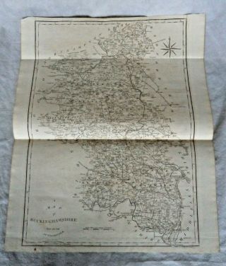
1793 Antique Map; Buckinghamshire - John Cary, & Correct English Atlas
Item History & Price
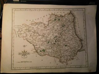
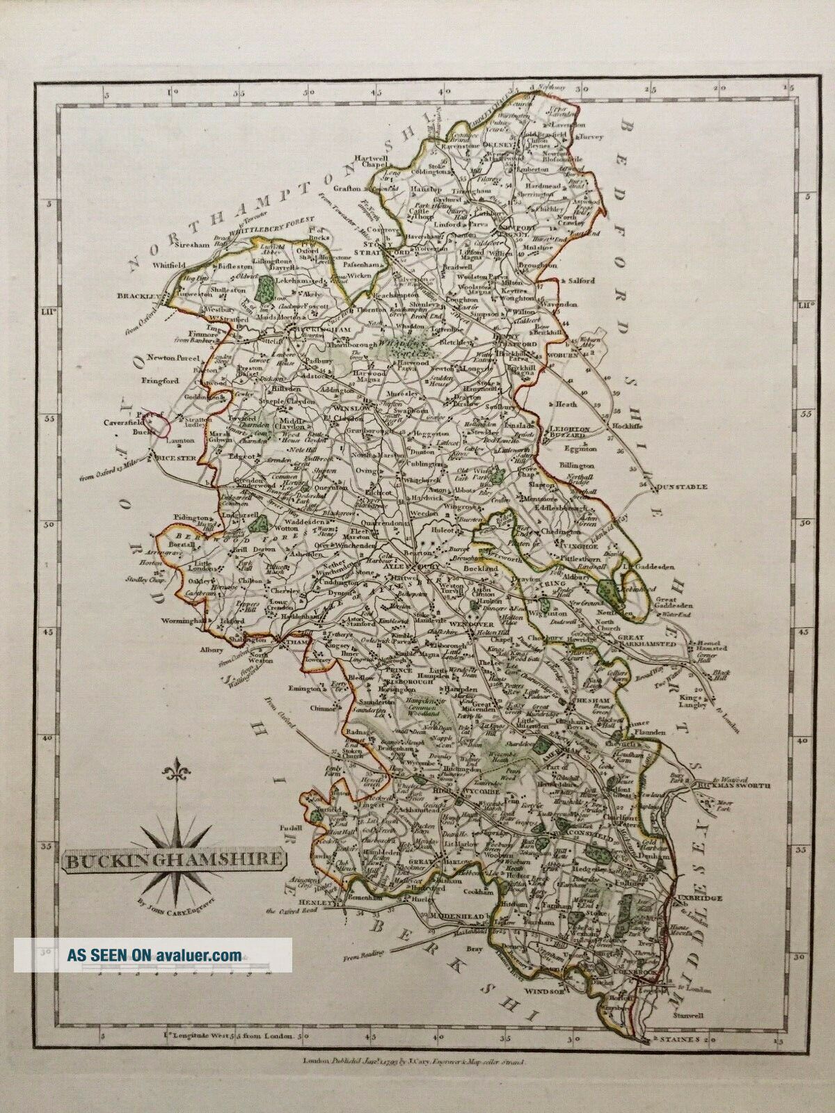
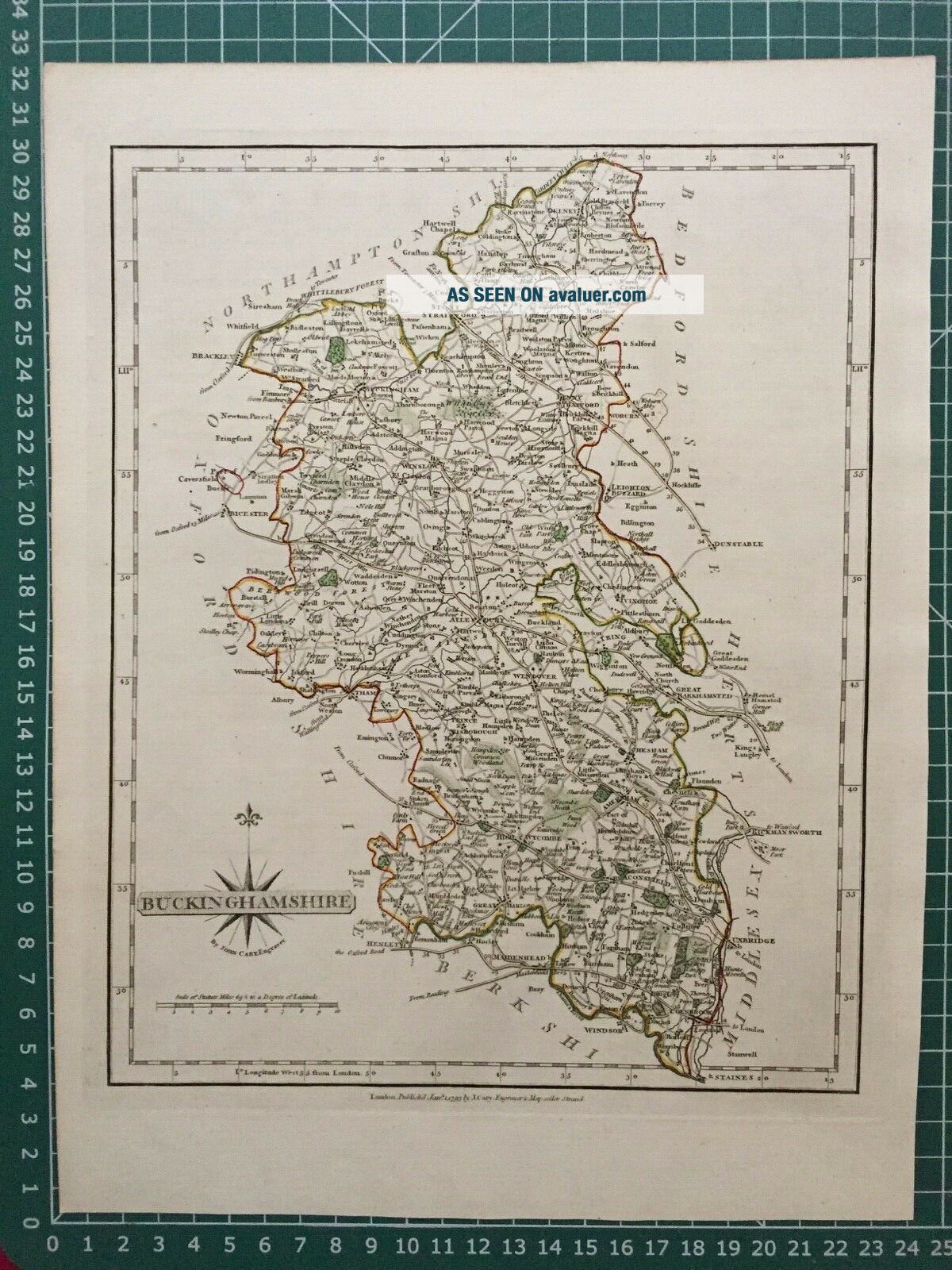
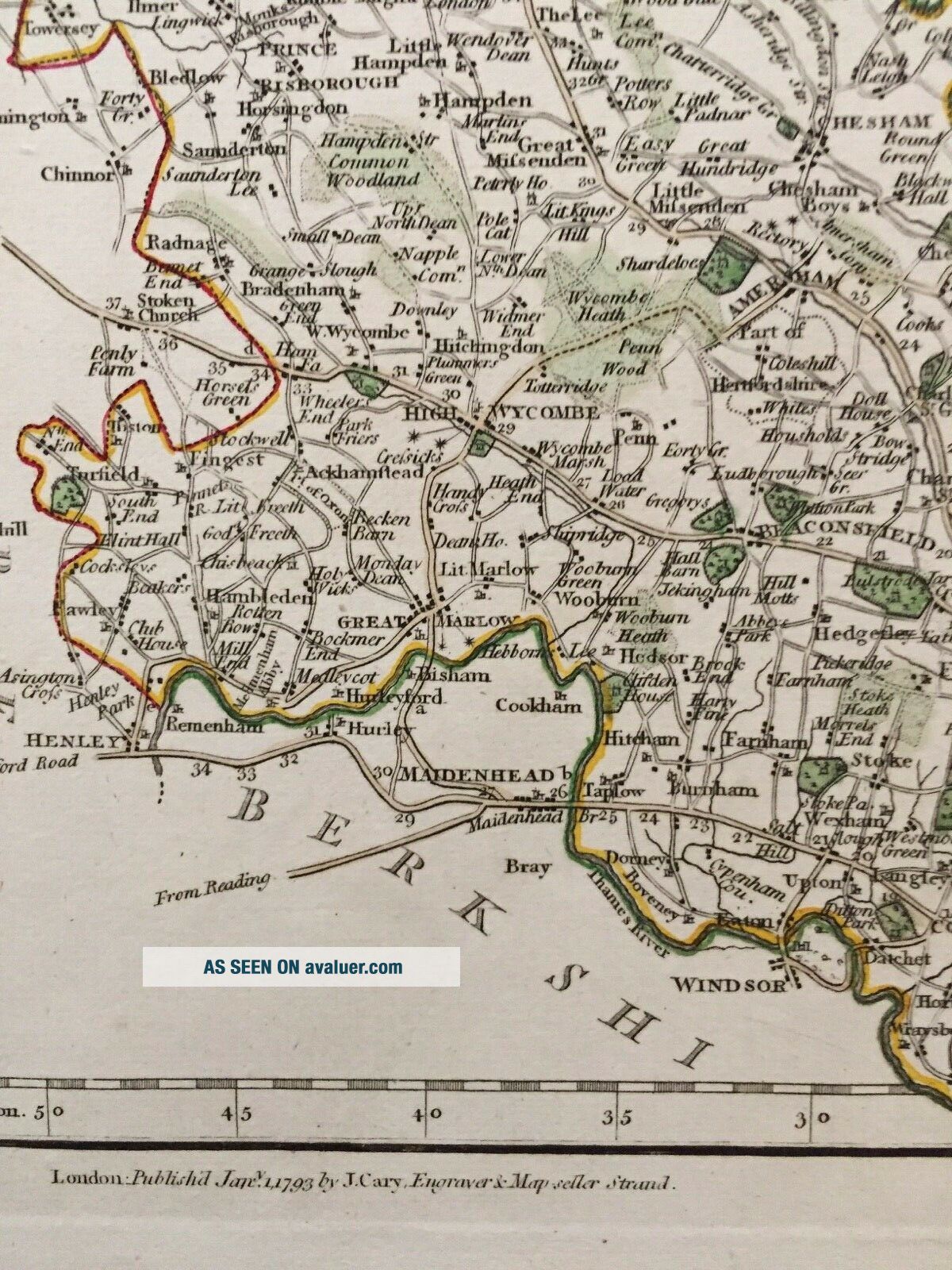
On offer: an original (i.e. not a later reproduction) map "Buckinghamshire". The map has early outline colour.
DATE PRINTED: 1793. This map was issued between 1787 and 1809. This example has the imprint dated 1793 .SIZE: The printed area of the view, including titles, is approximately 21 x 27 cm , 8.25 x 10.5 inches (medium) plus margins. ARTIST/CARTOGRAPHER/ENGRAVER: Published by John Cary. John Cary was a very important Eng...lish cartographer who published "The New and Correct English Atlas" in 1787. It was revolutionary in its time. Cary abandoned the elaborate decoration and mythical beasts which adorned earlier maps in favour of a more detailed, accurate and scientific approach. His work became the standard which other cartographers were to follow.PROVENANCE: This print was published in "The New and Correct English Atlas".TYPE: Antique copper engraving printed on paper. VERSO: There is nothing printed on the reverse side which is blank.CONDITION: Good; suitable for framing. Please check the scan for any blemishes prior to making your purchase. Virtually all antiquarian maps and prints are subject to some normal aging due to use and time which is not significant unless otherwise stated. I offer a no questions asked return policy. AUTHENTICITY: This is an authentic antique print, published at the date stated above. I do not offer reproductions. It is not a modern copy. The term 'original' when applied to a print means that it was printed at the first or original date of publication; it does not imply that the item is unique. RETURNS POLICY: I offer a no questions returns policy. All I ask is that you pay return shipping and mail back to me in original condition. BACKGROUND INFORMATION: Please explore my ebay shop for more antique prints.
Track Page Views With
Auctiva's FREE Counter