1610 - 1637 Antique Map Of Radnorshire, Wales (Saxton & Kip)

Item History & Price
| Reference Number: Avaluer:37223 | County: Radnorshire |
| Date Range: 1600-1699 | Type: County Map |
| Country/Region: Wales | Year: 1637 |
| Era: 1600s | City: Saxton |
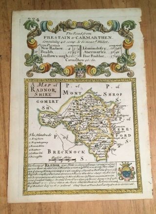
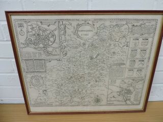
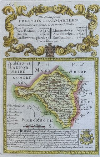
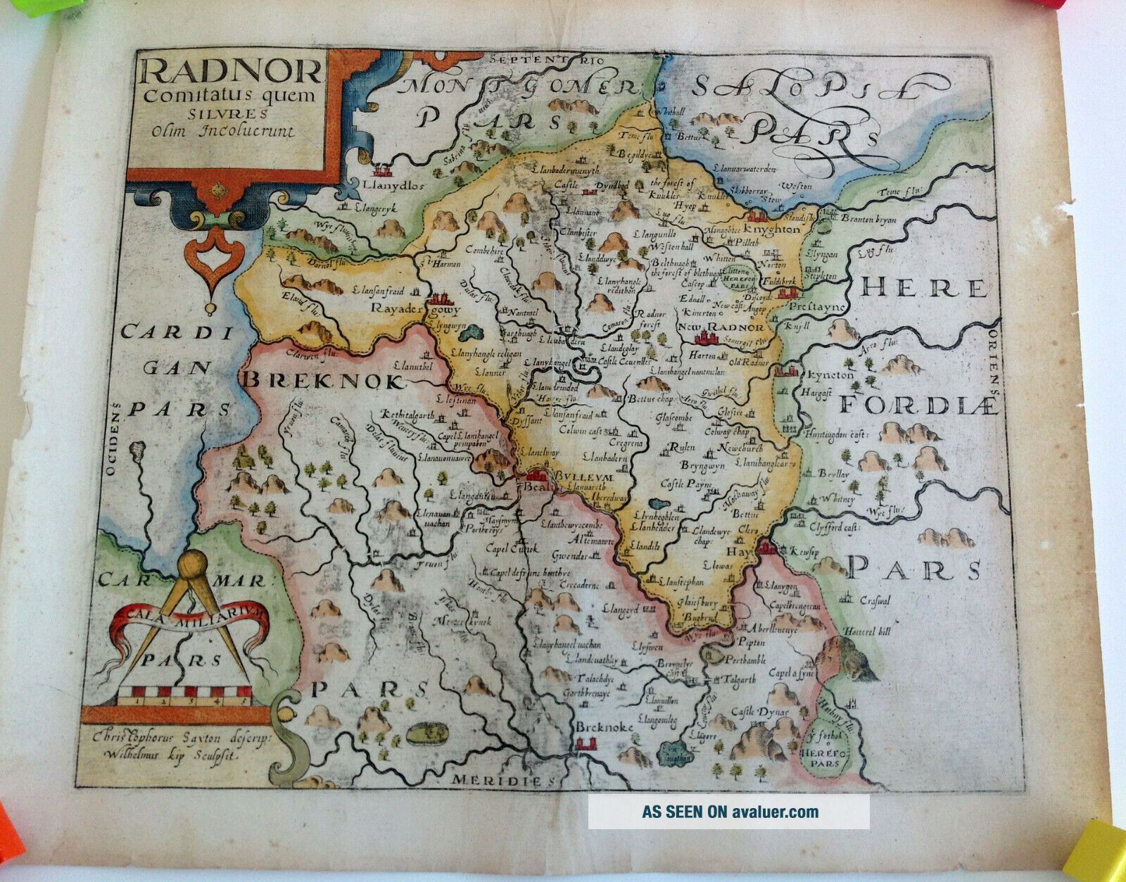
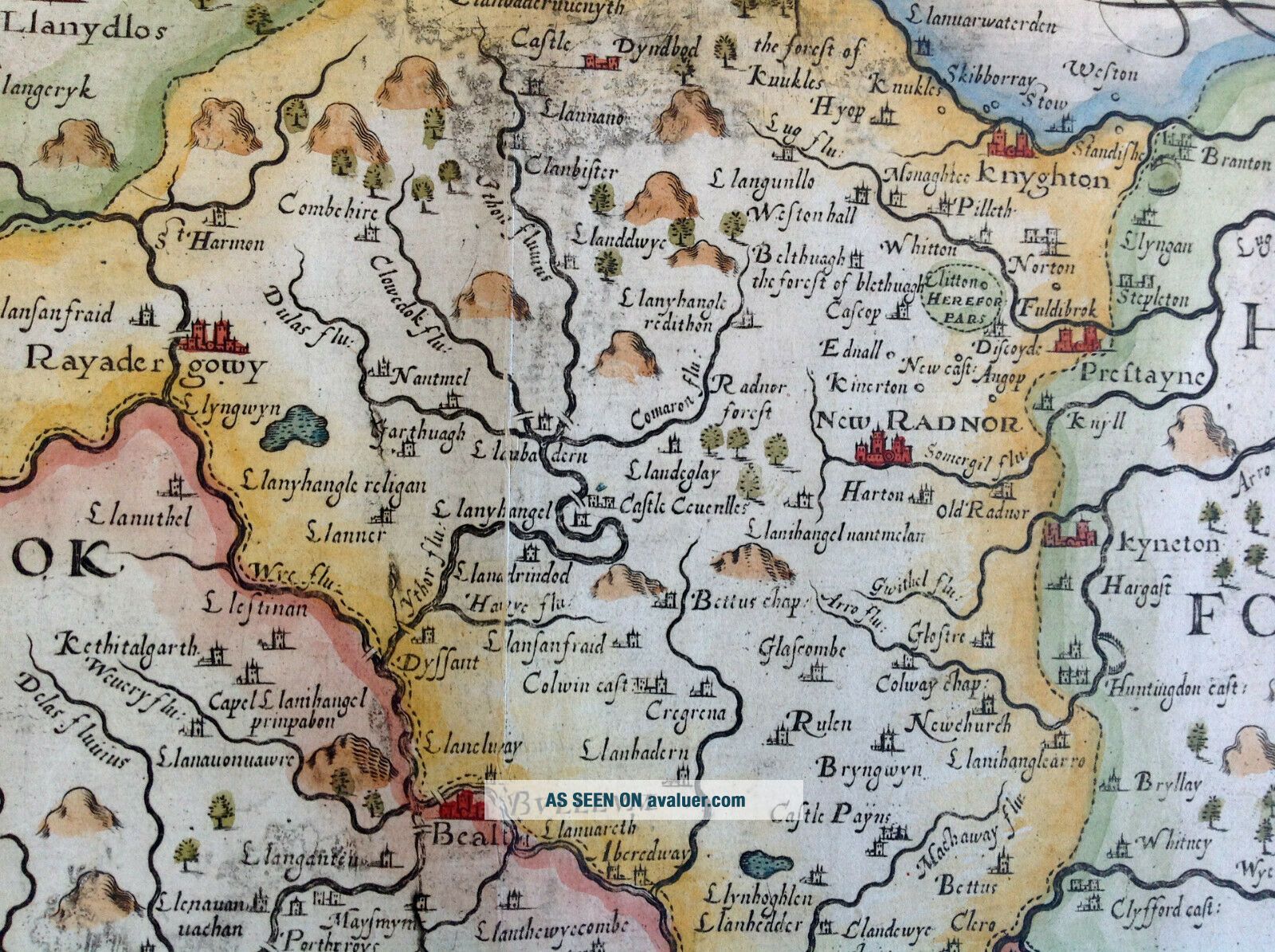
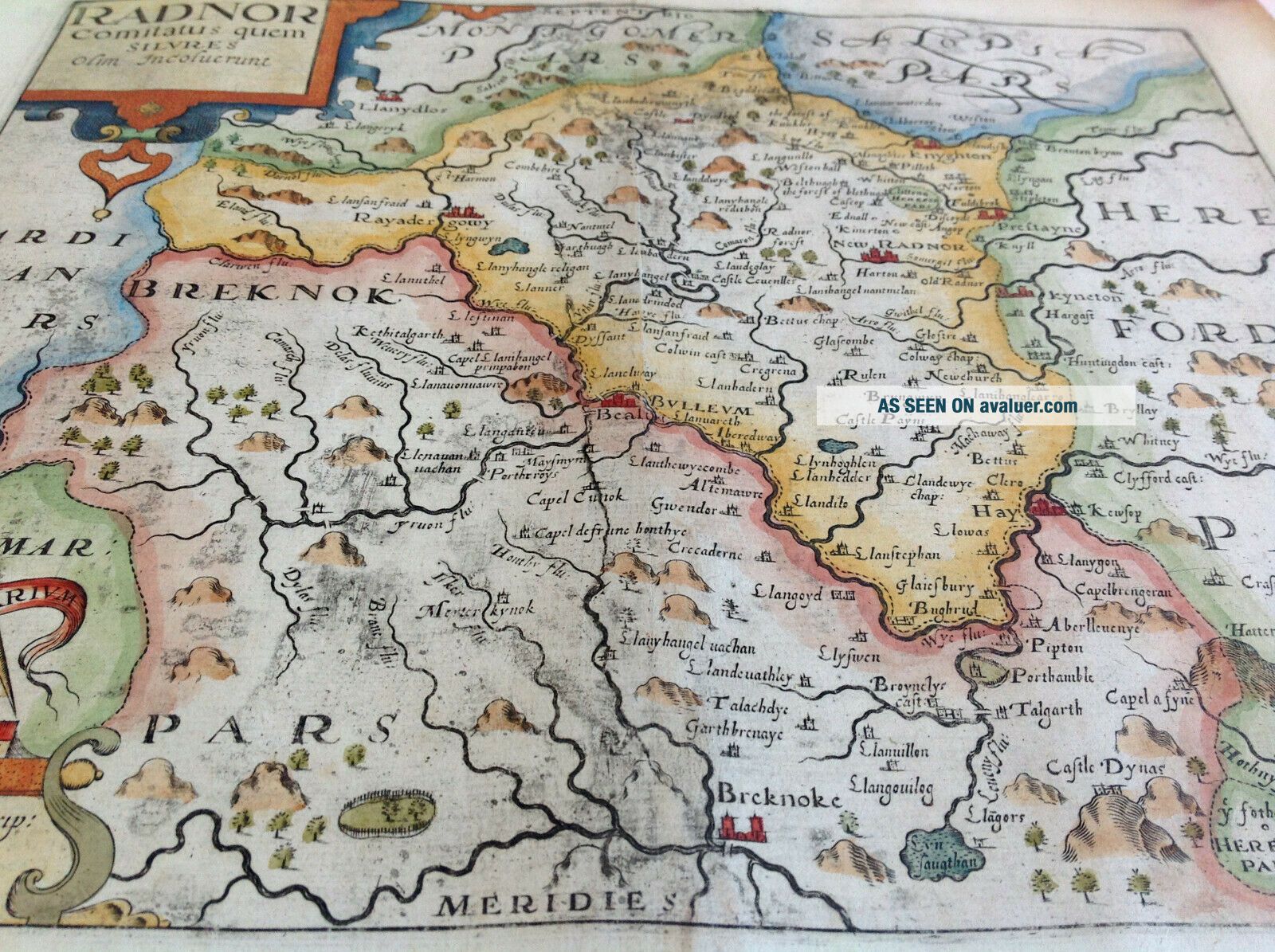
Beautiful hand coloured antique 17th Century copperplate map of the historic county of Radnorshire, Wales.
First published in the 1607 edition of Britannia by William Camden, that version had Latin text on the reverse. The map also appeared in the 1610 and 1637 editions, although these two versions appear to be identical, making it difficult to ascertain which edition this one is from.
The hand colouring has been added subsequent to its publication.
Cartographer: Christope...r Saxton.
Engraver: William Kip.
Date: circa 1610 or 1637
Condition: VERY GOOD. Map has a light vertical fold and has previously been stored rolled. A few small nicks in the edges and light creases around the fold. Some light discolouration, mostly around the border. Various other surface marks, although nothing particularly detrimental to the overall appearance. Some other small spots and light wear across the map and reverse.
Dimensions: 14 8/10" wide x 12 1/2" high (approximately)
Domestic (UK): Royal Mail Signed For
Worldwide: Royal Mail International Tracked and Signed
Buyers are responsible for any local sales taxes, customs charges, import taxes and any other associated fees that may apply.
A signature will be required on delivery.