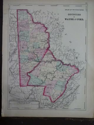
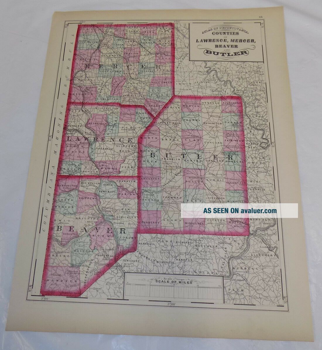
1872 Antique COLOR Map///COUNTIES OF LAWRENCE, MERCER, BEAVER & BUTLER, PA


Item History & Price

Information:
Reference Number: Avaluer:3799937Original/Reproduction: Original
Features: AntiqueYear: 1872
Topic: AntiquesUS State: Pennsylvania
Original Description:


THIS ITEM IS A GENUINE ORIGINAL VINTAGE MAP

FROM THE SOURCE/DATE LISTED
    
Name - Counties of Lawrence, Mercer, Beaver, and Butler, PA

Date - 1872
Source - Atlas of Pennsylvania, hand-colored
Size - about 13x17.25"

Condition - Very Nice

  Yes!! We Do Combine Shipping on Multiple Purchases!!
Payment due within 14 days after our initial after auction contact.
Pennsylvania residents MUST add appl...icable SALES TAX
or send resale number.

Thanks.

Good Luck! To See Our Other Auctions and Store Items CLICK HERE!  


    Similar items


  • Antique Colored Map - Plan Of Kittery,  Maine - / Atlas York County,  Me - 1872

    Antique Colored Map - Plan Of Kittery, Maine - / Atlas York County, Me - 1872

  • 1774 Antique Color Map//coast Of Africa From Sierra Leone River To Cape Negro

    1774 Antique Color Map//coast Of Africa From Sierra Leone River To Cape Negro

  • Antique Colored Map - Plan Of Cheltenham - Lithograph - C1875

    Antique Colored Map - Plan Of Cheltenham - Lithograph - C1875

  • Antique Color Map : Environs Of London : Streets Findlay Muirhead 1930

    Antique Color Map : Environs Of London : Streets Findlay Muirhead 1930

  • Antique Colored Map - Plan Of Glasgow - Lithograph - C1875

    Antique Colored Map - Plan Of Glasgow - Lithograph - C1875

  • Antique Color Map - Plan Of Sevilla,  Spain - Karl Baedeker - 1913 Rare

    Antique Color Map - Plan Of Sevilla, Spain - Karl Baedeker - 1913 Rare

  • 1893 Antique Color Map Chart Of The World On Mercator

    1893 Antique Color Map Chart Of The World On Mercator ' S Projection

  • 1872 Hand - Colored Map Of Pa/counties Of Wayne And Pike.

    1872 Hand - Colored Map Of Pa/counties Of Wayne And Pike.


    • You might also like


    • 1860 Mitchell Hand Colored Map Colorado,  Nebraska & Kansas - Civil War Era

      1860 Mitchell Hand Colored Map Colorado, Nebraska & Kansas - Civil War Era

    • 18th Century French Map Of North America

      18th Century French Map Of North America

    • Las Vegas Nevada Vintage 1967 Us Geological Survey Quadrangle Map 4 Panels

      Las Vegas Nevada Vintage 1967 Us Geological Survey Quadrangle Map 4 Panels

    • Rare Antique 1845 Maps United States Exploring Expedition Book Antartica Hawaii

      Rare Antique 1845 Maps United States Exploring Expedition Book Antartica Hawaii

    • Vintage 1926 Map Hollywood From The Best Surveys Of The Time

      Vintage 1926 Map Hollywood From The Best Surveys Of The Time

    • American Continent (western Hemisphere) 1747 Bowen Antique Copper Engraved Map

      American Continent (western Hemisphere) 1747 Bowen Antique Copper Engraved Map

    • Gulf Coast Florida Texas United States 1705 De Fer Unusual Antique Engraved Map

      Gulf Coast Florida Texas United States 1705 De Fer Unusual Antique Engraved Map

    • California As Island United States 1700 De Fer Unusual First Edition Antique Map

      California As Island United States 1700 De Fer Unusual First Edition Antique Map

Avaluer          About Us          Privacy Policy          Contact Us          UP
© 2022, avaluer.net, Inc. or its affiliates