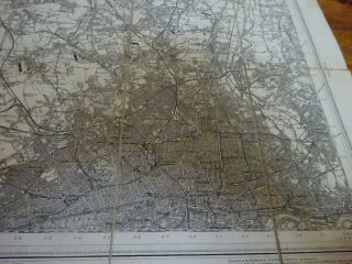
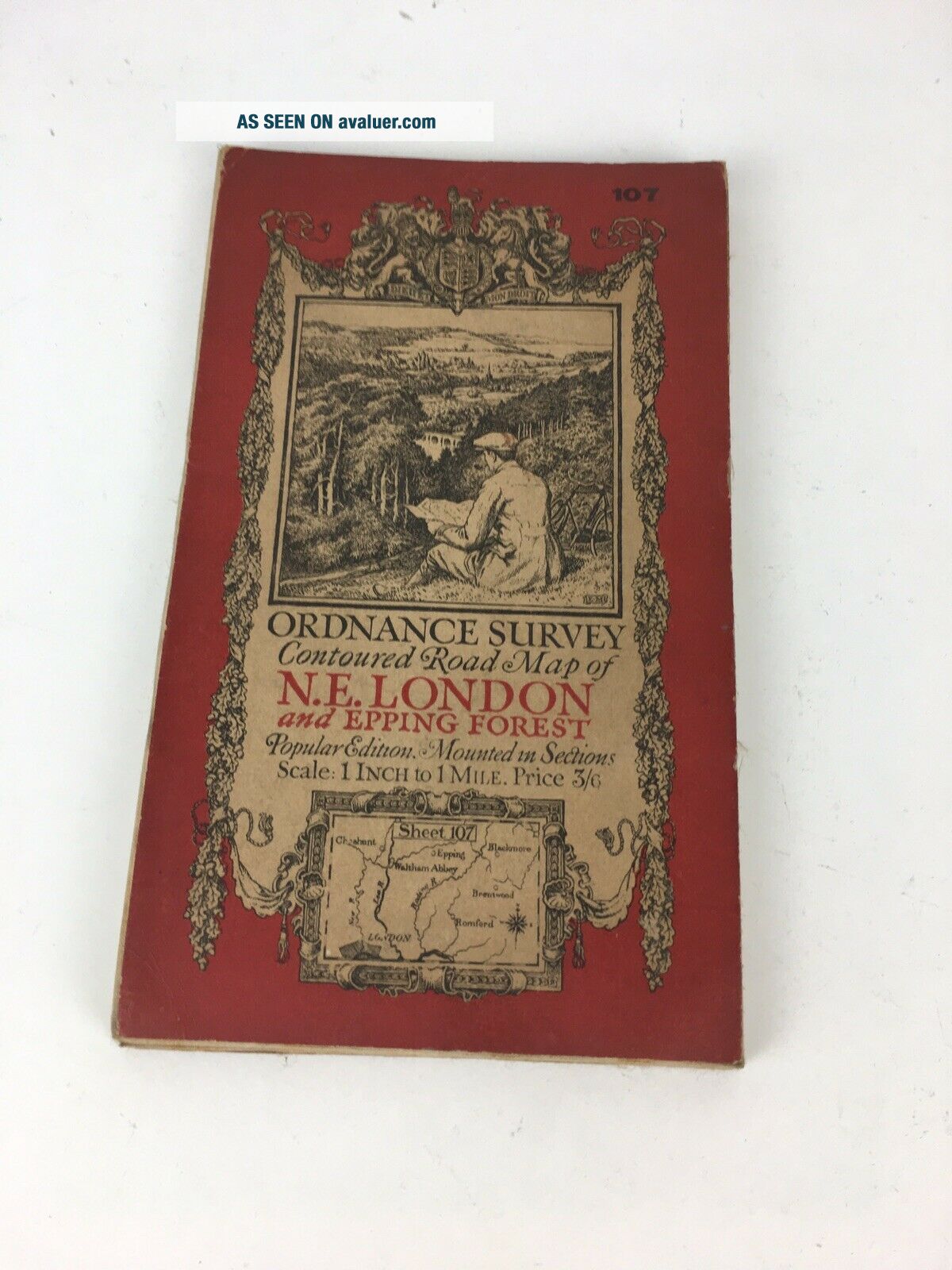
Vintage Cloth Ordnance Survey Map Of North East London & Epping Forest


Item History & Price

Information:
Reference Number: Avaluer:4106119
Original Description:
Vintage Cloth Ordnance Survey Map of North East London & Epping Forest.
Dispatched with Royal Mail 2nd Class Large Letter.


    Similar items


  • Vintage Cloth Ordnance Survey Map Of North London

    Vintage Cloth Ordnance Survey Map Of North London

  • Vintage Cloth Ordnance Survey Map Of North Wales

    Vintage Cloth Ordnance Survey Map Of North Wales

  • Vintage Cloth Ordnance Survey Map Of North Scotland

    Vintage Cloth Ordnance Survey Map Of North Scotland

  • Vintage Cloth Ordnance Survey Map Of North West England Inc Leeds Scarborough

    Vintage Cloth Ordnance Survey Map Of North West England Inc Leeds Scarborough

  • Vintage Cloth Ordnance Survey Map Of North Mayo Ireland 1914

    Vintage Cloth Ordnance Survey Map Of North Mayo Ireland 1914

  • Vintage Cloth Ordnance Survey Map Of Belfast And North East Ireland

    Vintage Cloth Ordnance Survey Map Of Belfast And North East Ireland

  • Vintage Ordnance Survey Map Of North East England (1946) Bradford,  Whitby York

    Vintage Ordnance Survey Map Of North East England (1946) Bradford, Whitby York

  • Vintage Sifting Praed Cloth Ordnance Survey Map Of South East London To Gravesen

    Vintage Sifting Praed Cloth Ordnance Survey Map Of South East London To Gravesen


    • You might also like


    • Hungary & Romania 1579 (1584) Ortelius Unusual Antique Copper Engraved Map

      Hungary & Romania 1579 (1584) Ortelius Unusual Antique Copper Engraved Map

    • Brussels Bruxelles Belfium 1777 De Ferraris & Dupuis Large Antique Map Sheet Xxi

      Brussels Bruxelles Belfium 1777 De Ferraris & Dupuis Large Antique Map Sheet Xxi

    • 1616 Atlas Map Of Iceland.

      1616 Atlas Map Of Iceland.

    • Kazan Russia 1767 Le Clerc/lespinasse Antique Copper Engraved City View

      Kazan Russia 1767 Le Clerc/lespinasse Antique Copper Engraved City View

    • 1899 Stanford,  Folding Map Of Norwich,  Norfolk,  Arthur Collins,  Jarrold & Sons,

      1899 Stanford, Folding Map Of Norwich, Norfolk, Arthur Collins, Jarrold & Sons,

    • 1948 Vintage Linen Colour Map Geological Survey Ten Mile Of Great Britain

      1948 Vintage Linen Colour Map Geological Survey Ten Mile Of Great Britain

    • 1944 Map Flying Bombs Sussex Ww2 Newspaper Military Kent Courier German V1 V2

      1944 Map Flying Bombs Sussex Ww2 Newspaper Military Kent Courier German V1 V2

    • Dated 1638 Vellum Map Of Icklesham Sussex Showing Land Uses Owners Etc

      Dated 1638 Vellum Map Of Icklesham Sussex Showing Land Uses Owners Etc

Avaluer          About Us          Privacy Policy          Contact Us          UP
© 2022, avaluer.net, Inc. or its affiliates