Robert E. Lee ' S St. Louis Harbor Map Of 1837. Plus1838 Diagram Map Of Mo.


Item History & Price
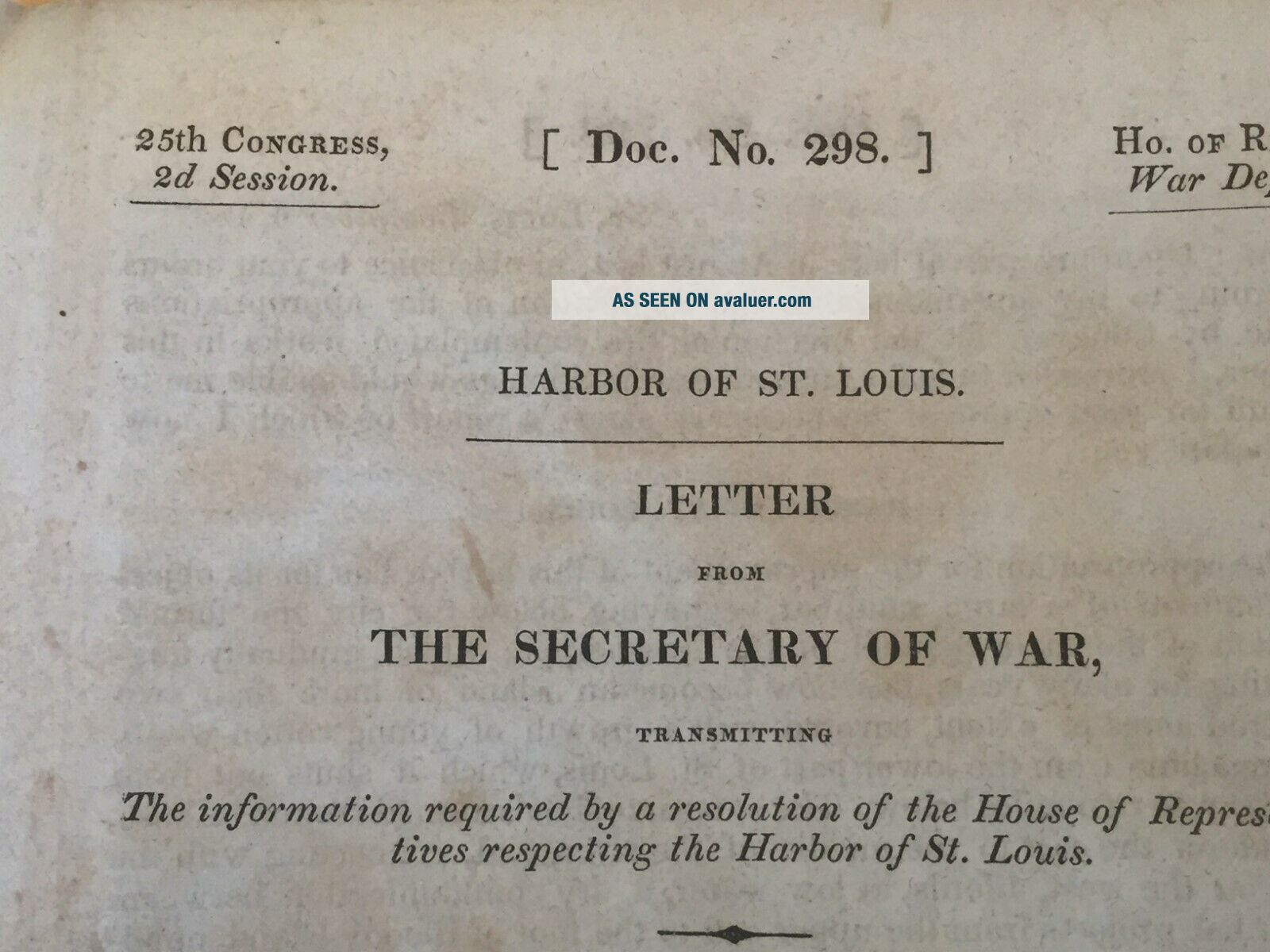
Information:
Reference Number: Avaluer:41873Year: 1837
US State: MissouriCartographer/Publisher: Congress
City: St. LouisOriginal/Reproduction: Antique Original
Original Description:
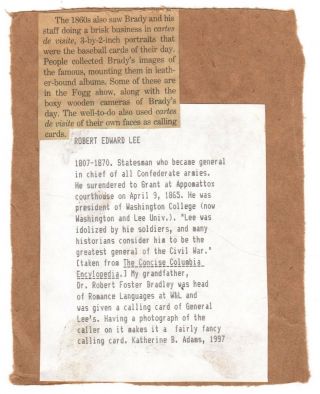
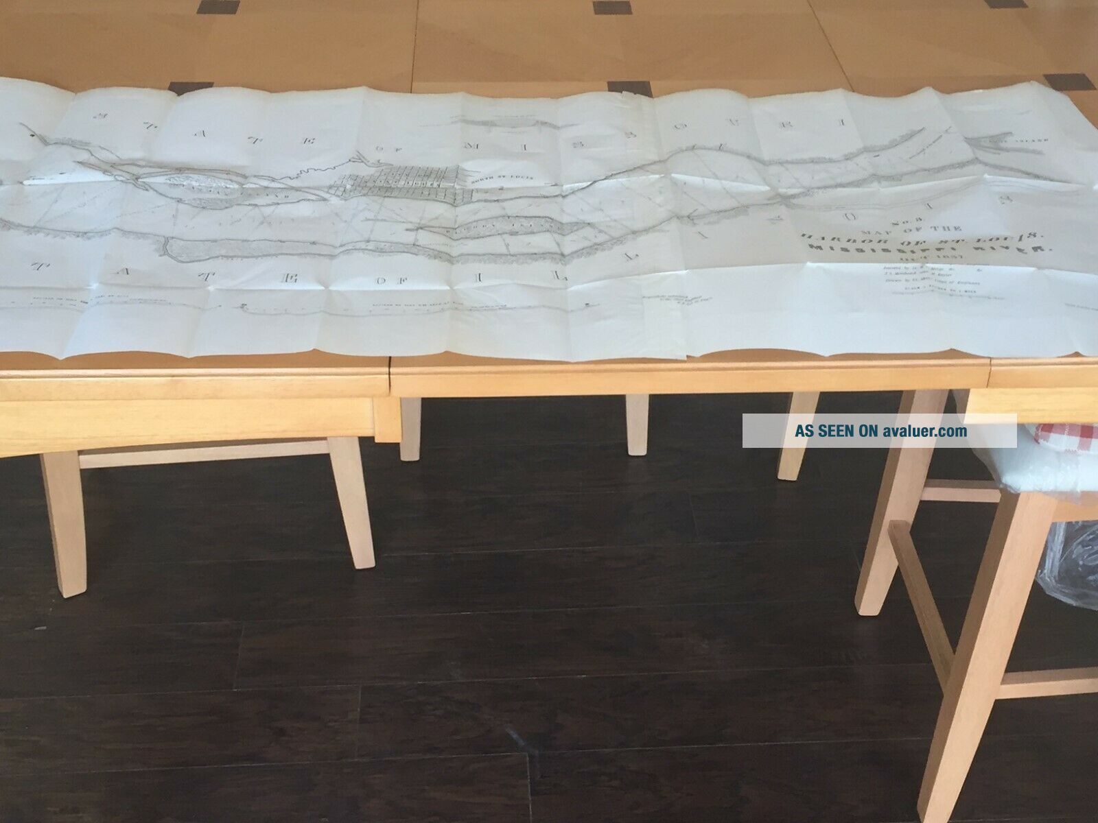
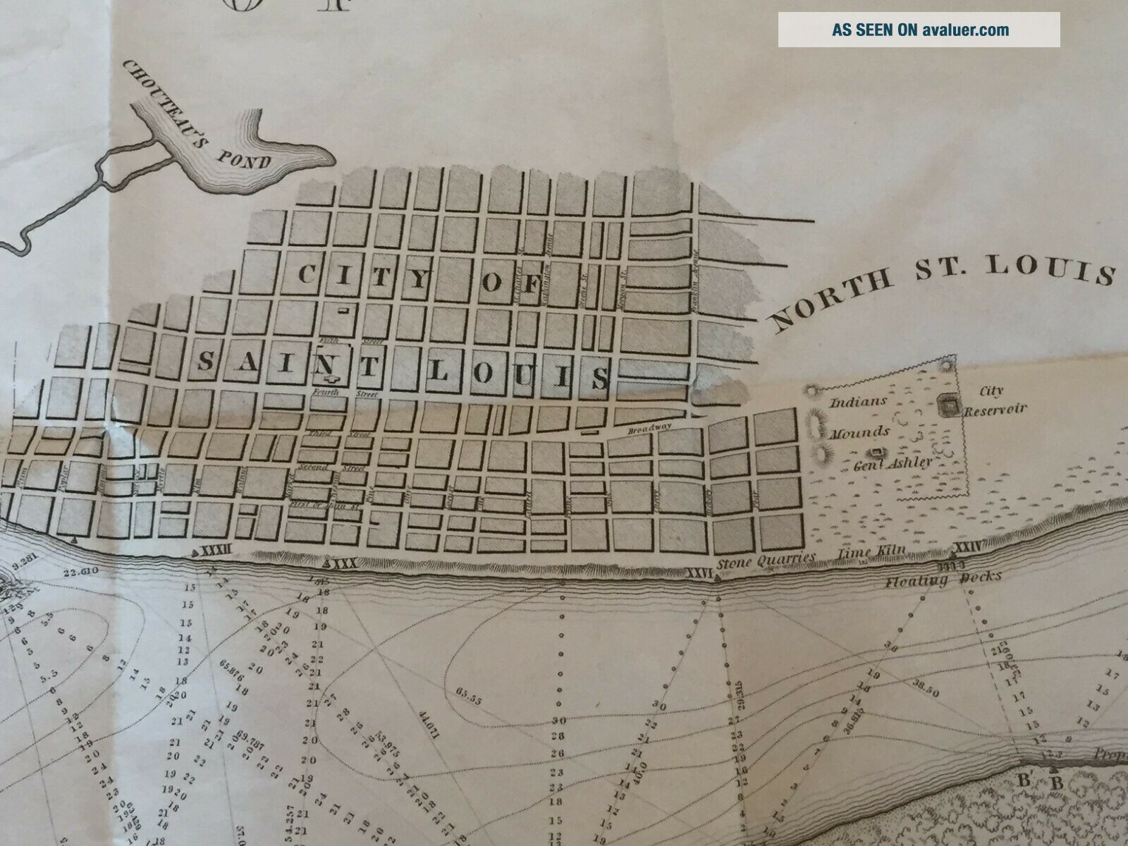
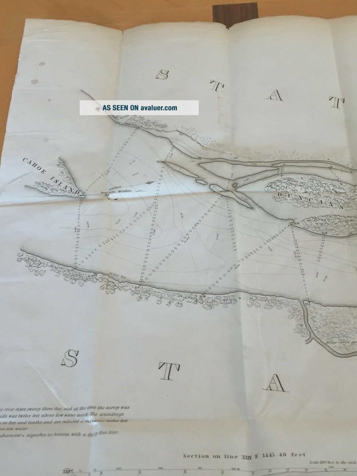
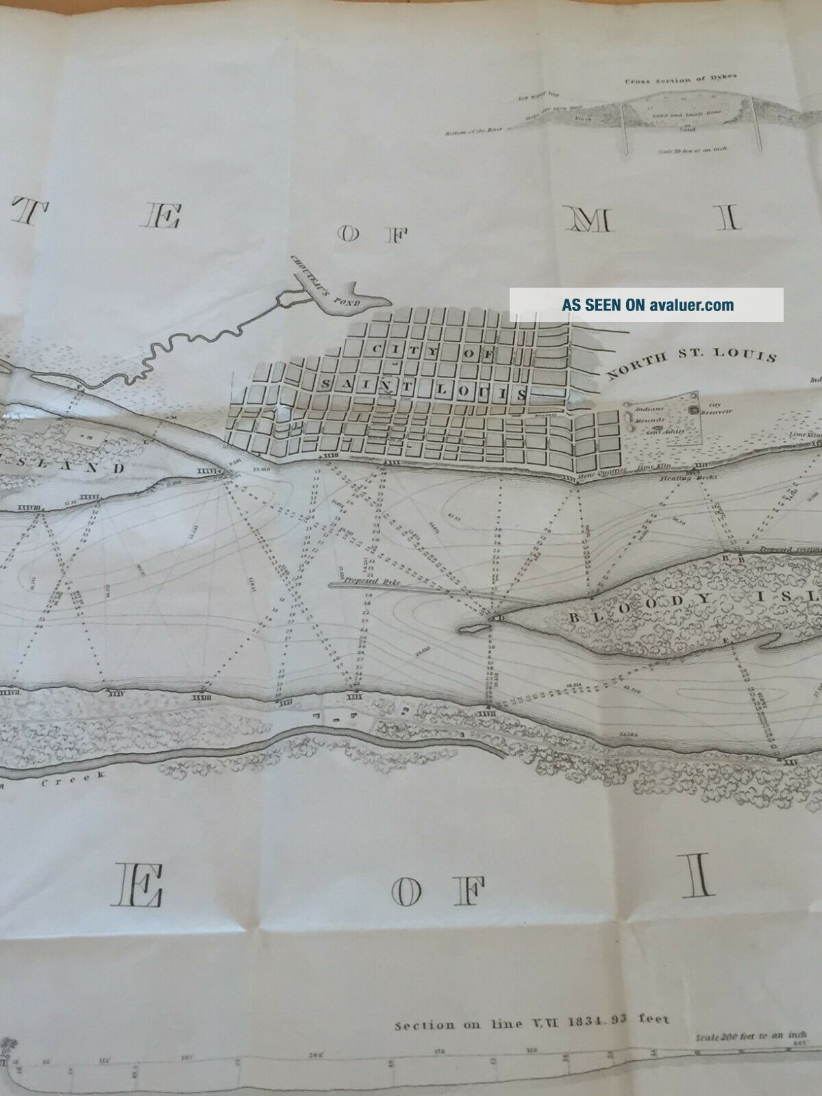
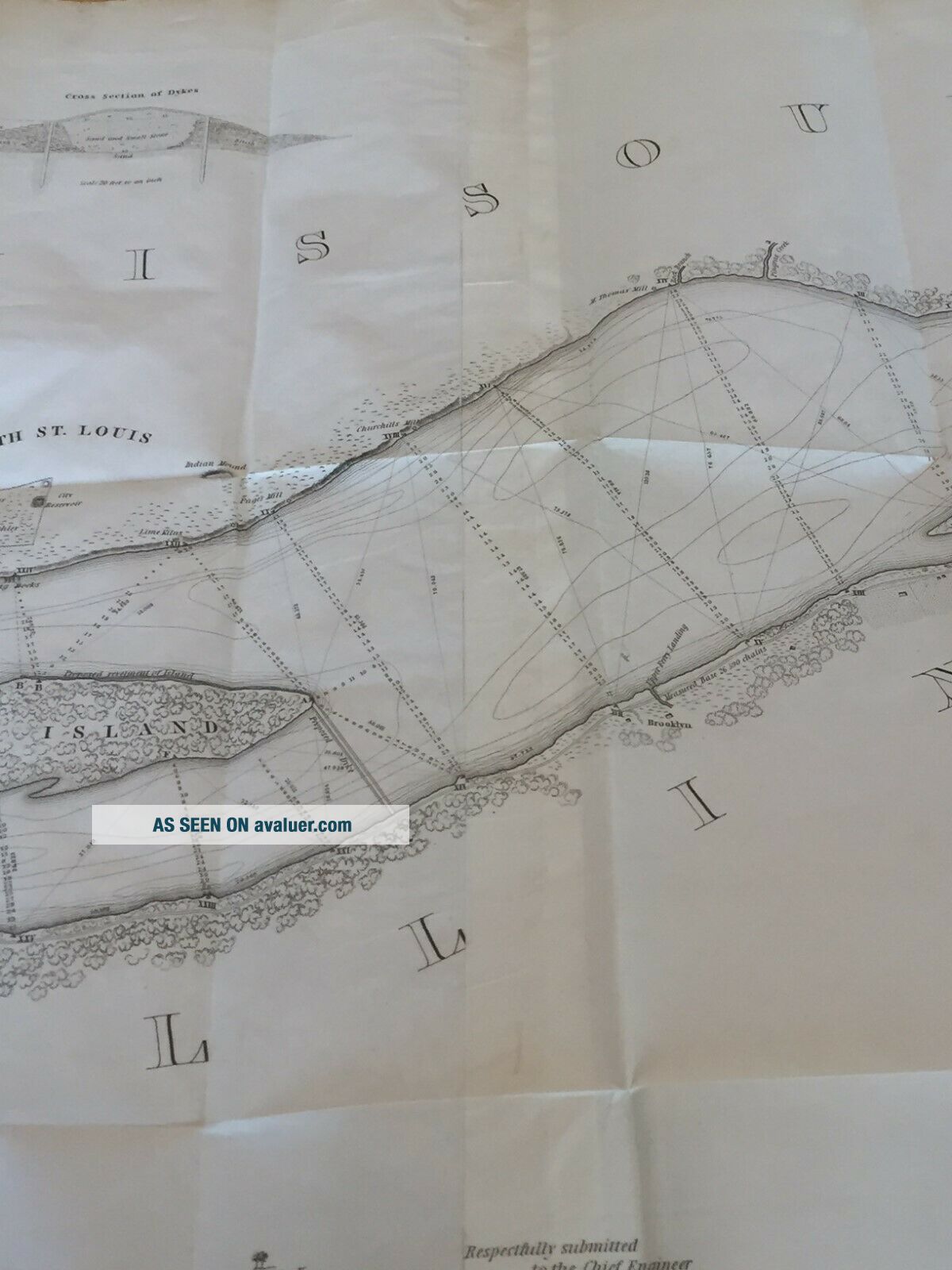
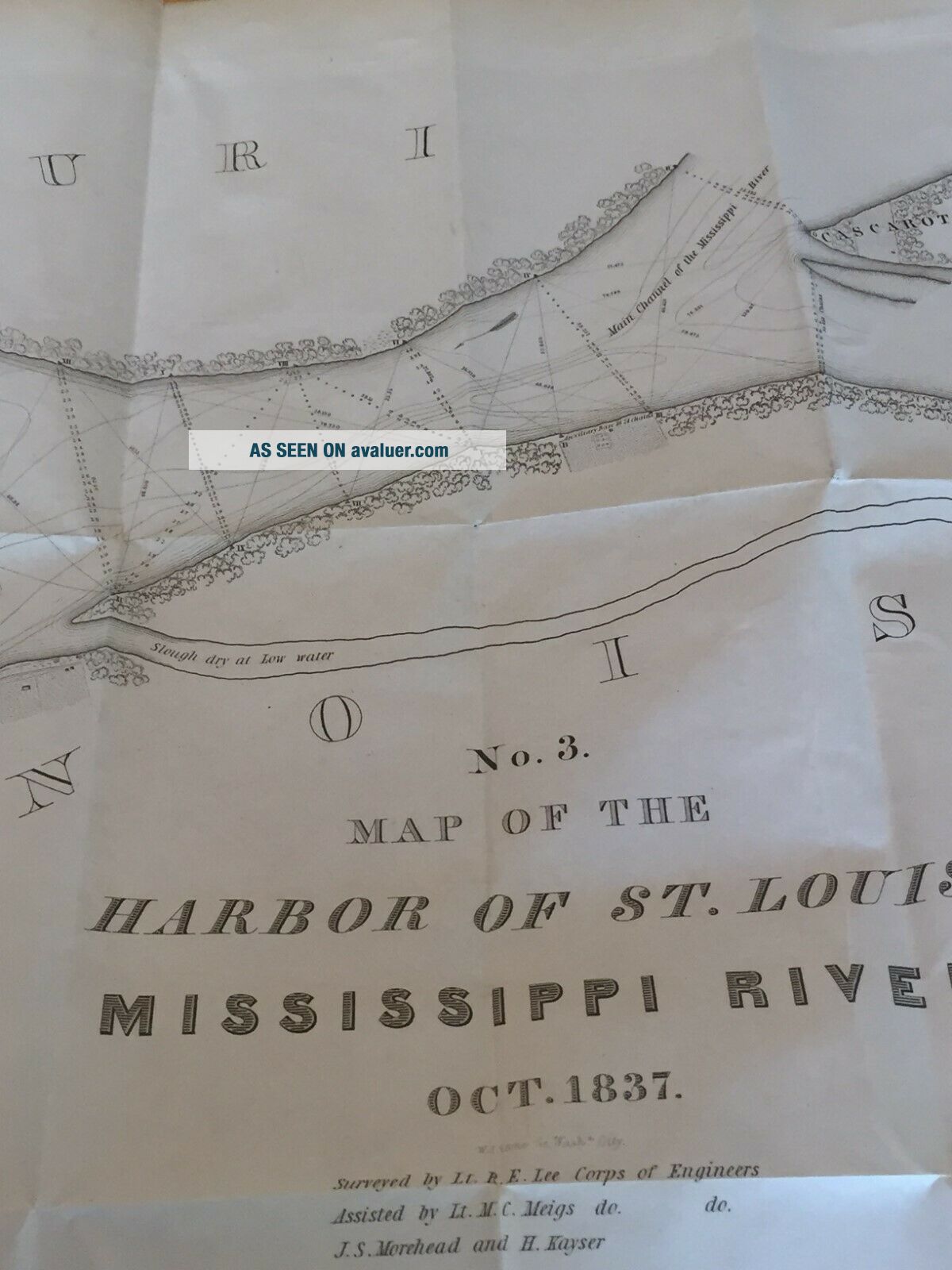
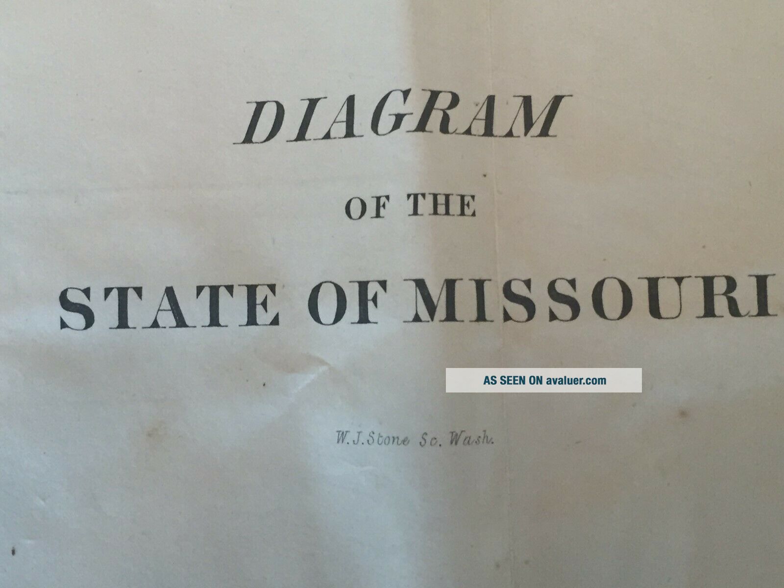
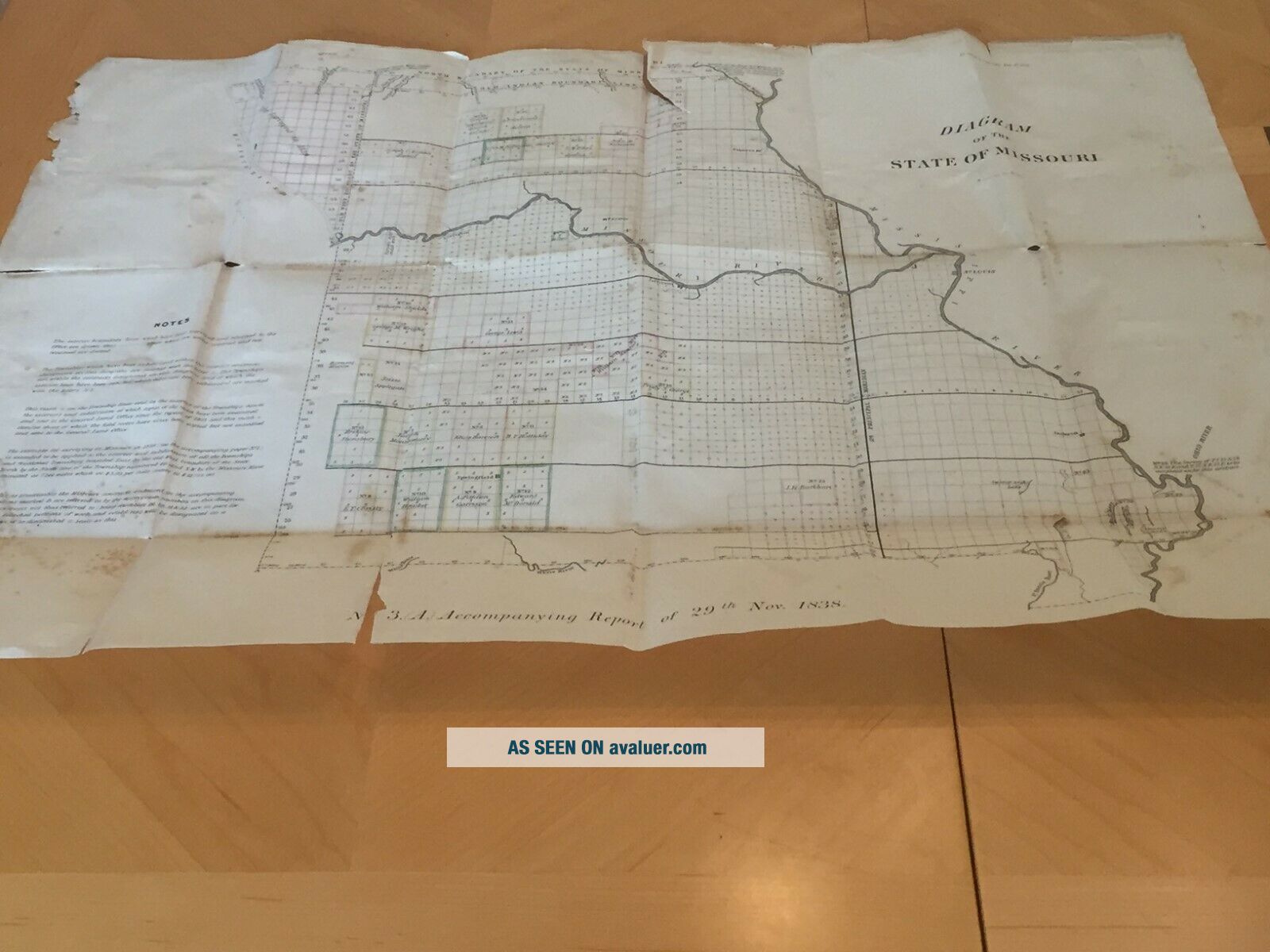
Robert E. Lee's St. Louis Harbor map of 1837. Plus1838 Diagram map of Mo.. Shipped with USPS First Class Package. Somewhat rare engraved map, on two sheets joined together, 42.5 x 16.5. One of the maps Lee produced of the Mississippi river for Congress in 1837. Lee was directed by the 25th Congress, 2n Session, Senate Doc. # 139. Portion of the original Congressional record calling for the map is included. The folds in the map is how the map was folded to fit into the Congressional rec...ord. The map show the area of the river from Cahoe Island in the south to Cascarot Island in the north. The map includes the harbor, dykes, street plat of the City of St. Louis with individual buildings stores and some family names. Also included is an 1838 Diagram map of the state of Missouri with Indian lands and owners listed, also commission by Congress and the original Congressional record entry is also included. It is a wonderful map I have had it for 45 years time for a new home. Please any questions just email me


    Similar items


  • 1950

    1950 ' S Anheuser - Busch Budweiser Beer Robert E Lee Steamboat St Louis Levee

  • Significant Lock Of Robert E.  Lee

    Significant Lock Of Robert E. Lee ' S Hair - From Washington & Lee Department Head

  • Wood From General Robert E.  Lee

    Wood From General Robert E. Lee ' S Headquarters Gettysburg, Pa

  • Gettysburg Battlefield Witness Wood From General Robert E.  Lee

    Gettysburg Battlefield Witness Wood From General Robert E. Lee ' S Hq ' S

  • Robert E Lee

    Robert E Lee ' S Surrender To Ulysses S Grant 10in Collector ' S Plate

  • Stereoview Card - 1903 General Robert E Lee

    Stereoview Card - 1903 General Robert E Lee ' S Home, Arlington, Virginia

  • Set 3 Robert E Lee

    Set 3 Robert E Lee ' S Lieutenants, Douglas Southall Freeman: Civil War 1970 Hc/dj

  • Set 3 Robert E Lee

    Set 3 Robert E Lee ' S Lieutenants, Douglas Southall Freeman: Civil War 1970 Hc/dj


    • You might also like


    • 1860 Mitchell Hand Colored Map Colorado,  Nebraska & Kansas - Civil War Era

      1860 Mitchell Hand Colored Map Colorado, Nebraska & Kansas - Civil War Era

    • 18th Century French Map Of North America

      18th Century French Map Of North America

    • Las Vegas Nevada Vintage 1967 Us Geological Survey Quadrangle Map 4 Panels

      Las Vegas Nevada Vintage 1967 Us Geological Survey Quadrangle Map 4 Panels

    • Rare Antique 1845 Maps United States Exploring Expedition Book Antartica Hawaii

      Rare Antique 1845 Maps United States Exploring Expedition Book Antartica Hawaii

    • Vintage 1926 Map Hollywood From The Best Surveys Of The Time

      Vintage 1926 Map Hollywood From The Best Surveys Of The Time

    • American Continent (western Hemisphere) 1747 Bowen Antique Copper Engraved Map

      American Continent (western Hemisphere) 1747 Bowen Antique Copper Engraved Map

    • Gulf Coast Florida Texas United States 1705 De Fer Unusual Antique Engraved Map

      Gulf Coast Florida Texas United States 1705 De Fer Unusual Antique Engraved Map

    • California As Island United States 1700 De Fer Unusual First Edition Antique Map

      California As Island United States 1700 De Fer Unusual First Edition Antique Map

Avaluer          About Us          Privacy Policy          Contact Us          UP
© 2022, avaluer.net, Inc. or its affiliates