WALES Montgomery/ Saxton, Kip Antique Map 1607 - 1610
Item History & Price
| Reference Number: Avaluer:42224 | Type: Antique |
| Date Range: 1607-1610 | Medium: Etching/ Engraving |
| Country/Region: Wales | Original/ Repro: Original |
WALES Montgomery/ Saxton+ Kip Original Antique Map 1607-1610
Genuine OriginalAntique or Collectable from heatons-of-tisbury.co.uk
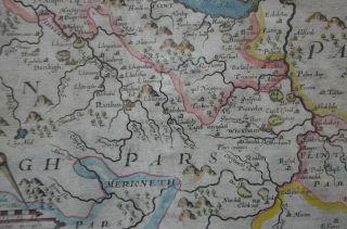
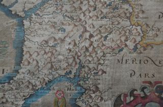
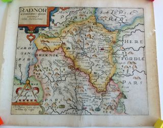
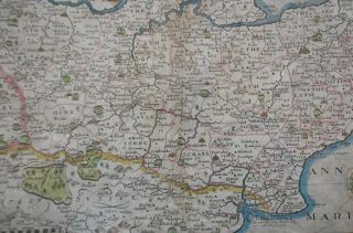
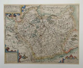
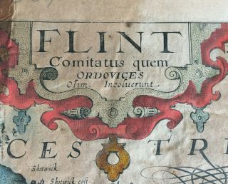
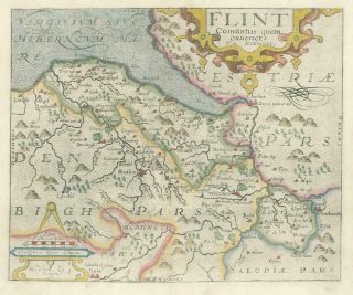
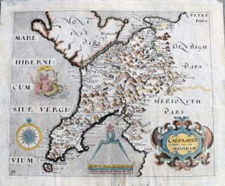
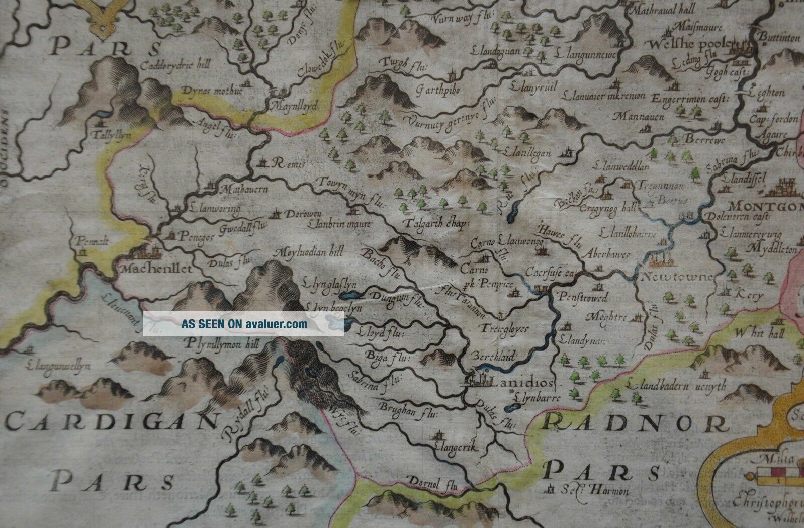
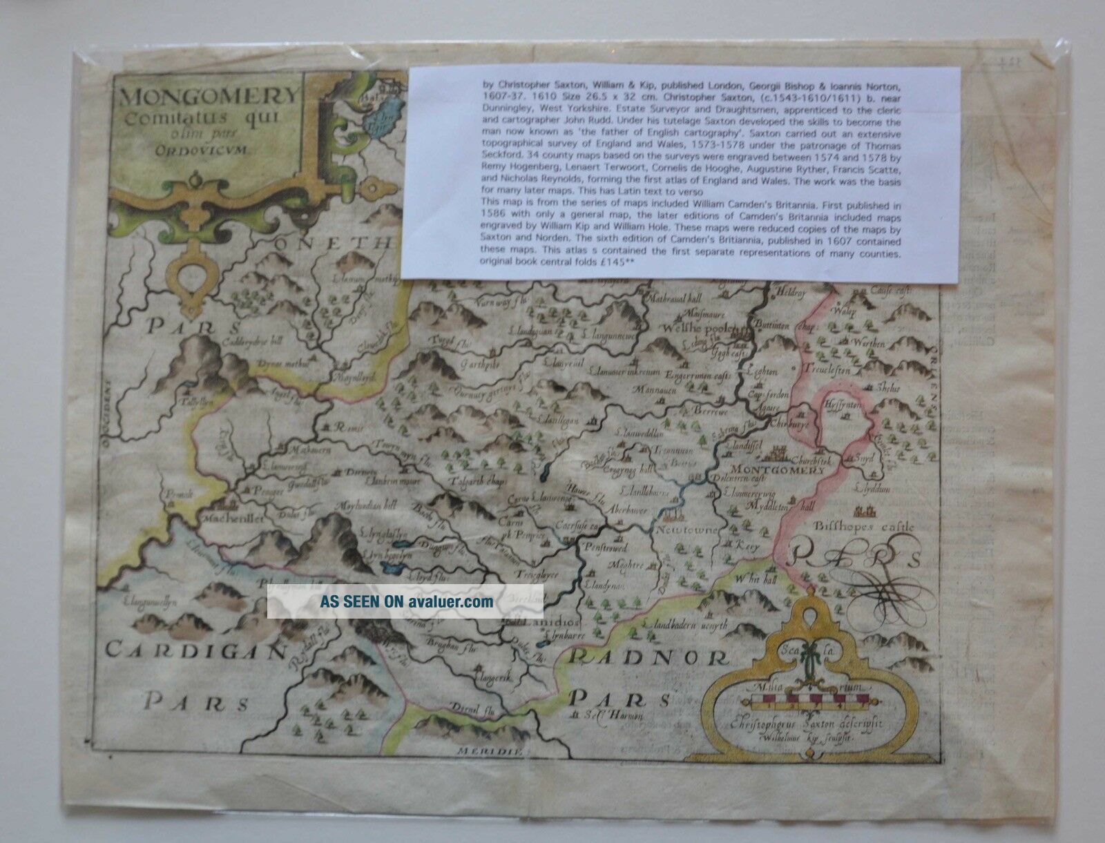
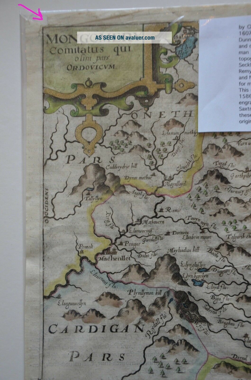
Available for sale is an Antique hand coloured engraved map entitled Montgomery comitatus quei olim. . ... Published London, Georgii Bishop & Ioannis Norton, 1607-10. Size 265 x 310mm (10½ x 12¼ inches) . A map of the county from the first English edition of the 'Britannia', translated by Philémon Holland. Engraved by Robert Vaughan..., from the Christopher Saxton survey of 1578, this example is one of the earliest separate printed maps of the county.CONDITION Small parts of loss near top corner but scarcer county Good margins . Sale item as sorting shelves They are all as per image in both age and condition I do not sell copies and include flat UK postage for all larger and earlier items google heatons-of-tisbury/ hence rosatheatons. Items will also be available at the shop and may be removed without notice if sold there. eBay also now sees less that 5 stars as a failure on businesses and financially penalises us. Extra Photographs on request please send a direct email as the new ebay system does not always forward them but does compress them to add their logo ! . . . email address below in business information.Terms & Conditions. . the boring bits Postage..... I will fit in with specific requests . Some special sized items occasionally take a few days to pack and find best option as often cheaper if consignment is split especially if over 2kg as the cost triples. . . If an item is wrong it can be returned for a refund before feedback is left. ** Phone number is requested on paypal as if sending via courier you are then informed by UPS rather than a horrid note saying in barn etc for larger items** Payment /Contact.......Payment from outside the UK - I accept PAYPAL Payments in Pounds Sterling / Euro's also cheques in sterling, euro's etc I can accept credit cards by phone direct from the shop (Mon/Fri & Sat) Packing . I do pack well. I do not email every five minutes to say going to post etc All our items are vintage / antiques correct to the dates indicated. I do not sell reprints or reproductions or hide behind pseudo names . Anything not sent Royal mail will come normally via UPS and never Yodel etc
Thank you for looking and good luck. Ros Cheques to Heatons if used _gsrx_vers_841 (GS 7.0.16 (841))
Genuine OriginalAntique or Collectable from heatons-of-tisbury.co.uk
Available for sale is an Antique hand coloured engraved map entitled Montgomery comitatus quei olim. . ... Published London, Georgii Bishop & Ioannis Norton, 1607-10. Size 265 x 310mm (10½ x 12¼ inches) . A map of the county from the first English edition of the 'Britannia', translated by Philémon Holland. Engraved by Robert Vaughan..., from the Christopher Saxton survey of 1578, this example is one of the earliest separate printed maps of the county.CONDITION Small parts of loss near top corner but scarcer county Good margins . Sale item as sorting shelves They are all as per image in both age and condition I do not sell copies and include flat UK postage for all larger and earlier items google heatons-of-tisbury/ hence rosatheatons. Items will also be available at the shop and may be removed without notice if sold there. eBay also now sees less that 5 stars as a failure on businesses and financially penalises us. Extra Photographs on request please send a direct email as the new ebay system does not always forward them but does compress them to add their logo ! . . . email address below in business information.Terms & Conditions. . the boring bits Postage..... I will fit in with specific requests . Some special sized items occasionally take a few days to pack and find best option as often cheaper if consignment is split especially if over 2kg as the cost triples. . . If an item is wrong it can be returned for a refund before feedback is left. ** Phone number is requested on paypal as if sending via courier you are then informed by UPS rather than a horrid note saying in barn etc for larger items** Payment /Contact.......Payment from outside the UK - I accept PAYPAL Payments in Pounds Sterling / Euro's also cheques in sterling, euro's etc I can accept credit cards by phone direct from the shop (Mon/Fri & Sat) Packing . I do pack well. I do not email every five minutes to say going to post etc All our items are vintage / antiques correct to the dates indicated. I do not sell reprints or reproductions or hide behind pseudo names . Anything not sent Royal mail will come normally via UPS and never Yodel etc
Thank you for looking and good luck. Ros Cheques to Heatons if used _gsrx_vers_841 (GS 7.0.16 (841))