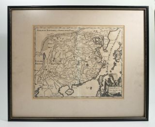
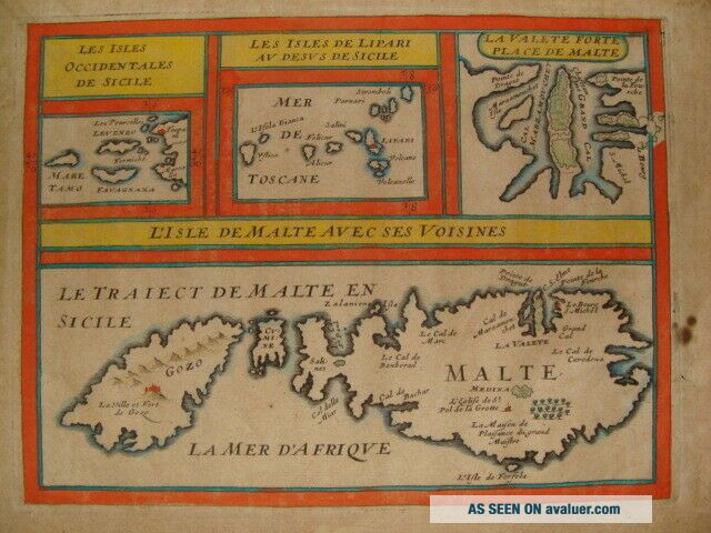
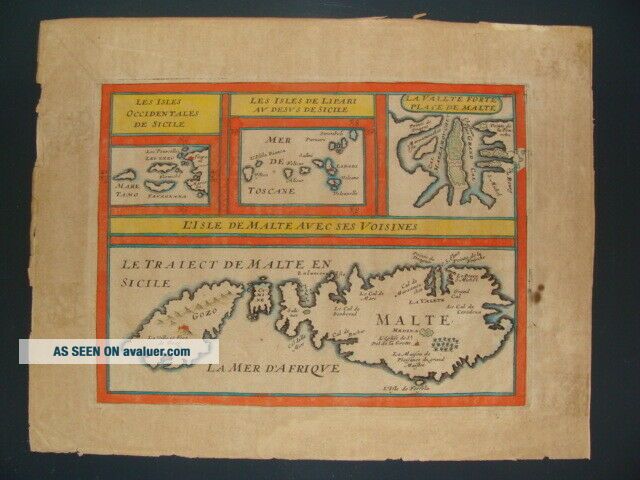
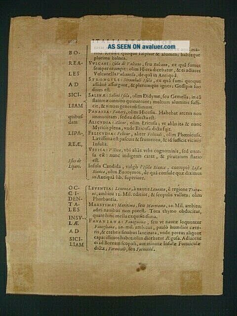
MALTA MAP By PHILIPPE BRIET 1649


Item History & Price

Information:
Reference Number: Avaluer:43536Cartographer/Publisher: Briet
Year: 1649Original/Reproduction: Antique Original
Country/Region: Malta
Original Description:
MALTA MAP by PHILIPPEBRIET 1649
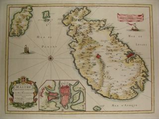
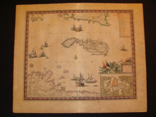
Avery interesting coloured copper engraved map of theIsland of Malta published 1649 in Parisby Philippe Briet (1601 – 1668).Agetoned paper; irregular margins; traces of previous framing on therear; otherwise good condition on watermarked paper.
Size:25cm x 19, 5cm margin included
Ifyou have any questions please send me a mail even if it is in German, French or Italian. Thanks for looking and bid with confidence. Ifully guarantee th...e authenticity of all my offerings. I do NOT sellreproductions of any kind.
Winningbidder to pay via PayPal within 7 days of auction end. 15$ registered shipping charges worldwide.


    Similar items


  • Malta Map By P.  Du Val 1677

    Malta Map By P. Du Val 1677

  • Malta Map By Frederik De Wit 1680

    Malta Map By Frederik De Wit 1680

  • Antique German 1600s Map By Philipp Cluver Celtic Tribes

    Antique German 1600s Map By Philipp Cluver Celtic Tribes

  • 1800 Malta Valletta City Plan Antique Map By John Stockdale 219 Years Old

    1800 Malta Valletta City Plan Antique Map By John Stockdale 219 Years Old

  • 100 Malta Gozo Valetta Map By J Walker C1835

    100 Malta Gozo Valetta Map By J Walker C1835

  • Rare Framed Antique Map Of China By Philipp Cluver Published 1697.

    Rare Framed Antique Map Of China By Philipp Cluver Published 1697.

  • 1926 Rulers Of The South Sicily Calabria Malta 2vols Illus Maps By Crawford

    1926 Rulers Of The South Sicily Calabria Malta 2vols Illus Maps By Crawford

  • 100 Malta Gibraltar Corfu Map By Tallis C1858 Vgc Colour

    100 Malta Gibraltar Corfu Map By Tallis C1858 Vgc Colour


    • You might also like


    • Hungary & Romania 1579 (1584) Ortelius Unusual Antique Copper Engraved Map

      Hungary & Romania 1579 (1584) Ortelius Unusual Antique Copper Engraved Map

    • Brussels Bruxelles Belfium 1777 De Ferraris & Dupuis Large Antique Map Sheet Xxi

      Brussels Bruxelles Belfium 1777 De Ferraris & Dupuis Large Antique Map Sheet Xxi

    • 1616 Atlas Map Of Iceland.

      1616 Atlas Map Of Iceland.

    • Kazan Russia 1767 Le Clerc/lespinasse Antique Copper Engraved City View

      Kazan Russia 1767 Le Clerc/lespinasse Antique Copper Engraved City View

    • 1899 Stanford,  Folding Map Of Norwich,  Norfolk,  Arthur Collins,  Jarrold & Sons,

      1899 Stanford, Folding Map Of Norwich, Norfolk, Arthur Collins, Jarrold & Sons,

    • 1948 Vintage Linen Colour Map Geological Survey Ten Mile Of Great Britain

      1948 Vintage Linen Colour Map Geological Survey Ten Mile Of Great Britain

    • 1944 Map Flying Bombs Sussex Ww2 Newspaper Military Kent Courier German V1 V2

      1944 Map Flying Bombs Sussex Ww2 Newspaper Military Kent Courier German V1 V2

    • Dated 1638 Vellum Map Of Icklesham Sussex Showing Land Uses Owners Etc

      Dated 1638 Vellum Map Of Icklesham Sussex Showing Land Uses Owners Etc

Avaluer          About Us          Privacy Policy          Contact Us          UP
© 2022, avaluer.net, Inc. or its affiliates