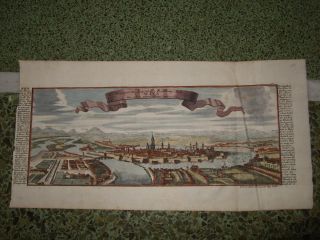
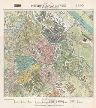
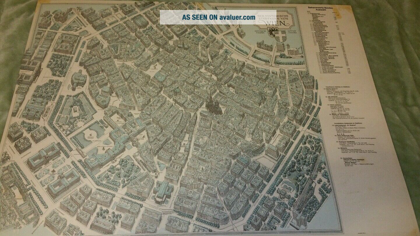
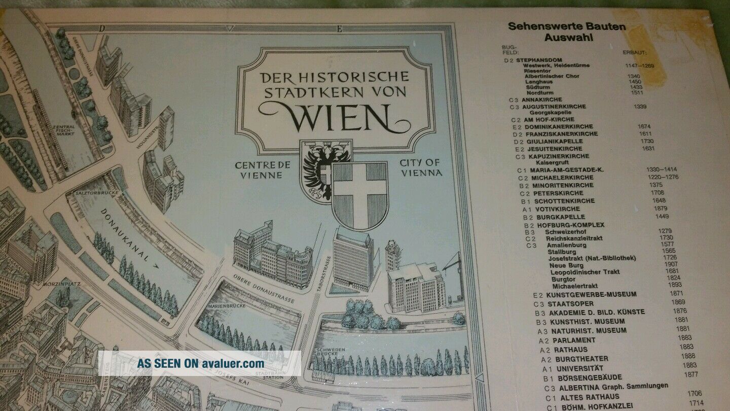
Vtg VIENNA 1924 Ludwig Austria Picture Map 3D Pictorial Cartoon Map Vienna Wien


Item History & Price

Information:
Reference Number: Avaluer:43747Type: City Map
Year: 1963City: Vienna
Country/Region: AustriaTopic: Maps
Format: Travel Map
Original Description:
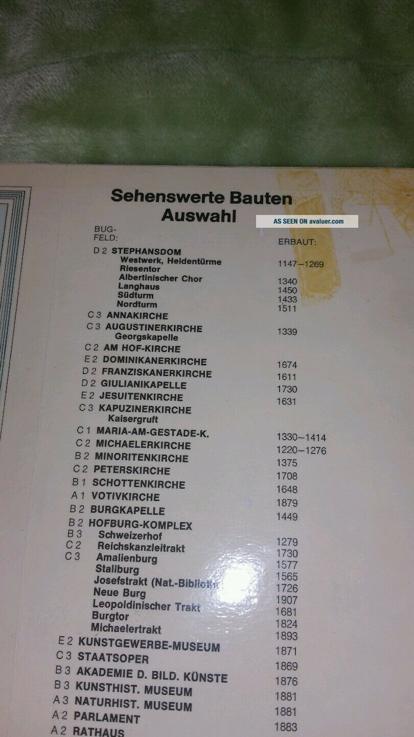
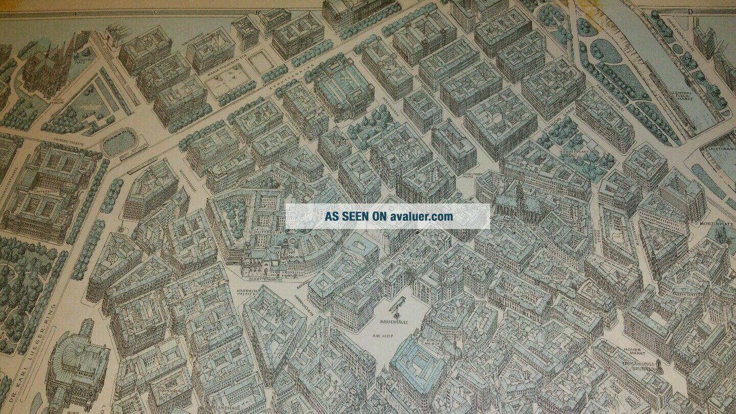
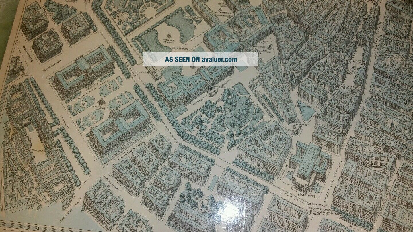
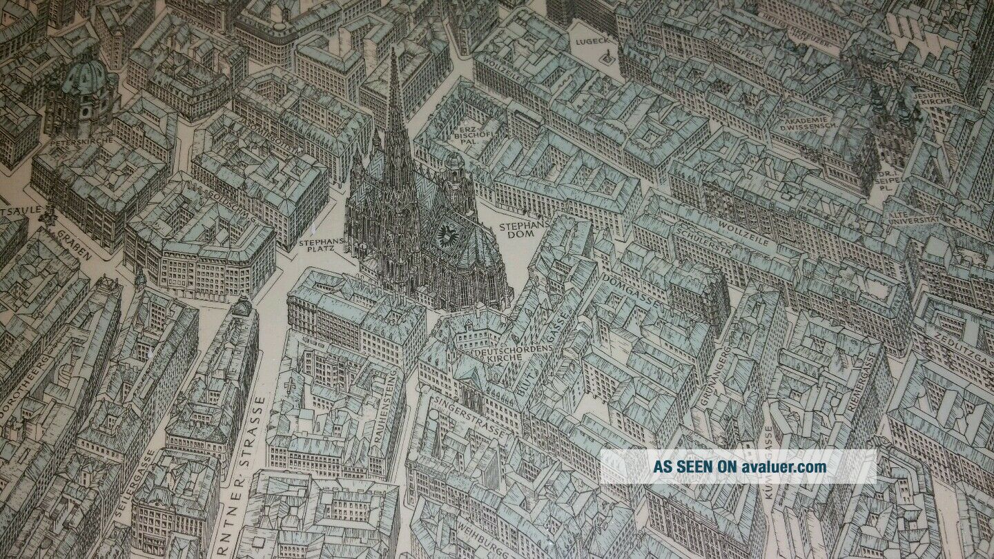
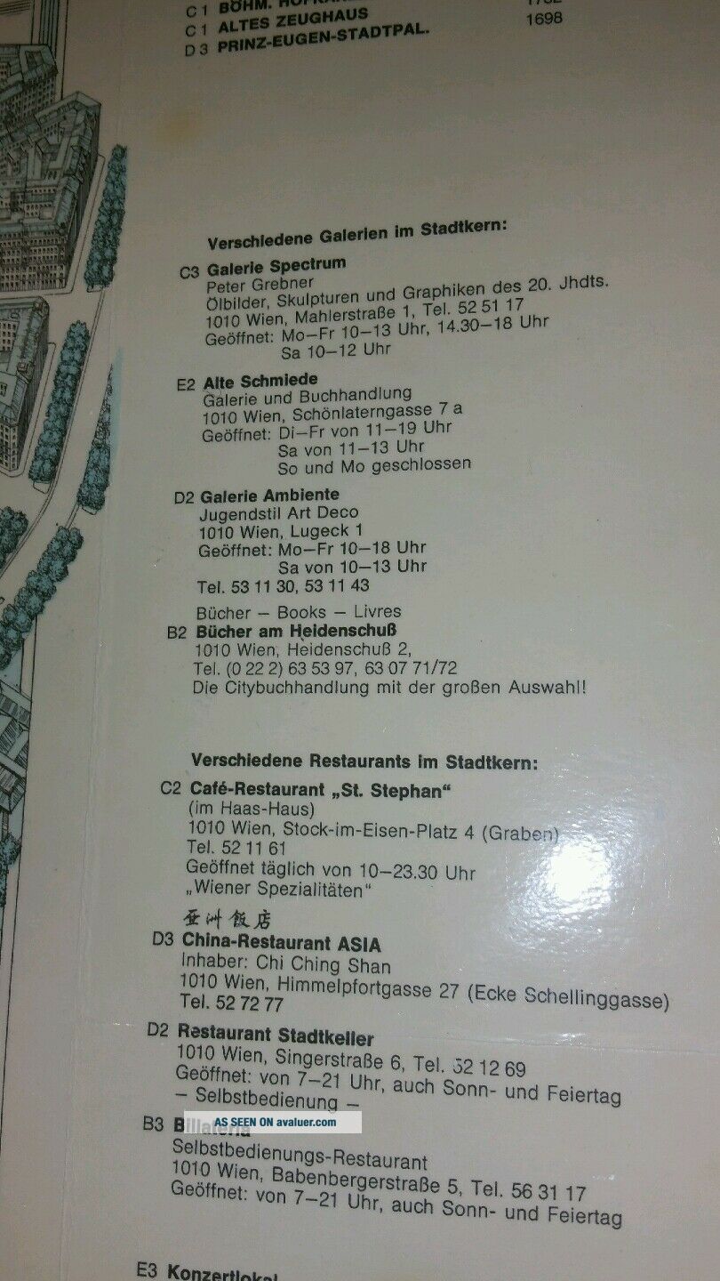
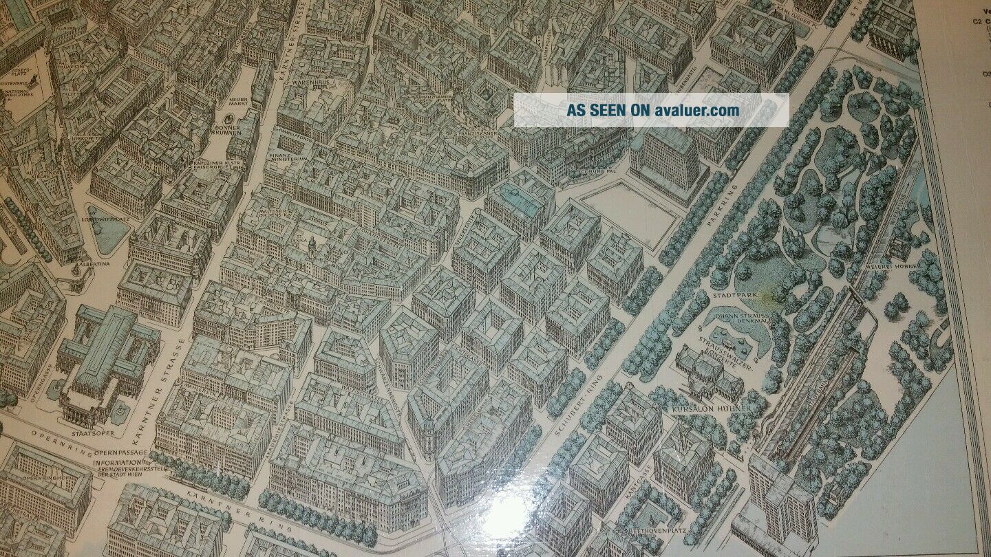
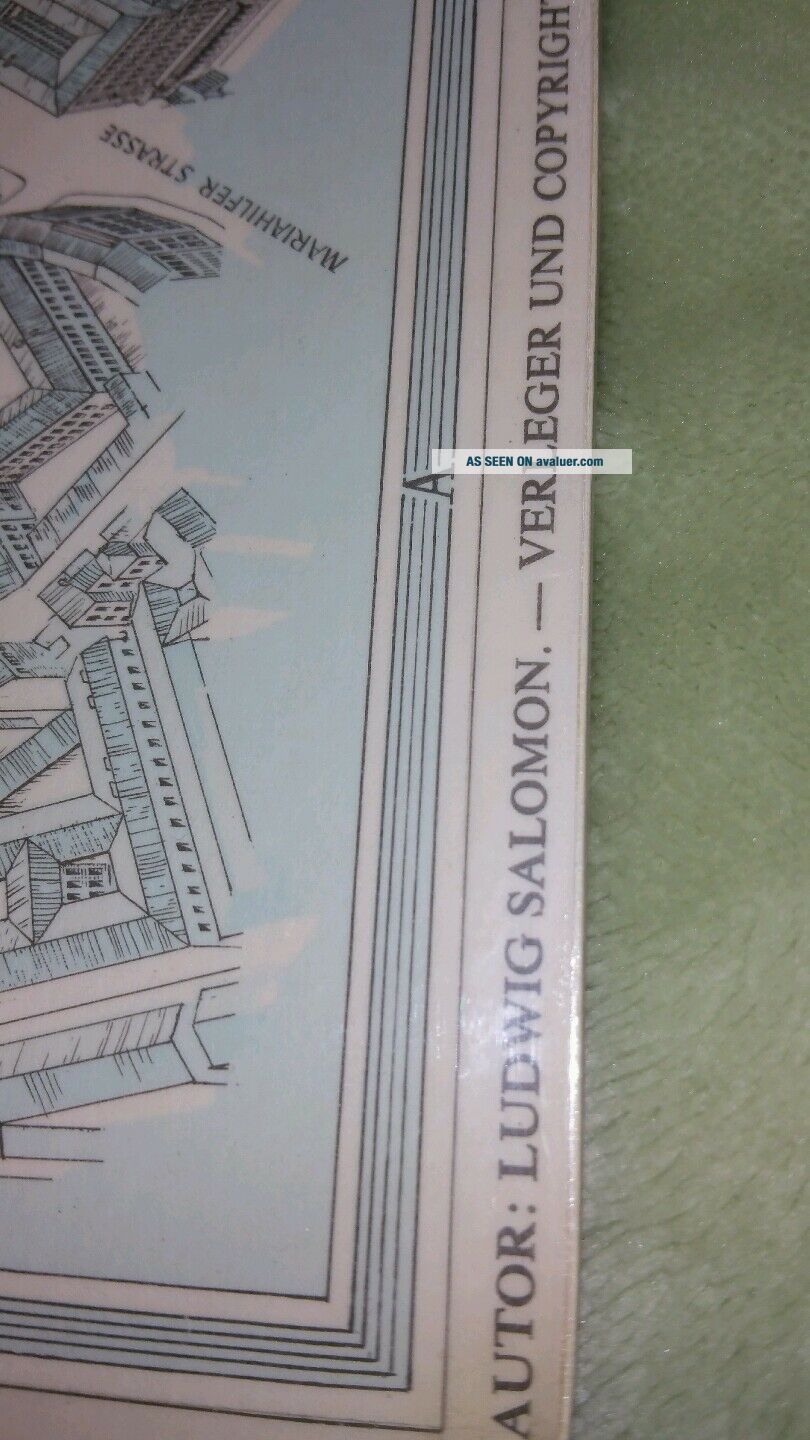
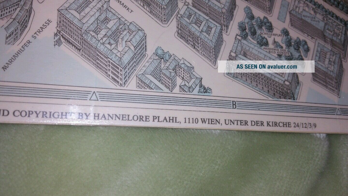
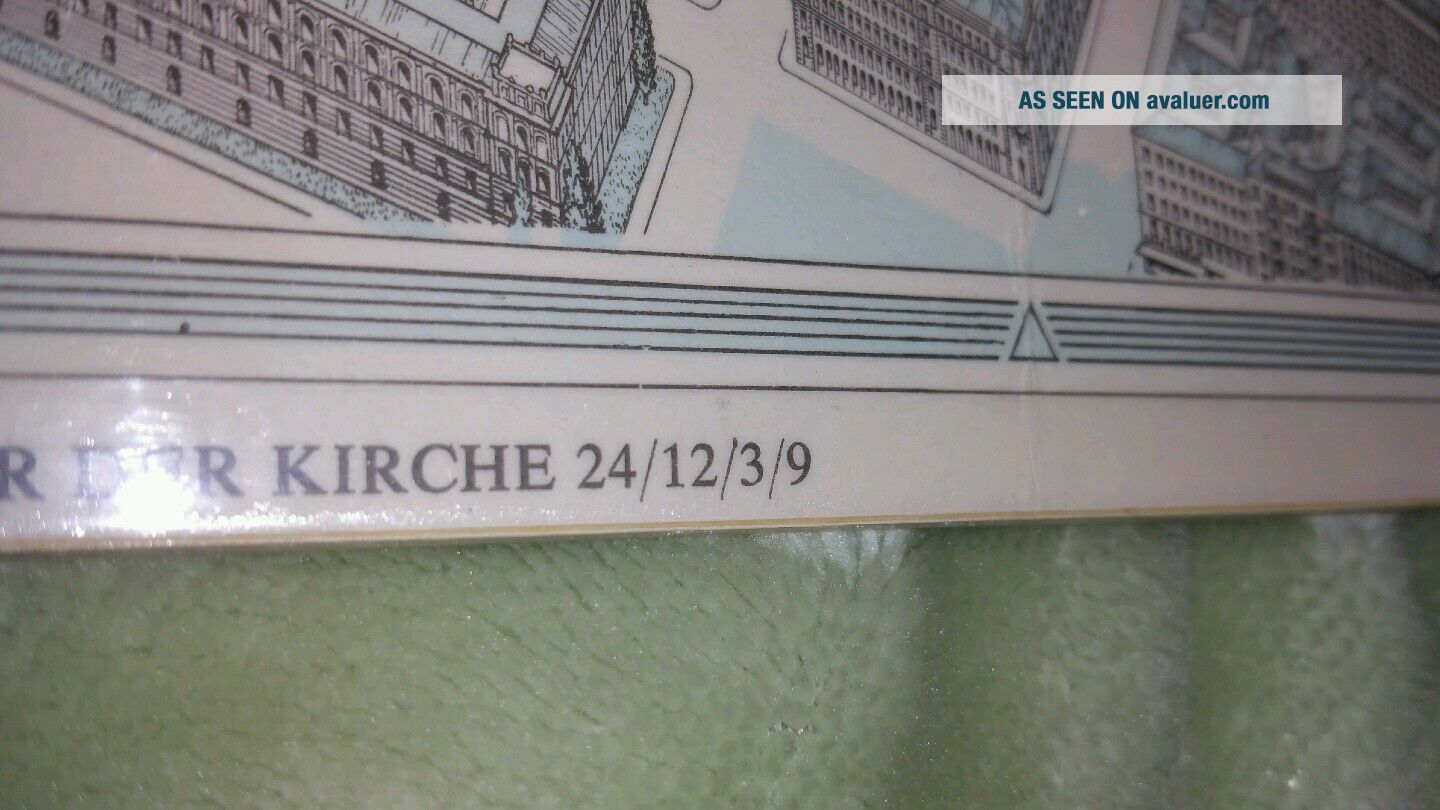
offered for sale here's a great 1924 map made by Ludwig salomon. this is a great map of the city of Vienna 3D Style with loads of buildings in detailed aerial view. Copyright by hannelore plahl. Right side shows buildings names and when they were built. Measures 28" by 21". It's in really nice condition some d
Fold lines but no tears or stains. Thanks for looking. Any questions, just ask.


    Similar items


  • Vtg Zealand Natural Flax Linen Pictures & Map

    Vtg Zealand Natural Flax Linen Pictures & Map

  • 1889 Vienna City Plan Austria Antique Map By Letts,  Son & Co.

    1889 Vienna City Plan Austria Antique Map By Letts, Son & Co.

  • 1719 Manesson Mallet Atlas Map View Vienna - Vienne - Wienn - Austria

    1719 Manesson Mallet Atlas Map View Vienna - Vienne - Wienn - Austria

  • Vtg Mexico Vernon Kilns Plate Picture Map Red Midcentury Souvenir State Road

    Vtg Mexico Vernon Kilns Plate Picture Map Red Midcentury Souvenir State Road

  • Vtg White Gold Plastic Frame Picture Violin 3d Mcm Rare Home Interiors Wall Deco

    Vtg White Gold Plastic Frame Picture Violin 3d Mcm Rare Home Interiors Wall Deco

  • 1720s,  L,  Good Panorama View,  Vienna/wien,  Vienne,  Austria,  Österreich,  Autriche

    1720s, L, Good Panorama View, Vienna/wien, Vienne, Austria, Österreich, Autriche

  • 1890 Koke City Map Or Plan Of Vienna,  Austria

    1890 Koke City Map Or Plan Of Vienna, Austria

  • Vintage Bordeaux Vase Handle Footed Vienna Austria Picture Of Man & Women 12 "

    Vintage Bordeaux Vase Handle Footed Vienna Austria Picture Of Man & Women 12 "


    • You might also like


    • Hungary & Romania 1579 (1584) Ortelius Unusual Antique Copper Engraved Map

      Hungary & Romania 1579 (1584) Ortelius Unusual Antique Copper Engraved Map

    • Brussels Bruxelles Belfium 1777 De Ferraris & Dupuis Large Antique Map Sheet Xxi

      Brussels Bruxelles Belfium 1777 De Ferraris & Dupuis Large Antique Map Sheet Xxi

    • 1616 Atlas Map Of Iceland.

      1616 Atlas Map Of Iceland.

    • Kazan Russia 1767 Le Clerc/lespinasse Antique Copper Engraved City View

      Kazan Russia 1767 Le Clerc/lespinasse Antique Copper Engraved City View

    • 1899 Stanford,  Folding Map Of Norwich,  Norfolk,  Arthur Collins,  Jarrold & Sons,

      1899 Stanford, Folding Map Of Norwich, Norfolk, Arthur Collins, Jarrold & Sons,

    • 1948 Vintage Linen Colour Map Geological Survey Ten Mile Of Great Britain

      1948 Vintage Linen Colour Map Geological Survey Ten Mile Of Great Britain

    • 1944 Map Flying Bombs Sussex Ww2 Newspaper Military Kent Courier German V1 V2

      1944 Map Flying Bombs Sussex Ww2 Newspaper Military Kent Courier German V1 V2

    • Dated 1638 Vellum Map Of Icklesham Sussex Showing Land Uses Owners Etc

      Dated 1638 Vellum Map Of Icklesham Sussex Showing Land Uses Owners Etc

Avaluer          About Us          Privacy Policy          Contact Us          UP
© 2022, avaluer.net, Inc. or its affiliates