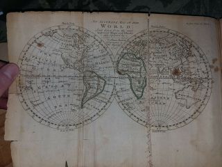
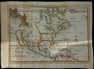
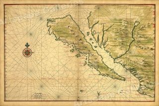
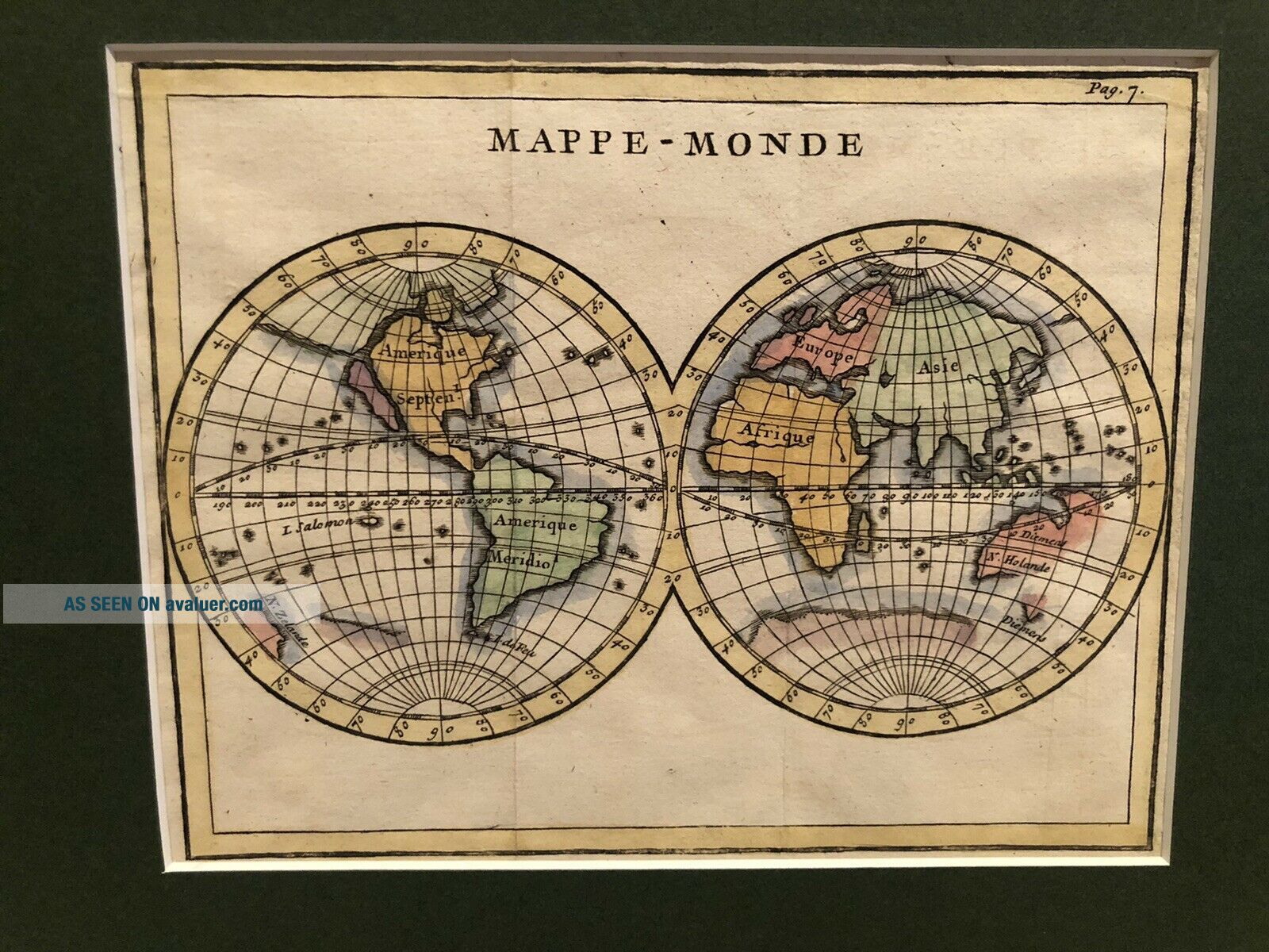
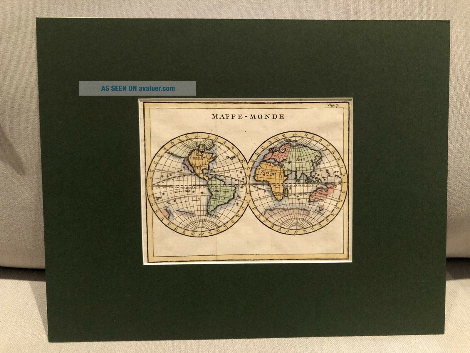
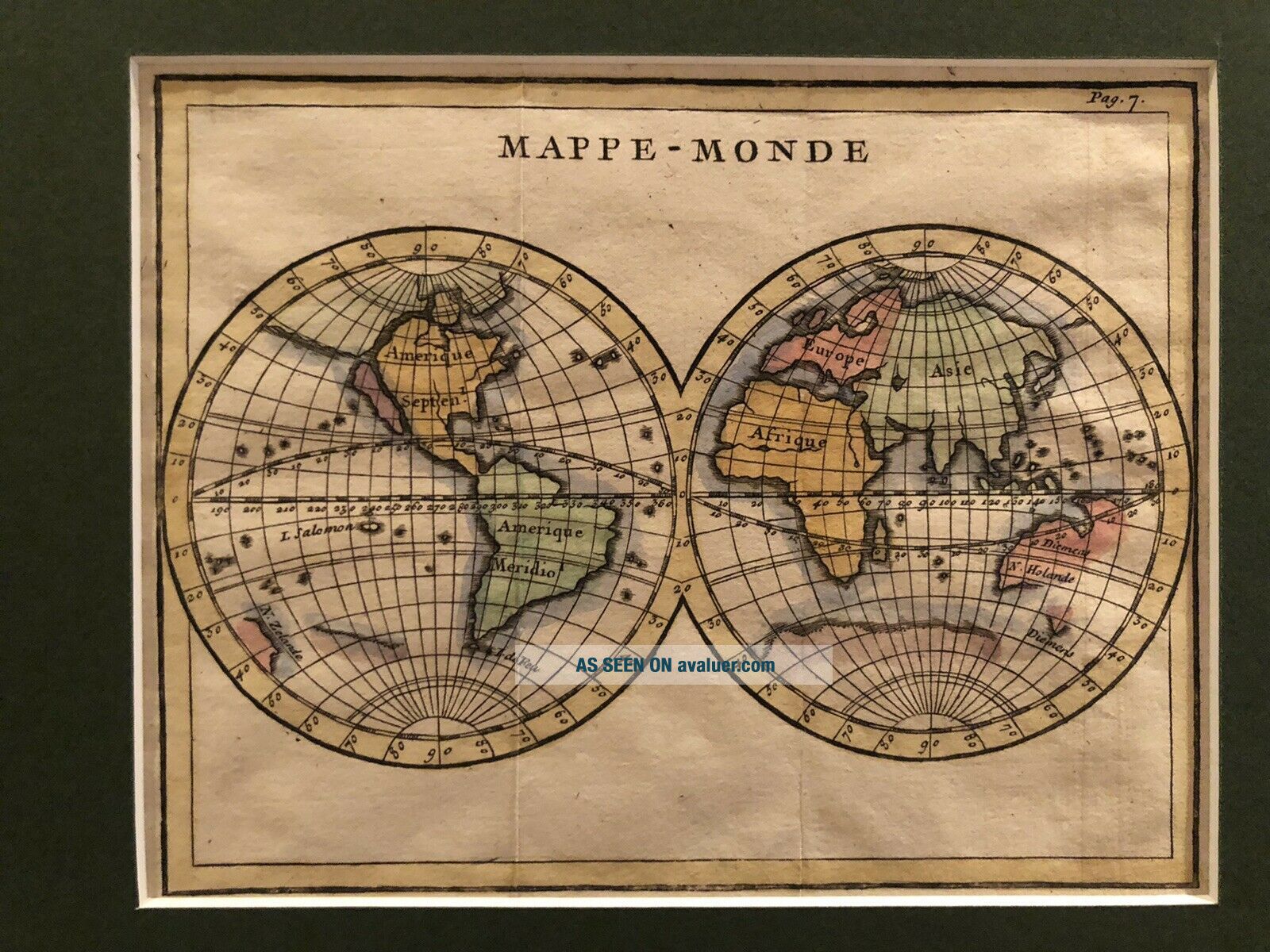
1700s Map Of California As Island Mappe - Monde


Item History & Price

Information:
Reference Number: Avaluer:48234313US State: California
Year: 1700
Original Description:
1700s Map Of California As Island Mappe-Monde. World map it’s a amazing early 1700s map depicting California as island. This is a original hand colored map matted with olive Forrest green. The size of the map is 5.5”x7” and fits a frame 11”x14”.


    Similar items


  • 1747 The Preceptor Vol Ii London Maps Of California As An Island Edmund Bowen

    1747 The Preceptor Vol Ii London Maps Of California As An Island Edmund Bowen

  • Rare Circa 1700 North America California As Island Map By N.  Sanson

    Rare Circa 1700 North America California As Island Map By N. Sanson

  • 1650s Vinckeboons

    1650s Vinckeboons ' Map Of California As An Island - 24x36

  • Old 1890 Southern Pacific Railroad Climatic Map Of California - As - Is

    Old 1890 Southern Pacific Railroad Climatic Map Of California - As - Is

  • 1709 First Edition Of The Septuagint Bible In Greek - Map Of Calif As Island

    1709 First Edition Of The Septuagint Bible In Greek - Map Of Calif As Island

  • California As Island United States 1700 De Fer Unusual First Edition Antique Map

    California As Island United States 1700 De Fer Unusual First Edition Antique Map

  • 1650 Map Of California Shown As An Island Unusual Error Map - 16x24

    1650 Map Of California Shown As An Island Unusual Error Map - 16x24

  • Circa 1690 A Map Of All The Earth J Moxon,  King Charlesii & California As Island

    Circa 1690 A Map Of All The Earth J Moxon, King Charlesii & California As Island


    • You might also like


    • 1860 Mitchell Hand Colored Map Colorado,  Nebraska & Kansas - Civil War Era

      1860 Mitchell Hand Colored Map Colorado, Nebraska & Kansas - Civil War Era

    • 18th Century French Map Of North America

      18th Century French Map Of North America

    • Las Vegas Nevada Vintage 1967 Us Geological Survey Quadrangle Map 4 Panels

      Las Vegas Nevada Vintage 1967 Us Geological Survey Quadrangle Map 4 Panels

    • Rare Antique 1845 Maps United States Exploring Expedition Book Antartica Hawaii

      Rare Antique 1845 Maps United States Exploring Expedition Book Antartica Hawaii

    • Vintage 1926 Map Hollywood From The Best Surveys Of The Time

      Vintage 1926 Map Hollywood From The Best Surveys Of The Time

    • American Continent (western Hemisphere) 1747 Bowen Antique Copper Engraved Map

      American Continent (western Hemisphere) 1747 Bowen Antique Copper Engraved Map

    • Gulf Coast Florida Texas United States 1705 De Fer Unusual Antique Engraved Map

      Gulf Coast Florida Texas United States 1705 De Fer Unusual Antique Engraved Map

Avaluer          About Us          Privacy Policy          Contact Us          UP
© 2022, avaluer.net, Inc. or its affiliates