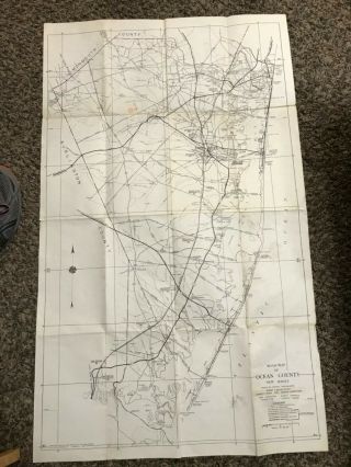
1889 MAP OF OCEAN, NEPTUNE, EATONTOWN N. J. C. WOLVERTON ' S ATLAS
Item History & Price
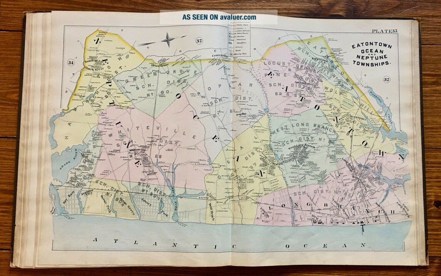
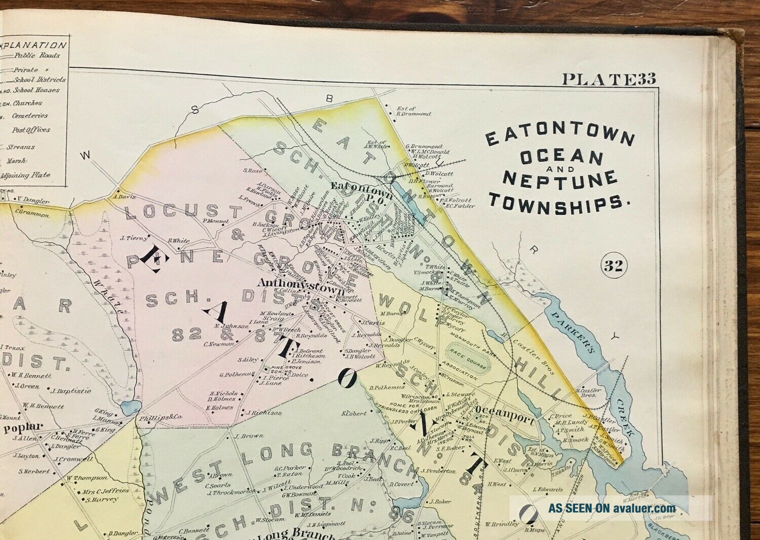
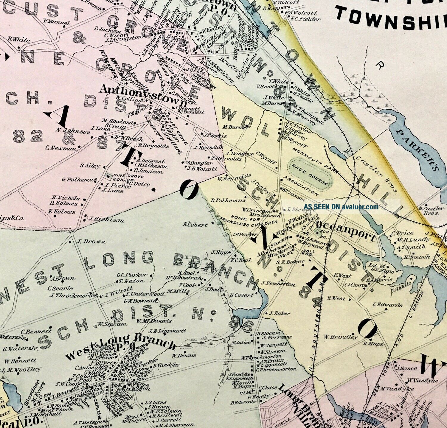
1889 ORIGINAL MAP OF EATONTOWN, OCEAN and NEPTUNE TOWNSHIPS, NEW JERSEY &n...bsp; FROM CHESTER WOLVERTON'S ATLAS OF MONMOUTH COUNTY Plate # 33 * ANTIQUE ORIGINAL*
*NOT A HIGH RESOLUTION REPRODUCTION*
* Multiple Map Purchases Gladly Combined for one Shipping cost of $5.90 *
*This is one of a group of Antique Original 1889 Monmouth County maps, I am offering for sale* Please take a look at my other auctions, and the positive feedback my maps have received. This antique, original 1889 Hand Colored Map is sitting in place in the Chester Wolverton's Atlas of Monmouth County until it is sold. I have provided a photo of the title page of the Atlas for reference and authenticity, but this auction is for the map only.
From North Long Branch to Key East along the coast and Eatontown to Wall and everything in between this is a beautifully colored and heavily detailed 19th century Monmouth County, New Jersey map.
Several old hotels can be seen scattered along the ocean front including the Brighton Hotel, the Ocean Wave Hotel, the Atlantic Hotel, and the West End Hotel; the Elberon Casino as well as the Long Branch Pier can all be seen.Many early railroads, churches, P.O.'s, and cemeteries are noted.
The 'Home for Friendless Children' in Eatontown can clearly be seen. It was a 4 acre parcel of land (formerly the Eatontown Seminary) that was donated by John D. Wright to be used as a branch home for 'friendless children' under the control of the Female Guardian Society.
Whether you are a current resident or native of these towns, or simply a fan of Monmouth County History, you will enjoy this map! Size: A generous 30" wide x 20 1/2' high with full margins.
Condition: Clean and legible, beautifully colored. No holes or tears, ready for matting and framing.
ENJOY THE AUCTION!