Antique Map 1902 Posey County Indiana Poseyville Wadesville Springfield 13171


Item History & Price

Information:
Reference Number: Avaluer:59049248US State: Indiana
Country/Region: United States of AmericaDate Range: 1900-1909
Format: Folding MapCity: Poseyville
Type: Topographical MapOriginal/Reproduction: Antique Original
Year: 1902
Original Description:
Antique Map 1902 Posey County Indiana Poseyville Wadesville Springfield #13171
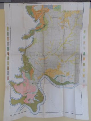
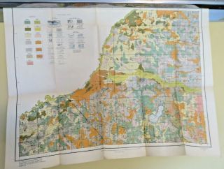
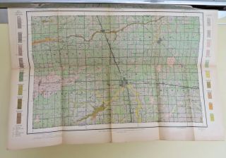
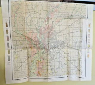
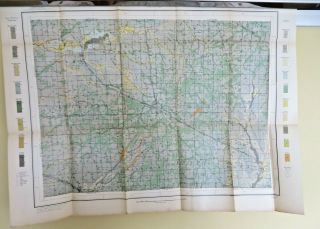
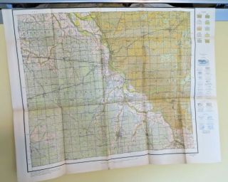
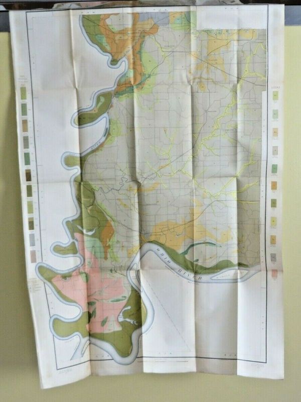
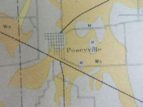
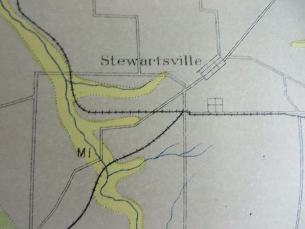
Posey County IndianaPoseyville Wadesville Springfield StewartsvilleNew HarmonyNew BaltimoreWest FranklinMt VernonFarmersvilleBlairsvilleand more...Measures approximately 23" wide by 33" longFolded approximately 9 by 6 inchesWill have foxing, small tears along fold lines/cornersPaper is over 100 years old, use care when unfoldingPlease review description and pictures for more detailsShips in... rigid photo mailer 


    Similar items


  • 1902 Soil Map Posey County Indiana Poseyville Mt Vernon Approx 24 X 34 10251

    1902 Soil Map Posey County Indiana Poseyville Mt Vernon Approx 24 X 34 10251

  • Antique Map 1915 Starke County Indiana Hamlet Knox N Judson San Pierre 13037

    Antique Map 1915 Starke County Indiana Hamlet Knox N Judson San Pierre 13037

  • Antique Map 1912 Tipton County Indiana Goldsmith Windfall Sharpsville 13097

    Antique Map 1912 Tipton County Indiana Goldsmith Windfall Sharpsville 13097

  • Antique Map 1907 Marion County Indiana Indianapolis Vertland Invington 13139

    Antique Map 1907 Marion County Indiana Indianapolis Vertland Invington 13139

  • Antique Map 1912 Boone County Indiana Lebanon Zionsville Milledgeville 13094

    Antique Map 1912 Boone County Indiana Lebanon Zionsville Milledgeville 13094

  • Antique Map 1915 Grant County Indiana Jonesboro Gas City Marion Bucktown 13036

    Antique Map 1915 Grant County Indiana Jonesboro Gas City Marion Bucktown 13036

  • Antique Map 1902 Howell County Missouri Pomona Brandsville Siloam Spgs 13178

    Antique Map 1902 Howell County Missouri Pomona Brandsville Siloam Spgs 13178

  • Antique Map 1912 Hamilton County Indiana Noblesville Carmel Millersburg 13095

    Antique Map 1912 Hamilton County Indiana Noblesville Carmel Millersburg 13095


    • You might also like


    • 1860 Mitchell Hand Colored Map Colorado,  Nebraska & Kansas - Civil War Era

      1860 Mitchell Hand Colored Map Colorado, Nebraska & Kansas - Civil War Era

    • 18th Century French Map Of North America

      18th Century French Map Of North America

    • Las Vegas Nevada Vintage 1967 Us Geological Survey Quadrangle Map 4 Panels

      Las Vegas Nevada Vintage 1967 Us Geological Survey Quadrangle Map 4 Panels

    • Rare Antique 1845 Maps United States Exploring Expedition Book Antartica Hawaii

      Rare Antique 1845 Maps United States Exploring Expedition Book Antartica Hawaii

    • Vintage 1926 Map Hollywood From The Best Surveys Of The Time

      Vintage 1926 Map Hollywood From The Best Surveys Of The Time

    • American Continent (western Hemisphere) 1747 Bowen Antique Copper Engraved Map

      American Continent (western Hemisphere) 1747 Bowen Antique Copper Engraved Map

    • Gulf Coast Florida Texas United States 1705 De Fer Unusual Antique Engraved Map

      Gulf Coast Florida Texas United States 1705 De Fer Unusual Antique Engraved Map

    • California As Island United States 1700 De Fer Unusual First Edition Antique Map

      California As Island United States 1700 De Fer Unusual First Edition Antique Map

Avaluer          About Us          Privacy Policy          Contact Us          UP
© 2022, avaluer.net, Inc. or its affiliates