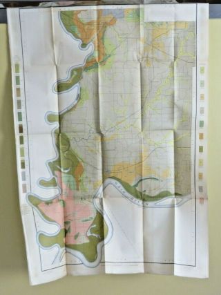
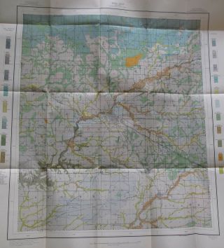
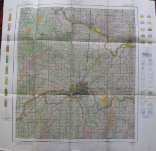
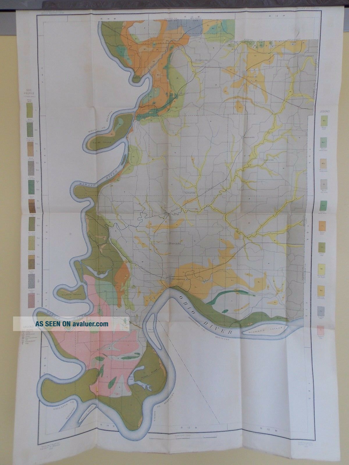
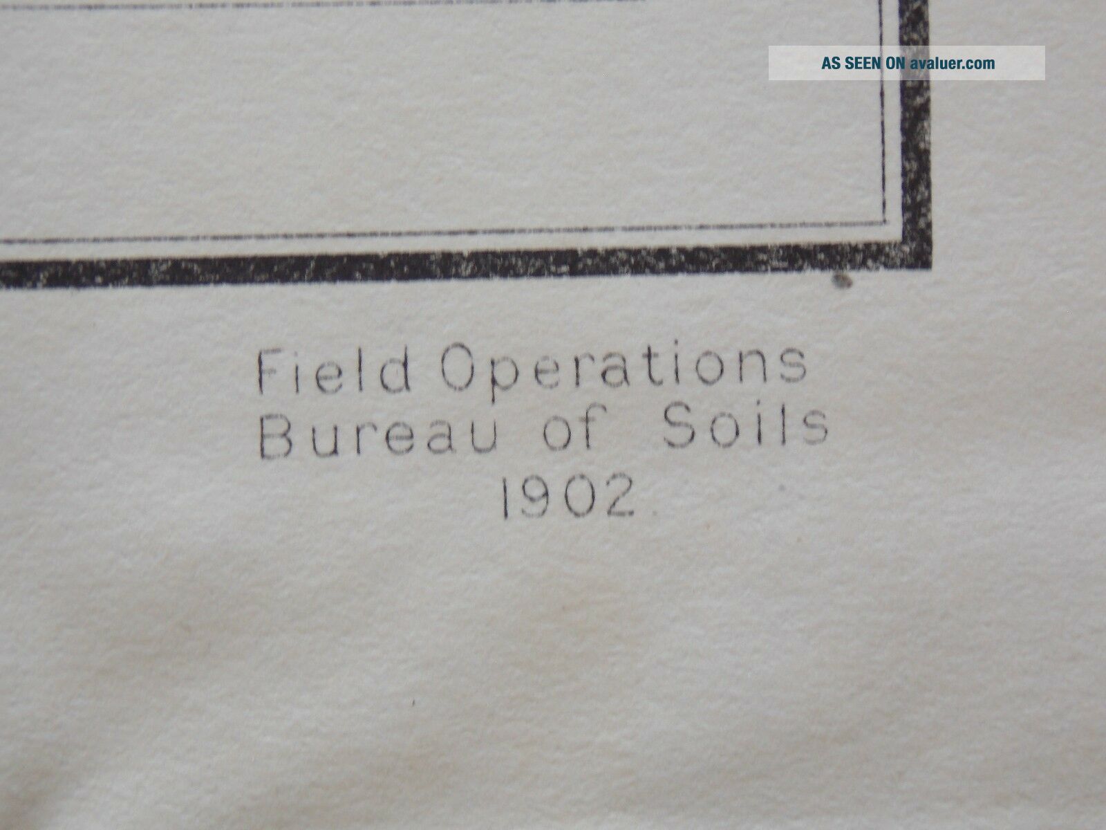
1902 Soil Map Posey County Indiana Poseyville Mt Vernon Approx 24 X 34 10251
Item History & Price
| Reference Number: Avaluer:48262221 | US State: Indiana |
| Maker: US Dept of Agriculture | Date Range: 1900-1909 |
| Type: Soil Map | Original/Reproduction: Original |
| Year: 1902 |
Antique 1902 Soil Map Posey County Indiana 24 X 34
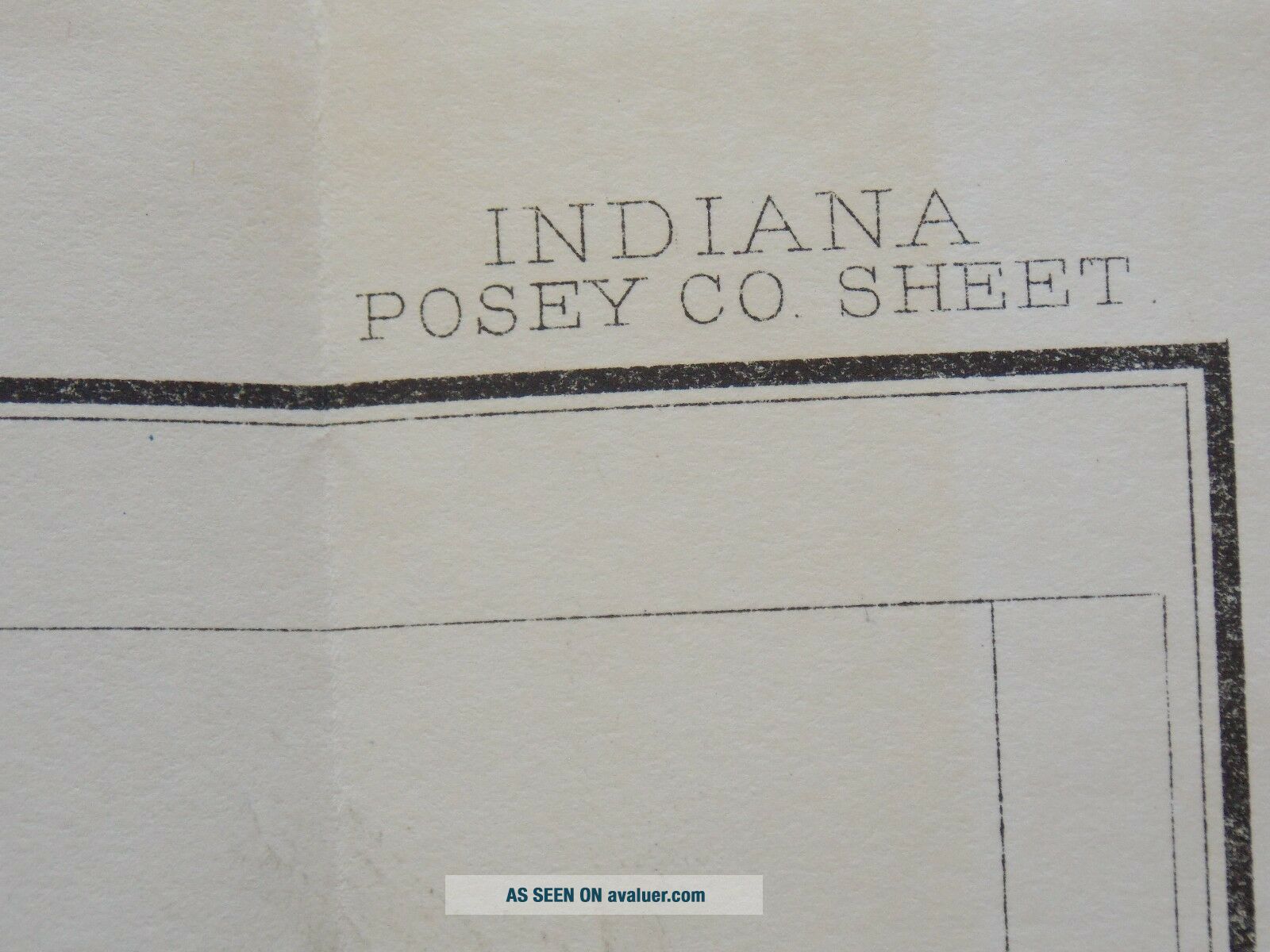
US Department of Agriculture Bureau of SoilsOriginal soil map dated 1902Suitable for framingMeasures approximately 24" wide 34" height including marginsFolded measures 9" X 5 3/4"Posey County IndianaIncludes:PoseyvilleMt VernonNew HarmonySpringfieldShips in a rigid photo mailerSoil Survey Map is over 100 years old - Paper shows yellowing/foxing consistent with age, may have some minor crease/fold line pin holes or tears, some ed...ge or margin tears possible. Please review pictures.
US Department of Agriculture Bureau of SoilsOriginal soil map dated 1902Suitable for framingMeasures approximately 24" wide 34" height including marginsFolded measures 9" X 5 3/4"Posey County IndianaIncludes:PoseyvilleMt VernonNew HarmonySpringfieldShips in a rigid photo mailerSoil Survey Map is over 100 years old - Paper shows yellowing/foxing consistent with age, may have some minor crease/fold line pin holes or tears, some ed...ge or margin tears possible. Please review pictures.