SPEED MAP C1627 ISLE OF MAN Humble COL ENGRAVED Theatre Great Britain


Item History & Price
| Reference Number: Avaluer:7810 | Cartographer/Publisher: John Speed |
| Country/Region: United Kingdom | Year: c1627 |
| Era: 1600s | Date Range: 1600-1699 |
Original Hand coloured SPEED map
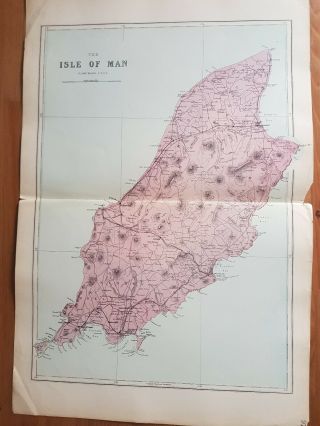
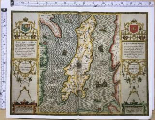
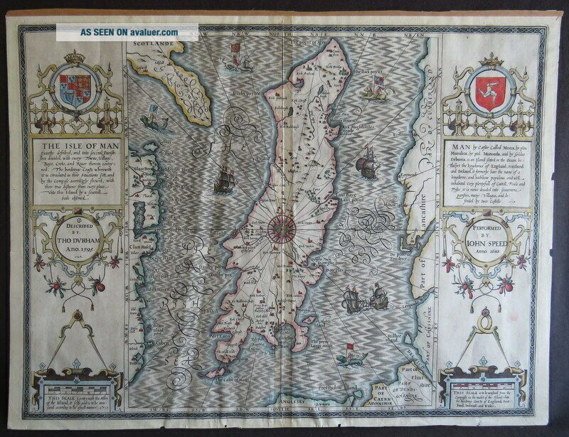
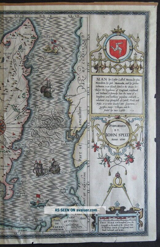
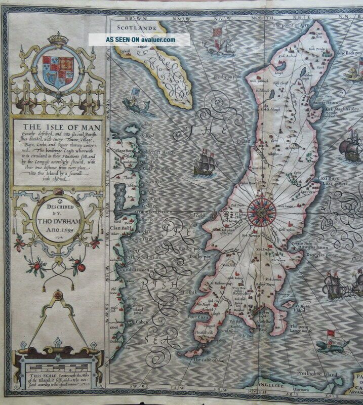
'THE ISLE OF MAN'
'The Isle of Man exactly decribed and into Several Parishshes divided with every Towne, Village, Baye, Creke, and River therein conteyned. The bordringe Coats wherewith it is circulated in their situations sett, and by the Compase accorigly shewed, with their true distance from every place unto this Island by a Severall scale observed'.
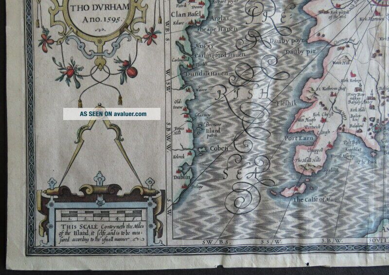
Described by Tho. Durham Ano. 1595Performed by John Speed Anno 1610
[Geo...rge Humble, 1627, or later]
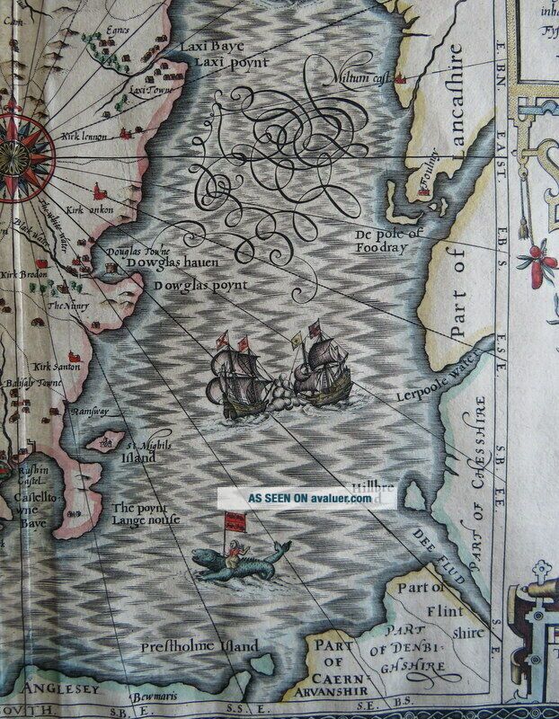
A striking decorative 17th century map of the ISLE OF MAN. With large strapwork cartouches to vertical margins, text detail, Isle of Man symbol and crest to either side. Decorative compass rose in the centre of the island with radiating lines and lovely scroll lettering in sea. Several wonderful ships and sea creatures ridden by figures holding flags. The reverse of the map has English text. Central fold.
John Speed (1552-1629) was the most famous cartographer of his age. His 'Theatre of Great Britain' was the first atlas of the British Isles: Speed prepared the maps himself about two years before they were published. His maps and books dominated the seventeenth-century English market. The present map is most likely taken from the 1627 English edition published by George Humble.
Copper engraved, measuring 53cm x 40.3cm, with hand colouring. As can be seen from the images, the margins are little nicked/chipped, have been trimmed and top edge has remnants of fixing tape. The fold is a bit worn/browned and has stub mount to rear. Little wavy/creased. Small remnants of repair to bottom edge. Pale pink mark to right edge.
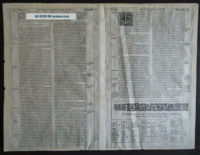
English Text to verso, with woodcut first letters and device.
An attractive, original, John Speed, hand coloured, copper engraved map.
Terms & Conditions
*Payment Details: We accept Paypal, UK Cheques, Postal Orders, *Shipping: We will gladly ship anywhere in the World, and combine multiple items to reduce postal costs. *Packaging: All our books, will be carefully and securely packaged. We aim to send all items within 48 hours of payment. *Returns Policy: If you are unhappy in any way, for whatever reason, with the transaction or the item, please contact us as soon as possible. Your item is fully refundable without question. *Our Policy: We aim to give detailed and accurate descriptions, and have established a reputation for honesty, quality and reliability, which we hope to continue. We know that sometimes ebay or internet buying can be a bit daunting, so please feel free to ask any questions, ask for more details or images, and we will be happy to help. We are very approachable and want to make this a pleasant experience. TRADE WITH CONFIDENCE
'THE ISLE OF MAN'
'The Isle of Man exactly decribed and into Several Parishshes divided with every Towne, Village, Baye, Creke, and River therein conteyned. The bordringe Coats wherewith it is circulated in their situations sett, and by the Compase accorigly shewed, with their true distance from every place unto this Island by a Severall scale observed'.
Described by Tho. Durham Ano. 1595Performed by John Speed Anno 1610
[Geo...rge Humble, 1627, or later]
A striking decorative 17th century map of the ISLE OF MAN. With large strapwork cartouches to vertical margins, text detail, Isle of Man symbol and crest to either side. Decorative compass rose in the centre of the island with radiating lines and lovely scroll lettering in sea. Several wonderful ships and sea creatures ridden by figures holding flags. The reverse of the map has English text. Central fold.
John Speed (1552-1629) was the most famous cartographer of his age. His 'Theatre of Great Britain' was the first atlas of the British Isles: Speed prepared the maps himself about two years before they were published. His maps and books dominated the seventeenth-century English market. The present map is most likely taken from the 1627 English edition published by George Humble.
Copper engraved, measuring 53cm x 40.3cm, with hand colouring. As can be seen from the images, the margins are little nicked/chipped, have been trimmed and top edge has remnants of fixing tape. The fold is a bit worn/browned and has stub mount to rear. Little wavy/creased. Small remnants of repair to bottom edge. Pale pink mark to right edge.
English Text to verso, with woodcut first letters and device.
An attractive, original, John Speed, hand coloured, copper engraved map.
Terms & Conditions
*Payment Details: We accept Paypal, UK Cheques, Postal Orders, *Shipping: We will gladly ship anywhere in the World, and combine multiple items to reduce postal costs. *Packaging: All our books, will be carefully and securely packaged. We aim to send all items within 48 hours of payment. *Returns Policy: If you are unhappy in any way, for whatever reason, with the transaction or the item, please contact us as soon as possible. Your item is fully refundable without question. *Our Policy: We aim to give detailed and accurate descriptions, and have established a reputation for honesty, quality and reliability, which we hope to continue. We know that sometimes ebay or internet buying can be a bit daunting, so please feel free to ask any questions, ask for more details or images, and we will be happy to help. We are very approachable and want to make this a pleasant experience. TRADE WITH CONFIDENCE