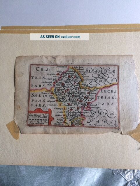
" Speed Atlas " Staffordshire Map
Item History & Price
| Reference Number: Avaluer:7812 | Type: Atlas |
| Original/Reproduction: Original | Maker: George Humble |
Original Staffordshire Map from a "Miniature Speed" Atlas
The following write up was provided by a local map appraisal shop on the history of this map.
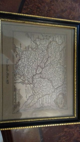
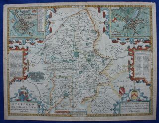
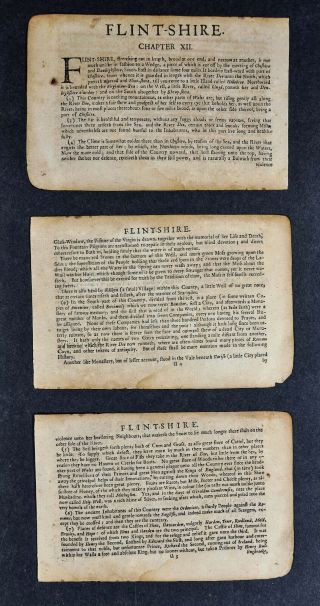
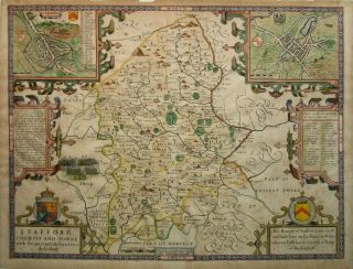
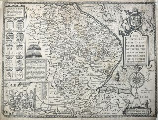
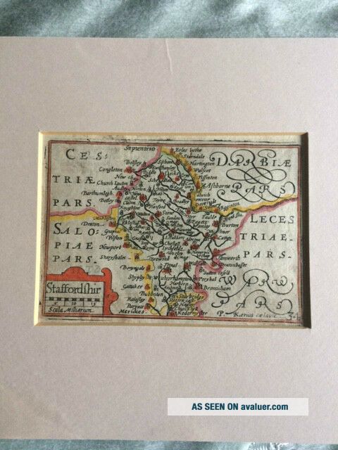
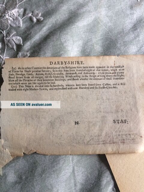
John Speed’s England Wales Scotland and Ireland Described. London: George Humble, 1632(?). Engravings, some by Pieter van den Keere. Ca. 3 1/2 x 5. Skelton: 19 About 1605-1610, Pieter van den Keere (Petrus Kaerius) issued a collection of 44 maps of parts of the&nbs...p;British Isles, probably intended for an atlas covering the entire isles. The counties of England and Wales were after the maps of Christopher Saxton (issued in 1579), those of Ireland were after the work of Abraham Ortelius, and those of Scotland after B. Boazio. Within a few years, John Speed issued his famous folio atlas of the British Isles and soon thereafter the van den Keere plates were in the hands of Speed’s publisher, George Humble. Humble had new plates engraved for the sections of the British Isles missing from the original group, had the titles changed to English, and then in 1627 issued the new set of maps as a miniature version to accompany the second edition of the folio Speed atlas. This “miniature Speed” atlas was probably issued again in conjunction with the 1632 Speed folio, and it is from that edition that these wonderful maps come. They present a charming and rare depiction of the various regions of the British Isles in the early seventeenth century.
This map is attractive and has appropriate hand coloring.
Sheet: 4 1/4" x 6" Map: 3 1/4" x 4 3/4"Matte Frame: 8 3/4" x 7 1/2"
The following write up was provided by a local map appraisal shop on the history of this map.
John Speed’s England Wales Scotland and Ireland Described. London: George Humble, 1632(?). Engravings, some by Pieter van den Keere. Ca. 3 1/2 x 5. Skelton: 19 About 1605-1610, Pieter van den Keere (Petrus Kaerius) issued a collection of 44 maps of parts of the&nbs...p;British Isles, probably intended for an atlas covering the entire isles. The counties of England and Wales were after the maps of Christopher Saxton (issued in 1579), those of Ireland were after the work of Abraham Ortelius, and those of Scotland after B. Boazio. Within a few years, John Speed issued his famous folio atlas of the British Isles and soon thereafter the van den Keere plates were in the hands of Speed’s publisher, George Humble. Humble had new plates engraved for the sections of the British Isles missing from the original group, had the titles changed to English, and then in 1627 issued the new set of maps as a miniature version to accompany the second edition of the folio Speed atlas. This “miniature Speed” atlas was probably issued again in conjunction with the 1632 Speed folio, and it is from that edition that these wonderful maps come. They present a charming and rare depiction of the various regions of the British Isles in the early seventeenth century.
This map is attractive and has appropriate hand coloring.
Sheet: 4 1/4" x 6" Map: 3 1/4" x 4 3/4"Matte Frame: 8 3/4" x 7 1/2"