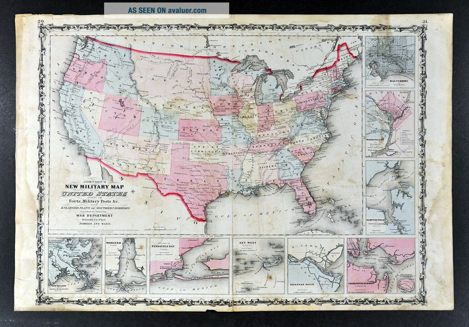
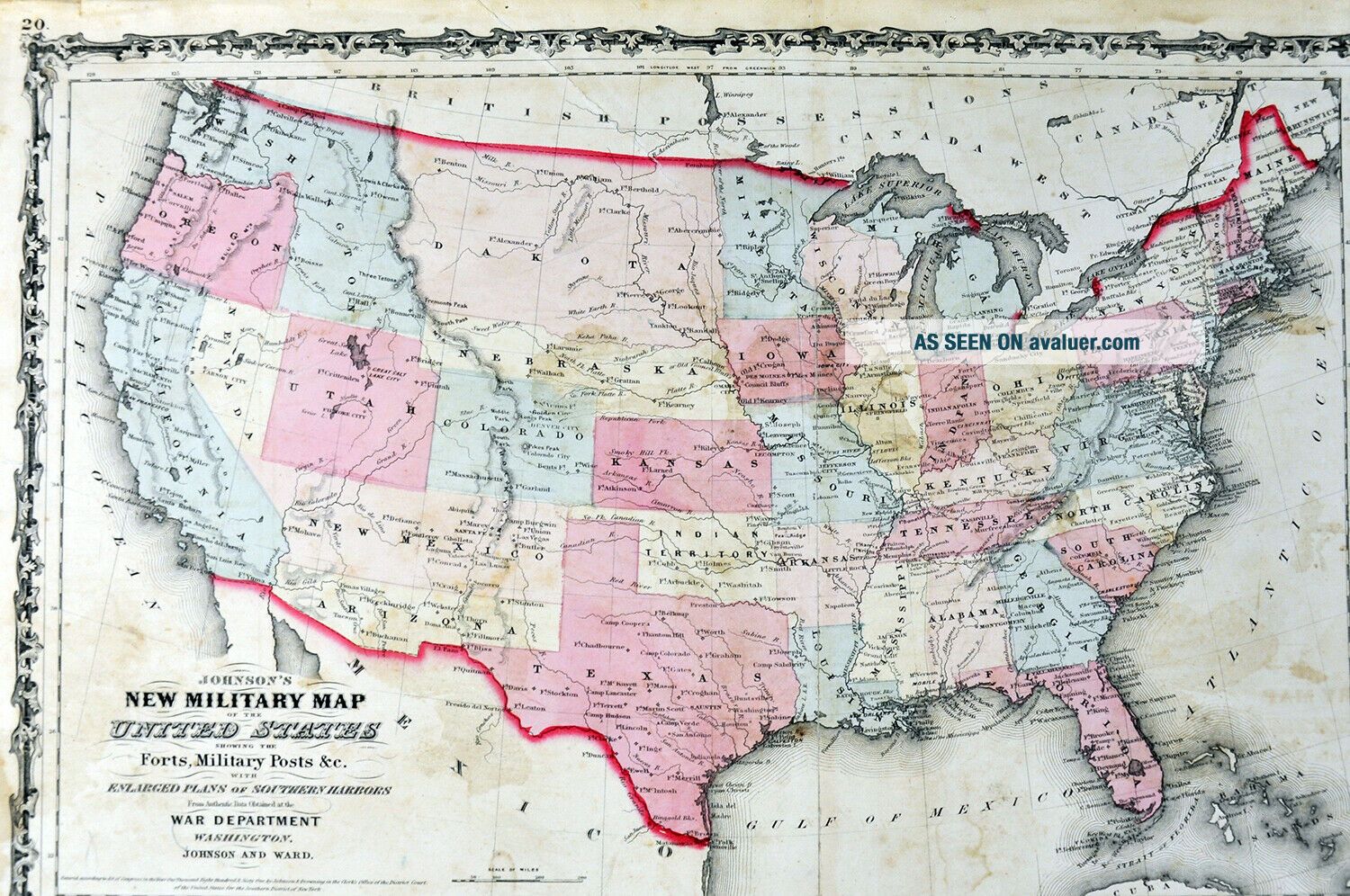
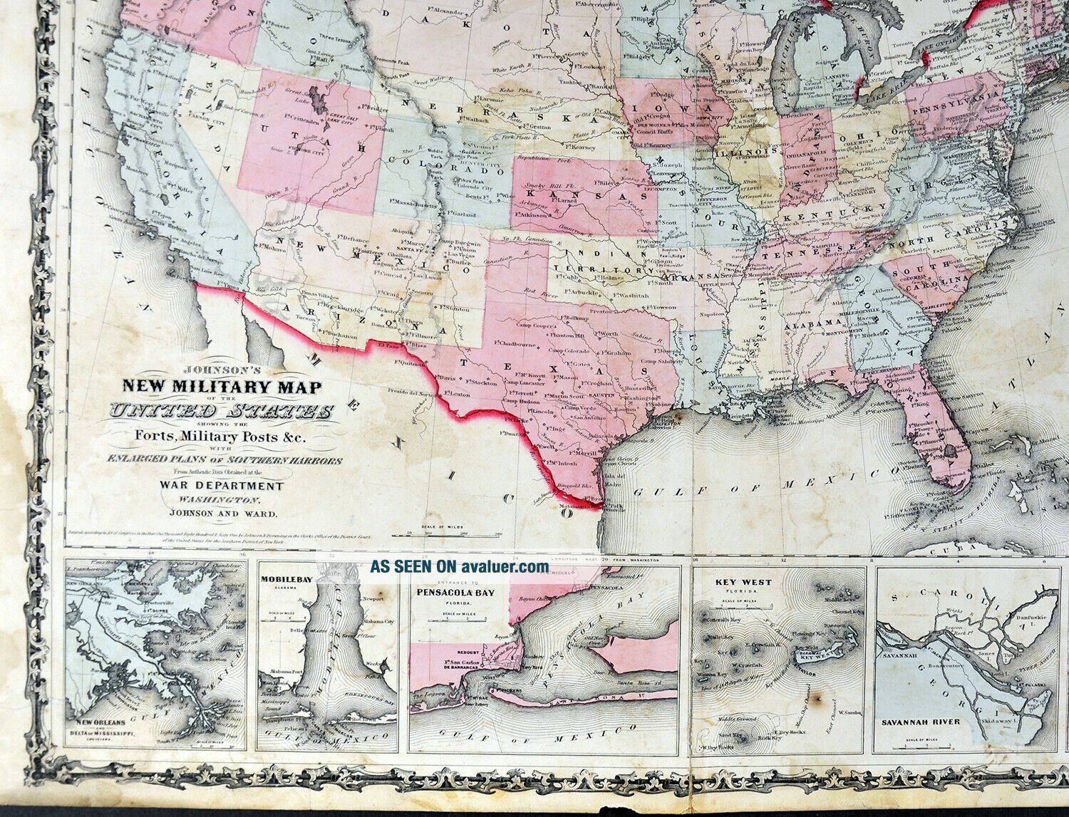
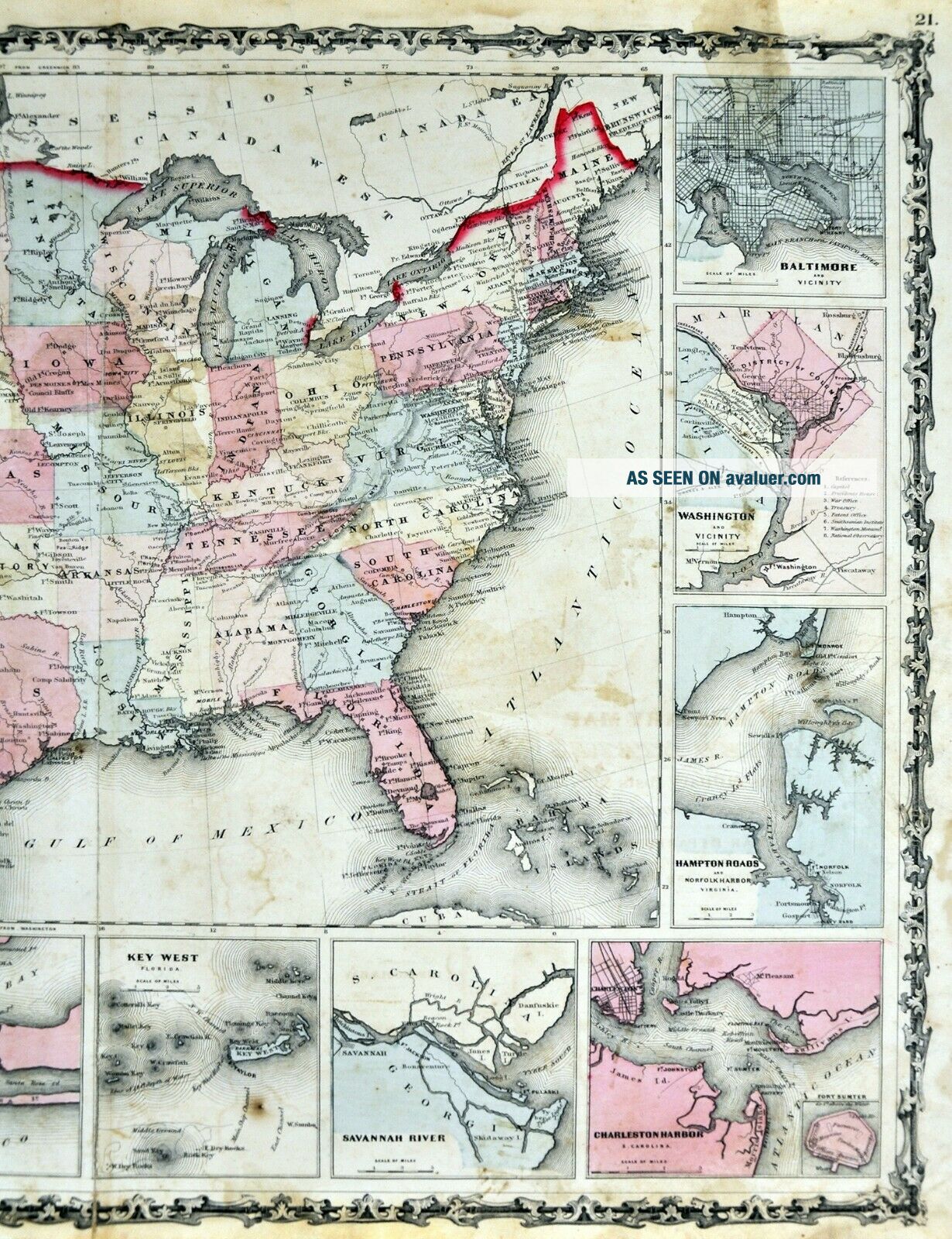
1861 Johnson Civil War Map United States War Department Washington Harbor Plans
Item History & Price

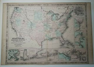
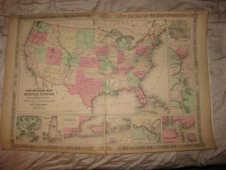
1862 Civil War Era Johnson ' S Military Map United States Forts Posts Harbors
Vintage Mid Century Brochure Howard Johnson ' S Road Map United States Lodges
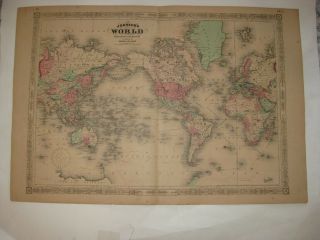
Huge Antique 1866 Johnson World Handcolored Map United States Asia Australia Nr
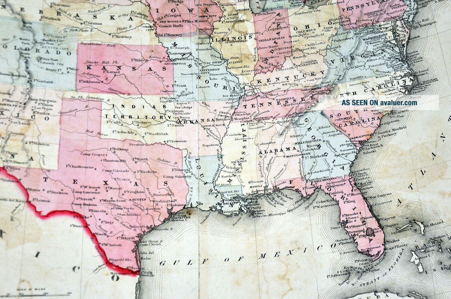
Antique 1861 United States Johnson Civil War Military Map Washington Dc Texas Nr
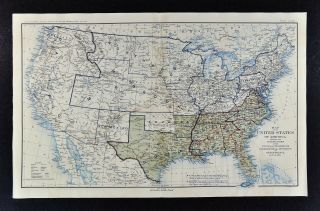
Civil War Map - United States Of America April 1865 Union Confederate Boundaries
Large Antique Map United States Civil War Illustrated London News Ettling 1861
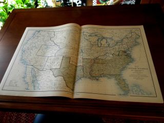
Civil War Atlas Map: United States, Confederate States June 30, 1861
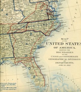
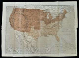
Civil War Atlas Map: United States, Confederate States June 30, 1862

1860 Mitchell Hand Colored Map Colorado, Nebraska & Kansas - Civil War Era

18th Century French Map Of North America

Las Vegas Nevada Vintage 1967 Us Geological Survey Quadrangle Map 4 Panels

Rare Antique 1845 Maps United States Exploring Expedition Book Antartica Hawaii

Vintage 1926 Map Hollywood From The Best Surveys Of The Time

American Continent (western Hemisphere) 1747 Bowen Antique Copper Engraved Map

Gulf Coast Florida Texas United States 1705 De Fer Unusual Antique Engraved Map

California As Island United States 1700 De Fer Unusual First Edition Antique Map